|
|
Mountain/Rock |
|---|---|
|
|
43.72400°N / 113.963°W |
|
|
10256 ft / 3126 m |
|
|
Overview

The Pioneer Mountains are mostly recognized as the high rugged peaks just east of Sun Valley such as Hyndman Peak, Cobb Peak, or The Devils Bedstead East. However, the range is quite large and extends a great deal to the north and east, forming impressive peaks and solitude unlike anywhere else in Idaho. Glide Mountain intitiates the beginnings of the impressive southern divide just south of a strange and uncharacteristic dip in the crest of the range. Although not overly impressive itself, because this mountain is located between the two divides, Glide Mountain is an excellent spot to familiarize with the surroundings of the Pioneer Range.
Glide Mountain sits above the serene Copper Basin in between the eastern Pioneers and White Knob Mountains. The Copper Basin, sitting at 8,000', is the highest and one of the most remote basins in the state. It spans about 20 miles in traingular circumference and is cornered by high, impressive peaks on every side. It is rarely visited and is truly a special place.
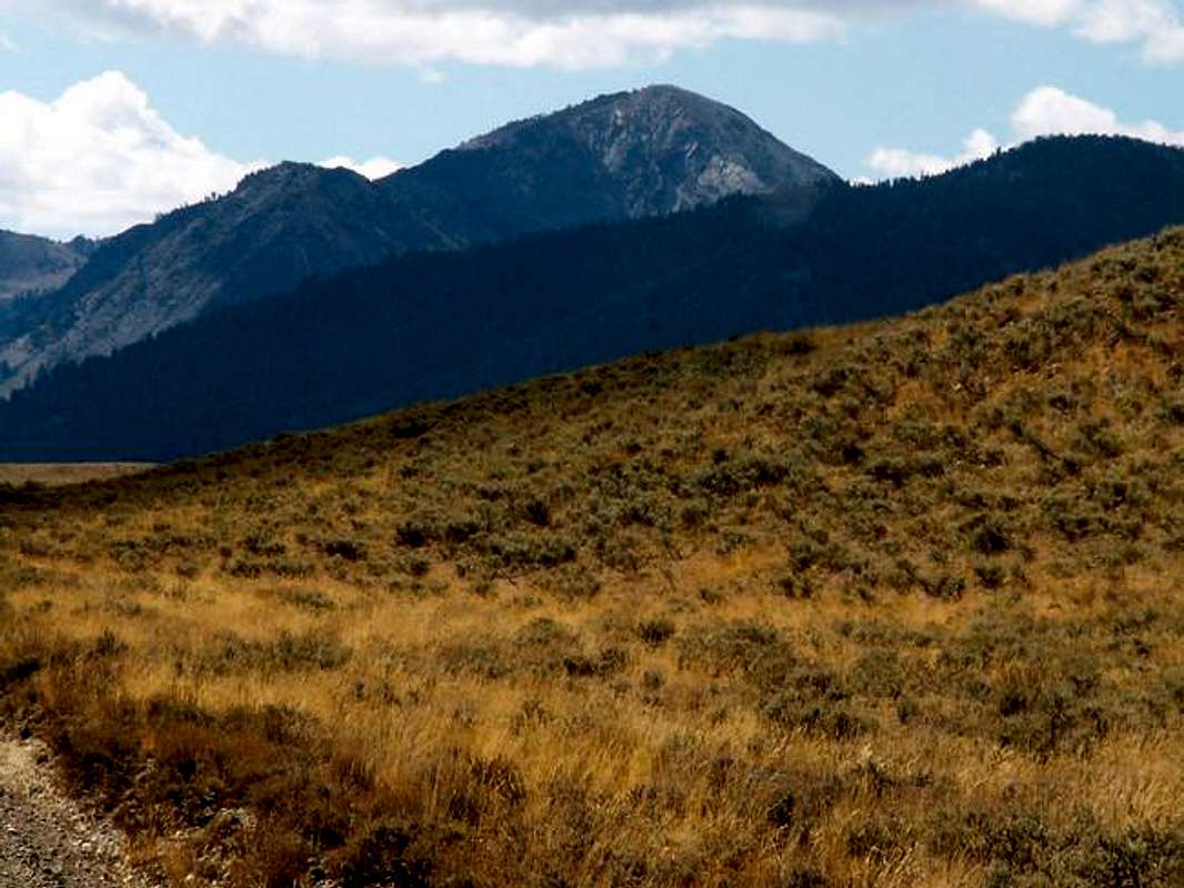
Glide Mountain, although a comparitively small peak for the area, has some attractive qualities. Its broken granite north face dominates the skyline of the southern Copper Basin while its other more gently faces create attractive scenery for campers in the area.
Glide Mountain by any means is an isolated peak, therefore, is very rarely climbed. Of the few people who come to hike in the Copper Basin, most head for larger Pioneer Mountains, so one can expect complete solitude and isolation if attempting to the short class 2 climbs that lead to the summit.
Getting There
To access the East Ridge Route from Ketchum Idaho, drive northeast on Trail Creek Road for 22 miles, up and over Trail Creek Summit on a good gravel road, until reaching the turnoff for Wildhorse Canyon, Antelope Pass, and Copper Basin on the east side of the road.
Take the gravel dirt road for 11 miles past Wildhorse Canyon until entering the Copper Basin and reaching the Copper Basin Loop Road.
Take the Copper Basin Loop Road south for a further 10 miles to Star Hope Campground. Continue just past the campground until seeing a small sign indicating Star Hope Canyon. Take this road and continue driving southward.
The Star Hope Road quickly deteriorates in condition and a four-wheel drive, high clearence vehicle is needed. Park around 2 miles from the turnoff at the base of the west face of Glide Mountain.
Red Tape
No red tape or permits required.
Be aware of the open range law in effect across the Copper Basin and keep your eyes open for the numerous cattle herds in the area.
The Copper Basin Road is closed during winter.
When To Climb
Glide Mountain may be climbed as soon as the Copper Basin Road opens usually in June, right up until the onset of winter in November.
A winter ascent would be a tremendous undertaking to the isolation of Glide Mountain.
Camping
Star Hope campground sits at the foot of Glide Mountain and offers all the usual amenities. There are also countless areaas in the Copper Basin and along Star Hope Road to pull off and set up camp.
Camping on Glide Mountain or Stuck Lake is not recommended for reasons of exposure.
Mountain Conditions
Glide Mountain is isolated and not located near any major weather reporting stations. However, the Copper Basin RAWS site is located near the base of Glide Mountain and gives an idea on current conditions.
The Copper Basin is one of the coldest, harshest basins in the United States. It often rivals Stanley, Idaho, Body, California, or Leadville, Colorado as the coldest spot in the nation with temperatures of -40 and -50 quite common during winter, but due to its location and reporting abilities these readings are not registered by many national or regional reports.
The following links may also be helpful for information on conditions.


