
|
|
Mountain/Rock |
|---|---|
|
|
42.77299°N / 0.15042°W |
|
|
Mountaineering |
|
|
10820 ft / 3298 m |
|
|
Overview
THE MAP BELOW IS REPRODUCED FROM THE EDITORIAL ALPINA ORIGINAL
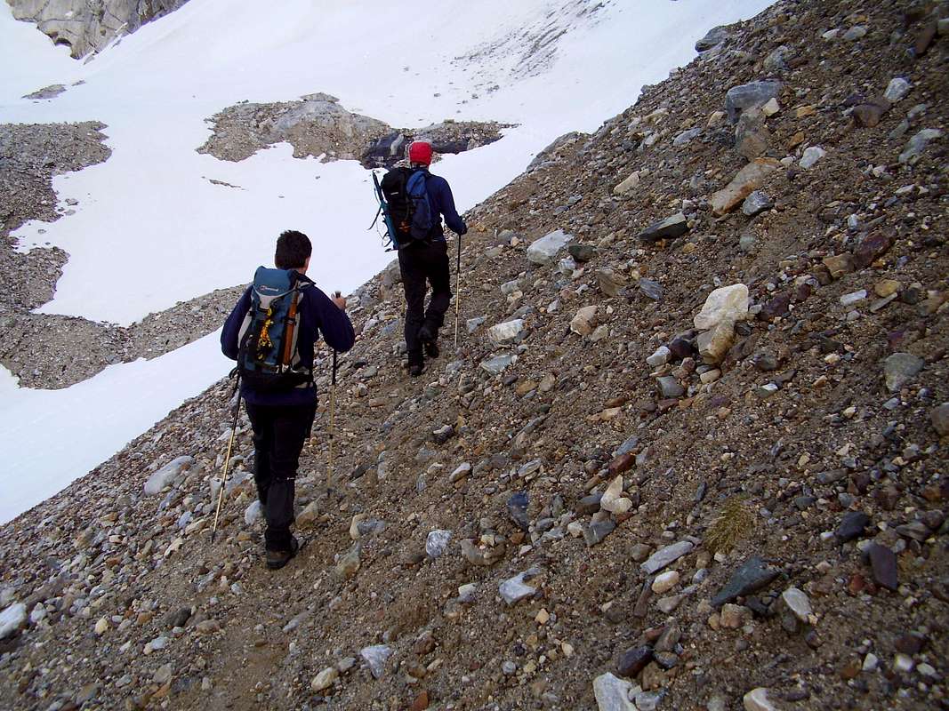 Morrain of the Glacier d' Ossoue
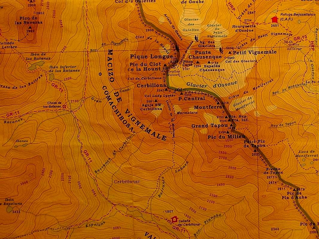 Grand Vignemale or Pique Longue 3298m.
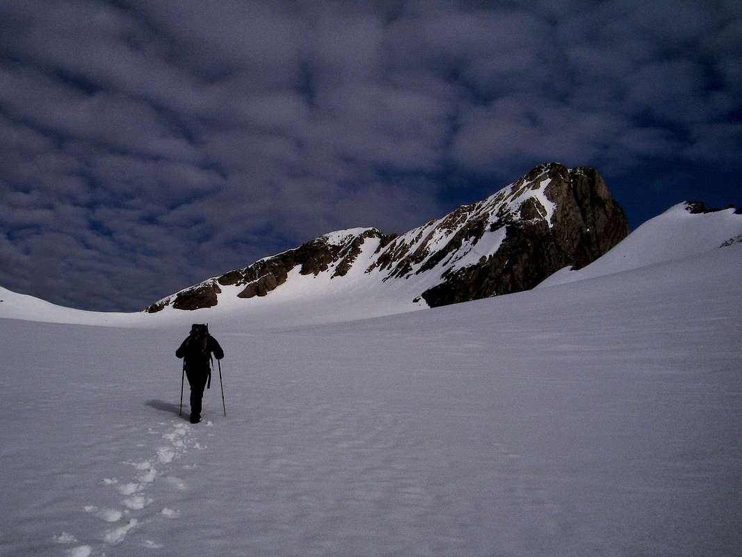 Glacier d'Ossoue
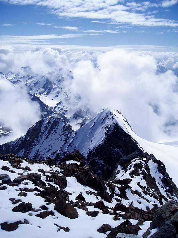 View from Vignemale summit
The first ascent of this well-defined mountain was by Anne Lister of Halifax (UK) on August 7th, 1838. The route to the summit was found by Henri Cazaux and Bernard Guillembert in 1837. Cazaux even signed the certificate to say that Ms. Lister reached the summit first.
(see Comments below for alternative 1st ascent) Ascents can be made from bases on both sides of the border, these being Cauterets and Garvarnie in France and Bujaruelo in Spain.
![Summit rocks of Vignemale]() Summit rocks of Vignemale
Summit rocks of Vignemale
![View from Vignemale summit 2]() View from Vignemale summit
The Vignemale 'voie normal' follows the route of the first ascensionists over the Glacier d'Ossoue and up gently angled slabs of rather loose rock to the frontier ridge and then up a few metres onto the summit. The time required to do the normal route is around three to three and a half hours from the Bayssellance refuge and about 2 hours on the way back to the refuge (depending on snow conditions and method of descent). The dotted line on the map from the Refuge Bayssellance to the summit of Pique Longue clearly illustrates the normal route.
View from Vignemale summit
The Vignemale 'voie normal' follows the route of the first ascensionists over the Glacier d'Ossoue and up gently angled slabs of rather loose rock to the frontier ridge and then up a few metres onto the summit. The time required to do the normal route is around three to three and a half hours from the Bayssellance refuge and about 2 hours on the way back to the refuge (depending on snow conditions and method of descent). The dotted line on the map from the Refuge Bayssellance to the summit of Pique Longue clearly illustrates the normal route.
![The summit of Vignemale]() The summit of Vignemale
The summit of Vignemale
![Refuge Baysellance]() Refuge Baysellance
Refuge Baysellance
![Refuge de Grande Holle]() Refuge de Grande Holle
Campsites are plentiful in the area particularly in Gavarnie and Cauterets in France and in Bujaruelo in Spain. Wild camping is possible as water is readily available in the area, however in the National Parks camping is normally not allowed, although bivvying at night is generally permitted at high levels providing tents are taken down early in the morning. (Check locally with rangers to determine current rules) Hotels, Hostals and Refuges abound on both sides of the frontier. Accomodation does become scarce though during the peak seasons so pre-booking is advised. Of particular note is the Refuge Bayssellance, at 2651 metres the highest hut with guardians in the Pyrenees, this is owned by the French Alpine Club (CAF) and is ideally situated for an ascent of Vignemale via the Glacier d'Ossoue. There is also another refuge owned by the CAF, this is the Refuge La Grange de Holle that is located close to the town of Gavarnie. From personal experience, I can commend the hospitality to be found there.
Refuge de Grande Holle
Campsites are plentiful in the area particularly in Gavarnie and Cauterets in France and in Bujaruelo in Spain. Wild camping is possible as water is readily available in the area, however in the National Parks camping is normally not allowed, although bivvying at night is generally permitted at high levels providing tents are taken down early in the morning. (Check locally with rangers to determine current rules) Hotels, Hostals and Refuges abound on both sides of the frontier. Accomodation does become scarce though during the peak seasons so pre-booking is advised. Of particular note is the Refuge Bayssellance, at 2651 metres the highest hut with guardians in the Pyrenees, this is owned by the French Alpine Club (CAF) and is ideally situated for an ascent of Vignemale via the Glacier d'Ossoue. There is also another refuge owned by the CAF, this is the Refuge La Grange de Holle that is located close to the town of Gavarnie. From personal experience, I can commend the hospitality to be found there.
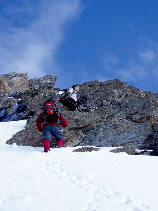 Summit rocks of Vignemale
The area in which Vignemale is situated is very accessible but largely unspoilt. In addition to the many mountains that form the frontier and the spur branching from there that is the retaining wall for the glacier, are a series of verdant valleys that totally surround the heights. It is a paradise for all outdoor sports.
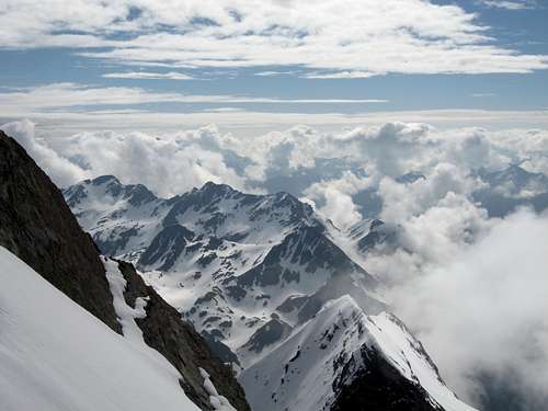 View from Vignemale summit
 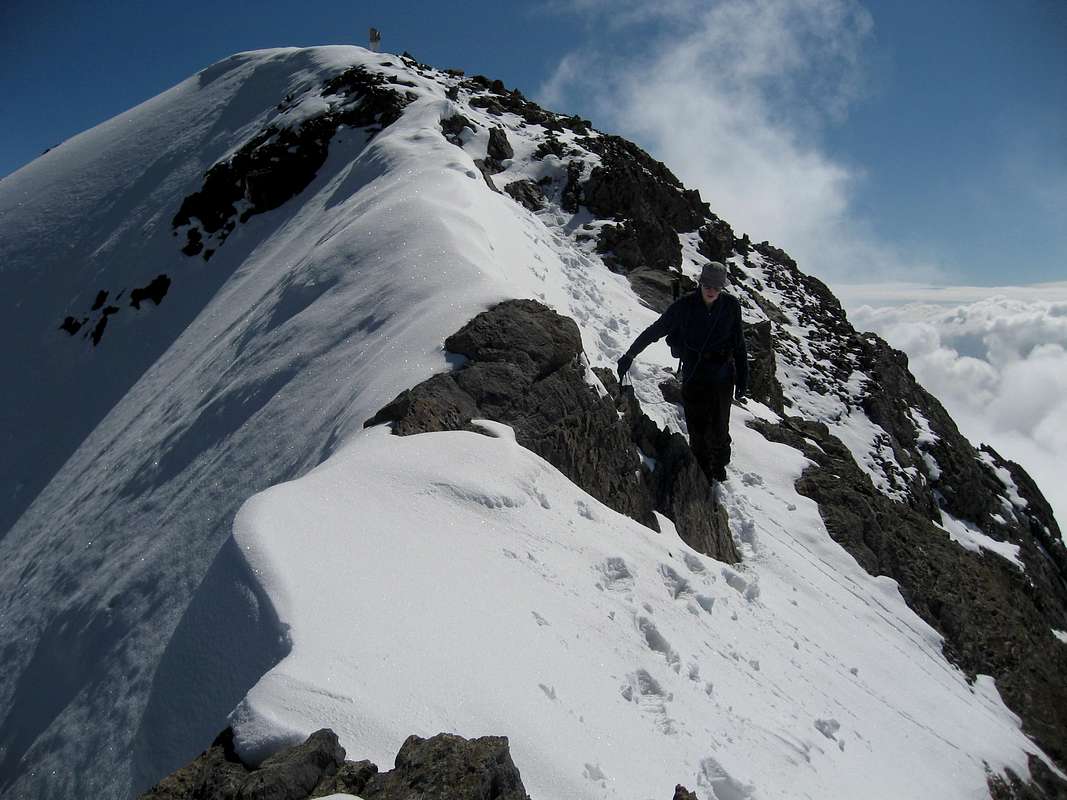 The summit of Vignemale
Getting There
Access from the French side of the border by road is from the East-West autoroute E80 (Bayonne to Toulouse) and the National road N21 via Lourdes and the D821 / D920 to Cauterets or the D921 to Gavarnie. There are airports at Pau and Toulouse. On the Spanish side, travel by road from Pamplona to the west of the region via the N240 / N330 and the N260 to Torla then via a short local road to Bujaruelo or from Zaragoza south of the region via the N330 to Huesca and then the N260 to Torla. Airports at Pamplona and Zaragoza serve the area. For those who aspire to travel with a very low carbon footprint, there are two long distance paths that pass close to Vignemale, GR10 in France and GR 11 in Spain.Red Tape
There is no specific red tape, no permits are required for the ascent from either France or Spain. There are of course certain rules of conduct in the National Park.Camping and other accomodation
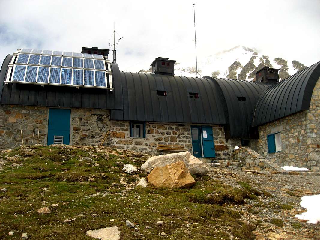 Refuge Baysellance
 Refuge de Grande Holle
Rafa Bartolome - Aug 1, 2008 5:35 am - Voted 10/10
The namethe name is Grand Vignemale and not Grande Vignemale. You must attach the peak to its massif: Vignemale Massif (parent)
DrJonnie - Aug 2, 2008 11:55 am - Hasn't voted
spelling?Hi Rafa, thanks, I'm mixing my Spanish and French obviously. I will make the changes you suggest. cheers Johnnie
Rafa Bartolome - Mar 28, 2009 2:45 pm - Voted 10/10
coordinates of summitactually the coordinates are wrong, the peak appears near of Breche de Roland Try this coordinates: 42.77463 -0.14527
DrJonnie - Apr 2, 2009 6:11 pm - Hasn't voted
Whoops againHi Rafa, thanks for the check, I have tended to roughly position the arrow on the digital map rather than entering the coordinates directly. A bit lazy I guess. I will correct it. Gracias Johnnie
Sheridanne - Mar 18, 2020 12:00 pm - Hasn't voted
Anne ListerThe first documented, "official" ascension of this peak was by English landowner and traveler Anne Lister and three local guides in 1838.[2][3][4] Some man came up after her and tried to lay claim about being first, but he was met by her and her lawyer and one of the guides that got bribed by the man.
DrJonnie - Mar 19, 2020 6:38 am - Hasn't voted
Re: Anne ListerHi Sheridanne, Thanks for your comment. I've added a note to the text to indicate your alternative 1st ascentionist, cheers Johnnie