

-
 21099 Hits
-
 86.74% Score
-
 23 Votes
|
|
Area/Range |
|---|---|
|
|
42.91419°N / 0.09613°E |
|
|
Hiking, Mountaineering |
|
|
Spring, Summer, Fall, Winter |
|
|
10472 ft / 3192 m |
|
|
Overview
 Col des Tentes
 Balaïtous
 Lac de Gaube
The Bigorre (Gascon: Bigòrra), "Land of the Adour river", is a very ancient region of the former broader Gasconia, which nowadays designate almost exclusively only the part of the corresponding French Pyrenean mountainside.
It is often confused with the equivalent of the administrative departement of the "Hautes-Pyrénées" (65), but it encapsulates more than the only Bigorre, since the region called "Quatre-Vallées" (Aure & Louron) was apeended to it after the French Revolution, to make it not a too small entity.
While the anonym and industrial Tarbes makes the administrative center, the most famous city of the Bigorre is undiscutably Lourdes, known all around the world for reasons that have little to see with mountains. But which certainly drains significant masses of pilgrims, in which many are seeing, in the quietness and the grandeur of mountains, a proper environment for religious and philosophic meditating.
The "Pyrénées Bigordannes" indicutably own most of the world-famous sites of the range on the northern side, and summarizing it would be just too complicated, given the amount and the diversity of the areas found there.
Thanks its assymetry that reaches its maximum in this section, all three main characteristic rims of a typical tectonic mountain range like the Pyrenees are present in the Bigorre.
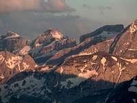
 Gavarnie sunset panorama from Bellevue
 Vignemale from Cabaliros
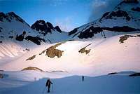 To the Grand Tapou
 Grand Vignemale
 Petit Vignemale
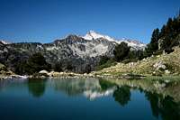 Néouvielle
 Lac de Bastan
Limestone kings such as Gavarnie, the Vignemale and the Munia, that share the border with Spain, as well as the fame of the neighbouring Monte Perdido, Europe's tallest limestone summit (Marmolada is 12m smaller !), form the end of a prominent southern limestone rim, runnning uninterruptedly over all the spanish mountainside and its canyons.
Other not less spectacular regions such as the Néouvielle, the Ardiden and Marcadau mountains, forming the granitic horst, spread their lacustrine boulder chaos more north, still rivalizing in height with the first.
And then, still further north, few other schists mastodonts such as the Pic du Midi, the Arbizon and the Monné, oppose a last sedimentary barrier, remain of the northern rim dug by the erosion of valleys. Before fading out into more rounded, woody and pastoral forehills. After we pass the last hilly regions such as the Lavedan and Barronies, with their bucolic hills. The Pyrenees disappear as the wide Lannemezan moraine plateau, dug by a star-shaped range of rivers, spread the Pyrenean waters within an angle of more than 90°.
Historically speaking, it is undoubtedly in the Bigorre that occured the most legendary high feats of the "Pyrénéisme", with Ramon's quest of the "Mont Perdu", believed at this time to be the top of the Pyrenees; with Russell's love story with the Vignemale; with the incredible epics of the geodesic officers Peytier and Hossard in the Balaïtous region, the edification of the Midi observatory by the general Nansouty, as well as many others such as Packe, Schrader, Chaussenque.
Just like the Luchonnais has Bagnères-de-Luchon as headquarters, Cauterets is the second capital of Pyrénéisme. Not to say the first, until the highest top unfortunately migrated to the Aneto in the 19th century...
More recently, the yearly event of the Tour de France regularly show the plendour of the Bigorre to millions of telespectators, along the best cyclers struggling with the passes of Tourmalet, Aspin, Aubisque and the likes...
 Blue Lac de Bastan
Coverage and Subregions
 Cirque de Gavarnie
 Pic du Midi
 Vignemale's Couloir de Gaube
 Grande Fache
 Gavarnie waterfall
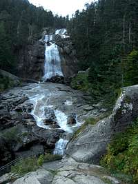 Pont d'Espagne waterfall
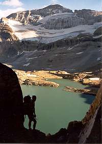 Tuquerouye at noon
 Tuquerouye at night
The limits of the Bigorre, as we chose to present it on SummitPost, could be defined as follows: it corresponds to the watershed of the Adour river, leaving the Gave de Pau more West into the Béarn.
View Bigorre in a larger map
- In the West, the Bigorre shares its border with the Béarn. The limit is natural in the upper part near the border, as it is made by the ridge of the Balaïtous. For practical reasons, this mountainous unit is described more extensively into the Béarn page, despite it can be climbed from the Arrens valley. Lower, this limit continues to follow the water divide, but the nearest we get to the plain, the most administrative exceptions we find to this rule. This is not only the border between 2 departments but also 2 French administrative regions: Aquitaine and Midi-Pyrénées.
- On the South West, the Ardiden and Marcadau granitic regions share the border with, the upper upper Tena valley, where the region of Infierno makes the continuity, with the same granitic and lakes character.
- On most of the South till the South East corner, the border of the Bigorre coincidates exactly with the Ordesa-Monte Perdido region.
- Along all the Eastern border, the Bigorre shares the border with the Pays des Nestes and Luchonnais, which belong to the watershed of the Garonne. But for practical reasons, not to cut entities like the Néouvielle and Arbizon in two (most of their waters flows east), the river Neste d'Aure was chosen as a separation line as high as Port de Bielsa, largest depression in the border ridge.
 Misty Gavarnie
Getting There
 Luz Ardiden road
 Col du Tourmalet
 Col d'Aspin
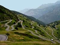
 Route du Col des Tentes
 Vignemale sunrise
 Cloudy pallas
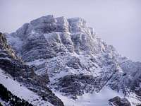 Frozen Marboré
 Gavarnie sunrise
 Marcadau valley
 Grande Fache
 Couloir Swan
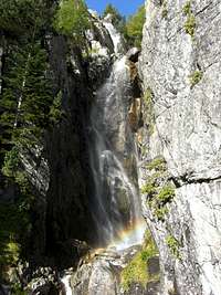 Cascade d'Embarrat
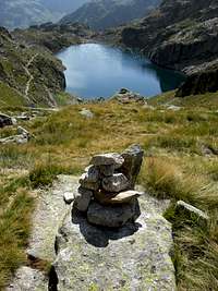 Lac de Portet
 Lac de Portet
 Top of Vignemale
 Serre Mourene ridge
By public transports
French public transports are concerned as the area is on this side.
The Bigorre, due to its high touristic popularity, is quite well served with public transports, in comparison with other French areas of the piedmont of the Pyrenees.
Unfortunately no railway is penetrating the range like it does in other valleys, but all these former train lines have been replaced by autobuses. One can reach Arrens-Marsous, Cauterets, Luz-Saint-Sauveur as well as the whole valley as deep as Gavarnie, Barèges, La Mongie, and Saint-Lary by the SNCF bus lines. Other private transporters may allow to get deeper into the range, but this kind of data is always changing, and the best advice is to contact the tourist information of a specific place to get the information needed.
There might be as well some private shuttles to all the ski resorts, but not on a regular basis. If you come from far and want to explore all transport opportunities, it can be worth phoning to them and ask.
From Far, Gavarnie is the most advantageous trailhead, to be as close as possible to the range. From there, one can explore conveniently the three Cirques of Troumouse, Estaubé, Gavarnie, and possibly the rest of the Monte Perdido range with few days of hike and the help of huts. The Vignemale range is also withing reach of hand via the Oussoue valley that one can afford walking on foot.
All timetables can be checked on the SNCF website : www.voyages-sncf.com.
 Spain by car
The Bigorre, due to the presence of huge massifs on the border, does not own any road passage across the border.
The most convenient passages are located as far as the tunnel of Bielsa (East), or the Pourtalet pass (West, see the Getting There section in the Béarn page).
Of course the location from where you come from will mostly determine your choice, but the Bielsa tunnel has few advantages :
- Is the most convenient of the two as it serves a wide part of the Néouvielle, Barroude, the Arbizon and the Baronnies. Use the road pass of Hourquette d'Ancizan instead of Col d'Aspin if you need to switch into the Campan valley and further. This itinerary has the advantage to be more direct, and very beautiful !
- Few mathematic calculations by Google Maps show that Luz-Saint-Sauveur, exactly in the middle of an itinerary from the Pourtalet to Bielsa via France (200km in total, 100km from each side), is reached half-an-hour quicker in time. The "middle" of the same journey, if we take into account the time, is roughly in Pierefitte-Nestalas. Which means that for Cauterets, it has no real importance. But For Gavarnie, Bielsa is definitely better.
There is an asphalted road that leads to Port de Boucharo (2270), whose access is limited until Col des Tentes (car park and trailhead to Brèche de Roland); this "road" has an equivalent, not asphalted, on the Spanish side, climbing up the Ara valley until San Nicolás de Bujaruelo and then heading into the mountainsides towards Puerto de Bujaruelo (Spanish spelling of Boucharo). These are the remains of an aborted project of cross-border link anterior to the existence of the National Park, meant to make good use of the lowest point between the Vignemale and the Gavarnie peaks...
Fortunaltey, for mountain lovers of these splendid regions, the project never succeeded. But hiking French areas from Spain is possible from the region of Torla.
 France by car
Thanks to the A64 (E-80) Motorway that goes very close along the Pyrenees on its section between Tarbes and Lannemezan, the access to the Bigorre is made quite quickly. One can leave the A64 in Tarbes, Tournay, Capvern or Lannemezan to reach the different valleys. The axis leading to Lourdes and Argelès-Gazost is quite fast, a dual-carriageway on most of the way.
Both the Argelès and Campan main valleys divide in several branches, both unlinked to Spain and in cul-de-sac. Other secondary valleys develop deeper: Arrens, Azun, Cauterets, Luz, Barèges, Lesponne, Gripp.
The only main pass that links two valleys in the Bigorre is the very famous Col du Tourmalet, linking the Gripp and Barège valleys. Coming from the north, it is not really needed, its main interest is for those who come from the Aure valley and need to reach other valleys more West, or those whose trailhead is located on it.
On the West, the Col du Soulour and Col d'Aubisque make another main pass which links to Laruns in the Béarn. Besides the access to the massifs in the Gourette area (Ger, Gabizos), its interest is for those coming from the Ossau valley.
View Larger Map
 Lac d'Aumar
Nature and Regulations
 Chamois & Pic du Midi
 Brown vulture
 Pyrenean marmot
 Alpine Ptarmigan
 Deer in the lower forests

The regulations of the National Parc specify that :
- One can wildcamp or bicouac in mountains as far as one hour of walk away minimum from a road, only during the night or by bad weather, between 19pm and 9am.
- Dogs forbidden
- Fires forbidden
- Rubbish forbidden
- Flower-picking forbidden, no Hunting
- Motors (4x4, motorbikes) forbidden
- Mountain bike authorized only on designated tracks
- Paragliding forbidden
- No noise...
- Fishing allowed in certain conditions. Regulations even more complex for subalpine mountain lakes.
The area covered by the Bigorre is quite varied when it comes about fauna and wildlife diversity.
The Isards (Pyrenean name of the chamois) are met in huge herds, especially in the limestone zones near the border. Brown vultures, one of the largest bird of prey in Europe, is seen over almost every possible ascending stream, flying in large circles.
The hardwood forests of the Lavedan and the Barronies are a dream land for the deer, whose belling (le "brâme du cerf") is draining crowds of nature lovers in the autumn.
Lakes and streams are the home few endemic species such as the Desman, small aquatic mammal also known as the Trumpet Rat.
The mountain lakes of the Ardiden and Néouvielle areas host countless species of fishes, algaes. As for flora, passing the huge variety of flowers from which the Ramondia is the most famous endemic specie, there is no other place in Europe where trees grow so high: the though "black pine" can be seen as high as 2600m in the Néouvielle !
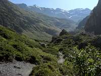
 Marcadau valley
Vignemale Massif
 Vignemale from Gaube
 Vignemale from Badet
 Petit Vignemale
 Oussoue glacier
Despite the Iberic side of this complex mountainous unit is already aborded in the Ordesa-Monte Perdido region, most of this massif, as well as all its most famous features, are located on the northern side. The Oussoue glacier is the largest in all the French Pyrenees, and the huge cracked triangular north face, with its vertical drop of more than 1000m, belongs to the standard postcards. Most of the routes to access them, as well the only mountain hut (Baysellance), and all famous historical facts linked to them, are located on the french side too.
Not less than ten three-thousanders, forming a huge horseshoe over a half of the upper circumference of the glacier, can be collected. We find, in the order the Petit Vignemale, the Pointe de Chausenque, the Piton Carré, the Pique Longue, the Clot de la Hount, the Cerbillona, the Pic Central, the Montferrat, the Grand Tapou and the small.
A specific page about the Vignemale, as a subregion of the Bigorre, makes a very detailed description of the area, with a focus on the rock-climbing routes on the sharp north face of the mountain, as it is seen from the Gaube valley.
 Vignemale from Port de Cambalès
Cirque de Gavarnie
 Cirque de Gavarnie
 Brèche de Roland
 Gavarnie waterfall
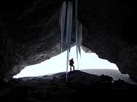 Casteret cave
Again, most peaks of of the the border ridge are described in the Ordesa-Monte Perdido region, as they are climbed also from the not less famous site of Ordesa. Often described as its French counterpart, the Cirque of Gavarnie, with Europe's tallest waterfall, is a must-see site as well.
"The most mysterious architecture by the most mysterious of architects, nature’s coliseum, Gavarnie", wrote Vicor Hugo. Gustave Flaubert, even more enthusiastic, said "I have never seen something so beautiful". Other world-famous French writers praised it, such as Alfred de Vigny, Chateaubriand, or Georges Sand ,who summarized it as simply as "This is Hell" ! And let's pass the many pages other more prolific mountain-specific writers such as Russell produced.
A crowd of famous painters, not exclusively devoted to landscapes niether mountains, also made their try to immortalize the view: Jean Auguste Dominique Ingres, Jules Dupré, Gustave Doré, Ugarte, Sulpice Guillaume Chevalier. Even high personalities such as the Queen Hortense de Beauharnais and Napoléon III came to visit it.
Many three-thousander that can be counted until ten, again, form the rim of Gavarnie. From West to East are found the two Gabiétous, the Taillon, the Casque, L'Epaule, the three "Pics de la Cascade", the Marboré, and the two Astazous. Out of the border ridge are found other lower very characteristic mountains, like the Piménée, well known observatory, or the Sarradets, just under the well known mountain hut under the Brèche de Roland, huge gateway to Spain, monumental door sculpted by the nature into the Gavarnie walls.
 Sunset on the Brèche de Roland
 Cirque d'Estaubé
 Tuquerouye view
Next to Gavarnie is located the narrow Estaubé valley, which we can access via the pass of Hourquette d'Allans (2430). On its way is located the second famous hut of Gavarnie, the Refuge Des Espuguettes. Estaubé leads to the Tuquerouye saddle, place of legend as it provides one of the only access to the Monte Perdido. The sudden sight of Lac Glacé, whose beauty struck more than one mountaineer with wonder. A historical unguarded shelter stands there since 1890 and hosted generations of Pyreneists.
A specific page about Gavarnie, as a subregion of the Bigorre, makes a very detailed description of the area for ice-climbing.
 Sunrise on Estaubé and Gavarnie
Troumouse - La Munia
 Cirque de Troumouse
 Troumouse from Col de la Sède
 Les Deux Soeurs de Troumouse
 La Munia & Troumouse
East from Gavarnie is located another huge limestone mountainous unit, culminating in La Munia (3133), remote extension of the Monte Perdido, overlooking Troumouse, the last of the "Three Cirques" as is often called the triplet of valleys over Gèdre.
Broader, greener and more pastoral than its brothers Gavarnie and Estaubé, this "Cirque" owns not less vertical walls that makes all its fame. Walls from which we find the perfect symetry on the opposite side as we switch into Cirque de Barroude, next on the East, more usually accessed from the Aure valley. To extend further the similarity, both of these sites own beautiful natural lakes nestled on a limestone bed: Lacs des Aires in Troumouse and Lacs de Barroude in the last. The horseback separating Barroude and Troumouse, extremely narrow at some points (one can sit on it with one leg on each side !), contribute to the fame of this place. Two little pinnacles, the "Soeurs de Troumouse", on the foot of the walls, are praised by rockclimbers.
Troumouse is bordered on each side by smaller secondary valleys: the Vallon de Gabiédou (W), providing the access to Estaubé, and the Vallon des Aiguillous (E), providing access to Barroude. More North, over Gèdre, start another broader valley, Vallon de Campbiel, historical route leading to the Aure valley, and its main pass Port de Campbieil. For sleeping, Troumouse is not featured with any mountain hut, but the Auberge du Maillet over Héas provides a similar type of basic accomodation.
 Cirque de Troumouse
 Serre Mourene ridge
 Pic Heid ridge
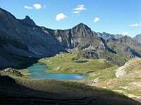 Cirque de Barroude
 Barroude glacier & lake
As for summits, the Munia unit mentioned earlier owns other secondary three-thousanders: Pic de Serre-Mourène (3090), Pic de Troumouse (3085), Pic Heid (3022), or the Robiñera, located entirely in Spain, but still withing reach of hand thanks to the high saddle of Clé du Curé (2776). Just next to it stands the Pène Blanque (2905). The two twins Pic de Bouneu (2706) and Gabiédou (2809), often confused with its Gavarnie quasi-homonym, make the easiest targets for hikers in the Cirque thanks to the smooth couloir leading to Port de la Canau (2886). The Gabiédou valley, next, serves Pic d'Estaubé (2807), frontier with the eponym valley. In the east part of which, Pic de la Canau (2766) and Mounherran (2718) are reached. Between the two passes of Port Neuf de Pinède (2466) and Tuquerouye (2660) that provide access to Pineta valley are located Pic de Pinède (2860) and Punta Forcarral (2717), its sharp twin as seen from Pineta.
Other major peaks, also failing to reach 3000m but still as charismatic and prominent, are found if we keep going on the north ridge. Pic Gerbats (2904), perfect triangular prism, form the north end of the narrow Troumouse ridge. Pic de la Géla (2851) makes a magnificent observatory overlooking the Barroude lakes. On the other side, accessed only from Port de Campbieil, the Soum des Salettes (2973), provides a superb panorama. The ridge then merges with Pic de Campbieil and the Néouvielle region.
 Cirque de Troumouse
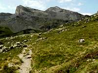 Soum des Salettes
 Salettes from La Gela
Few spectacular high saddles linking these places, are worth mention in the area: Col de La Sède (2651) linking the Cirque to the Aiguillous valley, Hourquette de Héas linking the Aiguillous valley to the Badet valley, and Hourquette de Chermentas and its speactacular suspended trail that leads directly from the Badet valley to Barroude.
Besides the only guarded mountain hut of the area, the site of Barroude owns a modest peak (2772), whose interest is embellished by the presence of the Via-Ferrata "Camino de las Pardas". Unfortunately, this beautiful site is threatened by a project of extension of the ski-resort of Piau-Engaly...
Lutour - Marcadau
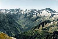 Val d'Azun
 Balaïtous from Barbat
 Near the Larribet hut
 Batcrabère valley
North from the Vignemale area, the limestone is surprisingly giving place quickly to a wide terrain made of granite. This huge complex region, in many ways comparable to the nearby Néouvielle or the Spanish Aigüestortes, hosts countless lakes, in a labyrinth of ridges and valleys. Five main units spreading north can be counted in the area of the Bigorre (this granitic region is shared with the eastermost part of the Béarn as well as the upper Tena), separated by as many valleys.
A weak percetage of the highest peaks access the coveted status of three-thousanders, but this "disadvantage" is compensated by the fact that the three last valleys, merging over Cauterets, are commonly mentioned as the most beautiful triplet in the French Pyrenees. The spectacular waterfalls of Pont d'Espagne and Lutour, in their respective junctions, contribute widely to this reputation.
The Arrens valley, longest but narrowest, provides the access to two mountain huts: Refuge Migouelou and Refuge de Larribet, ideal bases to climb the Balaïtous (3151) and the Pallas (2974). The Estaing valley, tributary of it, and which once reunited form what we call in broader sense the Val d'Azun, is the less known. It provides access to the Grand Barbat (2813) and the Pic de Cambalès (2965). Smaller mountains too, like Midi d’Arrens (2267m), Bassia du Hoo (2571m), Maleshores (2703m) or Bernat Barrau (2592m). The valley owns one mountain-hut, Refuge d'Ilhéou, also named "Raymond Ritter".
 Batcrabère lake
 Lac d'Embarrat
 Balaïtous from Barbat
 Lac de Gaube
 Lac de Gaube
The last mentioned peaks are reached equally easily from the wide Marcadau valley, one of the grandest of the region speaking beauty. Not only its curved shape provides access to a wide range of hiking destinations, but the meanders of the river, in a landscape of grassy meadows bordered with high lone pines, confere it a certain magic. Pic Arrouy (2785) makes the goal of a beautiful loop often made via Lac de Pourtet. The Grande Fache (3005; Grande as it has a small lower sister) is the only three-thousander of the valley, but other peaks such Arratille (2805) and Péterneille (2764) share the same popularity. Many convenient passages to Spain and the region of Pics d'Enfer (Infierno), like Col d'Aragon, Col de la Fache, Port du Marcadau, Col d'Arratille, are also a reason that explain its popularity.
Marcadau, by the way, comes from "Market", being a frequent point of passage between the two countries, the valley always used to be an important trading place of goods. One famous mountain hut, Refuge Wallon, stands at the convergence of all these trails.
 Pic Arrouy south panoramic view
 Vignemale & Grande Fache
 Lutour valley
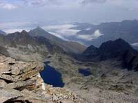 Lacs d'Ardiden & Viscos
 Ardiden jagged ridge
At the Pont d'Espagne, downstream (car park), this valley merges with the Gaube valley, whose access is eased by a chairlift, given the popularity of Lac de Gaube. This natural waterbody is remarkable by its unusual size combined with the relatively low level at which it is situated, as well as the famous view to the north face in the distance. A hôtel that hosted almost all emblematic figures of the "Pyreneism" in the 19th century stands next to it, however nowadays this building hosts only a restaurant. One needs to push much further until Refuge des Oulettes de Gaube to spend a night.
Pic Meillon (2930), Pic de la Sède (2976), Pic d'Estibe Haute (2815) are some of the most frequent hiking goals that belong to the present granitic area. However, most mountaineers use this valley as an access to the Vignemale massif, where is ending the so impressive north face, and the famous Couloir de Gaube, the narrow gully that splits it, named after the valley.
The Col d'Arraillé and Hourquette d'Oussoue are also frequently used trails leading into the Lutour valley, next, whose convergence downstream is met at the Cascade du Lutour. The Vallée du Lutour, also named Vallée d'Estom, has the particularity to be as long (10km) as straightforward, into invariable V-shaped hillsides. In the distance, the skyline is barred by the mass of Pic de Labas (2946). The flat portion ends near the beautiful blue lake of Estom, near which stands a hut, Refuge d'Estom.
Located higher, the group of lakes of Estom-Soubiran is the common hiking goal, followed by peaks such as Malh Arrouy (2965), Sud d’Aspé (2968), Cestrede (2947), Estom-Subiran (2829), Chanchou (2949), Pébignau (2895). This huge group is topped on the east side by the Pic d'Ardiden (2988), failing to reach 3000 for little. With its eponym group of lakes, they are better reached from Luz-Saint-Sauveur, in the Gavarnie valley.
 Marcadau valley
Néouvielle reserve
 Les Laquettes
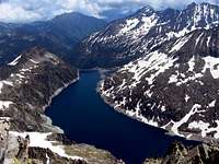 Lake Cap de Long
 Pic de Campbieil
 Pic Long & Néouvielle
The "Réserve Naturelle du Néouvielle", by its full name, is a very beautiful granitic area with splendid lakes, owning many granitic high and proud mountains. Due to the amount of informations related to it, it was choosen to present if as a subregion in this page, dedicated to the area covered by the natural reserve.
Due to the many roads that serve the large water reservoirs and thus providing quite high access, the area is extremely touristic, especially when visited from the Aure valley and the "Route des Lacs" (serving Cap-de-Long, Aubert and Aumar). However, other less known trailheads, in the Barège and Gripp valleys, that contrary to Aure are situated within the borders of the Bigorre region, provide access to the northern regions such as the valleys of Campana de Cloutou, Ets Coubous, Aygues-Cluses, La Glère, and Barrada.
Speaking quantity of three-thousanders, the area rivalizes with the Gavarnie area and the Vignemale area with ten specimens available in the area !
They are dispatched into two groups :
- The Néouvielle massif : Néouvielle (3091), Ramougn (3011), Trois Conseillers (3039), Turon de Néouvielle (3035).
- The Pic Long massif : Pic Long (3192), Badet (3160), Maou (3074), Bugarret (3031), Campbieil (3173), Estaragne (3006).
Both of these units host glaciers of significant importance, but their size is getting smaller and smaller each year. For some of them, like the Glacier of Pays Baché that provides access to the normal route to Pic Long, it is very problematic as the level of ice eases or complicates the length of a difficult scramble to reach a saddle.
 Lac Inférieur de Bastan
 Val d'Estaragne
 Néouvielle south face
Another important mountainous unit, more north, fail to reach 3000, but small group of significant peaks, part of a charasteristic lacustrine area : Quatre Termes (2724), Pic de Bastan (2715), Portarras (2712).
The Néouvielle region is well provided with mountain huts: Orédon, L'Oule, Bastan, Campana de Cloutou, La Glère.
 View upon Campbieil/Pic Long 3 Conseillers
Arbizon - Bassia
 Auloueilh valley
 Pic d'Aulon
 Lac de Montarouye
 Porte de la Paloume
North-East from the Néouvielle, and in the continuity of it, stand a very prominent and individualized massif, culminating in the Arbizon.
This group differentiates itself from the rest by its different geology, being made of sedimentary stones such as schists and jurasic limestone, very dark in the area since full of carbon.
Another feature that makes the Arbizon area comparable to the Néouvielle is the existence of a multitude of small asphalted roads reaching a high elevation, and then allowing bagging these peaks without too long approaches. The only difference is that instead of water reservoirs they tend to reach the many ski resorts of the area (Pla d'Adet, Piau engaly, Espiaube, Payolle...)
This geologic change occurs behind the previously mentioned Portarras, as we meet Pic d'Aulon (2738), beautiful belvedaire that can conveniently be climbed in winter. The Pichaley (2626) and the Bastan d'Aulon (2721) are also famous skitouring goals.
As we pass Porte de la Paloume, high saddle linking to the north side, we meet the Pic de Montfaucon (2712), brother of the Arbizon (2831) and the Petit Arbizon (2712).
This range of peaks is commonly accessed from Aulon and the Auloueilh valley, served from the Aure Valley in Ancizan, near Saint-Lary, and ending in Granges d'Aulon, popular trailhead in the eponymous village. The upper Auloueilh valley owns an open unguarded hut, very often used by mountaineers due to its convenient location.
 Panorama to the Arbizon
 Aulon from Montfaucon
 Arbizon group from Néouvielle
 Casque du Lhéris
 Casque du Lhéris
The Arbizon group is also commonly accessed from the north and the Payolle area, famous for hosting a rare mineral the "grenats grossulaires". The Vallée de la Gaoube, or the area of the small Lac d'Arou are the most commonly used routes. The high road of Hourquette d'Ancizan, linking the village Ancizan and Payolle, just below Col d'Aspin, offers also several starting points to reach the Petit Arbizon.
North from Payolle, large cross-country ski resort, and the Col de Beyrède, pass served by an asphalted road closed to cars, stands the Signal de Bassia (1921), a long stretched sentinel mostly made of grassy terrain, and few limestone cliffs, whose character reminds a lot the neighboring mountains of Low Luchonnais. The other west end, overlooking the Campan valley, is ended by the top of Casque du Lhéris (1595), whose particularity is to own a huge dolomitic rocky south face, appreciated by climbers for the excellent rock. North from this range, the height suddenly decreases to give place to the Barronies forest.
 Signal de Bassia
Campan - Midi
 Midi from the Pene Det Pouri
 Midi from Coume de Porteilh
 Midi de Bigorre
 Montaigu
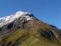 Pic du Midi
 Pic du Midi
 Lac Bleu
 Lac d'Oncet
 From South
 Col d'Aouet
The zone located between the valleys of Lesponne Campan, in the neighbourhood of the town Bagnères de Bigorre, own the most emblematic mountain of the Bigorre, and perhaps of the whole Pyrenees amongst people who do not hike: the Pic du Midi de Bigorre (2872). Its popularity can be explained by two reasons.
First, due to its location very far from the border, and its exceptional height for such place, it fills all the Pyrenean panorama as seen from the plain of the Adour watershed, crushing down all other features of the skyline as meaningless details. It can be seen most of the time from the large towns of Tarbes and Pau, and by good clear weather, one can recognize it from as far as the Massif Central !
The second reason is scientific, as well as polemical since few years. Its top hosts a world-famous observatory since 1878 and its creation by the General de Nansouty. For decades, the building was not very significant and not much more than a simple shelter, until 1958 when it was featured with a spectrograph, followed by a NASA telescope in 1963, a bigger one in 1980 a third in 1982 for to amateur astronomy. Due to its exceptional location which avoids parasite lights and allows an exceptional clearness of the sky, it is nowadays the best telescope in France and one of the best in the world. By clear weather, the morning and evening views are stunning. Russell, who once swop his caves for the cozy home of Nansouty at its beginning, and despite he was a fervent opponent of constructions on mountains, declared that "the place would give to the saints the nostalgia of earth" !
The polemic stats in the 21th century, when the peak, served by a cable-lift, becomes also a touristic attraction, in order to compensate a financial deficit. The two separate websites (observatory vs attraction) illustrate well these distinct activities, which occasionally enter into conflict, when for example the oily smokes of the cafeteria dirtied the telescopes lens....
A terrace with barriers is built in order to host as much as 600 people. And here is the polemic: No one is allowed to step in unless he has paid the touristic ticket, about 20€, for the reason that the lift is not the main cost, but touristic infrastructures (interactive visit the observatory). Since then, hikers tend to summit the peak by interrupting the hike just below the terrace. The view is the same, but kind of frustrating...
Before the existence of the cable-lift, whose start is in La Mongie, people used to access the peak via a very small asphalted road, nowadays closed, that starts at the Tourmalet pass. Epic stories from French grandparents who took it long ago with their Citroën 2CVs or Renault 4L, motor smoking like hell, are legion ! Currently, this road is now praised by cyclers, who see the highest point of France one can cycle up...
The Pic du Midi "de Bigorre" (because it shouldn't be confused with his not less famous Ossau homonym, neither the less known "Pic du Midi de Genos" (2445), neither the earlier mentionned Midi d’Arrens, occupies a considerable superficy in the present area, but other interesting hiking goals can be found around him. It is surrounded by three lakes of varying sizes: Lac d'Oncet from the Tourmalet, Lac de Peyrelade and the very famous Lac Bleu on the North, from the Campan valley.
On its upper end, the pass Hourquette d'Ouscouaou allows to switch in the Lavedan and the valley of Cauterets, where the beautiful lake of Isaby is seen. Soum Arrouy (2480), Soum de Lascours (2490) and Pène det Pouri (2587) are the local hiking goals. North from the Lesponne valley is found the Montaigu (2339), probably the most popular peak after Pic du Midi. Its eatern cliffs confere it an atmosphere of big peak.
Here end the high mountains. More peaceful visitors will certainly enjoy visiting the three valleys of Campan, Lesponne, and Gripp, very famous for their picturesque villages and pretty churches.
 Panorama to all peaks of the Bigorre, from the East (Mont Né)
Lavedan
 Pibeste from Vidalos
 Viscos from Cauterets
 Monnné
 Valley of Arizes
The Lavedan designates an historical region that was a part of the Bigorre with extensions in the eastern Béarn, stretching until the Spanish border, and whose "capital" was Argelès-Gazost. Nowadays, using this word is as a placename is made only in the context of mountain geography, and tends to designate the forehills of the western Bigorre, around the town of Argelès-Gazost, as far south as a virtual line reaching Cauterets, and the "big mountains", understand the granitic massifs of the Lutour-Marcadau described above. As we can expect then, the Lavedan designates the area of sedimentary mountains.
The Pic du Pibeste (1349) is the most famous of their representants as it makes a fine viewpoint over the valley, but it forms only the easternmost end of a long stripe of higher mountains more west like Prat du Rey (1525m), Soum de Conques (1759m), Soum de Granquet (1881m) or Pic de l'Estibète (1851m), as we head West until the border with the Béarn.
South and East from Argelès-Gazost are found some other interesting peaks such as the Cabaliros (2334), the Monné (2565), emblematic excursion from Cauterets, the pyramid of Pic de Viscos (2141), very impressive as from the valley, or the Soum des Aulhères (2168m) near the constructions of the ski station. The Gabizos (2636) is located on the border of the Bigorre, but usually climbed from Gourette.
The northernmost part of the Lavedan, near Lourdes, is a terrain similar in many ways to the Baronnies, hilly and woody, described below.
Baronnies
 Autumn in the Baronnies
 Autumn in the Baronnies
 Local architecture
 Old hut
 Forest atmosphere
 Courtaou des Esclozes
The Pyrenean Barronies are not to be confused with an homonym region in Provence, but whose name origin is the same. Baronnies means a land that formerly was the property of a local Baron, the one of Esparros is this occurence.
This region nowadays designate only exclusively a region of low ang green mountains, rately exceeding 1000m, located north from the Signal de Bassia. This wide area is indeed very empty apart from few farms, and thanks to the lack of human features like pylons, or artificial clearings due to forestry works, it served in many times as a staging place for film makers looking for wild landscapes, for stories supposedly taking place in the past.
The Pyrenean Barronies are surnamed the "Small Amazon of the Pyrenees" for this reason, but also for the nature and the opulence of the flora, very wet and green due to the air saturated with humidity (see the article about the foehn effect). Moss is covering the branches of conifers, the ground is covered with ferns of several types. Even the Welsh poppy (Meconopsis cambrica), an atlantic specie usually found only in Wales and Ireland, is found there !
One remarkable geologic site is the stream of Gourgue d'Asque, featured with an educational trail from Arrodets. The valley, getting narrower as it flows down, end into a gap, before reappearing in the "Œil de l’Arros" a source of resurgence on the opposite hillside in the Campan valley. The terrain is full of cavities, as witness also the Gouffre d'Esparros, a splendid cave open to tourists.
The Barronies are a renowned terrain for mountain-biking thanks to the countless forestry tracks and generous elevation. As for tourism, some may enjoy the visit of the Abbey of Escaladieu or the Mauvezin Stronghold, or the Saint-Bertrand-de-Comminges Cathedral when the weather turns too cloudy for hiking. Don't miss also the watermill...
Accomodation
 Refuge Wallon
 Refuge des Sarradets
 Refuge de Baysellance
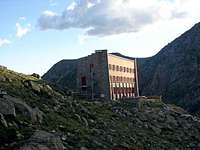 Refuge de la Glère
 Refuge de Barroude
 Grandes de Holle
 Chapelle des Templiers, Aragnouet
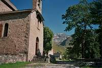 Chapelle de Heas
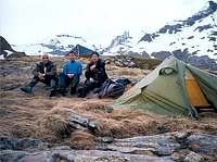 Last solution :)
 Last solution :)
Bivouacking, wild-camping
As mentioned in the red tape, overnight camping is allowed, if your tent is located at least 1 hour away from any road or mountain hut. Camping near mountain huts, using them only for eating and toilets purposes is allowed, despite it can be a surprising attitude in other countries. Removing the tent in the morning is required, despite leaving it the time of the hike is usually tolerated.
Unguarded huts and shelters
The Pyrenees have an incredible amount of places of this kind, which are inventoried in this fantastic site : www.pyrenees-refuges.com. This interactive map allows to locate them : http://www.geopyrenees.net (click "cabanes"). Some of them like Tuquerouye or Refuge Packe, in excellent state, have a huge historic background.
Official Campsites
One will find several convenient campsites in Saint-Lary all previously mentionned valley, mostly in the touristic centers. An exhaustive list is here.
Guarded Mountain huts & alpine hôtels
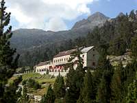
Thanks to its high pupularity, the Bigorre is densely featured with mountain huts, excepted around the areas of the Arbizon, the Pic du Midi and more north. Near the border, they are close enough from each other to link themselves in a day-hike. Some of them, especially in the Néouvielle, are former dam buildings reconverted into "mountain-hôtels", sometimes closely accesible by the road, but kept all their character.
- Refuge Migouelou
- Refuge de Larribet
- Refuge d'Ilhéou
- Refuge Wallon
- Refuge des Oulettes de Gaube
- Refuge d'Estom
- Refuge de Baysellance
- Refuge des Sarradets (or Brèche de Roland)
- Refuge des Granges de Holle (near Gavarnie town)
- Refuge Des Espuguettes
- Auberge du Maillet (road access but mountain-hut standard)
- Refuge de Barroude
- Refuge de la Glère
- Refuge-Hôtel du Lac d'Orédon
- Chalet-refuge de l'Oule
- Refuge de Bastan
- Refuge du Campana de Cloutou
Accomodations in the valleys
All the previously mentionned valleys have a crowd of possible accomodations. The most simple is to type places names in Google, or to check the touristic portals of these resorts and valleys:
- www.vallee-aure.com
- www.paysdesnestes.fr
- www.saintlary.com
- www.campan-pyrenees.com
- www.bareges.com
- www.gavarnie.com
- www.lestoys.com
One accommodation is worth mention for large groups of people: La Filature (former spinning mill), in Ancizan, with further information here and here (French). Prices can go as low as 10€ for groups over 10 people. A separate apartment is available too but rates may vary depending on the charges being shared with others or not.
Maps (paper and numeric)
 Trails...
 Dreams...
 Peace...
 Chaos...
Numeric maps
Due to the copyright policy of the IGN, it is not possible to scan and include map samples without permission. The only way to consult them online is via the database Géoportail, easily browsable via the site ClicGPX (we need to unzoom, move to the central Pyrenees and rezoom again)
Paper maps
Two types of maps are usually found in France for the Pyrenees :
- The TOP 25 series of IGN, high quality maps at the 1/25000 scale, mandatory for hiking all high regions mentioned above (apart from Lavedan & Baronnies). Several maps cover the area described in this page: 1647OT (Vignemale), 1748OT (Gavarnie), 1748ET (Néouvielle), 1647ET (Lavedan), 1747ET (Midi & Baronnies). See the France index for a more accurate look.
- The Rando Editions series, at the 1/50000 scale. This kind of map is usually enough if we stick to the trails, as well as for the soft relief of the Lavedan and Baronnies. One whole map covers the whole area : the N° 4 Bigorre.


edouet - Jan 20, 2008 5:39 pm - Hasn't voted
No camping?Rafa, please remember that overnight camping is allowed, if your tent is located at least 1 hour away from any road. Just to help people who might hike and sleep with some gear.
Rafa Bartolome - Jan 21, 2008 1:35 pm - Hasn't voted
Re: No camping?THANKS, I´ll write something about it
visentin - Apr 28, 2009 5:07 am - Hasn't voted
additionArbizon added, Bastan & Turon to come :)
Rafa Bartolome - Apr 29, 2009 2:45 am - Hasn't voted
Re: additionthank you, it's a great addition