|
|
Mountain/Rock |
|---|---|
|
|
38.64570°N / 106.3116°W |
|
|
13708 ft / 4178 m |
|
|
Overview
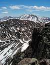
Grizzly Mountain is one of six Colorado thirteeners that are named "Grizzly". It resides in the southern part of the expansive Sawatch Range, west of Mount Antero and Tabeguache Peak. It is surrounded by a virtual sea of mountains, many of which are documented on SummitPost. Click on Nearby Mountains & Rocks, to the left, to get an idea. Cronin Peak, 2 miles to the northeast, is considered its "parent" (closest higher mountain). Grizzly Mountain is a satisfying climb, especially when combined with Cronin Peak via Grizzly's sharp, east ridge.Two attributes set Grizzly apart from its neighbors. It is the only gray colored peak among it all its reddish neighbors, and it appears to be unmolested by miners and prospectors.
Getting There
You may access Grizzly Mountain from the south, east, north, or west.Cyclone Creek Trailhead: At 10,760' elevation, provides access to Grizzly's south side. Drive 6 miles west on U.S. 50 from Poncha Springs. Turn north onto Chaffee County Road 240, which is well marked. Drive a little over 8 miles to the ghost town site of Shavano, also well marked. You will need a high clearance vehicle, but not necessarily four wheel drive, to make the last four miles of this road. Nice campsites are available along the road, if you get there early enough to claim them.
Baldwin Creek Trailhead: At 9,420' elevation, provides indirect access to Grizzly Mountain from the east, via North Carbonate. Turn west on Chaffee County Road 162 from U.S. 285, 6 miles south of Johnson Village. If you are coming from the south, the turnoff is about 15 miles north of the U.S. 285/U.S. 50 intersection in Poncha Springs. Go west on the County Road 162 (paved) for 12 miles to the Baldwin Creek Road. Park at this junction. With a 4WD vehicle, proceed south. Take a left when the road forks at 2.4 miles. Proceed another quarter mile southeast, to a road junction at 10,840 ft.
Baldwin Lake: Provides close access to Grizzly Mountain on the north. Take the right instead of the left fork of the Baldwin Creek jeep trail described above. Continue southwest past a series of lakes, terminating at the large Baldwin Lake at 12,047 ft.
Grizzly Lake: West and north of Grizzly Mountain. Continue west on County Road 162 for 5 miles past the Baldwin Gulch turnoff, to Saint Elmo. Take the jeep road 3 miles south to Grizzly Lake, at 11,177 ft.
Overview of Routes
South Slopes: Class 2 scramble. Six miles round trip from Cyclone Creek Trailhead. 2970' elevation gain.
East Ridge: Class 3 traversal, narrow and exposed ridge. Ten miles round trip from Baldwin Creek Trailhead. 4250' elevation gain.
West Slopes: from Grizzly Lake.
Red Tape
This mountain is in the San Isabel National Forest. All visitors and forest users are subject to Federal Regulations. Read the rules, which address camping, vehicles, camp fires, pets, and several other issues.Mountain Conditions / When To Climb
Current, local conditions are maintained by the Forest Service at their web site. Besides the current weather, they publish campground status, road conditions, trail status, and closures. You may also call the Forest Service office at 719-553-1400.Early June through September is the best time to climb mountains in the Sawatch. You are by no means assured of safe conditions on any day of the year, of course. Be aware of the high potential for lightning on summer afternoons. As always, use good judgment, and
Check the Weather Forecast before you go.
Camping
Grizzly Mountain is situated in the San Isabel National Forest, where there are numerous places to camp. Visit the San Isabel and Pike National Forest Campground Guide for a list of all developed campgrounds. There are several along Chaffee County Road 162 and several along Road 240. Dispersed camping is also permitted in many areas and with certain restrictions.If your destination is the Cyclone Creek trail, the Angel of Shavano Campground is about 4 miles below the trailhead along CR 240. Fee is $12 per night. Above that campground and along the same road there are approximately a dozen other small camping areas, good for one to five vehicles, with no fee. You may have to get there early to claim them, however. The North Fork Reservoir Campground ($6 per night) is two miles beyond the trailhead at 11,000 ft.


