On this page I would like to give an overview information of the Krn Subgroup (Julian Alps), in order not to be repeated on all distinct summit pages. The map above is also a short guideboog, on the SummitPost see also the mountain and routes pages! Regarding pictures and routes, this page is the place only for overall information.
Overview
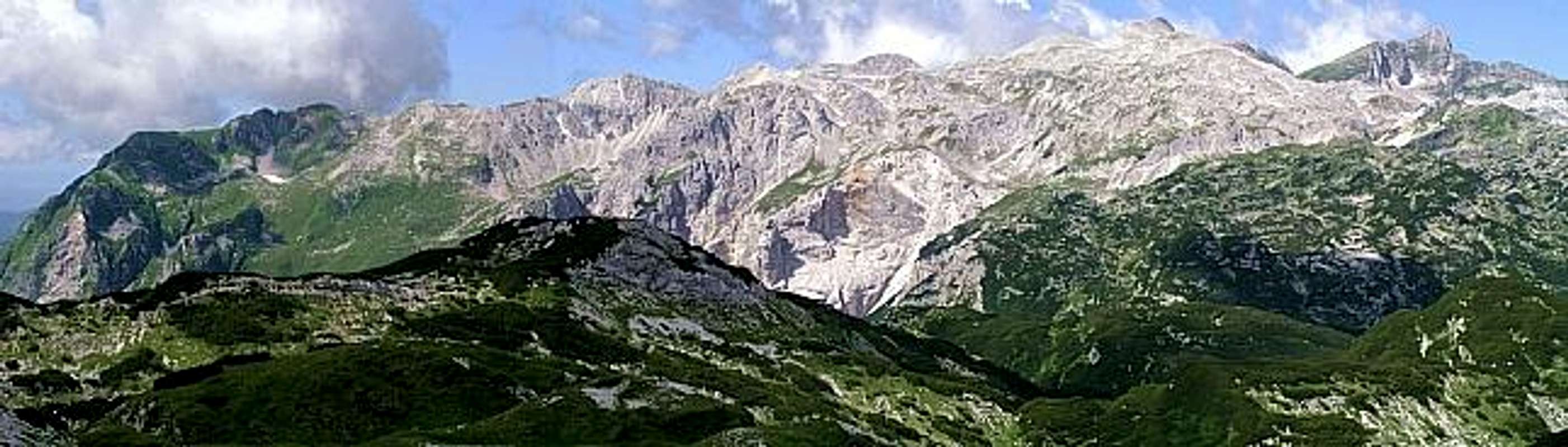
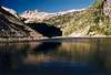
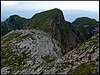
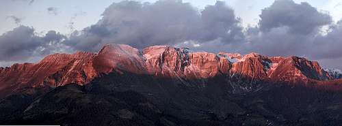
Krn group from the east, from Bohinjska vratca (saddle)
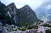
Summit panorama
Krn group from the east
Like a giant wedge, the Krn group is "pushing" the Soča river towards the west. Running towards the west, passing Bovec, it reaches Žaga village, where it turns sharply and continues flowing towards the southeast, through Kobarid to Tolmin and further on. The eastern borders of the Krn group can also be easily set. On the north it is Lepena valley, then the high valley east of the Krn lake and towards the south the valley of Tolminka.
The character of this group is interesting. Its mountains are not very high, but relative altitude differences are very considerable. The southern slopes of Krn, for example, are falling steadily down towards the Soča river for more than 2000 meters. Some mountains in the group are steep and difficult to reach. Especially on the north the 'Trenta character' of mountains is already visible. In the southern part, summits are quite similar, but some are still surrounded with more modest forehills. And the undisputable king of the group is Krn itself. Very dominant, with its typical nose shape, it can be seen almost from any point in the Julian Alps and from Slovenian forehills, down to the Adriatic coast.
Summits
On the southeast, Krn group starts rising with some moderate hills, until above the broad ex glacial amphitheatre all the main summits are arranged. The eastern slopes of this subgroup, rising above the valley of Tolminka river, are even steeper. Towards the north these mountains are falling with barren karst-like slopes down to the high valley of Krn lake. The main mountains are the following:
Krn, 2244 m. The king of the group, easy to ascend, also a ferrata and some harder climbs, great ski tours, unsurpassable panorama.
Batognica, 2164 m. Table-top mountain, known by the fierce fightings during the World War I.
Vrh nad Peski, 2176 m. Funny sharp peak with a lot of gravel. Nice ski tour.
Maselnik, 1903 m, Rdeči rob, 1913 m, ... less important summits of the SE corner.
Veliki and Mali Šmohor, 1931 m and 1944 m. Lonesome summits, standing south of the Krn lake.
From the Krn summit towards the northwest a long ridge runs. Its summits are steep, but vary only a little in altitude. Due to this fact and due to still preserved paths from the World War I, crossing the whole ridge is a great tour. In the middle of the ridge the Velika Vrata pass, 1938 m, allows easy passing from the western to the eastern side or vice versa. Summits:
Krnčica, 2142 m. Steep ridge, consisting of several peaks. Nice crossing, some demanding ski tours possible.
Vršič, 1897 m. Sharp peak with many remains from the World War I.
Kal, 1698 m. NW end point of the ridge, where during the World War I the most severe fightings were conducted.
Close to Velika Vrata from Krnčica ridge a strong side ridge goes towards the east. It soon lowers to Čez Potoče pass, 1845 m, after which it continues to the important summit of:
Veliki Lemež, 2043 m. A stand alone mountain, nice panorama. The eastern foresummit is Debeljak, 1869 m.
In the northern part of the group, above the rivers of Soča and Lepenica, the most remote mountains stand. Also visiting these summits will take you back in the times of World War I. Especially on the Lipnik, you will find the whole settlement of houses - a kind of Slovenian Macchu Picchu! From the Krnčica ridge these summits are separated by the beautiful high valley, called Dolič. Summits:
Javoršček, 1557 m. Broad, not very high, but stand-alone and nicely visible mountain.
Lipnik, 1867 m. Remote, rarely visited. Interesting remains from the World War I.
And finally the wedge. West of the Krnčica ridge there are some nice alpine meadows, actually a long, high mountain pass. West of it, the long ridge, named Polovnik, rises. Crossing it is very rewarding, but not easy. Some peaks are steep, paths are disappearing and hard to find, there you will be most certainly alone. The highest two summits are:
Krasji vrh, 1773 m. Good path, nice panorama.
Veliki vrh, 1767 m. Remote, challenging summit.
Mountaineering Highlights
There are too many mountaineering goals to mention them all. Here are just some ideas:
Krnčica ridge. Take two days. Park on Zapleč meadow (above Drežnica and Drežniške Ravne), ascend Vrata pass in the Krnčica ridge. Leave there sleeping bag (tent?) and other equipment. Continue over the whole Krnčica ridge, but before reaching Krn, go on the northern side around it to Krnska škrbina and to the top. Return to Krnska škrbina and visit Batognica summit. Return below the Krnčica ridge and find the WW1 supply path, going on its eastern side. Go to the Griva summit, 1999 m, Skutnik, 2074 m and back to the Vrata pass. Sleep there. The second day continue over the whole ridge towards the NW. Descend from the Kal either towards the south (to your car) or find the passage towards the NE into the Dolič valley. Continue towards the Javoršček or Lipnik and then return back to yor car around the western side of Kal.
Krn from the Krn lake. Reach Dom pri Krnskih jezerih (hut) either from the Lepena valley or from the Komna and ascend from there the summit of Krn. Also a nice ski trip.
Lipnik. Reach the Golobar alpine meadow, either from the Zaprikraj alpine meadow (above Drežnica and Drežniške Ravne) or from the Bovec valley (Kal-Koritnica or Čezsoča). Continue towards the E by a good path (not marked) to the saddle north of the Lipnik and to the summit.
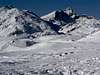
Krn south slopes ski tour. Drive to the Krn village and ascend the summit of the Krn over south slopes. Ski down there.
Komna - Krn ski tour. From the Komna ascend the Bogatinsko sedlo (pass), ski down to the Krn lake, ascend the summit of Krn and return back. Very long!
Batognica/Vrh nad Peski round tour. From the S side ascend to the beautiful Jezero v Lužnici (lake), continue on Batognica and cescens b the other (W) side.
Rdeči rob from Tolminka valley. Ascend the beautiful Lašca medow and by the abandoned high area the summit of Rdeči rob. Descend on the other side and return over other remote alpine meadows.
Other Natural and Cultural Pearls of Krn Group
Kozjak waterfallKrn summit. Sharp, dominant peak with an unsurpassable panorama.
Krn lake. A glacial lake with crystal clear water. Protected as a national monument of nature.
Soča river. Have a walk by the river or take a rafting or kayacking adventure.
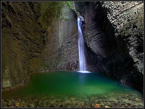
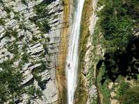
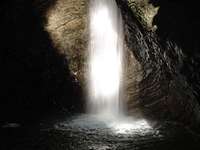
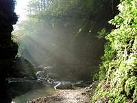
Waterfalls. Krn group is rich with beautiful waterfalls. Some of them are easy to reach, others very hard and require quiding of local experts and canyoning equipment. Here's a valuable link for waterfall enthusiasts. Some of the most nice waterfalls are:
Kozjak. North of Kobarid, easy to reach. You'll feel like in a church - very nice, 15 m.
Tolminka gorges. On the Tolminka and its tributary Zadlaščica there are nice gorges, arranged also for public visit. There's a saying that Dante Alighieri got inspiration for his Hell just here (but I heard that also for many other places).
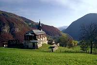
Javorca. This is a small church, erected on a beautiful place in the Tolminka valley. It is devoted to Austro-Hungarian soldiers, who were killed in the WW1. Their names are listed on plates along the church walls.
Lipnik. On this summit there's a World War I settlement of Austro-Hungarian army. Very picturesque.
World War I In Krn Group
Javorca - In memoriam to WW1 soldiers
World War 1 frontline in Krn...
In these mountains during the WW1 some of the most fierce clashes occured. The picture below shows how the frontlines were running after stabilizing in the first year of war. Early in the war, the Italian army succeeded to take the summit of Krn, but that was more or less all which the two oponents gained, before of the great offensive breakthrough of Austro-German army in 1917, of course. But the fact of steady frontlines didn't mean that there were no casualties. On the contrary. In addition to the fact that many died in hostile activities, shocking is also the fact that even more people died as victims of avalanches. Winters in these mountains were certainly not a joy! Trenches, that were needed in the Soča valley (near Bovec), were less close in the valley of Slatenik creek. They came as close as possible on the small summit of Kal, the northwesternmost in the long Krnčica ridge. Italians were holding the summit (as the whole Krnčica ridge), but Austro-Hungarians were just a few meters below, attempting to take the strategic position (also with a mine war). So, the Austro-Hungarians were holding the crest of Javoršček, Lipnik and Lemež, while the Italians were holding the crest of Polovnik, Krnčica and the summit of Krn. On all these places fortifications can still be seen. South-east of Krn, the Italian army reached also the summit plateau of Batognica. There the two armies were entrenched in the distance of only some 15 meters. But none of them could advance. So also here a mine war developed. Attempting to dig under the opponent positions, soldiers of both armies even met underground (in tunnels) and finally in some explosions the summit blew up. You can see the crater even today. Further on, the Austro-Hungarians were holding the ridge above the Tolminka valley, so the frontline descended into the Soča valley again and crossed the river. You will see remains from the WW1 wherever you go in Krn group. Although now prohibited, people were for decades gathering grenades, equipment and other items, some of them are arranged true home museums. So now the artefacts, that could be taken with you, are rare, but can still be found. Treating explosives requires attention, of course. But there is no danger of mines, as this is the case in the territories of ex Yugoslavia after the 90's war. Hiking in Krn group is completely safe. In the Soca valley you could also take a guided tour. In Kobarid it you can visit the World War I museum. There are many internet pages on these events, unfortunately not so many in English. The most beautiful page in Slovenian language is this, and from it here are many links to English pages. But they are not mountaineering oriented.
Getting There
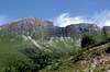
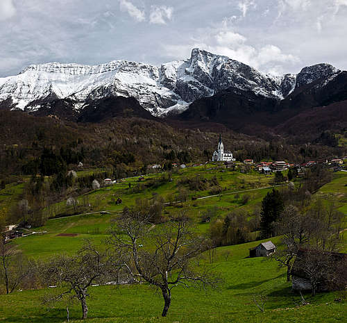
Drežnica with Krn
For the broader orientation (highways, railways, airports, ...) see the Eastern Alps GROUP page, and, because this is only a subgroup page, the Julian Alps page. On these two pages you will see, how to reach the Soča valley, either from the south (from Gorizia), from the west (from Udine), the north (from Tarvisio over the Predel pass) or the north-east (over the Vršič pass). Tolmin can also be reached over one of the passes from the east, from the central Slovenia (Ljubljana). Once being in the Soča valley, you can reach by mountain roads (all are toll free) the following points:
Lepena valley end,
Drežnica and Drežniške Ravne village and the meadows above them,
Krn village,
Tolminka valley end.
Maps:
Krn. Planinska zveza Slovenije. 1:25000
Julijske Alpe, zahodni del (western part). Planinska zveza Slovenije. 1:50000
The Krn group is part of the Triglav national park. So, please do everything to preserve nature! Here are some links to web pages where information is also in English:
Months with the most stable weather are usually from July to October. For tour skiing the best months are from March to May. For weather see here. Even better site is wunderground - here's the direct link to Kredarica station, 2515 m (below Triglav summit).
Camping
In Krn group three huts are supporting outdoor activities:
Gomiščkovo zavetišče just below the summit of Krn, 2182 m. Tel.: (05) 3023030, (050) 611363. The ascents to the hut are identical to ascents on the summit of Krn.
Dom pri Krnskih jezerih, 1385 m. Tel.: (05) 3023030. The high valley, where the Krn lake lies, is a place, where several paths meet. At the end of the Lepena valley slopes rise some 650 meters and we reach the upper plateau, where several high karst valleys meet. The hut can be reached:
From the Lepena in 1 h 30 min (easy, marked path). 2.
From the south, from the Tolminka valley. You can reach with a car the Polog meadows, 458 m. From there, you proceed northwards to the sources of the Tolminka river, 675 m. Planina pod Osojnico is the alpine meadow, where you can choose between two options. The right one is marked and leads NE, reaches in many turns Planina Dobrenjščica (meadow) and there turns left over a karst landscape on Prehodci pass, 1639 m. The other option continues towards the NW and is not marked. This is the supply path from the World War I and is comfortable and easy to follow. In the deep ravine below Kuntar it turns right and ascends in many turns the Prehodci pass, 1639 m. From Prehodci you go best in the NW direction (path, but not marked) until you reach the broad path from Bogatinsko sedlo (pass) and soon the area of Krn lakes. From Tolminka valley 5 h.
3. From the Komna plateau. If you are traversing Julian Alps, you can reach the Krn lake also from the Komna (huts), 1520 m. In 1 h 15 min you reach from Komna the important pass of Bogatinsko sedlo, 1804 m, continue towards the west into the valley Za Lepočami, 1608 m and by the valley further down to the Krn lake. Broad, good marked (No. 1) path, from Komna 2 h 30 min.
4. From Gomiščkovo zavetišče (hut) on the summit of Krn. See also the Krn page! From the summit of Krn you descend to Krnska škrbina (notch), 2058 m, turn left (N) and by the good marked (No. 1) path descend to the Krn lake. 2 h.
Dom dr. Klementa Juga, 700 m. Tel.: (05) 3023030, (050) 622719. This hut carries the name of Klement Jug, one of Slovenian pioneers among climbers, who fell in the Triglav north wall, in a route, now also named after him. The hut is standing at the end of Lepena valley and can be reached by car. It is the starting point for tours in the neighbouring mountains, not only in the Krn group.
Bivouac na Črniku stands on the altitude of 1160 m, just below the W face of Krn. It is always open and has 10 places.
Children refers to the set of objects that logically fall under a given object. For example, the
Aconcagua mountain page is a child of the 'Aconcagua Group' and the 'Seven Summits.' The
Aconcagua mountain itself has many routes, photos, and trip reports as children.
Parents refers to a larger category under which an object falls. For example, theAconcagua mountain page has the 'Aconcagua Group' and the 'Seven Summits' asparents and is a parent itself to many routes, photos, and Trip Reports.

 19666 Hits
 89.01% Score
 28 Votes
 Summit panorama
 Krn group from the east
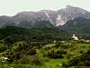

 Javorca - In memoriam to WW1 soldiers
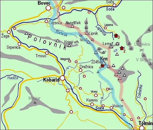


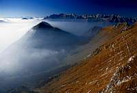
 First snow on Krn group