
|
|
Area/Range |
|---|---|
|
|
46.44000°N / 13.66000°E |
|
|
Hiking, Mountaineering, Trad Climbing, Sport Climbing, Toprope, Bouldering, Ice Climbing, Aid Climbing, Big Wall, Mixed, Scrambling, Via Ferrata, Canyoneering, Skiing |
|
|
Spring, Summer, Fall, Winter |
|
|
8787 ft / 2678 m |
|
|
Overview
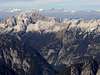
Geographical structure: Eastern Alps > Julian Alps > Mangart and Jalovec SubgroupThe broadest group with high variety. While on the northern part giants with high walls stand, in southern part there is a world of a different wildernes. Summits above the Trenta valley (upper part of Soca river) are also high above valleys. But they don't offer hard technical climbs. Still this does not mean they are easily ascendable. They are wild, steep, often grassy, with no paths. Special skills are needed to survive there. End of 19th and start of 20th century Trenta's wild hunters were unsurpassed climbers. Many of them were mountain guides of the great explorer of Julian Alps Julius Kugy.
Jalovec and Mangart are two powerful mountains in Julian Alps which have own group. Jalovec is the six highest mountain in Slovenia and Mangart is the third highest mountain in Slovenia. Mangart is located on the frontier between Slovenia and Italia. Around Jalovec and Mangart is very huge area with many beautiful mountains, amazing rivers and lakes, caves, gorges and other beauties of nature. Here are also many various plants and animals.
 |  |  |  |  |
More Photos of Landscape 1
 |  |  |  |  |
More Photos of Landscape 2
 |  |  |  |  |
Geographical overview
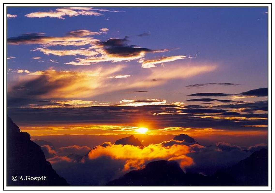
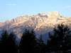
Beautiful sunset above Jalovec (on the left) and Mangart from Kredarica hut.
The Mangart and Jalovec group is surrounded by some big valleys: Planica and Tamar valley, Trenta valley (Zadnja Trenta valley, Zgornja Trenta valley and Spodnja Trenta valley), Bavscica valley, Koritnica valley, Val Romana, Jezerska dolina or Valle Rio di Lago and some small valleys.
The Mangart and Jalovec group lead in Slovenia and Italia. The northern part of group is on frontier. The group has mountains on frontier from the frontier crossing Passo del Predil (Predel pass) to another frontier crossing Vallico di Fusine (Ratece). On the frontier are some main summits like Mangart, Vevnica and Visoka Rateska Ponca (Ponce ridge). They are forming a beautiful ridge. On the Italian side fall down huge and powerful faces. They are high from 800-1200 meters. On the east side (Slovenian side) of Ponce ridge is Tamar valley and on the south side (Slovenian side) of Mangart is Koritnica valley. In the nearness of Mangart is the Slovenian highest road called Mangart road. You drive on the altitude more then 2000 meters so that is nice for ascend on Mangart from here.
From the frontier from Vevnica comes in the S way a ridge to the Jalovec. Before it rises up on the summit of Jalovec there is a famous Kotovo sedlo (pass), which is very popular in Winter for tour skiing. The W side of Jalovec falls steeply down to Koritnica valley and the NE side falls down to Tamar valley. From the summit of Jalovec goes in the E direction the ridge where are some high mountains: Site, Travnik, and Mojstrovke ridge. At the end of this ridge is Vrsic pass. On the S side of this ridge is Trenta valley. From the summit of Jalovec goes in SW way the ridge called Loska stena. There are some high mountains like Morez, Briceljk, Vrh Krnice. This is the wildest part of Mangart and Jalovec group. This ridge has over 1000 meters high north face. From the summit of Jalovec goes in S way another ridge. This ridge has some steeply summits, which don’t have marked routes. Only the last one Bavski Grintavec is marked and it is the last peak of group before the slopes fall down on the south to Trenta valley. Between Loska stena and Bavski Grintavec is a valley called Bavscica. From Bavski Grintavec leads on the E direction another wild ridge, which is too unmarked. There are some summits like Srebranjak, Trentski Pelc and others. On the N side they have the big faces, which fall down to Zadnja Trenta valley.
 |  |  |  |  |
Getting there
The heart of the region is Kranjska Gora resort town, 84 kilometers from the Slovenian capital Ljubljana. From Kranjska Gora you can reach over roads to other starting points in Mangart and Jalovec group. You can travel by bus. But you can go from Kranjska Gora to many others towns and villages (Bovec, Log pod Mangartom, Travisio,...) with train or bus.For more information how to come here check the Julian Alps group page.
Maps:
 |  |  |  |  |
Valleys
by VelebitPlanica and Tamar is first, 5km long, side valley of Zgornja Savska Dolina (upper Sava river valley), which makes northern border of Slovenian Julian Alps. From north Planica cuts deep into Jalovec group. At its mouth or end is Ratece village (870m) and one of two sources of 1000km long Sava river. Sides of the valley rise steeply. On the west (right) is sharp and wild ridge of Ponce group with Velika Ponca (2274m), its highest peak. On the east (left) is Ciprnik (1746m). At the end of the valley is mighty north wall of long Travnik (2379m) – Mojstrovka (2366m)ridge. 6km from entrance, in the upper, 2km long, part of the valley called Tamar stands Tamar hut (1108m). Travnik – Mojstrovka wall towers just above but what draws one’s attention is magnificent Jalovec panorama. From here it shows its most beautiful face of a crystal. From the hut valley slightly changes direction towards SW as it gets narrower and ascends ever steeply when it turns into scree slopes which finally end as deep and dark couloir, squeezed between cliffs of Jalovec and Golicica. Planica is also very popular among climbers, especially very demanding wall of Mojstrovka. Tour ski route from Kotovo Sedlo pass is also very popular. Planica is best known because of Ski jumping and flying where current world record is set. First man flew over 100m here. It was Sepp Bradl in 1936. Also first jump above 200m happened here. Every March final event of World Cup competition is held here.
Trenta is by many most beautiful and most romantic valley of Julian Alps. It is certainly one of longest (around 22km), placed in the heart of Julian Alps, dividing them into western and eastern part. Its mouth or end is near the small town of Bovec where it enters Bovec basin. Through it runs the most beautiful Slovenian river, crystal clear Soca! It has amazing light blue – light green color and is very popular for rafting. Along the river there are few villages and hamlets. Largest and most beautiful are Soca and Trenta villages. Trenta is very deep valley. Some of the peaks rise 2000m above it. Trenta begins bellow beautiful Bavski Grintavec (2347m) peak. Its 5km long upper part, squeezed between Jalovec group and Trentski Pelc ridge is called Zadnja Trenta. This is wildest and most beautiful part of the valley. At the end of Zadnja Trenta, where valley begins to make 180 degree turn around Trentski pelc group is source of Soca river. It appears on the surface 100 meters above valley floor, coming out of deep hole filled with crystal clear blue water, surrounded by smooth and dark cliffs. A kilometer lower, at bridge over Soca and Limarica rivers, Vrsic pass road begins to ascend. Few hundred meters up the road is famous monument to Julius Kugy which as ever looking at Jalovec. This is one of most beautiful panoramas in Julian Alps!
Koritnica is northern tributary to Soca river, most significant in its upper part. End of Koritnica valley is near the small town of Bovec where it enters the Bovec basin and runs into Soca river. Koritnica valley is dark, deep and narrow. Two kilometers before the end of the valley, at Kluze fort, is famous Koritnica gorge, which is only few meters wide but over 50m deep, amazing place. In the upper part of 12km long the valley is nice village Log pod Mangartom (650m). As the name says it is placed bellow mighty Mangart (2678m). Opposite of Mangart is also impressive Jalovec (2645m). Both mountains rise 2000m above valley and make beautiful panorama! Just above the village is beautiful Loska Stena face, few kilometers wide and 1000m high.
 |  |  |  |
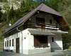
Towns and Villages
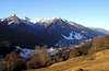
Kranjska GoraThe Zgornjesavska Valley is one of the most breathtaking alpine valleys whose center of activity is the resort town of Kranjska Gora. The valley has developed into a major tourist and sports region, famed primarily for its World Cup competitions in alpine skiing and ski flights on the giant ski-jump in Planica. But it still has much, much more to offer. With its broad variety of tourist services, this alluring valley attracts visitors all year round.
Ratece
Ratece is village on the altitude 870m. In the nearness of spring of Sava Dolinka river in the on of the most beautiful parts of Jalovec and Mangart group. It is in nearnes of frontier between Slovenia, Italia and Austria. It is well-known by the beautiful view on Jalovec, Visoko Ratesko Ponco and Mojstrovko, by the nice mountainous forests and meadows.
Tarvisio
 |  |  |
Triglav National Parc
by Velebit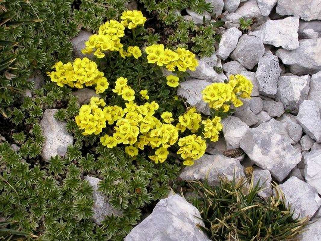
Beautiful flora in Triglavski Narodni park.
TNP is Slovenian largest national park, which is covering almost entire Julian Alps that belong to Slovenia. First ideas to protect this beautiful area came from Dr. Belar. He proposed, in 1908, 7 Triglav Lakes Valley to be protected. Because of land ownership problems it could not be realized. Finally, in 1924, on the area of 14 hectares, Alpine Nature Park was established in the valley, with time limit of 20 years. After WW 2 came the idea of true National Park. 7 Triglav Lakes Valley, together with Triglav, were declared Triglav National Park in 1961, on the area of 20 square km. But the true objectives of NP could not be obtained so finally in 1981, after years of preparation, true TNP was established. It was significantly enlarged to 838 square km with inner (542km square) and outer circle of protection. Park was named after Triglav, nation’s highest peak and symbol, which is almost in the middle of the park. As Julian Alps are mostly made of limestone, park area is exceptionally rich in various karst phenomena, including a special type of the mountain karst. It includes numerous valleys and peaks. All of Slovenian glacial lakes, except Bled Lake, are inside the park. Park is very rich with flora, which is mostly alpine but due to vicinity of Mediterranean climate there are some endemic species. Lowest point of the Park is only 180m.
Triglavski Narodni park
Important mountains

Mangart/Jalovec Group interactive map: Point on red numbers to see subgroup names, click on them to get SummitPost pages!
Here are some main information of the most important mountains. Some more information you can find on summitpost pages which are already posted.
Mangart, (2678m).
Mangart is the highest mountain of the group and it is very powerful mountain. Mali Koritnishki Mangart (2333 m) on the very east side is important, because its north wall is especially steep, offering a challenge to the best climbers, who can find there the most difficult routes.


Jalovec, (2645m).
Jalovec, also called a Crystal Mountain, is one of elite peaks of Julian Alps. It belongs among highest of them but in the ‘beauty scale’ it holds, by some, undisputed 1st place. ‘Matterhorn of Slovenia’ is ever present in books, posters or postcards. It is one of mostly climbed of high Slovenian peaks!


Bavski Grintavec, (2347m).
Bavski Grintavec is the highest mountain which leads in the long ridge from the end of valley Trenta (NE) to the almost start of valley Trenta (SW). It is lonely but has beautiful view from the summit on all Julian Alps.

Travnik, (2379m).
Travnik is nice mountain between Jalovec and Mala Mojstrovka. On its summit don`t lead any route so it is approachable for good mountaineers.

Vevnica, (2340m).
Vevnica is a very powerful mountain with a lot of slopes and big faces, which are respuned with ravines, pillars, crests, steep grassy slopes and deep notches and it leads on the frontier between Slovenia and Italia. On its summit leads the hardest ferrata in Julian Alps. It also has one of the famous faces in Julian Alps.

Mala Mojstrovka, (2332m).
Nice not hard approachable mountain is Mojstrovka. It is well seen from Vrsic pass.

Visoka Rateska Ponca, (2272m).
Below the Visoka Ponca is the world famous sky flying champion in Planica. One of the beautiest mountain in this area.

Pelc nad Klonicami, (2442m).
Nice mountain in nearness of Jalovec. It has four summits. There are also three Pelcs. Veliki, Srednji and Zadnji Pelc and all of them are hardly approachable. Very wild area.
Site, (2305m).
Site is the mountain in between Travnik and Jalovec. It is hardly approachable and has one of wildest faces in this area.

Loska stena, (around 2200-2300m), many peaks.
This are one of the longest ridges of Julian Alps. Over 12 kilometres long ridge is composed by many peaks. The highest peak is Briceljk. Briceljk is the only one which has the marked route. All others are unmarked and very wild. The others important peaks in this ridge are: Vrh Krnice, Morez, Oltarji and Plesivec.

Srebrnjak, (2100m).
Srebrnjak is a mountain in nearness of Bavski Grintavec. It has beautiful north face and nice approach over south slopes.

Trentski Pelc, (2109m).
The neighbour of Srebrnjal with wild north face and nice approach over south slopes.

Slemenova spica, (1911m).
The last mountain which is important in this group is the most visited and the easiest in group. It is nice approachable from Vrsic pass and it is suitable for hikers. It is beautiful place with very nice view.

 |  |  |
Popular hiking routes and ferratas
Here only some of them. For more information look the summitpost pages of separate mountain.- Normal route. Normal route, very popular.
- Hanzova route. Hard ferrata.
- Tamar valley routes. Hard ferratas.
- South route. South route from Zavetisce pod Spickom hut. Secured route.
- Via della Vita. Very hard ferrata from Italian side.
- Italian route. Very hard ferrata from Italian side.
- Slovenian route. Nice route from Mangartsko pass. Secured route.
- From Zadnja Trenta valley. Hard ferratas.
There are many more routes which are not mentioned here. A lot of nice paths for strollers and other not very expert mountaineers.
 |  |  |
Nice climbing routes
- Severni raz. UIAA IV-/III. 300m.
- Kaminska smer UIAA IV+/III-IV. 300m.
- Kovinarska smer. UIAA V/IV. 400m.
- Smer Debelakove. UIAA IV+/IV. 450m.
- Steber Revezev. UIAA V-/IV+. 500m.
- Zajeda Travnika. UIAA VI-,A0/V. 700m.
- Asenbrenerjeva smer. UIAA VI-,A1. 800m.
- Crni Biser. UIAA VII (all route). 800m.
- Smer Herlec – Kocevar. UIAA V-. 500m.
- Smer Belac – Zupan. UIAA V. 500m.
- Zajeda Sit. UIAA VI-, A1/V. 350m.
- Smer JLA. UIAA VI,A2/V+. 300m.
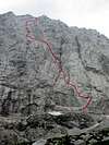
- Hornova smer. UIAA IV+/II-III. 400m.
- NE pillar. UIAA VI, A1/IV+. 400m.
- Dularjeva zajeda. UIAA VI+. 250m.

- NW column. UIAA IV+. 450m.
- Bratovska smer. UIAA V+/IV+. 450m.

- Lovska smer. UIAA V/II-III. 1000m.
- Novogoriska smer.UIAA V+. 1100m.
- Lepoticka. UIAA V. 350m.
- Levi Piussi. UIAA V+/A1. V. 500m.
- Mihelic-Zumer. IV-V. 550 m.
- Gollijeva smer. VI-/V. 600 m.

- Zajeda Cozzolino. UIAA VI/V. 800 m.
- Spominsko smer Janeza Jegliča – Johanovo. UIAA VII. 900m.
- Spominska smer Alesa Kunaverja. UIAA VI, A0, VI-V. 800m.
- Mec. UIAA VI+, V-VI. 900m.
- Mihelic – Zumer. UIAA IV-V. 350+450 m.
 |  |
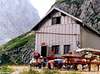
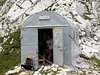
Mountain huts and bivouacs
Dom v Tamarju (1108m) hut stands on the edge of picturesque meadow, in Tamar, which is upper part of Planica valley. Hut was built in 1899 and since than numerous times rebuilt and renewed, last time in 1984. From here is beautiful view on the towering peaks around, north wall of Mojstrovka and especially Jalovec. This is one of the most romantic spots in Julian Alps. It has 128 beds, hot water, electricity, phone etc. and its open ALL YEAR. Tamar hut is accessible by car from Ratece (6km).
Zavetisce pod Spicko (2064m) refuge stands on the scree slopes just bellow Spicek, isolated needle and high above Trenta valley. First refuge was placed here in 1935. Today it has 30 sleeping places and it is supplied in summer. In winter there is winter room available. From the hut is amazing view towards east and peaks on the other side of Trenta valley: Prisojnik, Razor, Triglav and Kanjavec.
Koca pri izviru Soce (866m) hut stands in Zadnja Trenta (upper trenta) valley, two kilometers from the junction on the Vrsic pass road. 10 minutes above the hut is source of Soca river. Since this is not very popular Jalovec trailhead it is more a restaurant than hut. It has 44 beds, electricity and is open from April to October.
Koca na Gozdut (1226m) hut is standing just by the Vrsic road, 8 kilometers from Kranjska Gora and 4 kilometers from Vrsic. First house standing here has been built in WW I for the workers of Vrsic road. After the war mountaineering club from Kranjska Gora bought it and opened it in summer of 1922. Hut had to be closed in 1979 because of bad condition. In summer of 1984 construction of new hut begun and it was opened in 1986. It has 43 beds. Each room has its own bathroom. It is open ALL YEAR.
Erjavceva Koca na Vrsicu (1525m) hut is standing on top of small head, surrounded by larch trees, just by the road, some hundred vertical meters or 1 kilometer in distance bellow the Vrsic pass on the north side. From the hut is beautiful view on the towering Prisojnik (2547m). First hut was built here in 1901. In 1987 it has been decided that old hut is in bad condition and no longer usable, has to be demolished and new one build, at the same spot. New hut was opened in 1991. It has 94 beds, hot water, electricity, phone etc. It is open ALL YEAR.
Ticarjev Dom na Vrsicu (1620m) hut is standing on the southern side of Vrsic pass, just by the road. First hut here was opened in 1912 and was named Slovenska Koca (Slovenian Hut). Between 1964 and 1966 a new hut has been built, just by the old one, which was demolished upon finishing the new one. In April of 1975 huge avalanche from Mojstrovka destroyed part of the hut. It has 91 beds, hot water and electricity, phone etc. and is open from May 1st till the end of October.
Postarski Dom na Vrsicu (1688m) hut is highest standing of 3 Vrsic pass huts and has most beautiful view. Since it is not accessible by car it remained truly mountaineering hut. It has been built in 1952 on a small terrace bellow the Vrsic peak (1737m), after which pass was named. It has 65 beds, electricity, phone, hot water and its open from June 1st to September 30th. 15 minutes on foot from Vrsic pass.
Kocha na Mangartskem sedlu (1906 m).

Rif. Luigi Zacchi (1380m).
Dom na Predelu (1154m).
Mladinski tabor (710m).
Bivouac Nogara below the north face of Mangart.
Bivouac Travisio leads on the notch Rob nad Zagacami between Mali Koritniski Mangart and Vevnica.
Camping
Camping inside the Triglav National Park is forbidden. Beside the mountain huts there are plenty of hotels and private apartments in the towns and villages, which surround the area. Here are few links where you can find info on accommodations closer and further away:Kranjska Gora
Bovec
Mojstrana
Bled
Tarvisio
Mountains On Summitpost
Mangart, Jalovec, Bavski Grintavec, Vevnica, Mala Mojstrovka, Visoka Rateska Ponca, Slemenova spica, Travnik, Site, Picco di Mezzodi, Kotova spica, Strmi Strug, Pelc nad Klonicami, Skala and Male Spice / Cime Verdi, Mali vrh, Ciprnik, Svinjak.Mountain and Weather Conditions
Mountain conditions in Julian Alps are well known, thanks to Kredarica (2515m) hut and meteo station, which is bellow the Triglav.You can observe current conditions and forecast for Kredarica on the Wunderground meteo site. Here is direct link to Wunderground - Kredarica page.
Some weather information can also be found here.