
-
 13706 Hits
-
 87.31% Score
-
 24 Votes
|
|
Mountain/Rock |
|---|---|
|
|
61.54124°N / 8.29149°E |
|
|
Oppland |
|
|
Mountaineering, Scrambling |
|
|
Summer |
|
|
6667 ft / 2032 m |
|
|
Overview
Geographical classification: The Scandes > Jotunheimen > Kyrkja
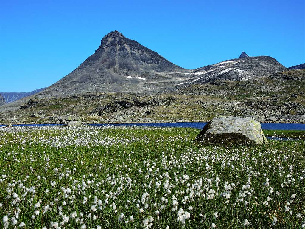
Kyrkja 2032 m
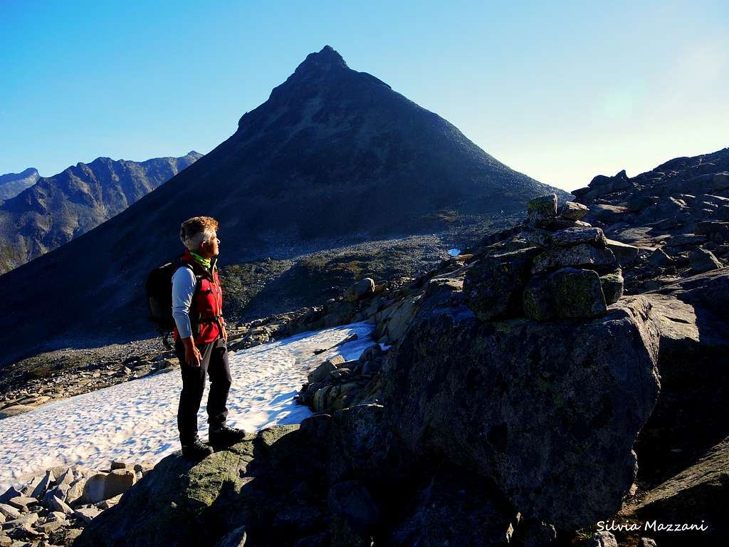
Kyrkja 2032 m, located close to Leirvassbu Mountain Lodge, is a charming pyramidal peak, surrounded by beautiful mountain lakes and extensive mountain ranges. A fine route is running on its South face, nothing more than a very pleasant scrambling Class 2, but involving an interesting climb with spectacular views all around. Really a wonderful peak to climb and stay on, admiring a breathtaking view towards four main valley and Jotunheimen peaks towering all around! The Jotunheimen range is located inside Jotunheimen National Park, 350 km North to Oslo, in the middle of Southern Norway, between the counties of Oppland and Sogn og Fjordane. In Norwegian Jotunheimen means "Giants Home" and the reason of this nickname is that the highest mountains in Norway lie in this area. It’s the most well-known and the largest mountain range in the country; valley level is about 1400 m and there are quite a number of glaciers in the area and above numerous snowcapped peaks.
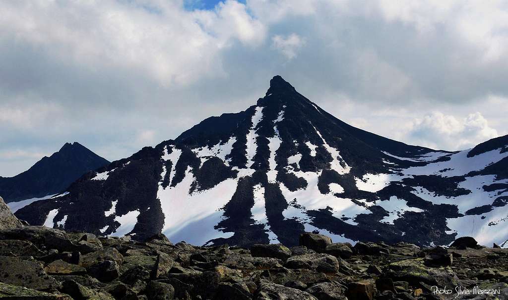
There are 291 peaks in Norway with elevations over sea level of 2,000 metres and Kyrkja is one of these, a landmark which cannot easily be forgotten, located in central Jotunheimen. Kyrkja, called the cathedral in reason of its shape, is a wonderful sharp and free-standing peak and probably one of the most popular mountain to climb in this region. When seen from Leirvassbu it sounds tremendous and difficult, but actually the Normal route up Kyrkja is easier than it appears.

|

|
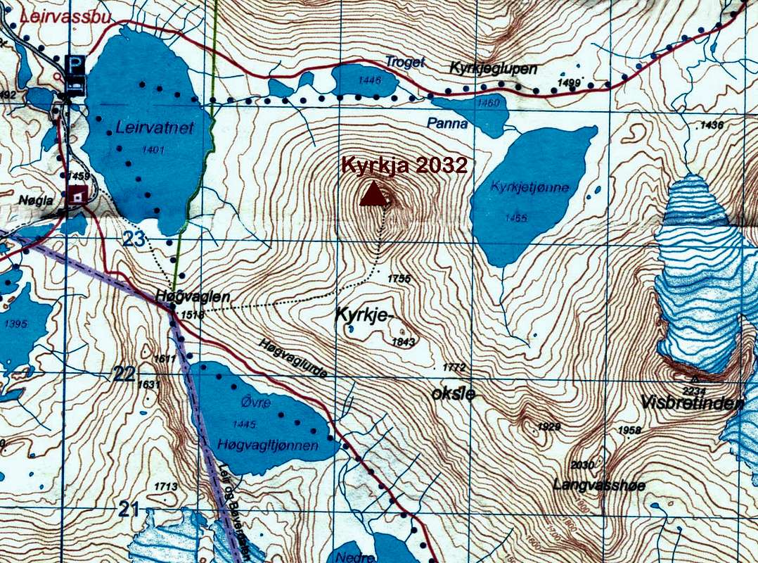
The standard route starts walkin up a trail alternatively amongst boulders and snow fields onto the col at 1755 m between Kyrkja and Kyrkjeoksle, then lot of boulders to get the foot of the steep summit tower. This latter is overcome by means of a straightforward scramble with 2-3 short stretch of easy climb. The ascent may become more complex in the presence of residual snow in early summer.
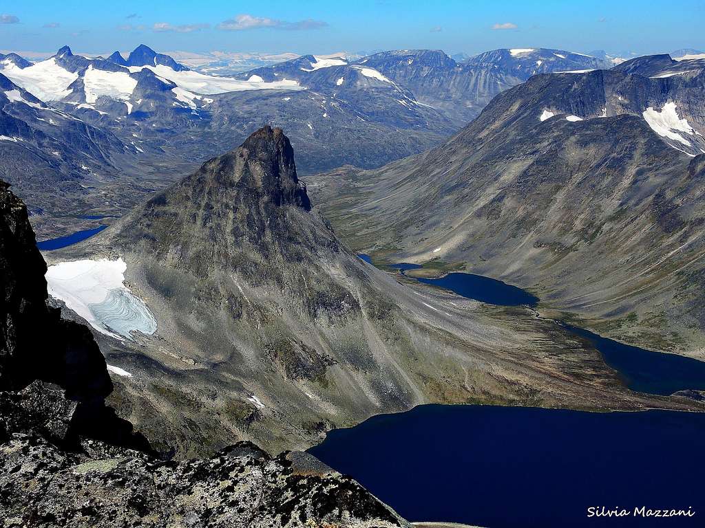
Summit view


Getting There
The starting point to climb is Leirvassbu Mountain Lodge 1405 m, located in the county of Lom, right next to the lake “Leirvatnet”, just below the characteristic mountain “Kyrkja” (The Church).
Public transportation
There are bus transportation from Oslo and Bergen to Lom and train from Oslo to Otta.
By car
If you are arriving from Lom, take highway 55 “Sognefjell" road travelling towards Turtagro and drive through Bøverdalen valley. After 20 km you will pass Elveseter Hotel on the right hand side of the road. Continue for another 6 km, before taking a left turn on the private toll road towards Leirvassbu. The crossroad is marked "Leirvassbu". If you are travelling from Årdal or Sogndal, you must take a right turn approximately 16 km after passing the highest point of the "Sognefjell" road.
The road starting from the Sognefjell road and leading to Leirvassbu is a private toll road (fee NOK 60). It is open from the beginning of the summer season, 29th of June, until the end of September.

|

|
Kyrkja Standard Route from Leirvassbu
Kyrkja Standard Route report
Summit altitude: 2032 m
Difficulty: scramble and some easy climbing
Vertical gain: 650 m
Exposure: South
Starting point: Leirvassbu Mountain Lodge
A worthwhile route inside a spectacular setting! The upper tower involves some easy climbing spots.
 |
 |
Jotunheimen Vest Turkart 2505 Scale 1:50.000
Route report
From Leirvassbu take a gravel road along the West side of Leirvatnet Lake heading Southward. Just after the gravel road starts turning right (SW) into Gravdalen, leave the main road and turn to left onto a trail getting to Hogvaglen col at 1518 m. Follow the trail between boulders and granite slabs, getting the Hogvaglen col, where it's located a small lake near a trail junction towards Langvatnet, Olavsbu and Gjendebu. At this saddle leave the well marked path to Gjendebu and turn to left onto an unmarked trail (cairns) up on the middle of the ridge towards Kyrkjeoksli, a small hill on the right of the trail.

|

|
After a steeper rocky ground, cross some snowfield (there may be more different trails, all heading to tha same point). At a certain point keep yourself on the Northern side of the ridge and without reach the point 1843 m, which is the top of the western hill of the Kyrkjeoksle ridge, individuate another lower track on the left (cairns), crossing and descending briefly to the col at 1755 m located between Kyrkjeoksli and Kyrkja.

|

|
From this col head towards the scree slope constituted of big granite stones. The slope progressively becomes narrower and steeper (cairns) and gets a wide shoulder at the bottom of the steep reddish rocky tower. Traverse the shoulder to the right, then overcome the reddish final tower with some easy climbing moves getting the awesome summit, where it appears a breathtaking view towards four main valley and towering peaks all around.

|

|
Descent - reverse the same route
Red Tape

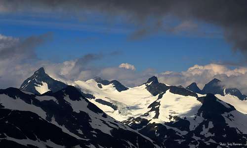
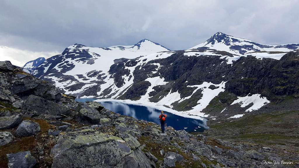
Jotunheimen rugged peaks seen from the summit
There are no particular restrictions in climbing and hiking. Credit card is needed to pay the toll at the road bar along the private road to Leirvassbu. Kyrkja is lying within the superb Jotunheimen National Park, established in 1980, covering an area of 1140 km² and including the 27 highest peaks in Norway. Jotunheimen is located between Oppland and Sogn og Fjordane counties and it's bordered by the great lake called Vågåvatnet, the valleys of Bøverdalen and Leirdalen and the road No. 55 (the mytical Sognefjellveg) to the N and NW, by the Road 51 to the East, by Bygdin, Tyin and Årdal to the South and by the mountain road between Årdal and Turtagrø to the West.
Nature and climate
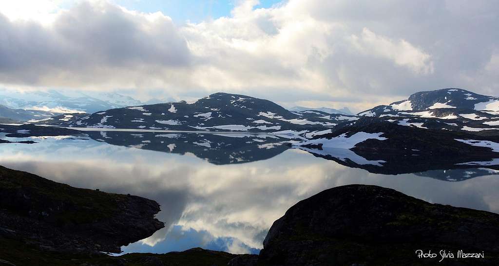
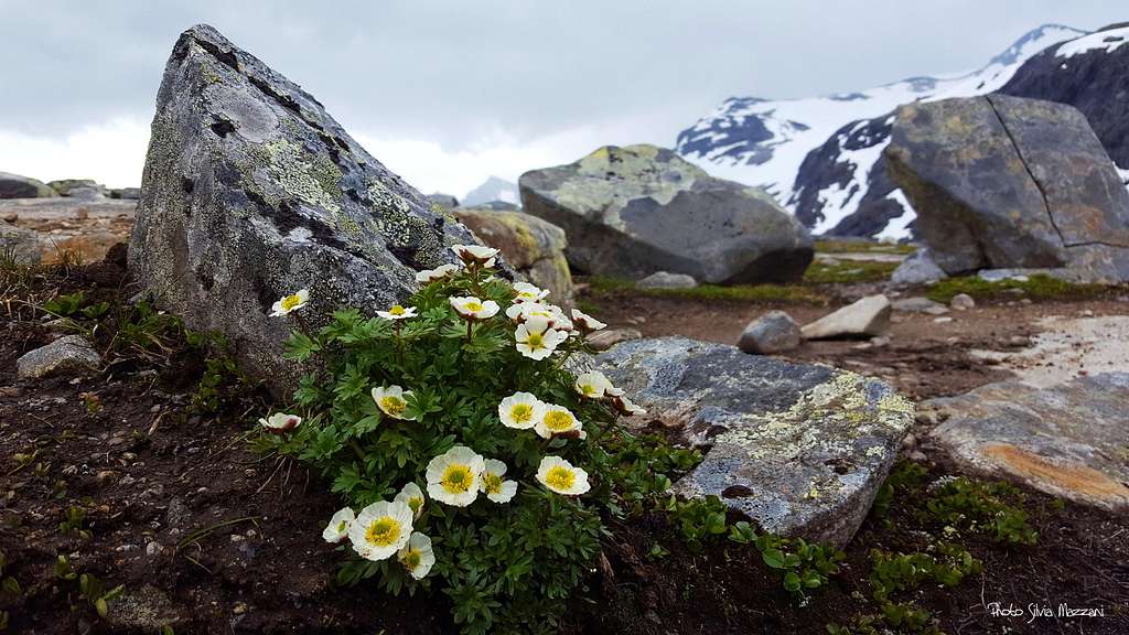
Jotunheimen is a wild area of majestic icecapped mountains, glaciers and wonderful lakes. Norway´s highest peak, Galdhøpiggen, lies within the National Park, together with icecapped Glittertind, only a few metres lower. There are also several large lakes, amongst those the largest one is Gjende. Rapid weather changes can occur, lots of snow in winter due both to the latitude and the high altitude, nice summer with over up to 25 degrees Celsius with sunny weather. Be aware that at higher altitudes deep snow can remain until mid summer. Mountaineering and hiking season varies, but usually they start in late June, being July and August the best months. In this area we can find the highest plants growing in Norway. The beautiful Glacier Crowfoot is the highestgrowing flowering plant, thriving at 2.370 metres on Glittertind, only 100 metres below the summit. Purple Saxifrage and Rose-root or Midsummer men also grow as high as 2.300 metres. Within Jotunheimen National Park we can find a rich variety of lime-loving plants, such as the Mountain Avens and other species, such as Hairy Stonecrop and Red Alpine Catchfly.
Hut and camping
Leirvassbu Mountain Lodge 1400 m
Situation: next to the lake “Leirvatnet”, just below Kyrkja
Open (Winter/Spring): One week before Easter – First weekend in May
Open (Summer): Mid June – End of September mid June/end of September
Guardian: Tove and Ole Jacob Grindvold
Phone: +47 61 21 12 10 Phone 2: +47 61 21 29 21 E-mail: leirvassbu@topofnorway.no

|

|
When to Climb
The best season is full Summer.
Meteo
Guidebooks
Guidebooks
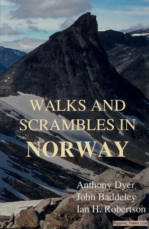 |
Walks and scrambles in Norway
Anthony Dyer - John Baddeley - Ian H. Robertson
Hiking, Scrambling and Mountaineering in Norway, an English guidebook covering Jotuheimen and several other areas in the Scandes
Ripping Yarns 2006
|
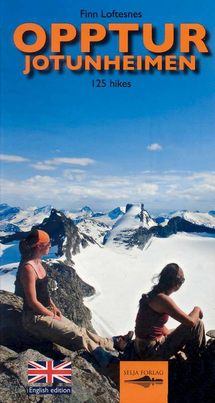 |
Opptur Jotunheimen
Finn Loftesnes
125 selected itinerary on Jotunheimen
Selja Forlag 2009
|
External links
- DNT Norwegian Tourism Organisation
- Jotunheimen
- Visitjotunheimen
- Norwegian Mountains