-
 3914 Hits
-
 84.27% Score
-
 18 Votes
|
|
Mountain/Rock |
|---|---|
|
|
61.44694°N / 7.78582°E |
|
|
Sogn og Fjordane |
|
|
Hiking, Scrambling |
|
|
Summer |
|
|
6834 ft / 2083 m |
|
|
Overview
Geographical classification: The Scandes > Jotunheimen > Store Soleibotntinden
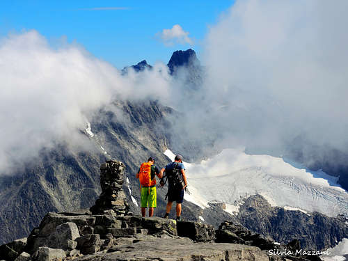
Store Soleibotntinden 2083 m
The Hurrungane Massif, located on the border of the Jotunheimen National Park, is one of the finest mountain area in Norway and probably in the whole Scandinavia. The mountain range belongs to the municipalities Luster and Årdal in Vestland county and it's located to the SW of the larger Jotunheimen range. Sharp peaks and towering mountains project their high vertical walls above broad crevassed glaciers, falling down into extensive valleys. The Hurrungane Massif includes the most challenging 2000er in the Scandes chain, as Store Skagastølstind.
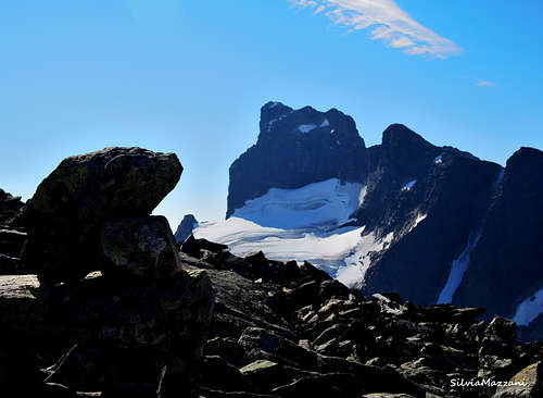
Among these magnificent mountains, however, there are also some peaks involving an easier climb, which absolutely deserve to be summited in reason of the beauty of the standard route and the excellent views. Store Soleibotntinden is one of these peaks and probably the easiest to climb in the Hurrungane Massif. This mountain whose name is hardly pronounced is a fantastic top! The West ridge via Bukkanosi along which it runs the standard route offers a fine access to the summit without exposed sections. The route is pleasant and not too long, however it opposes some stretches a bit tiring and steep in some places. The climb is rewarded with amazing alpine views to the surrounding peaks, mainly toward the mighty Austanbotntindane to the South-East and the Jostedalsbreen to the North-West.
The top was first climbed on August 14, 1888 by Kristofer Furaas, Margaret Sophia Green and Torgeir Sulheim.
Getting There
The start of the climb is located near a parking lot along the mountain road connecting Turtagrø to Øvre Årdal, about 9 km from Turtagrø. This locality may be approached both from Turtagrø and from Øvre Årdal, but the access from Turtagrø is more simple and advisable.
- Approach to Turtragrø
From Skjolden at the Northern tip of the Lusterfjord take the road 55 to the Turtagrø Hotel and here turnoff rightward to Øvre Årdal. Drive about 9 km on this road and locate a small parking lot next to a bridge over the river Tverrelvi at the altitude of 1224 m. Tverrelvi is the first stream along the road.
Starting from Øvre Årdal you will arrive from the opposite direction. You must drive on a narrow mountain toll-road (payment only with credit card). From the bar the road descends to Turtagrø. Locate the river Tverrelvi parking lot on the right between Berdalsfjellet and Berdalen.
Store Soleibotntinden West ridge "via Bukkanosi"
Store Soleibotntinden West ridge
Summit altitude: 2083 m
Difficulty: walk and scramble (Class 2)
Vertical gain: 870 m
Exposure: West
Starting point: Tverrelvi river parking lot
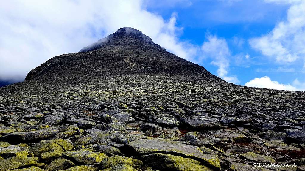
A worthwhile route for a great day enjoying breatktaking views all around over the Hurrungane Massif. It's an eaasy itinerary but with alpine character. At first following a good trail, the route reachs the back of the Bukkanosi and its lunar landscape of stones...
On the right of the parking lot (coming from Turtagrø) near the river Tverrelvi it branches off an unmarked, but clearly visible path. Take this path on the right side of the river and follow it, gradually gaining terrain in the right direction (South-East) with the river and all the small lakes on the left. Continue on steep terrain and overcome a rocky head above some small lakes.

|

|

|

|
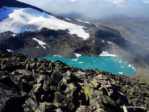
Shortly after the ground becomes less steep as you reach the top of the first hill where it's located a huge stone-cairn. A little further it starts the broad back of the Bukkanosi ridge and you can see clearly almost all the upper part of the climb, except for the wide final ridge. The route starts to cross a broad and less steep stretch of stony ground, then a steeper stretch in correspondence of some characteristic rocky blades that emerge from the ground. Further a second big cairn marks the start of a shelf with large and flat granite stones. Cross it heading to a clear and characteristic strip of light rocks. The mighty Store Austanbotntinden and a fine green lake with ice-boulders above us are constantly in sight on the right during all the ascent. On the back, you pass a 1674 m point before starting the steep climb on the last 400 vertical meters on big boulders.
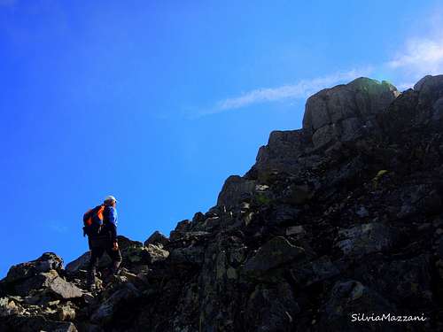
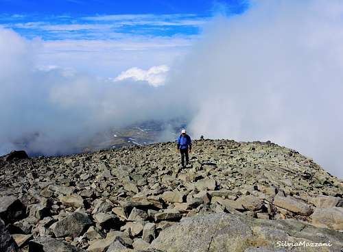
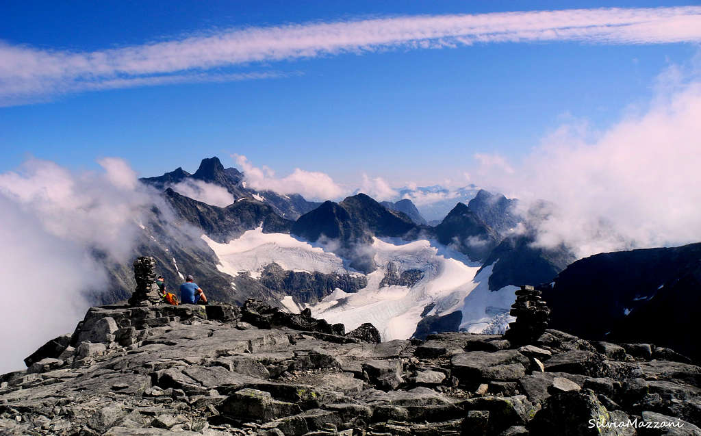
Just before the large summit crest and the summit there is a short steeper rocky section that must be crossed. There is no exposure in this passage, giving access to the broad and gentle angled final crest, where the views are truly impressive. The ridge rises to a first false summit with a small cairn with a horn. The ridge rises to a first false summit with a small cairn with a horn. It follows a second small cairn with a mailbox and the summit register and further a third cairn where it opens a tremendous view on the vertiginous peaks of the Hurrungane Massif.
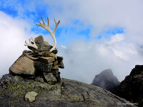
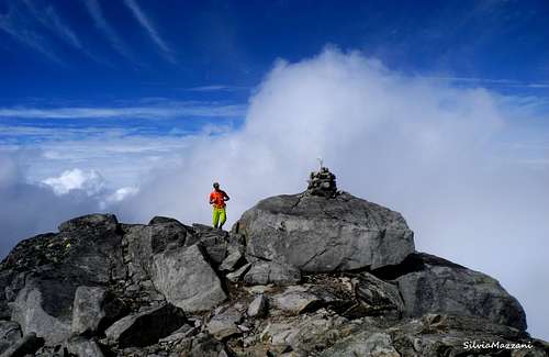
It appears the proud and impressive Store Skagastølstind and it opens a broad glacier below the summit. The views from the summit are wonderful! Clear views also towards Austabotntindane and Ringstindane, plus far away the Jostedalsbreen glacial expanses.
Descent: reversing the same itinerary
Red Tape
There are no particular restrictions in climbing and hiking. No fees and no permits required.
When to Climb
Summertime is the best period.
Accomodation
In Norway free camping is allowed in every place, if not expressly forbidden. Alternatively there is a mountain lodge in Turtagrø, the Hotel Turtagrø
Meteo
Guidebooks and maps


"Opptur Jotunheimen" Finn Loftesnes - 125 selected itinerary on Jotunheimen - Selja Forlag 2009
- Maps
Jotunheimen Vest Turkart 2505" Scale 1:50.000
External Links
Peakbook
Visit Jotunheimen
Scandinavian Mountains
Norwegian Mountains
Jotunheimen

