
-
 888 Hits
-
 83.69% Score
-
 17 Votes
|
|
Mountain/Rock |
|---|---|
|
|
61.40158°N / 8.72050°E |
|
|
Innlandet |
|
|
Hiking, Mountaineering, Scrambling, Skiing |
|
|
Spring, Summer |
|
|
6906 ft / 2105 m |
|
|
Overview
Geographical classification: The Scandes > Jotunheimen > Rasletind
Rasletinden 2105 m
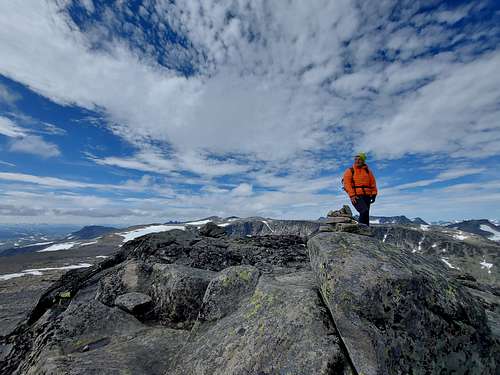
Rasletinden or Rasletind 2105 m is a summit surrounded by an exciting environment located in the South-Eastern sector of the Jotunheimen range and included in the Jotunheimen National Park, 350 km North to Oslo, in the middle of Southern Norway. In Norwegian Jotunheimen means "Giants Home" and the reason of this nickname is that the highest mountains in Norway lie here. The peak is located on the border of Vang Municipality and Vaga in Innlandet county. The mountain has two main summits, named Rasletinden, the higher summit, reaching an elevation of 2105 m, and Øystre Rasletinden, the secondary peak, reaching an elevation of 2010 m. Rasletinden is the Southeasternmost peak you can see when driving along the Valdresflya highway and it's among the easiest 2000-metre peaks to climb, a popular destination both on foot and on skis also because of the fantastic summit view.
Getting There
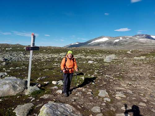
The starting point to climb is the Valdresflya Vandrehjem parking lot along the Valdresflya highway (National Road 51), open in summer.
Route
Rasletind Normal route from Valdresflya Vandrehjem report
Summit altitude: 2105 m
Difficulty: hiking and scrambling
Vertical gain: 830 m
Starting point: Valdresflya Vandrehjem parking lot
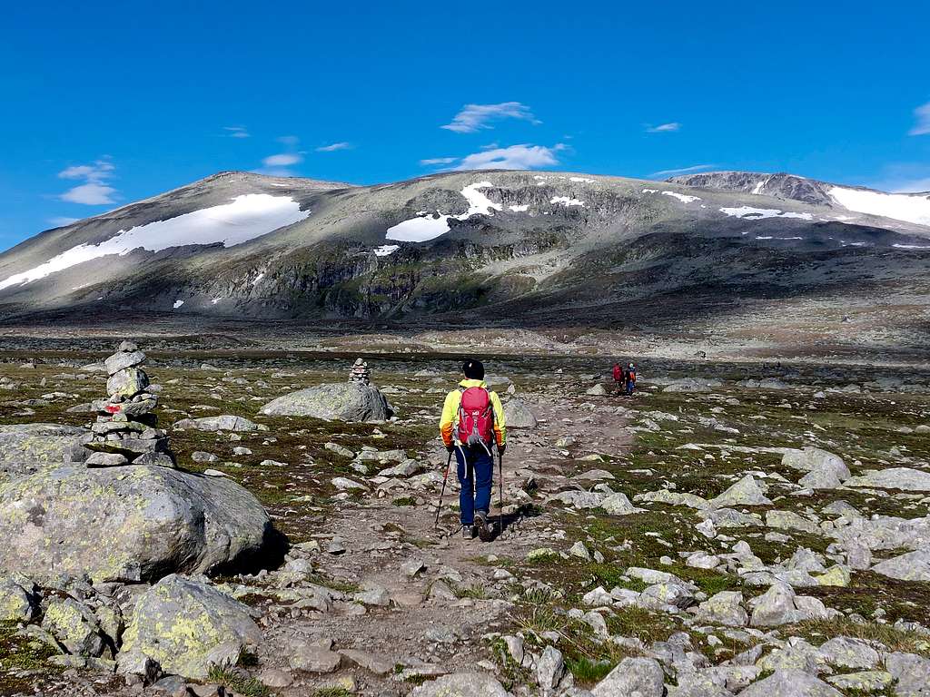
A long but not difficult route. The first part is a marked path with cairns and red T's, the highest part of the itinerary is on rocky terrain but equally marked.
From Valdresflya Vandrehjem parking lot cross the Road 51, reaching the opposite side of the road and head directly towards the eastern summit walking along a well worn path crossing the meadows on the south-west shore of lake Fisketjerni. After the long flat section pass by three small knolls, then lose some height into Steindalen.
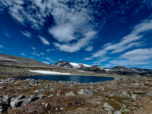
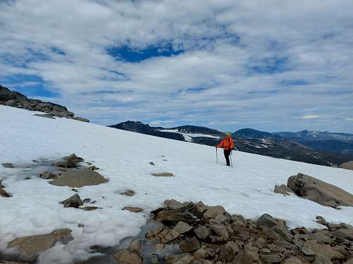
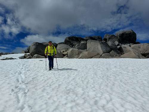
Here cross a stream, which is normally unproblematic to cross, before the main ascent is seriously tackled. Enter a cirque, passing by a small pond. From here the route starts to climb steeply and you will not be able to see the summits any more. Successively turn a bit to the right, aiming to a big stone block. From this boulder head to the left and follow the cairns in the direction of the NE ridge of Rasletinden. Slowly the view opens towards the peak south of Gjende.
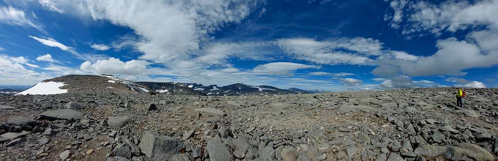
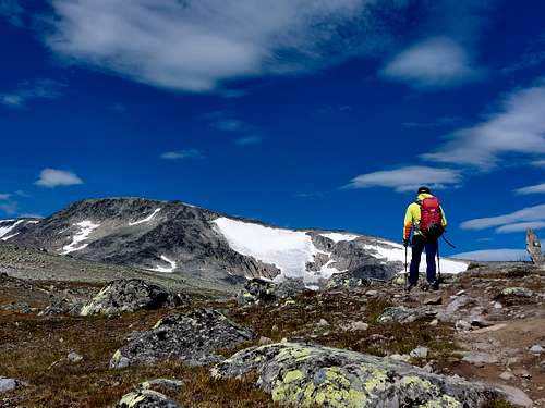
Continue up the ridge keeping yourself to the North (right) of the secondary summit 2010 m. A gentle snow slope rises towards the highest summit. If you prefer to get also the flat eastern summit, after it is easy to spot the route to the main summit.
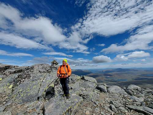
This short hike is no challenge except that it is rocky. The view is fantastic towards Sjodalen, Valdres with Bitihorn and Bygdin and towards the Gjendalpen. Tjønnholstinden is really nice to see, but the huge Jotun view is missing since neighboring peaks such as Munken and Mugna steal a lot of the view.
If you want to see more, just continue further West.
Descent: reversing the route
Red Tape

There are no particular restrictions in climbing and hiking. Rasletind is lying within the superb Jotunheimen National Park, established in 1980, covering an area of 1140 km² and including the 27 highest peaks in Norway. Jotunheimen is located between Oppland and Sogn og Fjordane counties and it's bordered by the great lake called Vågåvatnet, the valleys of Bøverdalen and Leirdalen and the road No. 55 (the mytical Sognefjellveg) to the N and NW, by the Road 51 to the East, by Bygdin, Tyin and Årdal to the South and by the mountain road between Årdal and Turtagrø to the West.
When to Climb
- Mountaineering: the best period to climb goes from the end of June to middle September.
- Ski-mountaineering: april - may
Where to stay
Meteo
Guidebooks and maps
Guidebooks


- "Opptur Jotunheimen" 125 selected itinerary on Jotunheimen - Finn Loftesnes - Selja Forlag 2009
- "Turkart Jotunheimen Aust"