
-
 2653 Hits
-
 83.69% Score
-
 17 Votes
|
|
Mountain/Rock |
|---|---|
|
|
45.77638°N / 7.21350°E |
|
|
Mountaineering |
|
|
9275 ft / 2827 m |
|
|
Overview
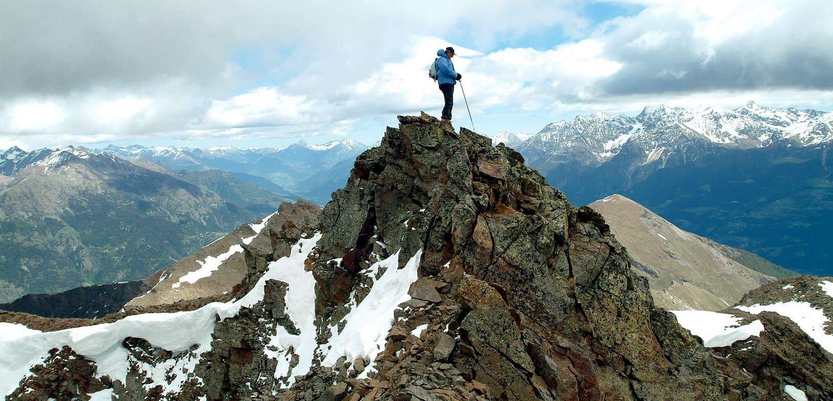
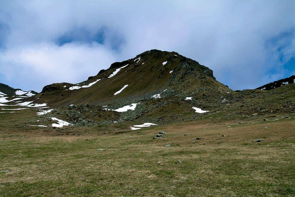
This mountain is located on the long ridge watershed from Mont Fallère (3.061m), the highest elevation of this whole area, falls first eastward and then definitely in the South reaching progression in the Mont d'Arsy, Mont de La Tsa, and that of the Punta Chaligne Met, now above the Municipalities of Aosta, and Sarre. "Smothered" the truncated pyramid of this, the Mont d'Arsy, known on its Northern Slope as Costa Mayan, is decidedly less visible from both South and North. Positioned between two collars (2.670 meters the Western 2.655 meters the opposite) relaxing on axis East / West and from the nearby small pyramid of Mont de La Tsa (2.741m) overhanging two small valleys to the South, in the Clusellaz Vallon above Municipality of Sarre in the Central Valley of Baltea, and the most important of Comba d'Arsy to the North, above the Common of Etroubles in Valley of Gran San Bernardo Mountain rarely frequented, has three sides and as many small ridges While those Southeast and Southwest are formed by steep slopes with many grassy-rocky debris, the North has a large wall of rocks very broken, interspersed with various couloirs, up to 400 meters high and known as Cote Mayan. A fairly steep Edge South-southeast, ending above the Lake of the leaves and the Alp Nouva (2.269m), separates the first two sides and through this last we recommend the climb, although the East Ridge, always starting from the same alp and through the collar 2.655 meters, is certainly easier, but boring. This can then be considered as the "Normal Route", while the opposite Crest or West (towards Mont Fallère) has three small rock walls, easy but you have to be ahead cautiously. Limited views to the West for the mass of Mont Fallère, while in the other three directions the view ranges widely, especially on the Valley of the Gran San Bernardo.
Questa montagna si trova sulla lunga cresta spartiacque che dal Mont Fallére (3.061 m), massima elevazione di tutta quest'area, scende dapprima verso Oriente e poi decisamente a Mezzogiorno raggiungendo in progressione il Mont d'Arsy, il Mont de La Tsa, la Punta Chaligne e quella di Met, ormai sopra i Comuni di Aosta e Sarre. "Nascosto" dalla piramide tronca di questo, il Mont d'Arsy, conosciuto sul suo Versante Settentrionale anche come Costa Mayan, risulta decisamente meno in vista sia da Sud come da Nord. Posizionato tra due colletti (2.670 metri quello Occidentale, 2.655 metri l'opposto) si distende sullo asse Est/Ovest partendo dalla vicina e piccola piramide del Mont de La Tsa (2.741 m) sovrastando due piccoli valloni a Sud, dentro la Val Clusellaz al di sopra del Comune di Sarre nella Valle Centrale della Dora Baltea, e quello più importante della Comba d'Arsy a Nord sopra il Comune di Etroubles, nella Valle del Gran San Bernardo Montagna assai raramente frequentata, presenta tre versanti ed altrettante piccole creste. Mentre quelli Sudest e Sudovest sono formati da ripidi pendii erboso-rocciosi con molti detriti, quello Settentrionale presenta una larga parete di rocce molto rotte, intercalata da vari canaloni, alta fino a 400 metri circa e conosciuta come Cote Mayan. Un abbastanza ripido Spigolo Sud-sudest, che termina sopra il Lago delle Foglie e l'Alpe Nouva (2.269 m), separa i primi due versanti e tramite questo ultimo consigliamo la salita, anche se la Cresta Est, partendo sempre dalla medesima alpe e tramite il Colletto 2.655 metri, risulta sicuramente più facile, ma noiosa. Questa può quindi essere considerata come la "Via Normale", mentre la Cresta opposta od Ovest (verso il Mont Fallère) presenta tre piccoli muri rocciosi, facili ma che bisogna precorrere con prudenza. Vedute limitate ad Ovest per la massa del Mont Fallère, mentre nelle altre tre direzioni la vista spazia largamente, soprattutto sulla Valle del Gran San Bernardo.
First Ascents
- First on the Summit: Unknown.
- In winter: Unknown.
- South-southeast Eperon: Osvaldo Cardellina and Emilio Bertona, (May 22th, 2003), in ascent from Thouraz-Alp Nouva.
- Traverse from Met Pass, Punta Chaligne, La Tsa, Mont d'Arsy, pass 2.670m): Osvaldo Cardellina and Marco Cossard, (Sep 14th, 1974).
Getting There
Specific Road: From Aosta towards Sarre Municipality with SS.26; from this by the Regional Road towards Ville sur Sarre, Mondache, Salet, Chavalançon, Thouraz (1.652m) Hamlets. By this last through the various paths concomitant more or less with the private farms dirt road up to the Alp Nouva (2.269m).
Approach and Route
Note: The approaches to this mountain are numerous and describe them in more detail with the various climbing routes; in any case have to differentiate those from the South with starts from Vetan, Verrogne and Thouraz Villages and also by climbing over the hills of Aosta and crossing Punta Chaligne those in the North consisting essentially of Arsy Vallon, above the Etroubles/Saint-Oyen Municipalities into Saint Bernard Valleys.
Nota: Gli avvicinamenti a questa montagna sono molteplici e li descriveremo con le varie vie di salita; in ogni caso son da differenziare quelli che provengono da Sud con partenze dai Villaggi di Vetan, Verrogne, Thouraz ed anche dalla collina di Aosta scavalcando le Punte Chaligne da quelli a Settentrione consistenti essenzialmente dal Vallone dell'Arsy, sopra i Comuni di Etroubles e Saint-Oyen nella Valle del Gran San Bernardo.

1) - SOUTH-SOUTHEAST EPERON: by Thouraz (1.652m) continue towards the North with the farm dirt road immediately below the junction reaching 1.638 meters; leaving Eastward the deviation for Vignon and the Alps of Metz, continue in the same direction by the same concurrent with the trail n° 8 A/8B/9A. Once at the following crossroads 1.680 meters, give this time to the left (Northwest) that for Goille Pesse-Arpy instead continuing towards Alp Moron (1.769m); after crossing two small torrents and not long after, to abandon the farm dirt road that well within reach in succession the Alps Combroz, la Comba, Frumière and Morgnoz (2.026m); directly reach the latter by the path n° 8 A/8B passing on a grassy promontory between two other small torrents (T; 1h'00/1h'15). Back on the farm road-trail n° 8B, go first toward Northeast reaching the Alp Chesère (2.178m; Chapel of "Our Lady of the Snows") and then Northwest towards Alp Nouva numbered 8F (2.269m; 0h'45), right at the base of the Ridge South-southeast. Go up directly with the application and, after a rocky and exposed step you win the left, arrive at 2.704 meters altitude and the next at the Summit, where it meets the Eastern Crest coming from Mont de La Tsa and with this conclusion (EE/from F to F +; 1h'20/1h'40).
1) - SPERONE SUD-SUDEST: da Thouraz (1.652 m) continuare verso Settentrione con la strada poderale raggiungendo subito appresso il bivio 1.638 metri; lasciando ad Est la deviazione per Vignon e le Alpi di Metz, continuare nella medesima direzione tramite la stessa concomitante con il sentiero n° 8A/8B/9A. Giunti al successivo bivio 1.680 metri, abbandonare questa volta a sinistra (Nordovest) quella per Goille Pesse-Arpy proseguendo invece verso l'Alpe Moron (1.769 m); dopo aver attraversato due torrentelli e non molto tempo dopo, abbandonare la poderale che con largo giro raggiunge in successione le Alpi di Combroz, la Comba, Frumière e Morgnoz (2.026 m); raggiungere direttamente quest'ultima tramite il sentiero n° 8A/8B passando su d'un promontorio erboso in mezzo a due altri torrentelli (T; 1h'00/1h'15). Ritornando sulla poderale-sentiero n° 8B, proseguire dapprima verso Nordest raggiungendo l'Alpe Chesère (2.178 m; Cappella della "Madonna delle Nevi") e poi a Nordovest in direzione dell’Alpe Nouva con numerazione 8F (2.269 m; 0h'45), proprio alla base della Cresta Sud-sudest. Salire direttamente con la medesima e, dopo un passaggio roccioso ed esposto che si vince sulla sinistra, arrivare alla quota 2.704 metri ed alla successiva presso la Sommità, dove si incontra la Cresta Est che proviene dal Mont de La Tsa e con questa concludere (EE/da F a F+; 1h'20/1h'40).
 |
 |
 |
 |
 |
2) - WESTERN and EASTERN RIDGES: Finally we analyze this ridge that descends from the great Shoulder 3.040/3 meters or Eastern Summit of the nearby Mont Fallère (3.061m) to an unnamed hill below 2.670 meters in altitude; this was certainly true in that passage "Alta Via delle Alpi" (High Route of the Alps) in past centuries led, across the whole of Europe, very ancient via from Amsterdam to the Venetian and vice versa. In fact it is more than mere transit as opposed Colle Finestra (Window; 2.941m) and with lower altitude to accomplish; both lead in the Vallon of Arsy or Vallon d'Ars, above the Municipalities of Etroubles and Saint Oyen on the road to the Great Saint Bernard. But it was the very ancient Hamlet of Thora (today rebuilt more in East as Thouraz) indicating the passage; completely buried by a enormous landslide from Becca France (2.312m) just behind him with all 600 residents at dawn on Jul 6th, 1564, it offered four great Fairs of European fame, among whom was the famous one turned to "Seed". A pass so ancient, popular and frequented fell, after the sad event, most complete anonymity, as was the East-northeast Ridge of Mount Fallère. No one thought to go up that way and this almost to the present day. Made this premise, we go to "view" this ridge that descends briefly above the aforementioned hill, but then rises again to form along the watershed dividing the Central Valley of Dora Baltea from the North of the Great Saint Bernard Pass and which would constitute his natural extension orographic up above the Town of Aosta. With three small walls on ridge the same reaches the Mont d'Arsy (2.826m) down to a small saddle (2.655m), above what is known as "Costa Mayan", and, turning gradually toward the Southeast, in succession reaches the Mont de la Tsa (2.741/2m) Punta Chaligne or Pointe Tzaligne (2.608m) and, after the Hill of Met or Metz, ends with the eponymous Point (2.553m). Furthermore, it is possible to join on the same ridge starting from the Valley of the Great St. Bernard Condemine-Buthier Villages (1.137m, 1.302m) and climb to new Chaligne Refuge (1.936m); this in a short time you reach the Tardiva Hill (2.410m) and through the easy Ridge North you come to Tsa, whence the previous route to the Summit. In any case, the crest looks long but easy and only descent through the West Ridge of Mont d'Arsy requires caution: it is necessary to find the way along the rocks and dangerous routes with three small walls allege the hill below (EE/A/F+/PD-; 1h'00 from Western Hill; 2h'30/3h'00 from Punta di Met or by Refuge Chaligne; 4h'00/4h'30 from various departures).
2) - CRESTE OVEST ed EST: Da ultimo analizziamo questa lunga cresta discendente dallo Spallone 3.040/3 metri o Punta Orientale del vicino Mont Fallère Fallère (3.061m) verso un sottostante colle innominato in quota 2.670 metri; sicuramente era questo il vero passaggio che nell'"Alta Via delle Alpi" nei secoli scorsi conduceva, attraversando l'intera Europa, da Amsterdam alle Venezie e viceversa. Infatti risulta di più semplice transito rispetto all'opposto Colle Finestra (2.941 m) e con minore dislivello da compiersi; entrambi conducono nel Vallone di Arsy o d'Ars, al di sopra dei Comuni di Etroubles e di Saint Oyen sulla via pel Gran San Bernardo. Ma era l'antico Villaggio di Thora (oggigiorno ricostruito più ad Oriente come Thouraz) che ne indicava il transito; completamente sepolto da una frana dalla Becca France (2.312 m) alle sue spalle con tutti i 600 abitanti all'alba del 6 Luglio 1564, offriva quattro grandi Fiere di fama Europea, tra le quali era celebre quella rivolta alle "Sementi". Un valico quindi antico, popolare e frequentato caduto, dopo il triste evento, nell'anonimato più completo, com'era la Cresta Nordest del Mont Fallère. Nessun pensava di salir da quella parte e questo quasi fin ai giorni nostri. Effettuata questa doverosa premessa, andiamo a "visionare" questa cresta che brevemente scende sopra il suddetto valico, ma in seguito si rialza a formare quel lungo spartiacque divisorio la Valle Centrale della Dora da quella Settentrionale del Gran San Bernardo e tale da costituire il suo naturale prolungamento orografico fino al di sopra della Città d'Aosta. Con tre piccoli risalti la stessa raggiunge il Mont d'Arsy (2.826 m) scende ad una selletta (2.655 m), sopra quella che é conosciuta come "Costa Mayan" e, volgendo progressivamente verso Sudest, raggiunge in successione il Mont de la Tsa (2.741/2 m) la Punta Chaligne o Tzaligne (2.608 m) e, dopo il Colle di Met o Metz, si conclude con l'omonima Punta (2.553 m). Inoltre risulta possibile inserirsi sulla stessa cresta con partenza dalla Valle del Gran San Bernardo da Condemine-Buthier (1.137 m, 1.302 m) e salita al nuovo Rifugio Chaligne (1.936 m); da questo in breve tempo si raggiunge il Passo Tardiva (2.410 m) e tramite la facile Cresta Settentrionale si perviene alla Tsa, donde alla precedente via. In ogni caso la cresta si presenta lunga ma facile e soltanto la discesa tramite la Cresta Ovest del Mont d'Arsy richiede cautela: é necessario trovare la via lungo rocce rotte e pericolose che con tre muretti adducono al colle sottostante (EE/A/F+/PD-; 1h'00 dal Colletto Occidentale; 2h'30/3h'00 dalla Punta di Met o dal Rifugio Chaligne; 4h'00/4h'30 dalle varie basi di partenza).
 |
 |
 |
 |
 |
Difficulties
From F to F+.
Da F a F+.
Equipment
For Hiking-Moutaineering.
Da Escursionismo-Alpinismo.
Campings
Remember that free camping is forbidden (except for emergency reasons, over 2.500m, from darkness until dawn).
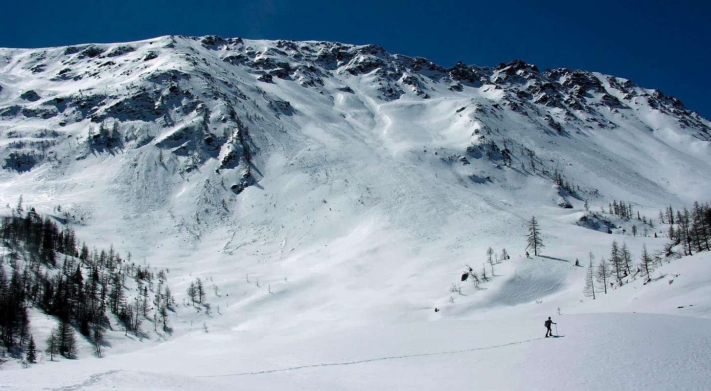
Mountain Conditions
- You can get meteo information at the official site of the Regione Valle d'Aosta:
- Valle d'Aosta Meteo
Webcam
- WEBCAM on Aosta Valley:
- Webcam
Books and Maps
BOOKS:
- "Guida dei Monti d'Italia-Alpi Pennine" (Vol. I°) di Gino Buscaini-Club Alpino Italiano/Turing Club Italiano, Luglio 1971.
- "Dove si specchia il cielo - i laghi della Valle d'Aosta", di Sergio Piotti, Ed. Ferrari Luglio 1996.
- "80 itinerari di Escursionismo Alpinismo e Sci Alpinismo in Valle d'Aosta", di Osvaldo Cardellina, Ed. Musumeci, Giugno 1977 (in Italian); seconda Ed. Luglio 1981; terza Ed. Luglio 1984; (in French), prima Ed. Febbraio 1978; seconda Ed. Marzo 1980.
 |
 |
 |
MAPS:
- Kompass "Monte Bianco Valle d'Aosta Sentieri e Rifugi" Carta turistica 1:50.000.
- Kompass "Gran Paradiso Valle d'Aosta Sentieri e Rifugi" Carta Turistica 1:50.000.
- I.G.C. Istituto Geografico Centrale Torino "Massiccio del Monte Bianco" (n° 4), Torino, 1998 1:50.000.
- Studio F.M.B. "Monte Bianco-Mont Blanc", Bologna 1988 1:50.000.
- I.G.C. Istituto Geografico Centrale "Carta dei sentieri e dei rifugi" 1:25.000.
- I.G.M. Istituto Geografico Militare 1:25.000.
Important Information
- REGIONE AUTONOMA VALLE D'AOSTA the official site.
- FONDAZIONE MONTAGNA SICURA Villa Cameron, località Villard de la Palud n° 1 Courmayeur (AO) Tel: 39 0165 897602 - Fax: 39 0165 897647.
- A.I.NE.VA. (Associazione Interregionale Neve e Valanghe).
Useful numbers
- Protezione Civile Valdostana località Aeroporto n° 7/A Saint Christophe (Ao) Tel. 0165-238222.
- Bollettino Meteo (weather info) Tel. 0165-44113.
- Unità Operativa di Soccorso Sanitario Tel. 118.
Acknowledgements
I am greatly indebted to my friend "Osva" for the detailed description of the routes and translation.