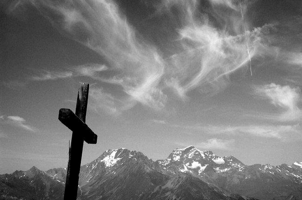
This mountain is located N/W of the Aosta town, and it is the top that you see above Aosta when you drive to the town from south, by the motorway. Due to it's central position with respect to the valley, it offers a very wide panorama, the easiest that you can reach in the area. You can see the whole central valley mountains, like Emilius, Grivola, and far, Gran Paradiso Group, Rutor Group, after Fallere, left part of the Mont Blanc Group, and, north side, Gran Combin, Mont Velan, Mont Gele', and far, Cervino and part of the Monte Rosa Group.
Getting There
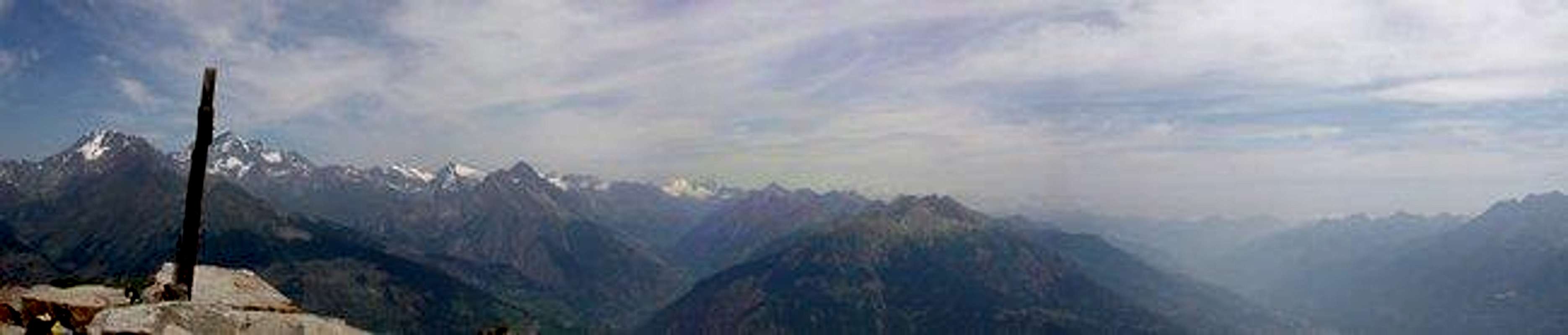
Mont Velan and Gran Combin
To reach the easy top, there are a few routes, both in summer than in winter.
from Buthier, a village in the Gran San Bernardo Valley. From Italy: exit Aosta East of the Motorway, bring the Gran San Bernardo way, after the galleries, a few kilometers far from Aosta town, there is the village of Gignod; a few hundreds meters far from the village, left side, indication for Buthier; follow the road till a sign after which is forbidden with the car, and park there. From Switzerlan, the deviation for Buthier is right side, a few kilometers after La Clousaz.
from Thouraz. Exit Aosta East of the Motorway, follow the normal route direction Courmayeur; after Aosta town, you will find Sarre: turn right, direction Ville Sur Sarre, and in Ville Sur Sarre, turn right and follow the sign Thouraz. This is a small new village, a few houses (overthere there is a ranch that rents horses...). The main Touraz village was destryoyed by a landslip that fell down from the Becca France (at your left) which buried the whole village with all it's 600 inhabitants, at 6 of clock of a July morning in the year 1564.
When To Climb
Summer season: from June to October, even earlier or later, according the season; in winter, from December to March, taking care to the last slopes, very steep.
All around view
These are the views from the top, in the different directions
North and East: Mont Velan, Gran Combin, the Valpelline, the Central Aosta Valley
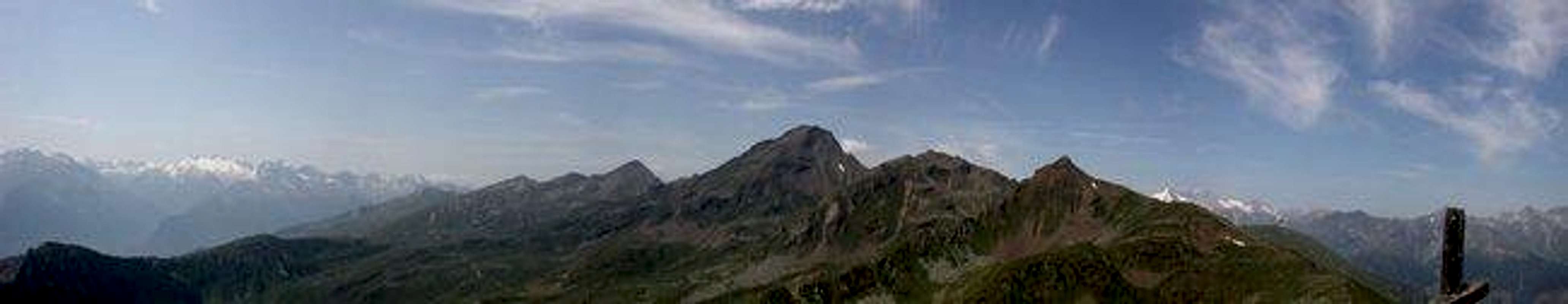
West: the highest top is Mont Fallere; behind, left side, the Rutor Group, right side, part of the Monte Bianco Group
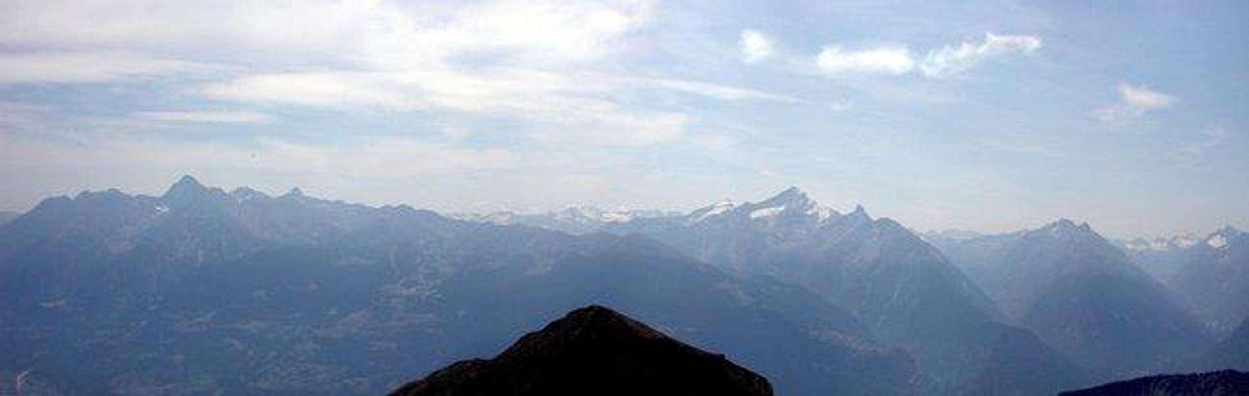
South: Emilius, Grivola, Gran Nomenon and Gran Paradiso Group
Campings
Outside Aosta, along the road that brings to Gran San Bernardo Pass, close to Buthier, there is a camping area.
Miscellaneous Info
The 16 of August, each year, a procession starts night time, around midnight, from 3 villages in the area, and arrives to the top, where there is a messe; this is due to a vote of the communities in the 16 century, when they ask to God to be preserved form the pestilence.
Mountain Conditions
Meteo: you can find all the needed informations at the official site of the Valle d'Aosta Region:
Children refers to the set of objects that logically fall under a given object. For example, the
Aconcagua mountain page is a child of the 'Aconcagua Group' and the 'Seven Summits.' The
Aconcagua mountain itself has many routes, photos, and trip reports as children.
Parents refers to a larger category under which an object falls. For example, theAconcagua mountain page has the 'Aconcagua Group' and the 'Seven Summits' asparents and is a parent itself to many routes, photos, and Trip Reports.


 6927 Hits
 81.84% Score
 14 Votes