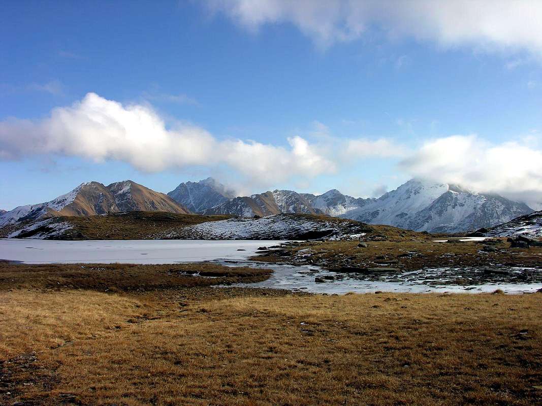
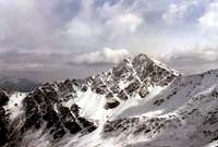
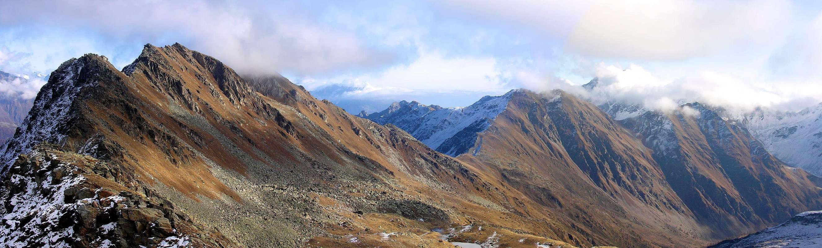
This mountain marks the line as a bridge between the Group Testa (Head) of Serena (2.830m) to the West and the Group of Mont Fallère (3.061m) on the opposite side, "tying", also, Citrin with those of Vertosan and Finestra Hills to the East. Placed on the axis Northwest/Southeast on the ridge dividing Vertosan Valley to the South and those of Citrin and Flassin to the North toward the Valley of thel Gran San Bernardo, has two distinct peaks but with almost the same height (2.767m North, Southeast 2.772m). Lets get down to the North-northeast a secondary ridge, that separates the latter two walloons, which, after the Testa Cordella (2.663m), culminating in the Tete de Bois de Quart (2.248m) above Saint-Oyen Municipality. Top seldom visited, except by hunters, has beautiful views of the Central Valley of Baltea and the neighbor across the Valley of the Gran San Bernardo.
Questa montagna segna la linea di trait d'union tra il Gruppo della Testa di Serena (2.830 m) ad Occidente ed il Gruppo del Mont Fallère (3.061 m) sul lato opposto, "legando", altresì, i Colli di Citrin con quelli di Vertosan e Finestra ad Oriente. Disposta sull'asse Nordovest/Sudest sulla cresta spartiacque tra il Vallone di Vertosan a Sud e quelli di Citrin e Flassin a Settentrione verso la Valle del Gran San Bernardo, presenta due cime distinte ma con quasi identica altezza (Nord 2.767 m; Sudest 2.772 m). Verso Nord-nordest lascia scendere una cresta secondaria, atta a separare questi due ultimi valloni, che, dopo la Testa Cordella (2.663 m), si conclude con la Tete de Bois de Quart (2.248 m) sopra il Comune di Saint-Oyen. Cima raramente frequentata, se non da cacciatori, presenta belle viste sulla Valle Centrale della Dora Baltea e sulla dirimpettaia Valle del Gran San Bernardo.
First Ascents
First on the summit: Unknown.
In winter: Unknown.
Great and Complete Traverse Testa Cordella-Mont Flassin NW Top-Flassin Pass-Quota 2.758/9m-Mont Flassin SE Summit-Northern Vertosan Pass-Mont Vertosan-Fenetre Pass, with descent to Comba Flassin: Osvaldo Cardellina, Marco Cossard and Giuseppe Lamazzi, Sep 17th, 1972.
Getting There
BY CAR:
From Torino, Milano, etc: Motorway A5.1) - Exit at Aosta Ovest and From the Aosta Ovest (Aymavilles) exit of the motorway, take state highway n° 26 Toward Courmayeur. After about 5 km, you'll reach the Village of Saint Pierre (731m). Turn right on the road for the small Village of Saint Nicolas (1.200m). Past the village, you'll reach a fork. The left branch leads to Colle di Joux (1.898m). Take instead the right branch in the direction of Vetan (1.671m). At the center of the small village turn left and proceed for about 150m on paved road. or 2) - Exit at Aosta East (Nus Municipality) and State Road to Gran San Bernardo Hill up to the Saint-Oyen Municipality (1.373m).
From Switzerland: through the Grand Saint Bernard Tunnel or the namesake pass.
From France: through the Mont Blanc Tunnel or Petit Saint Bernard Pass: It is not necessary to take Motorway A5: you can drive on SS.26, in the direction of Aosta.
BY PLANE:
Aeroporto "Corrado Gex" Saint Christophe (Aosta).
Approach A (From Vens Village to Vertosan Valley)
From the Village of Vens 1.697/1.750m) reached by the Regional Road Joux small Saddle (1.930m), at the entrance of Vertosan Valley. After a short descent, follow it all with North direction by means of a private dirt road that crosses the Alps in the progression of Neuves, Maisonnettes, Maison de Plan, Or de Breuil, Breuil, Jovençan, Tronchey and, after a reversal in the South of short path, reaches the last of Ruins (2.089m), where it ends (1h'30/2h'00 from Joux Saddle).
Dal Villaggio di Vens 1.697/1.750 m) raggiungere con la Strada Regionale la piccola Sella di Joux (1.930 m), all'ingresso nel Vallone di Vertosan. Dopo una breve discesa, percorrerlo tutto con direzione Nord per mezzo d'una strada poderale che oltrepassa in progressione le Alpi di Neuves, Maisonnettes, Maison de Plan, Or de Breuil, Breuil, Jovençan, Tronchey e, dopo un'inversione a Sud di breve percorso, raggiunge l'ultima di Rovine (2.089 m), dove termina (1h'30/2h'00 dalla Sella di Joux).
Approach B (From Saint-Oyen Municipality to Flassin Valley)
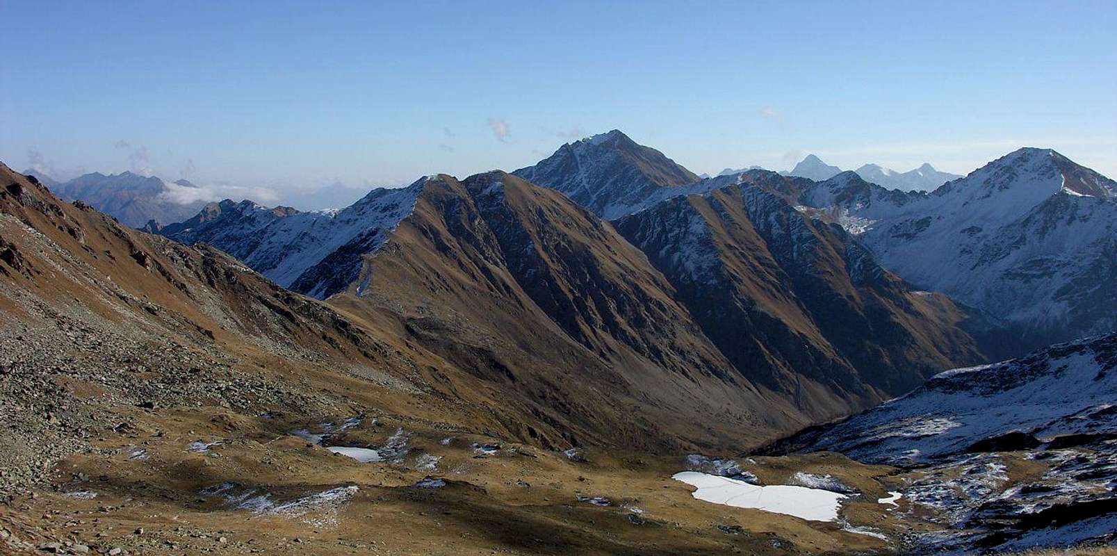
By the Municipality of Saint-Oyen (1.373m), accessible from the State Road from Aosta Town to the Gran San Bernardo, and abandon this, past a bridge over the Artanavaz Torrent, come to the Pasture of Pré Neue (1.324m), at the two Camp "del Mulino" (of Mill) and "Pineta". Through the farm dirt road to the trail concomitant n° 7, climb heading Southwest with the Alps of Champex (1.411m, to the East) and Rond (1.447m) to reach the next Flassin de Meitin (of Middle; 1.654m); in a short time to reach Flassin Pasture (1.700m). From this, going high to the East above the eponymous Torrent reach an altitude of about 2.200 meters, where, turning decidedly to the West, it passes over the coming Tsa (Higher Alp) de Flassin (2.258m; 2h'30/3h'00).
Dal Comune di Saint-Oyen (1.373 m), raggiungibile da Aosta con la Strada Statale per il Gran San Bernardo, abbandonare questa e, passato su di un ponte il Torrente Artanavaz, portarsi alla località di Pré Neue (1.324 m), presso i due Campings "del Mulino" e "Pineta". Tramite la strada poderale, concomitante al sentiero n° 7, salire con direzione Sudovest tra le Alpi di Champex (1.411 m; ad Est) e Rond (1.447 m) raggiungendo la successiva di Flassin de Meitin (di Mezzo; 1.654 m); in breve tempo raggiungere quella di Flassin (1.700 m). Da questa, passando alta ad Est sopra l'omonimo Torrent raggiungere l'altitudine di circa 2.200 metri dove, voltando decisamente ad Ovest, lo si oltre passa arrivando alla Tsa de Flassin (2.258 m; 2h'30/3h'00).
Route A (From Montagne Rovine towards Citrin Pass)
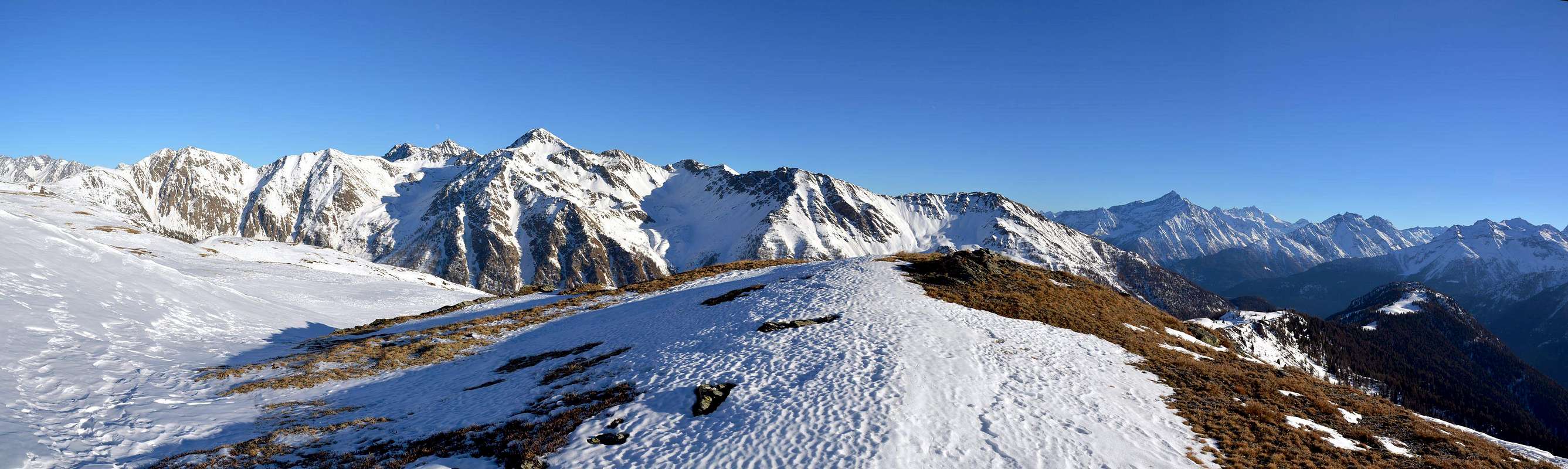
Not reach the Rovine Alp last bend but still continue towards the North, but more to the Northwest, through the path n° 11 for the Lakes of Dziule (2.545m); reached the fork 2.093 meters instead take the path n° 10/VA that exceeded the Alp Sorace (2.205m), with a diagonal Northwest reaches the Citrin Pass (2.484m; 1h'15/1h'30). From the pass climb the Ridge watershed Northwest reaching 2.611 meters and 2.767 meters shares or Antecima Northern, from which in a short time, after a small notch on the ridge, with always easy route to the Summit (0h'50 from the pass).
Non raggiungere la Montagna Rovine bensì all'ultimo tornante proseguire ancora verso Settentrione, ma leggermente più a Nordovest, tramite il sentiero n° 11 per i Laghi di Dziule 2.545 m); raggiunto il bivio 2.093 metri prendere invece il sentiero n° 10/VA che, superata l'Alpe Sorace (2.205 m), con un diagonale a Nordovest raggiunge il Col Citrin (2.484 m; 1h'15/1h'30). Dal colle risalire la Cresta spartiacque Nordovest raggiungendo le quote 2.611 metri e 2.767 metri o Antecima Nord, dalla quale in poco tempo, dopo un intaglietto sulla cresta, sempre con facile percorso alla Sommità (0h'50 dal colle).
Route B (From Flassin Alp and traverse through Testa Cordella)
From Alp Flassin Superior or Tsa leave the path n° 7 that climbs to Citrin Pass, or continue with the same rejoining the pass with Via A; instead of wanting to change the path, go up through the path n° 7B to the Northwest and arrive at an old alp in ruins (2.439m) From this continue reaching the Testa Cordella (2.663m); from this easy trail to the South, after a small saddle 2.606 meters, reaching the Antetop North (2.767m), from which, as in the previous route, the Summit (1h'15 from the Tsa of Flassin).
Dall'Alpe Flassin Superiore o Tsa lasciare il sentiero n° 7 che sale al Col Citrin, oppure continuare con lo stesso ricongiungendosi al colle con la Via A; volendo invece variare il percorso, salire verso Nordovest tramite il sentiero n° 7B ed arrivare ad una vecchia alpe in rovina (2.439 m), Da questa continuare raggiungendo la Testa Cordella (2.663 m); da questa con facile percorso in cresta verso Sud, dopo una piccola sella 2.606 metri, raggiungere l'Antecima Nord (2.767 m), donde, come per il precedente itinerario, alla Sommità (1h'15 dalla Tsa de Flassin).
Difficulty
Difficulty: E/F (for both the routes).
Difficoltà: E/F (per entrambe le vie).
Equipment
Hiking gear.
Da Escursionismo.
Campings
Remember that free camping is forbidden (except for emergency reasons, over 2.500m, from darkness until dawn).
Mountain Condition
You can get meteo information at the official site of the Regione Valle d'Aosta:
"Guida dei Monti d'Italia-Alpi Pennine" (Vol. I°) di Gino Buscaini-Club Alpino Italiano/Turing Club Italiano, Luglio 1971 (in Italian).
"80 itinerari di Escursionismo Alpinismo e Sci Alpinismo in Valle d'Aosta", di Osvaldo Cardellina, Ed. Musumeci, Giugno 1977 (in Italian); seconda Ed. Luglio 1981; terza Ed. Luglio 1984; (in French), prima Ed. Febbraio 1978; seconda Ed. Marzo 1980.
MAPS
Kompass "Monte Bianco Valle d'Aosta Sentieri e Rifugi" Carta turistica 1:50.000.
I.G.C. Istituto Geografico Centrale "Carta dei sentieri e dei rifugi" 1:25.000.
Parents refers to a larger category under which an object falls. For example, theAconcagua mountain page has the 'Aconcagua Group' and the 'Seven Summits' asparents and is a parent itself to many routes, photos, and Trip Reports.

 4127 Hits
 88.19% Score
 26 Votes