
-
 4467 Hits
-
 82.48% Score
-
 15 Votes
|
|
Mountain/Rock |
|---|---|
|
|
45.80245°N / 10.63980°E |
|
|
Trentino, Lombardy |
|
|
Hiking, Mountaineering |
|
|
Spring, Summer, Fall, Winter |
|
|
6483 ft / 1976 m |
|
|
Overview
Monte Caplone/Cima delle Guardie 1976 m
Monte Caplone is a mountain located on the border between Trentino and Lombardy, Brescia province. It is the highest peak of the Parco Regionale dell'Alto Garda Bresciano and belongs to the Prealpi Bresciane and Gardesane. Caplone is a mighty and rather complex mountain, showing a dolomitic appearance and holding impressive rock walls facing West and South. Some of the mountain sides are particularly wild and have not yet been fully explored. From the summit four ridges take their origin, between which the SE ridge, connecting Caplone and the adjacent Cima Bus del Balì, is the longest one. From this ridge it departs a secondary branch directed towards the East, connecting Caplone to Cima Berlinghera.
The SSE ridge ends in Val Caneva, while the NW ridge directed towards the Bocca di Campei creates another branch NE oriented, joining Bocca di Lorina. Between the two names of the mountain the most widely used nowaday is Monte Caplone, but the original name is Cima delle Guardie (meaning Summit of the Guards), already existing on the Tyrolean Atlas by Anich in the XIX century. In facts, as early as the late nineteenth century a few station of guards were placed on Caplone, located along the border between the Austro-Hungarian Empire and the Kingdom of Italy.
In facts, as early as the late Nineteenth century a few station of guards were placed on Monte Caplone. In fact like several peaks located in the High Garda territories, also Monte Caplone was located on the border between the Austro-Ungarian Empire and the Kingdom of Italy. Still today there are numerous remains of the military works dating back to WWI.
Getting there
The starting point for the ascent is the small village of Cima Rest 1200 m, located near the village of Magasa 970 m in Val Vestino. Road approach to Cima Rest - From Western Garda shore: from A4 Milano-Venezia Motorway exit Brescia West. Continue eastward along the South Ring Road-SS11 and then on SS45-West Gardesana. Leave to the right the detour to Salò and continue along the Western shore of Garda Lake, pass Gardone Riviera, Maderno, Toscolano, Bogliaco and Villa. Shortly after Gargnano, leave the Western Gardesana road and take the road to Valvestino (signposts Magasa), rising up and getting a dam after several bends. on the right crossing the detours to Musaga, then the next Sasso, Liano, Formaga, Costa.
A latter 'junction turn left, always along the SP9, it exceeds Navazzo and proceed towards the Valvestino. After the dam it runs on the right shore of the long and very narrow artificial lake of Valvestino and always keeping the right at the crossroads to Bollone and Capovalle Turano finally reaching Magasa 970 m. Shortly before entering the village on the right it departs an impressive winding road to reach the small village of Cima Rest 1200 m. Parking lot near the Church of the Alpini. - From Idro Lake: from the Idro Eastern shore leave the main road taking the SP9 to Capovalle, pass this village and reach Magasa.

|

|
Route: Monte Caplone from Cima Rest
Monte Caplone Standard route from Cima Rest
Summit quote: 1976 m
Difficulty: EE, F in wintertime
Difference in level: 800 m from Cima Rest
Exposition: South, then North
Time required: 3,30 hours round trip
Starting point: Cima Rest 1200 m
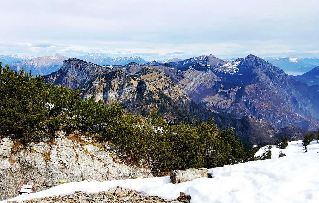
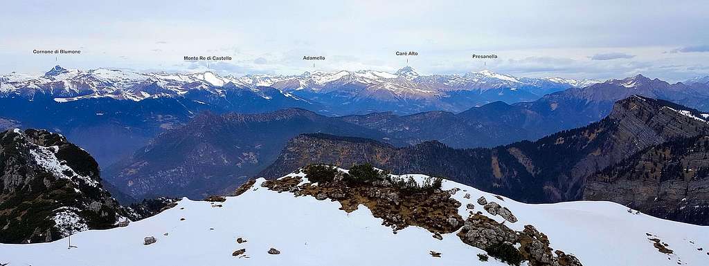
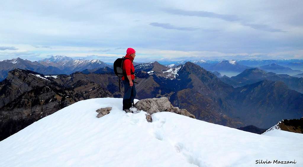
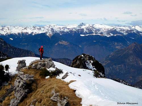
Superb itinerary having a considerable environmental, botanical and historical interest. The summit views are wide and spectacular. The whole area has a great botanical value due to the presence of rare endemic flora, such as "Saxifraga tombeanensis". Also visible are the various military structures, built during the First World War, used as machine-gun and artillery pieces.
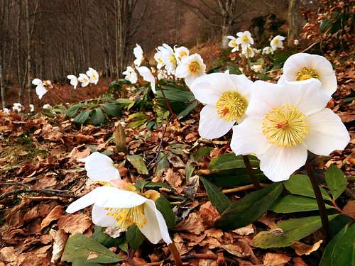
Broad blooming of Helleborus Niger along the route |
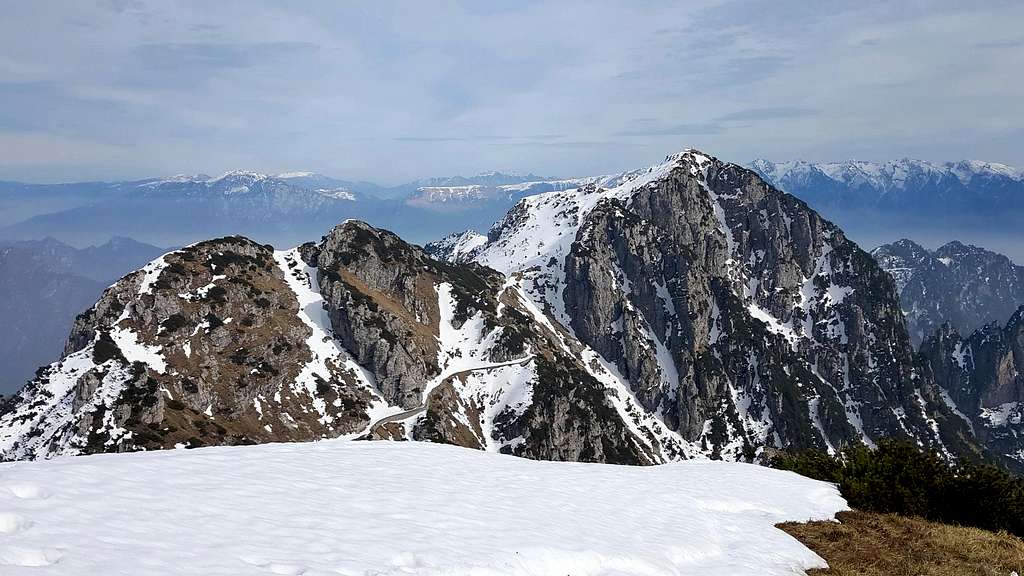
A glance to Cima Tombea from the old WWI track |
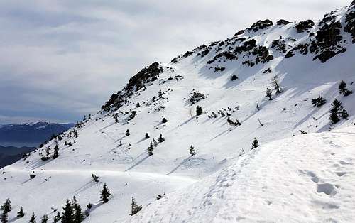
Northern slopes of Monte Caplone |
Route report - From the car park near the Church of the Alpini take to the left a narrow concrete road that rises to a few small groups of dwellings. The steep narrow street quickly rises to a collar with a few houses, where it falls in the midst of huge beech trees, getting Malga Alvezza 1280 m. After the hut the concrete road restarts to rise, quickly reaching a crossroad. To the right it branchs the road to Val Campei, to the left it branchs the path to Bocca di Cablone; our path is the central one (n. 66, signpost "Caplone" and "Tombea").
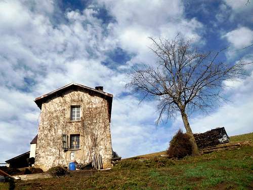
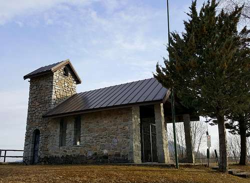
Country-house on the trail to Monte Caplone |
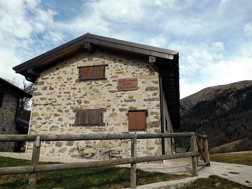
Malga Alvezza |
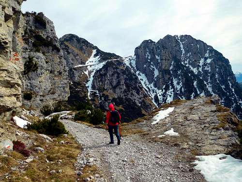
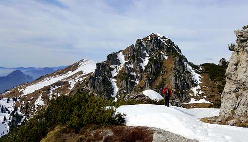
The WWI military track to Monte Caplone |
The path enters the "Selva dal Ponte", a beautiful sparse forest of beech and fir with spectacular flowering, especially in the months of March and April, due to the presence of numerous examples of the Helleborus Niger and runs within the wood with several turns, amongst broad views of Magasa and the plain of Denai. After passing a little stream, the path reaches the highest and more sparse part of the wood, finally exiting into the open ground and rising up to a grassy shelf from where it appears the majestic and rocky southern slope of Monte Caplone and of the left the smaller Monte Tombea.
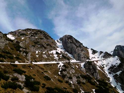
The old WWI military road to Bocca Campei |
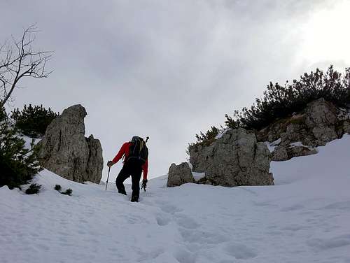
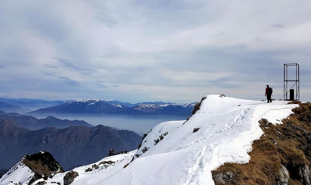
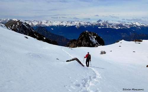
Snow-slopes near the summit |
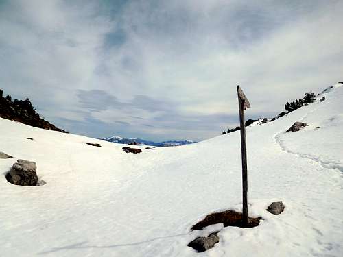
Wooden signpost near the summit |
Soon the path joins the fine and characteristic military track (n. 69) coming from the nearby Malga Tombea and connecting Bocca Cablone to the left and Bocca Campei to the right. Once joining the military trail (signposts) you must turn to right and follow the track carved into the rock descending along a very suggestive tract (signs on the botanical rarity of the region ). After a tunnel the military trail starts to rise getting the Bocca di Campei 1840 m.
Getting the pass, leave the main trail to Bocca Lorina and head to right crossing a slope, snowy until late Spring, to take a steep gully rising quickly to a terrace. Cross the terrace (wooden signpost) and overcome a last steep but brief slope on the right, giving access to the summit.
Descent: you can reverse the same route or alternatively you can climb also the near Cima Tombea (highly recommended, the digression is short and the summit-view is even finest than the previous from Monte Caplone). Both the alternatives require you to come back to the signposts at the junction between the trail coming from Cima Rest and the military track.
Malga Tombea
To climb Cima Tombea you must continue along the military track in the direction of Malga Tombea and Bocca Cablone. After 10 minutes you arrive near Malga Tombea, where on the right it starts a short path with several hairpins getting the summit of Cima Tombea.
Red Tape

There are not special restrictions in climbing, hiking and mountaineering. Cars on the concrete road after Chiesetta degli Alpini are not allowed.
When to Climb
The ascent can be performed all year round. Winter ascents require the proper equipment (crampons and axe), as well as early spring ascents. In fact on the itinerary, despite having full southern exposure, the snow may remain until May on the North oriented final slopes from Bocca di Campei to the summit, fairly steep but brief.
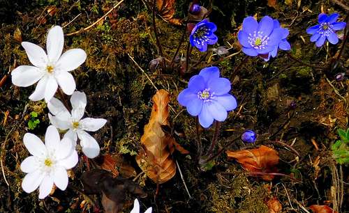
White and violet specimens of Anemone Hepatica |

Helleborus Niger |
Accomodation
Several possibilities of accomodation along Western Gardesana
Meteo
Meteo Arpa Lombardia
Meteo Trentino
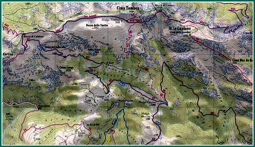
Guidebooks and maps
 |
 |
Guidebooks
"Prealpi Bresciane" by Fausto Camerini - Collana Guide dei Monti d'Italia, CAI-TCI
Maps
Lagiralpina sheet 016 - Alpi di Ledro - Tremalzo 1:25.000 Kompass 102 - Lago di Garda e Monte Baldo - 1:50000