|
|
Mountain/Rock |
|---|---|
|
|
44.21000°N / 71.446°W |
|
|
4051 ft / 1235 m |
|
|
Overview
Appalachian Mountains > White Mountains > Willey Range > Mt Tom
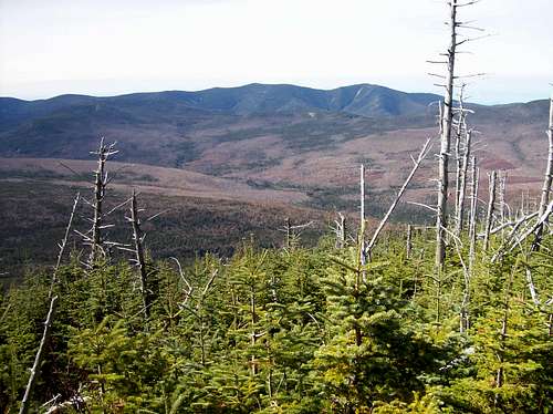
Mount Tom is located in Grafton County in the White Mountain National Forest. From the summit, there are some great views to the south, west, and north. The actual summit is fairly void of trees except to the east.
The hike up from Crawford Depot is absolutely beautiful. There are several stream crossings with lots of small waterfalls. The trails are clearly marked and well maintained.
Mount Tom is the northernmost 4000-footer in the Willey Range. The other significant peaks of this small range are close by and can be climbed in the same day. They are Mount Avalon (3,430), Mount Field (4,326), and Mount Willey (4,302). One lesser summit close by on a spur route is Mount Willard (2,840).
Getting There & Trails Overview
The easiest approach is from Crawford Depot:
Starting from North Conway, take Route 302 northwest to Crawford Depot which is on the left side of the road. This depot is a train station, look for the yellow gazebo-like tower at quayside. See the Route description for Avalon/A-Z Trail.
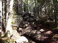
Once on top of the ridge, the summit of Mt Tom is reached by a short spur trail.
Mt Tom can also be reached by taking the Willey Range Trail over at least two other summits of the Willey Range, starting from one of two trailheads within Crawford Notch State Park (on rte 302 three or four miles southeast of Crawford Depot).
A third option is to start from Zealand Falls Hut, about three miles of easy hiking from the west. (The Hut can be reached on the nearly-flat Zealand Trail, about two miles long, from the north.)
Several loops and lollipops of various lengths are possible - consult a trail map.
Red Tape
Permits are not required to climb this mountain. Parking in the designated hikers' lot is $3 per day, but cheapskates can park in the Crawford Hostel or Crawford Depot lots for free.
Usual WMNF rules about fires, camping, etc.
When To Climb
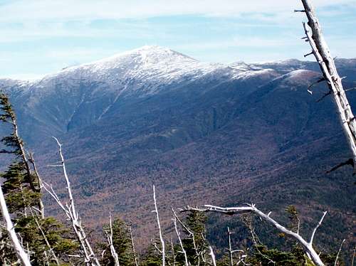
Mount Tom can be climbed year round. Mount Tom is very close to Mount Washington which boasts some pretty fierce weather, but this mountain is much smaller, basically tree-covered, and somewhat sheltered by the larger peaks nearby. Nevertheless, be prepared for New England's frequently-perverse weather.
In winter, snowshoes are usually needed. The trail is not particularly steep, but enough so that crampons may also be useful in icy conditions.
Camping
This is a small peak located very close to the road, so camping is strictly optional.
Several miles to the south of Crawford Depot / 13 miles north of Bartlett, New Hampshire is a camp-site named Dry River Campground. This is a state run campground offering (31) primitive camp-sites. There is a $13 per night fee for camping.
The closest trailside camping is Ethan Pond Campsite, on the Ethan Pond Trail (A.T.) about a mile west of the far (southern) end of the Willey Range Trail.
Backcountry camping is permitted with the usual WMNF restrictions, but not within Crawford Notch State Park, whose western border runs roughly from the summit of Mt Avalon to the summit of Mt Willey.
Mountain Conditions & Weather
Mt Tom is almost entirely below treeline, so the hike is much more sheltered than a Mt Washington climb would be. (Mt Tom is also about 2000 feet lower.)
Still, it's a good idea to check the Mt Washington Forecast and/or Mt Washington Webcam before heading up. Note that, in sharp contrast to Mt Washington's ravines, avalanche danger on Mt Tom is always nil.
Trail Conditions for New Hampshire on Views From the Top
External Links
- Mount Washington
Up to date information on nearby mount Washington. - New England Ice
Ice Climbing in New England with great links and information. - Dry River Campground
Local camp site information.


