

-
 31316 Hits
-
 80.21% Score
-
 12 Votes
|
|
Mountain/Rock |
|---|---|
|
|
36.96500°N / 117.148°W |
|
|
8738 ft / 2663 m |
|
|
Overview
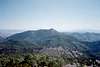
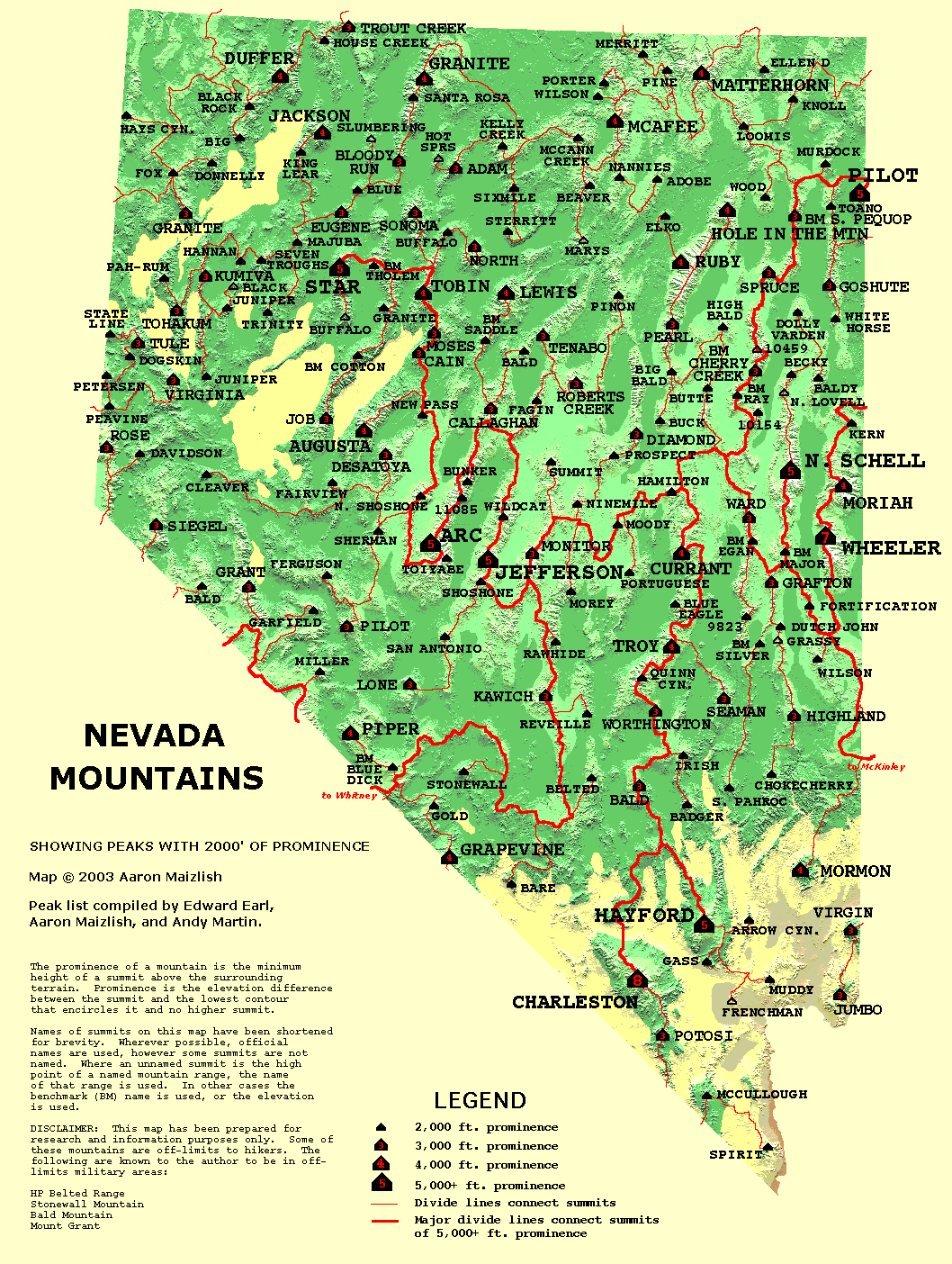
Grapevine Peak is the highest point in the Amaragosa Mountains. This mountain rises in a remote corner of Death Valley National Park in an area known as the Nevada Triangle. According to various sources, the Amaragosa Mountains actually consist of four distinct individual mountain ranges known as the Grapevine, Funeral, Black, and Greenwater ranges. Grapevine Peak is located in Grapevine Range. The slopes of Grapevine Peak are covered with juniper trees, which stand in stark contrast to the hot, barren slopes that make up most of Death Valley. Grapevine Peak towers over 7,000' above the northern parts of Death Valley, and is located far off the beaten path. It appears to receive few visitors and little attention. The slightly lower Wahguyhe Peak also rises impressively nearby.With an elevation of 8,738', Grapevine Peak ranks way down on the Nevada elevation list. But the new field of Prominence has made Grapevine Peak a more important mountain. With a prominence of 4,562', Grapevine Peak makes an impressive appearance on the crowded Nevada Prominence Map.
 |
 |
Getting There
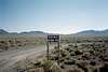
From the small town of Beatty on US Highway 93, drive about 13 miles north on US 93. Once you reach milepost 71, drive another ½-mile or so until you see an unmarked dirt road on the left. Turn off the highway here and start driving west. After about 75 yards, you will reach an unlocked gate. Go through the gate, and start driving up the road as it heads for Phinney Canyon. You will pass by a Death Valley National Park sign on the way in. The road has several forks, but you want to stay on the main road. The first half of the road is pretty good, but it gets rougher the further in you drive. However, overall the road wasn’t that bad. After about 21 miles, you will have to park somewhere in Phinney Canyon. We parked next to an abandoned mine shaft at about 6,900', which is shown on the topo map. Some high-clearance vehicles can drive a little further in, but a large boulder blocks the road higher up. However, it might be possible for some vehicles to squeeze by the boulder and continue all the way up to a saddle at 7,500'.
 |
 |
 |
Mountain Conditions
Contact Death Valley National Park for the latest information about Grapevine Peak. The park website is attached below.
Camping
There are no campgrounds near Grapevine Peak. This is a primitive camping area.External Links
Death Valley National ParkDeath Valley National Park
Nevada Prominence Map