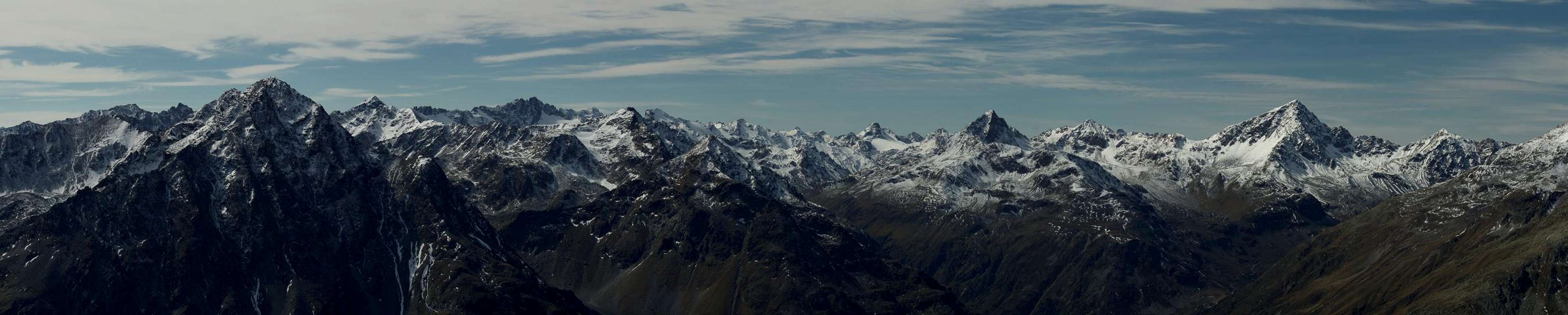
Overview
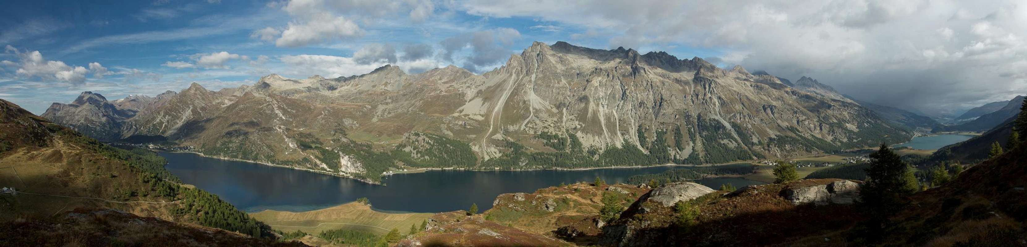
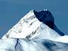
![Albula Alps]() Piz Julier and Piz Ot above St. Moritz Piz Julier and Piz Ot above St. Moritz |
The
Albula Alps are located in the east of
Switzerland in its easternmost canton (province)
Graubünden / Grisons / Grischun. The range belongs to the
Rhaetian Alps which again are part of the
Eastern Alps. It is located almost at the western end of both the larger areas in what are called the "
Central Eastern Alps" and thus part of the alpine main ridge.
Historically the range has some importance due to several mountain passes which have been in use since the Bronze Age. All are located in the southern and central parts of the range: Malojapass, Septimerpass and Julierpass all show signs of having been used for ages. In all three cases the Romans built roads to cross them, roads which fell into disrepair, after the Romans had to abandon the area. Especially around Julierpass and Malojapass you can still see the cart tracks which date 2000 years back.
Today the Albula Alps are part of the heartland of the Rhaetoromanic culture and heritage. here and in the neighbouring mountain groups and valleys the Rhaetic tounge is still spoken. There are a half dozen dialects, each of which is spoken in distinct areas. In an effort to preserve the language the written language
Romantsch Grischun has been developed as a means to support the language as a whole. Since 2003 it is the official language of the region. However, German has become the dominant language in the valleys east and north of the Albula Alps, a fact that is reflected in the mountain names in these areas.
Generally most mountains are known by their Raetian names, though the most important ones carry a German equivalent as well. For instance
Piz Kesch is
Aguglia d'Es-cha in Raetian or
Piz Julier is
Piz Guglia. Only in the north around Flüelapass will you find mountains with only German names like
Flüela Schwarzhorn or its neighbour,
Radüner Rothorn.
Finally speaking of mountains, most of the Albula Alps summits range in the area between 2800m and 3200m. Unlike the neighbouring
Silvretta, a range of similar height, the Albula Alps are a loosely knit range with the principal summits standing rather solitary. Thus they all carry only small glaciers with the exception of the
Grialetsch Subbgroup where several high mountains are grouped together to shelter a large glacier basin.
At 3417m the highest mountain of the
Albula Alps is
Piz Kesch followed by
Piz Calderas (3397m),
Piz Julier (3380m) and
Piz d'Err (3378m). All of these mountains are located in the central part of the range, between
Julierpass and
Albulapass.
The
Albula River is the naming patron of the range. It divides it into two parts (see next section), north and south of
Albulapass. Albula Valley and Pass are most famous for the
Albula Railway, a part of
Rätische Bahn, the train compaany which operates the lines in Graubünden and which has been declared UNESCO world cultural heritage. In several long loops the railway track heads up to the long tunnel which passes the range underneath
Albulapass and which emerges near
St. Moritz on the Engadin Side (east).
The Albula Alps are bounded by the
Inn River in their east,
Malojapass and
Septimerpass in the south,
Oberhalbstein / Sursess and
Albula Valley in the west and
Flüelapass in the north. Neighbouring mountain ranges, all of them parts of the
Rhaetian Alps, are
Sesvenna Group,
Livigno Alps and
Bernina in the east,
Val Massino Alps in the south,
Platta and Plessur Groups in the west and
Silvretta in the north.
The
Albula Alps are probably best known for their ski runs.
St. Moritz in the east and Davos in the nort-west are particularly important. Moreover, quite a number of the major mountains are good and popular ski tour destinations. In summer activities range from hiking and mountain biking across the many passes of the range to more or less difficult ascents of the higher mountains. The
Albula Alps are a all-year destination.
The Albula Alps on SP

The grouping and subgrouping structure on this page follows the classification of the Italian Alpine Club CAI. It separates the
Albula Alps into two parts (see the red line in the above map), north and south of
Albula Pass. Each of these two groups again is separated into subgroups, which themselves are made up by even smaller sub-subgroups. The areas designed in the map above refer to the smallest subgroups.
A - Güglia-Err-Bravuogn Chain
The Piz Lagrev Group above Lej da Segl |
A.1 - Güglia-Ot Group
A.1.1 - Piz Lagrev Group
- Motta da Sett (2637m)
- Piz dal Sase (2720m)
- Piz Lunghin (2780m)
- Piz Grevasalvas (2932m)
- Piz Materdell (2967m)
- Piz d’Emmat Dadaint (2927m)
- Piz d’Emmat Dadora (2851m)
- Roccabella (2731m)
- Piz Lagrev (3165m)
- Piz Polaschin (3013m)
- Piz da las Coluonnas (2786m)
A.1.2 - Güglia-Bever Group
- Piz Albana (3100m)
- Piz Güglia (3380m)
- Corn Suvretta (3072m)
- Piz Suvretta (3144m)
- Piz Bever (3220m)
- Piz Valetta (2918m)
- Corn Alv (2980m)
- Piz Surgonda (3197m)
- Piz Traunter Ovas (3152m)
A.1.3 - Piz Ot Group
- Sass Runzöl (2486m)
- Piz Nair Pitschen (2877m)
- Piz Nair (3056m)
- Piz Schlattain (3004m)
- Sass Corviglia (2862m)
- Sass Nair (2762m)
- Piz dal Büz (2955m)
- Piz Padella (2856m)
- Piz Grisch (3098m)
- Piz Corviglia (3057m)
- Piz Glüna (3102m)
- Piz Salüver (2957m)
- Piz Marsch (3120m)
- Cho d’Suvretta (2966m)
- Piz Ot (3246m)
- Piz Muottas (2914m)
- Piz Spinas (2883m)
- Cho d’Valetta (2493m)
A.2 - Err-Calderas Group
A.2.1 - Piz Calderas Group
- Piz Barscheinz (2617m)
- Piz Neir (2910m)
- Crappa dal Tocf (2860m)
- Piz Bardella (2839m)
- Piz Campagnung (2826m)
- Piz Cugnets (2739m)
- Piz d’Agnel (3205m)
- Tschima da Flix (3316m)
- Piz Picuogl (3333m)
- Piz Calderas (3397m)
- Piz Cucarnegl (3051m)
A.2.2 - Piz d‘Err Group
- Piz digl Plaz (2327m)
- Piz Colm (2415m)
- Carungas (2622m)
- Castalegns (3021m)
- Piz d’Err (3378m)
- Piz Jenatsch (3251m)
- Piz Laviner (3137m)
- Piz Chembels (2981m)
A.2.3 - Piz Bleis-Marscha Group
- Piz Bleis-Marscha (3128m)
- Piz Mulix (2887m)
- Piz Salteras (3111m)
- Piz Val Lunga (3078m)
- Piz Cuetschens (2919m)
- Pizza Grossa (2939m)
A.2.4 - Piz Bial Group
- Piz d’Alp Val (3053m)
- Piz Bial (3067m)
- La Piramida (2964m)
- Igl Danclér (2814m)
- Piz Palpuogna (2730m)
A.2.5 - Crasta-Mora Group
- Dschimels (2782m)
- Piz da la Blais (2930m)
- Piz Mez (2900m)
- Crasta Mora (2953m)
A.3 - Pizs da Bravuogn Group
- Tschimas da Tschitta (2745m)
- Piz Ela (3339m)
- Piz Rugnux (2736m)
- Piz digl Barba Peder (3239m)
- Piz Radond (2666m)
- Piz d’Uglix (2967m)
- Piz Spadlatscha (2761m)
- Corn da Tinizong (3173m)
- Piz Cuolmet (2796m)
- Piz Mitgel (3159m)
- Crap Neir (2432m)
B - Kesch-Chüealphorn-Grialetsch Chain
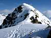
Northern Albula Alps seen from Piz Chastè |
B.1 - Greater Piz Kesch Group
B.1.1 - Albula Group
- Piz Muot (2670m)
- Piz Zavretta (3042m)
- Piz Üertsch (3267m)
- Igl Compass (3016m)
- Piz Blaisun (3200m)
- Muntischè (2528m)
B.1.2 - Tschimas da Tisch Group
- Piz Darlux (2642m)
- Tschimas da Tisch (2872m)
- Piz Fregslas (2819m)
B.1.3 - Piz Kesch Group (in the local sense)
- Piz As-cha (2719m)
- Piz Cotschen (3195m)
- Piz Kesch (Piz d’Es-cha, 3417m)
- Kesch Pitschen (2751m)
- Piz Val Müra (3162m)
- Piz Viroula (3062m)
- Piz Belvair (2822m)
- Pizzet (2910m)
- Piz Griatschouls (2912m)
- Piz Porschabella (3079m)
- Piz Viluoch (3042m)
- Piz Müsella (2897m)
B.1.4 - Piz Forun Group
- Murtel digl Stangels (2482m)
- Piz Forun (3052m)
- Piz Murtelet (3019m)
B.2 - Ducan-Monstein Group
B.2.1 - Piz Ducan Group
- Piz Prosonch (2684m)
- Piz Platta Roggia (2955m)
- Piz Crealetsch (2950m)
- Piz Ravigliel (2987m)
- Ducan Dador (3020m)
- Igls Cuetschen (2774m)
- Ducan Pitschen (2744m)
- Chlein Ducan (3004m)
- Hoch Ducan (3063m)
- Plattenflue (3013m)
- Mittaghorn (2735m)
B.2.2 - Monstein Group
- Muchetta (2623m)
- Fil da Stugl (2612m)
- Büelenhorn (2808m)
- Bott’Ota (2685m)
- Mäschengrat (2786m)
- Gipshorn (2814m)
- Chrummhüreli (2666m)
- Chrachenhorn (2891m)
- Gretji (2652m)
- Strel (2844m)
- Männli (2459m)
- Älplihorn (3006m)
- Erezberg (2616m)
- Leidbachhorn (2908m)
- Schwarzhorn (2625m)
- Schwarzflue (2818m)
- Marchhüreli (2578m)
- Rinerhorn (2495m)
B.3 - Chüealphorn-Schwarzhorn Group
B.3.1 - Chüealphorn Group
- Chüealphorn (3078m)
- Augstenhüreli (3027m)
- Leidhorn (2934m)
- Bocktenhorn (3044m)
- Sattelhorn (2980m)
- Hüreli (2574m)
- Gfroren Horn (2747m)
- Wuosthorn (2815m)
- Börterhorn (2697m)
- Tällihorn (2684m)
- Witihüreli (2635m)
- Jatzhorn (2682m)
- Jakobshorn (2590m)
- Brämabüel (2429m)
B.3.2 - Schwarzhorn Group
- Radüner Rothorn (3022m)
- Piz Radönt (3065m)
- Schwarzhorn (3146m)
- Brunhorn (2743m)
- Sentisch Horn (2827m)
- Baslersch Chopf (2629m)
- Büelenhorn (2512m)
B.4 - Grialetsch Group
- Piz Forun (2932m)
- Piz da l’Hom (2986m)
- Piz Punt Ota (3021m)
- Piz Grialetsch (3131m)
- Scalettahorn (3068m)
- Piz Vadret (3229m)
- Piz Sarsura (3178m)
- Piz Sarsuret (3126m)
- Piz d’Urezza (2906m)
- Piz Sarsura Pitschen (3134m)
- Piz d’Immez (2892m)
- Piz Arpschella (3032m)
- Piz Murterschömbel (2996m)
- Piz Murtaröl (2881m)
- Piz dal Ras (3026m)
Getting There
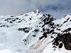
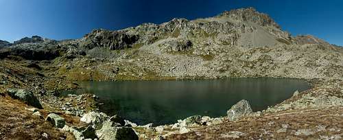
![Lej Nair beneath Piz Materdell]() Lej Nair beneath Piz Materdell
Lej Nair beneath Piz Materdell
The
Albula Alps are located in Switzerland's easternmost Canton (province)
Graubünden / Grison. You cannot reach the area by motorway directly but rather have to use narrow two laned highways.
- Western Access (Switzerland, Germany):
- Either take motorway A3 from Zürich or A13 from the Swiss - German - Austrian border near Bregenz.
- Both combine south of Liechtenstein and lead (A13) to Landquart or Chur.
- From these exits take one of the mountain passes (Flüela, Albula, Julier) to get into the range.
- North-Eastern Access (Austria):
- Take A12 (Inntalautobahn) to the exit Landeck.
- Switch to B180 and after Pfunds cross the Swiss border.
- Stay on B27 through Engadin until you reach Susch, Zernez, St. Moritz.
- South-Eastern Access (Italy through South Tyrol):
- Take Brenner Motorway A22 to the exit Bozen / Bolzano Sud.
- Switch to SS38 and pass Meran / Merano to drive through Vinschgau / Val Venosta.
- At Sponding / Spondinga turn onto SS40 to Schluderns / Sluderno
- Switch to SS41 through Glurns / Glorenza to the Swiss border.
- Stay on B28 across Ofenpass / Pass dal Fuorn until you reach Zernez
- Southern Access (Italy)
- Either Take SS37 through Chiavenna and Val Bregaglia to Maloja Pass and on to St. Moritz, Zernez and Susch (B3 and B27 in Switzerland).
- Or take SS38 to Tirano and B29 across Bernina Pass to Pontresina, St. Moritz and so on.
- Or take SS38 to Bormio and SS301 through Livigno, which will lead to B28 near Zernez.
Accommodation
![Albula Alps above St. Moritz and Samedan]() St. Moritz and Samedan beneath the Albula Alps
St. Moritz and Samedan beneath the Albula AlpsHotel Rooms and Apartments
Mountain Huts & Refuges
Red Tape
![Motherly Love]() Motherly Love
Motherly Love
Within the boundaries of the
Albula Alps Switzerlands largest natural park,
Parc Ela has been established. It protects the cultural, economic and natural heritage o an area where people have lived since the bronze age. Named after
Piz Ela in its midst the park covers an area of 550 square kilometres, 200 of which are untouched nature. The 19 communities on its groundsupport the goals of the park and use them to attract visitors.
Official WebsiteWeather Conditions
Maps & Books
Maps
Digital Maps
Swisstopo Maps
- 1:50000
- LK 268 T: Julierpass
ISBN: 978-3302302683
- LK 258 T: Bergün / Brauvogn
ISBN: 978-3302302584
- 1:25000
- LK 1276: Val Bregaglia
ISBN: 978-3302012766
- LK 1256: Bivio
ISBN: 978-3302012568
- LK 1257: St. Moritz
ISBN: 978-3302012575
- LK 1236: Savognin
ISBN: 978-3302012360
- LK 1237: Albulapass
ISBN: 978-3302012377
- LK 1217: Scalettapass
ISBN: 978-3302012179
- LK 1218: Zernez
ISBN: 978-9602122488
- LK 1197 Davos
ISBN: 978-3302011974
- Other Maps:
- Oberendagin / Alta Engadina
1:40000
Kompass Verlag
ISBN: 978-3850269094
Books
- Bündner Alpen 6
Manfred Hunziker
Sac Schweizer Alpenclub
ISBN: 978-3859021877
- Oberengadin - St. Moritz, Zuoz, Pontresina
Rudolf Weiss, Siegrun Weiss
Rother Verlag
ISBN: 978-3763340422
- Unterengadin. Scuol - Zernez - Münstertal
Rudolf Weiss, Siegrun Weiss
Rother Verlag
ISBN: 978-3763340439
- Skitouren Graubünden Süd: Oberhalbstein / Albula / Davos / Engadin
Vital Eggenberger
Sac Schweizer Alpenclub
ISBN: 978-3859023017
In Memory of Cyrill Rüegger
![]() A note from the SP staff
A note from the SP staff
Cyrill Rüegger, the member we all used to know as Cyrill and Digitalis, died on June 13th 2009 in an avalanche on the summit ridge of Piz Palü together with his wife Tanja and a common friend. They were swept down by the avalanche into a couloir underneath the east summit and died instantly. Their bodies were retrieved from the Palü Glacier by helicopter a day after the accident.
Cyrill joined SP in March 2006 and soon was one of the most prolific contributors on the site with almost 70 mountain and 5 range pages to his profile. He was an accomplished climber, bagging almost 1000 summits in not quite seven years. Among them are 35 4000ers and 272 3000ers, almost all of them in his home country Switzerland.
While contributing a lot on SP, Cyrill's real internet home was
www.hikr.org where he contributed 585 mountain profiles and reports in his native language German. Cyrill also posted on www.bergsteigen.at and other climbing sites, often under his real name but also under the pseudonym Digitalis. He was a botanist by profession and also contributed his knowledge about medical plants to different websites. Cyrill will be greatly missed by all.
This page will be kept in honour of Cyrill, one of SP's most prolific members and most active mountaineers.
Rest in peace, brother!
The picture above was taken on the summit of Matterhorn on July 28th 2007.


 23805 Hits
 87.76% Score
 25 Votes
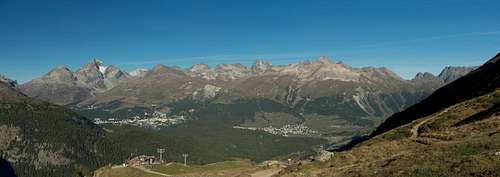 Piz Julier and Piz Ot above St. Moritz


 Lej Nair beneath Piz Materdell
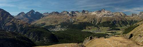 St. Moritz and Samedan beneath the Albula Alps


 Motherly Love
 A note from the SP staff
Cyrill Rüegger, the member we all used to know as Cyrill and Digitalis, died on June 13th 2009 in an avalanche on the summit ridge of Piz Palü together with his wife Tanja and a common friend. They were swept down by the avalanche into a couloir underneath the east summit and died instantly. Their bodies were retrieved from the Palü Glacier by helicopter a day after the accident.
Cyrill joined SP in March 2006 and soon was one of the most prolific contributors on the site with almost 70 mountain and 5 range pages to his profile. He was an accomplished climber, bagging almost 1000 summits in not quite seven years. Among them are 35 4000ers and 272 3000ers, almost all of them in his home country Switzerland.
While contributing a lot on SP, Cyrill's real internet home was www.hikr.org where he contributed 585 mountain profiles and reports in his native language German. Cyrill also posted on www.bergsteigen.at and other climbing sites, often under his real name but also under the pseudonym Digitalis. He was a botanist by profession and also contributed his knowledge about medical plants to different websites. Cyrill will be greatly missed by all.
This page will be kept in honour of Cyrill, one of SP's most prolific members and most active mountaineers.
Rest in peace, brother!
The picture above was taken on the summit of Matterhorn on July 28th 2007.
A note from the SP staff
Cyrill Rüegger, the member we all used to know as Cyrill and Digitalis, died on June 13th 2009 in an avalanche on the summit ridge of Piz Palü together with his wife Tanja and a common friend. They were swept down by the avalanche into a couloir underneath the east summit and died instantly. Their bodies were retrieved from the Palü Glacier by helicopter a day after the accident.
Cyrill joined SP in March 2006 and soon was one of the most prolific contributors on the site with almost 70 mountain and 5 range pages to his profile. He was an accomplished climber, bagging almost 1000 summits in not quite seven years. Among them are 35 4000ers and 272 3000ers, almost all of them in his home country Switzerland.
While contributing a lot on SP, Cyrill's real internet home was www.hikr.org where he contributed 585 mountain profiles and reports in his native language German. Cyrill also posted on www.bergsteigen.at and other climbing sites, often under his real name but also under the pseudonym Digitalis. He was a botanist by profession and also contributed his knowledge about medical plants to different websites. Cyrill will be greatly missed by all.
This page will be kept in honour of Cyrill, one of SP's most prolific members and most active mountaineers.
Rest in peace, brother!
The picture above was taken on the summit of Matterhorn on July 28th 2007.