

-
 11364 Hits
-
 81.18% Score
-
 13 Votes
|
|
Mountain/Rock |
|---|---|
|
|
61.42672°N / 8.14907°E |
|
|
Innlandet/Vestland |
|
|
Mountaineering, Scrambling |
|
|
Spring, Summer, Fall, Winter |
|
|
7077 ft / 2157 m |
|
|
Overview
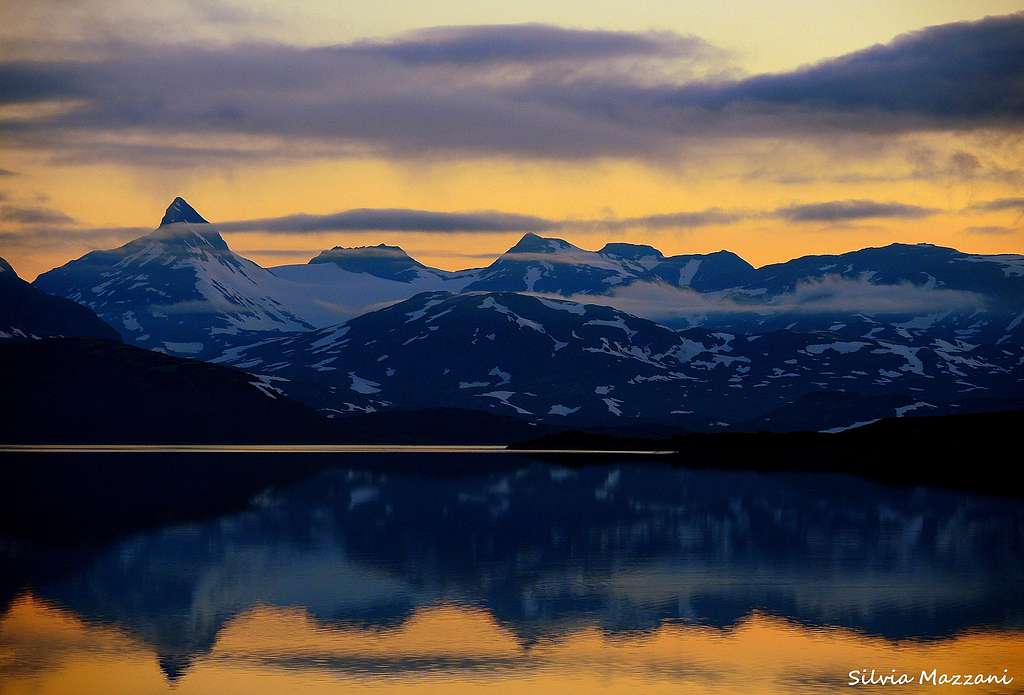
Uranostinden 2157 m
In the opinion of many mountain climbers, Uranostinden is the most esthetic and beatiful mountain in the Jotunheimen National Park. When approaching the Jotunheimen Area from the South, driving along the shore of the Lake Koldedals, it appears a great panorama of distant peaks over the line of the water. One of these, situated in an isolated position to the NE of the lake, catchs the traveler's eye more than any other with its spectacular shape: it's just the superb Uranostinden, in shape of a large pyramidal peak, one of the finest mountain inside the Jotunheimen National Park.
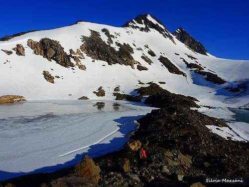
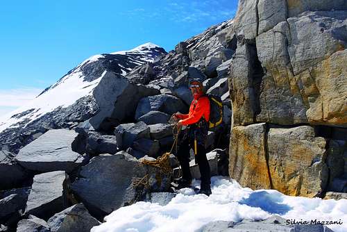
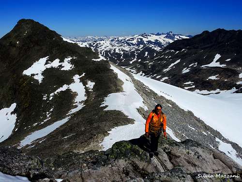
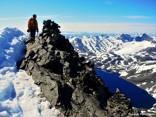
With a stunning and inviting profile, Uranostinden is a wonderful and varied mountain to climb. There are many different routes to choose when you're going to summit this peak. From East, South, West and North. The main summit and two subsidiary peaks are lined up a long and thin ridge. This attractive ridge is about 6 km in length, is steep sided both to the East and to the West and runs in a North-South direction. The North side of this ridge hosts the Normal route, less difficult than it may seem, which is frequently climbed both in summer and in spring (as a ski-mountaineering ascent). However, the route crosses the Uranosbreen glacier which hosts some huge crevasses, so it requires a good glacier experience.

During the winter and early spring ascents you should also pay attention to the large snow frames that border the summit ridge. The approach to Uranostinden is quite long, especially in the winter. It's a spring classic in Jotunheimen and frequently visited on skiis from both Tyinholmen and Eidsbugarden. In summer condition the start lies at 1200 metres above sea level with the summit at 2157 metres, so the difference in level is a little less than 1000 meters.
Getting There
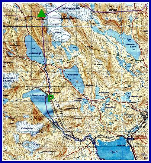
From Oslo as well from Bergen (opposite direction) take the E16 to Tyinkrysset. At the junction in Tyinkrysset leave the E16 and take the Road 252 from Tyin to Eidsbugarden (road open from mid June to mid October). At the following junction take the minor road to the right and drive along the Eastern side of the vaste Lake Tyin, getting the Tyinholmen Hoyfjellshytter, where there's another junction. Turn to left and take another minor construction road running long on the shores of a second lake, the Lake Koldedal, towards the Koldedalen valley, getting a road-bar in the locality Raudehaugen near a small waterfall. Park the car roadside. This latter road has not a good standard, and cars with low profile tyres are not recommended.
Route description
1 - Standard route via Uranosbreen/Uranos glacier and North Ridge
This is the standard route to summit Uranostinden. The route starts on the NW side of the Koldedalen lake, a few meters near the bridge over the stream draining the Urdadalsvatnet lake. Start 20 meters beyond the road-bar, taking to the right the well worn "T" marked trail towards lake Urdadalsvatnet and Skogadalsbøen. The route climb up a steep shoulder for 10 minutes until the terrain flattens. The trail heads to North on the west side of the river and after about 2 km from the start it path gains a well marked junction on a hill located to the South of the Urdadalsvatnet lake. At this junction leave the main path and take on the right a well worn path heading Eastward. Cross the river, there are stones to avoid the water, but in Juny/July it might be difficult not to be wet. After the crossing leave also this trail and start to head Northward in direction of a small stream emerging from a marshy bowl to the SE of a steep crag which drops straight into the Eastern shore of the pond 1518.
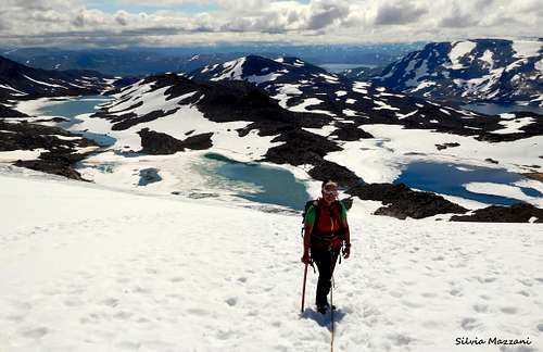
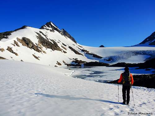
Enter this grassy bowl and climb up the moraine on a rough path which heads to north reaching the top of the moraine. From here head east across a desert landscape to the small pond at the mouth of the Uranosbreen glacier. Go round the south and then the east side of the slimy pond until you reach the boundary of the glacier. Rope up and start to climb the Uranosbreen glacier up to the North skirting the Uranostinden. While walking on glacier, rope and glacier-knowledge are necessary! The route goes up the gap between the Uranostinden and the Slingsbytinden. Here turn to left towards some granite boulders to take the wide North Ridge to Uranostind, rather easy to climb at the start. The slope becomes a bit steeper in the upper part, but nothing of difficult. When the snow slope approachs the summit ridge the slope levels off and it begins a 200 m long horizontal ridge a bit airy. The top is located at the southern end of this airy ridge. This stretch can be dangerous to climb in the winter or spring because of a huge snowdrift.
See here on SP the full description of the approach and the ascent of the standard route: Uranostinden Normal route - North ridge.
2 - South ridge
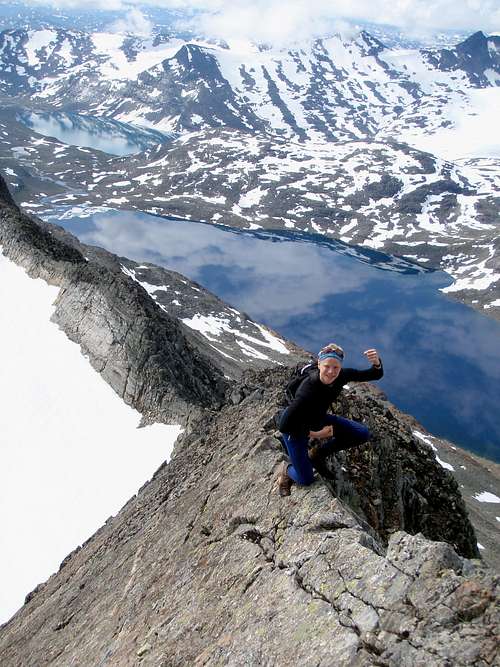
This is the most spectacular and airy route to Uranostinden and one of the most classic climb in Jotunheimen. It involves some short climbing sections up to grade III UIAA and a few longer scrambling sections. The exposure on some of these sections is remarkable. If you are scared of hights, a rope might be necessary. From Koldedalsvatnet follow the "T"-marked trail towards lake Urdadalsvatnet and Skogadalsbøen as described above for the route 1 (North Ridge). Follow this route for about 3 km to the silty pond near the Uranosbreen glacier and skirt the Westers shore of the pond to gain the foot of the S ridge. Start to climb up the ridge, the first section is across blocks but as you go up the ridge becomes airy and sharp. Scramble up reaching an airy notch before the summit of Southern Uranostinden. The last part to the Southern top is quite airy. From this fore-summit follow an easy ridge, after which it begins the most serious part of the ascent (up to II-III grade UIAA). Climb the very narrow ridge keeping the East side, then cross on the West side to reach the bottom of a chimney to be climbed. After the chimney reach again the ridge, becoming increasingly sharp, as long as it forces onto a very exposed slab on the East side. After this crux move there is another chimney on the East side again. Climb the chimney and from the exit an easy scramble leads to the main the summit.
Descent: the return can follow route 1
3 - From Skogadalsbøen
If you`re hiking from hut to hut and want to arrive Uranostinden from Skogadalsbøen the first step is to reach top "1900 metres" northwest for Uranostinden. (1) Via Skogadalen: Follow the Skogadalen trail until you reach the rivers coming from Uranosi, at the longitude with Skogadalsnosi. Take off the trail and walk up to top "1606 metres" east of Uranosi. Then you go east to the top "1900 metres" and follow the ridge to Uranostinden. You`re passing the northern summit at Uranostinden, called Slingsbytinde. It is some easy scrambling from this to the pass north of Uranostinden. (2) Via Uradalen: Follow the trail from Skogadalsbøen to Koldedalen via Uradalen. Take off the trail when the river from Uranosi crossing the trail. This is northwest of Steinsengene. Then you walk/scramble by the left side of the river to Uranosi. After that, there are an easy walk to top "1900 metres". The last part is described in "(1) Via Skogadalen".
4 - West face via the North ridge
The West flank of Uranostinden isn't certainly one of the best routes to summit Uranostinden. From Koldedalen follow the "T"-marked trail towards lake Urdadalsvatnet and Skogadalsbøen. Follow the trail until you reach the pass Urdadalsbandet. The route starts from an outcrop to the east of Urdadalsbandet, a watershed North of the lake Urdadalsvatnet. Climb steeply up snow slopes and scree until you reach the much steeper crags of the upper mountain. At the foot of these crags head north across scree and snow above a band of crags into a bowl to the west of the main saddle between Uranostind and Slingsbytind. Once in the bowl climb up to this saddle. From the saddle climb up the broad north ridge to the summit as described above for the route 1 (North ridge).
To reach the prow at the bottom of the ascent either climb up to it from Urdadalen valley starting ½ km north of the watershed or approach it from the south on a remarkable shelf of red iron-rich rock. To get onto this red shelf follow the preferred route as described below until you are between the glacial lake at the southern edge of the Uranosbreen glacier and a knoll with a height of 1487m. Then climb up the ridge for another 15 minutes until you are at about 1550m, then you veer west contouring round the steep hillside until you arrive at the shelf, which is followed for 2 km to its northern end at the prow. Allow 8-10 hours for the return trip from the start on the north east side of Koldedalsvatnet lake.
From Koldedalen, you follow the "T"-marked trail towards lake Urdadalsvatnet and Skogadalsbøen. Follow the trail until you reach the pass Urdadalsbandet. Now you go 600-700 metres up westwards before you traverse 600 metres to north. Then you go westwards to the pass north of Uranostinden, and reach the top easily. A little bit airy the last metres to the top. Between the pass and Urdadalsbandet there are some snow areas who are quite steep (an ice axe is useful), and the stones are rolling. It is important that you follow the correct route to avoid some dangerous slabs in the west face. It is more difficult to find the right way down to Urdadalsbandet than from Urdadalsbandet.
Red tape
No particulary restrictions. The peak is located inside the superb Jotunheimen National Park, established in the year 1980 and covering an area of 1150 square km, including the 27 highest peaks in Norway. Jotunheimen is located between Oppland and Vestland counties and it's bordered by the great lake called Vågåvatnet, the valleys of Bøverdalen and Leirdalen and the road No. 55 (the mytical Sognefjellveg) to the N and NW, by the Road 51 to the East, by Bygdin, Tyin and Årdal to the South and by the mountain road between Årdal and Turtagrø to the West. More info: Visit Jotunheimen.
Where to stay
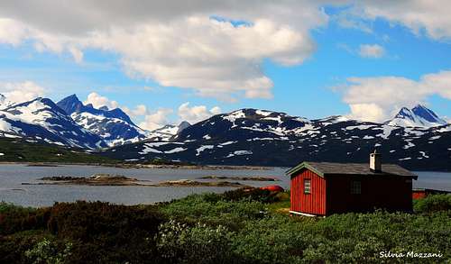
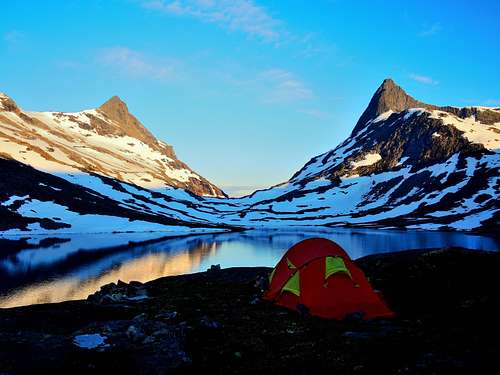
In Koldedalen there are some places with vegetation you can have your tent. Tyinholmen rents out apartments and huts. Eidsbugarden Hotel and Fondsbu are also places you can spend the night and have a meal.
When to climb
- Mountaineering: the best period to climb goes from the end of June to middle September.
- Ski-mountaineering: the North ridge is a classic in the spring on skis when much of the problems posed by crevasses are still absent.
Meteo
Meteo Eidsbugarden
Meteo Tyinholmen
Guidebooks and maps


Guidebooks
- "Walks and scrambles in Norway" Hiking, Scrambling and Mountaineering in Norway guidedebook by Anthony Dyer - John Baddeley - Ian H. Robertson - Ripping Yarns 2006
- "Opptur Jotunheimen" 125 selected itinerary on Jotunheimen - Finn Loftesnes - Selja Forlag 2009
Maps
- "Jotunheimen Vest" - Turkart 1:50.000 - 2505
- “Hurrungane” or “Jotunheimen Vest” - 1517 IV
- "Kartblad" 1517 I Tyin 1:50 000
External Links
Uranostinden from south, summer 2009 (norwegian)
The south peaks on Uranostind, fall 2008 (norwegian)
Film: The south peaks on Uranostind, fall 2008
Film: Uranostinden from south, fall 2009