
-
 73598 Hits
-
 99.69% Score
-
 128 Votes
|
|
Area/Range |
|---|---|
|
|
39.82178°N / 111.76041°W |
|
|
Hiking, Mountaineering, Trad Climbing, Sport Climbing, Bouldering, Ice Climbing, Scrambling, Skiing |
|
|
Spring, Summer, Fall, Winter |
|
|
11928 ft / 3636 m |
|
|
Overview
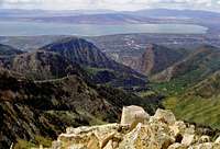
The Southern Wasatch are a stunning group of mountains located south of Salt Lake City. There are many peaks to climb, but most people only come here to climb two of them: Mount Timpanogos and Mount Nebo. The other mountains are often overlooked and seldom visited. The majority of ascents up the lesser known peaks are by people who live nearby. The Southern Wasatch runs north to south from Box Elder Peak to Mount Nebo. This is approximately in the Wasatch Front from American Fork to Nephi.
The mountains located in between Cascade Mountain and Santaquin Peak offer more solitude. This is a huge contrast compared to the hundreds of people who hike up Mount Timpanogos each weekend during summer. There is also considerable evidence of glaciation in these mountains and several alpine cirques have been carved into the mountainsides. This is a wonderful area that offers steep canyons, rugged peaks, and spectacular scenery.
The Alpine Loop Scenic Byway goes through American Fork Canyon and connects with Provo Canyon. This twenty-mile drive winds through the canyons and offers great views of Mount Timpanogos and other nearby peaks. The Nebo Loop Scenic Byway is located farther south. It goes along the entire eastern side of Mount Nebo and has beautiful views of all of the surrounding mountains. The best thing about the Wasatch is their easy accessibility. They are all within a short distance of many cities along the Wasatch Front.
There are two wilderness areas in the Southern Wasatch. The Mount Timpanogos Wilderness is located south of American Fork Canyon and north of Provo Canyon. It was established in 1984 through passage of the Utah Wilderness Act and contains 10,750 acres of national forest. The Mount Nebo Wilderness is located about two hours south of Salt Lake City. It was also established in 1984 by the Utah Wilderness Act and contains about 28,500 acres. These mountains are located in the Uinta National Forest. This was Utah's first National Forest and was created by Grover Cleveland in 1897. This beautiful forest land attracts visitors with breathtaking views, nice campground facilities, and an extensive trail system.
The Wasatch Range
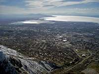
The Wasatch Range is part of the Rocky Mountains. The Wasatch Range rises to elevations of more than 11,000 feet and stretches for over 200 miles from Soda Springs, Idaho to Nephi, Utah. It starts with the Bear River Mountains in southeastern Idaho and northern Utah, the Wellsville Mountains near the city of Mendon, the Northern Wasatch above the cities of Ogden and Bountiful, the Central Wasatch above Salt Lake Valley, and Southern Wasatch, which has the highest mountains in the range, from Provo to Nephi. The Wasatch Range is an imposing and important geographic feature in the western United States. From a geologic perspective, the mountains are a complex mix of igneous, sedimentary, and metamorphic rocks.
From a demographic perspective, these mountains, and their western base, is a corridor known as the Wasatch Front. Over 80 percent of Utah's population lives within 15 miles of the Wasatch range. Salt Lake City lies between the Wasatch Range and the Great Salt Lake. Not only those that live in the areas around Salt Lake City but Logan, Ogden, and Provo have the Wasatch Mountains as a spectacular backdrop each morning. Hiking, rock climbing, skiing, camping, mountain biking, and fishing are a few things that the Wasatch Mountains have to offer. This mountain playground is an ideal place for all kinds of outdoor enthusiasts.
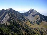
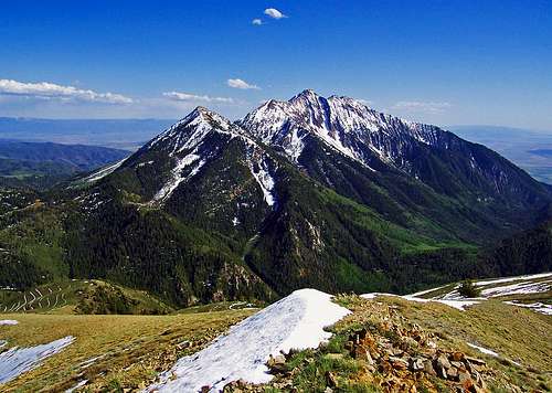
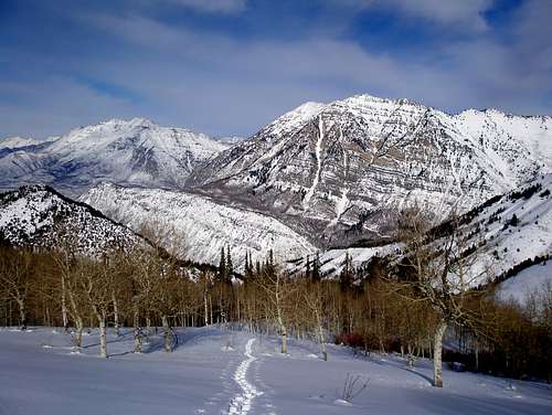 Mount Timpanogos and Cascade Mountain - by Zeejay
When to Climb
Spring - This is the best time to do steep couloirs and snow routes. Consolidated snow develops in the high basins. Early in the day, you will have firm and icy snow that allows for a fast ascent. In the afternoon, the snow softens and you will be plunge stepping all the way down. Glissading is the best way to descend most snowfields. This is also a good time to travel to areas with talus and boulderfields because much of the loose rubble will be covered in snow. The foothills are the safest place to hike during spring. South facing slopes will have small snow patches but will be passable by most people. Many trails will be muddy and wet. Popular mountains to climb in spring are Cascade Mountain, Box Elder Peak, Big Baldy and Little Baldy, Squaw Peak, and Y Mountain.
Summer - This is the normal climbing season in the Wasatch Mountains. It lasts from July to September. This is also when everybody else is out hiking and climbing. Like most areas, the season is determined by the amount of snow in the mountains. During a heavy snow year, it may be until late summer for snow to melt from sheltered areas. Going to the higher elevations is the best way to escape the heat. When the city temps are hot, it may be very windy and cold on top of a mountain. North facing slopes offer the most shade during summer. Popular mountains to climb in the summer are Mount Timpanogos and Mount Nebo.
Fall - This is a great time to climb. Long hikes and climbs are made easier by the cooler temperatures. The amount of daylight will be shorter though. These mountains have spectacular fall colors which make even the less interesting mountains beautiful. In September, the first big snowstorm of the season usually hits the Wasatch. A period of nice weather usually follows before winter comes. Popular mountains to climb in the fall are Provo Peak, Spanish Fork Peak, Santaquin, and Loafer Mountain.
Winter - This has become a popular time to climb these mountains. This is generally from December to February. In the mountains, the season extends into March and April. Climbing the high peaks in winter should not be taken lightly because of the continuous threat of avalanches which have claimed several lives. An avalanche beacon, probe, and shovel are recommended, as well as the knowledge to use them. Winter usually requires that you walk longer distances because normal trailheads may be closed or inaccessible. Most mountains in the Southern Wasatch can be climbed in one long day. Popular mountains in the winter are Mount Timpanogos, Mount Nebo, and Box Elder Peak.
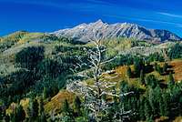
 Mount Timpanogos covered with snow in Autumn - by marauders
Getting There
The Southern Wasatch Mountains are south of the Central Wasatch. They are parallel to Interstate 15. They are not in one general area like the Central Wasatch. The city of Provo is located about an hour south of Salt Lake City. The mountains at the northern end will be nearby for people who live in Salt Lake. Listed below are the main canyons and trailheads for these mountains. Almost all of these trailheads are reached from exiting off of I-15 and heading east toward the mountains. This is the major highway that goes north to south all the way through Utah. Check each mountain page for exact trailhead locations.

Box Elder Peak
American Fork Canyon
If you are arriving from the north or south on Interstate 15 take Exit 284 (Alpine-Highland exit), then turn east on State Highway 92 and proceed into the mouth of the canyon. You'll pass Timpanogos Cave National Monument on the way. This road connects with the Alpine Scenic Loop and Provo Canyon.
Provo Canyon
From I-15 take (exit 272) and then this will turn into State Highway 92 through the canyon. You'll pass by Sundance Resort and over the mountainous scenic route known as the Alpine Scenic Loop. Because of the narrow and winding road, buses and large vehicles over thirty feet are not allowed to travel on the Alpine Scenic Loop. The Alpine Scenic Loop is closed during the winter.

North Peak
Rock Canyon
From I-15, get off at exit 266 for University Ave. Drive North on University and at 2230 N, turn right. Follow this to North Temple Drive, and turn left toward the canyon. From North Temple Drive, you cross 2230 N again and turn left. At the intersection turn right and this will go right to the parking area.
Spanish Fork Canyon
Drive on 1-15 take the first Spanish Fork exit from I-15 (US-6 to Price and Manti). Go east on US-6 and enter into the mouth of Spanish Fork Canyon. This large canyon is located south of Spanish Fork Peak and north of Santaquin Peak and Loafer Mountain.
Mount Nebo
Nebo Loop Road - North
Take Interstate 15 south toward Provo. Continue south past Provo until you reach Payson Exit 254. Exit and turn left onto Payson Main Street (State Route 77). Travel south until Main Street intersects with 100 North (State Route 198). Turn left and travel east to 600 East, then turn right on 600 East. Stay on this road, which eventually becomes Canyon Road, and head south to the entrance to Payson Canyon and the beginning of the Scenic Byway.
Nebo Loop Road - South
Follow Interstate 15 north to Nephi Exit 222. Turn here and travel north on Nephi Main Street (State Route 41) to 100 North (State Route 132). Turn right and go east about two miles to the entrance of the Byway (CR 015) on your left. This is a windy but is very scenic road. The entire road can be driven from city of Nephi to the city of Payson.
 Box Elder Peak seen from the north - by highpeakskier
Box Elder Peak Area
This area is located south of Lone Peak and the Alpine Ridge. Some of these trails are on border of the Central and Southern Wasatch. Mount Timpanogos dominates the view toward the south. American Fork Canyon gives access to much of the area.

Box Elder Peak
Box Elder Peak - (11,101 feet)
This mountain is northwest of American Fork Canyon and has the unfortunate luck of being right in between Lone Peak and Mount Timpanogos. Maybe its location is a good thing because there are great summit views and less people. It resembles Ben Lomond in the Northern Wasatch because of its distinct pyramid shape. Terraces can be seen along the slopes of Box Elder Peak. They were made by the Civilian Conservation Corp sometime between 1933 and 1942. They were built to prevent erosion caused by years of overgrazing livestock. The Deer Creek Trail from Granite Flat is the standard route. Dry Creek is a longer route and starts from the city of Alpine.

Box Elder South Peaks
Box Elder South Peaks - (10,626 feet)
The Box Elder South Peaks refer to Peak 10,626 and Peak 10,057. They are visited much less than Box Elder Peak which is higher in elevation. One peak is located due south of Box Elder Peak and the other is farther southeast. They are usually approached from Box Elder Trail 044. This is a nice scenic trail that goes up to a saddle between the two peaks. The trail is sometimes steep but in good condition. Then some off-trail hiking can get you to the summits. You can also climb all three peaks together as a fun loop.

Dharma Peak
Dharma Peak - (9,237 feet)
This is also known as Willow Canyon Peak. It can be seen above American Fork Canyon. One route to the top is from Willow Canyon. Another route goes up Wadsworth Canyon and then ascends a couloir on the north face. A more challenging route is Ascetic's Ridge. It ascends the ridge between Willow Canyon and Preston Canyon. There is considerable scrambling up higher if you follow the ridge directly. You may want to bring a light rack or be comfortable at climbing 5th class rock. Preston Canyon West is another route option. Devil's Eye is an arch located on the south ridge.

Pine Hollow Peak
Pine Hollow Peak - (8,460 feet)
Pine Hollow Peak is located above American Fork Canyon south of Tibble Fork. It is southeast of Box Elder Peak and southwest of Mill Canyon Peak. To get to the trailhead, you drive up American Fork Canyon to the junction with Timpooneke Campground. Continue on the Alpine Loop Road up switchbacks to the northernmost curve in the road. This is where you can park and the trail starts here. The trail switchbacks up to the ridge and goes to Mud Springs. The route to Pine Hollow Peak goes west and then eventually south side to the top.

Ant Knolls
Ant Knolls - (9,852 feet)
Ant Knolls extends several miles south from Alpine Ridge. The mountain is located near Ridge Trail 157. It is a multi use trail open to everyone. Hikers can use the trail to traverse the ridge between Sunset Peak, Ant Knolls and Mill Canyon Peak farther south. This is the most scenic and preferred route but requires a two car shuttle. The shortest and easiest way to Ant Knolls is from Pole Line Pass. You can get to the pass up a dirt road from the town of Midway. A trail leads to the ridge with the highpoint on the north end.

Mill Canyon Peak
Mill Canyon Peak - (10,349 feet)
Mill Canyon Peak is a relatively unknown peak east of American Fork Canyon. The northernmost trail starts from Pole Line Pass which is part of Ridge Trail 157. It follows the Great Western Trail south toward the summit. A trail up Mill Canyon can be reached from Tibble Fork Reservior. It meets up with the Great Western Trail south of point 8,800 where you can follow a trail that leads north toward the peak. There is a junction in the trail on the west side of the peak. It can also be approached from Cascade Springs. There are great views back toward Alpine Ridge, Box Elder Peak, and Mt. Timpanogos.
 Everest Ridge on Mount Timpanogos - by marauders
Mount Timpanogos Area
Mount Timpanogos is considered by many people to be their favorite mountain in the Wasatch Range. It is a large and complex mountain with several sub-peaks and foothills. Some of the smaller peaks may not need their own seperate page so I have listed them below.

North Timpanogos
North Timpanogos - (11,441 feet)
North Timpanogos is one of the high peaks located north of Mount Timpanogos. There is no trail to the top and few people ever venture away from the Mount Timpanogos trail to climb it. The regular routes to the summit are the West Ridge, the Northwest Ridge, and the North or Northeast Ridge. They are all rated class 2. More challenging routes on North Timpanogos include the Grunge Couloir and Cold Fusion Couloir. A full day of hiking would be to traverse the whole Mount Timpanogos massif including North Timpanogos and several other rugged peaks to the south.

Bomber Peak & North Timp
Bomber Peak - (11,347 feet)
Bomber Peak is located between North Timpanogos and Mount Timpanogos. It is on the main ridgeline to the southeast of North Timpanogos but it is not climbed often. It was named after the famous plane crash of a B-25 bomber in March of 1955. Bomber Peak can either be climbed from Aspen Grove or from the Timpooneke Trail. You'll want to hike to Timpanogos Basin. There are two routes that go to Bomber Peak. The first one goes toward the B-25 crash site. Hike up the basin until you see the wreckage which is scattered around the talus slopes. You can climb up the north ridge of the mountain from here. The second route goes up to Timpanogos Saddle from the regular trail follows the south ridge to Bomber Peak.
Forgotten Peak
Forgotten Peak - (10,509 feet)
Forgotten Peak is located on a ridgeline to the northeast of Bomber Peak. It is lower in elevation than the surrounding mountains so it blends in well and is often forgotten. This is one of the least climbed peaks in the Mount Timpanogos area and is a good choice for people looking for solitude. The mountain is most easily climbed from the Timpooneke Trail. Hike up the Giant Staircase toward the Middle Basin. This basin usually holds snow into the middle of summer. You can either climb up the ridge to the northeast of Forgotten Peak or continue farther up Middle Basin and climb up the south ridge of the mountain.

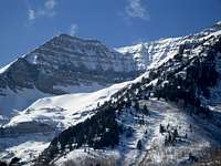
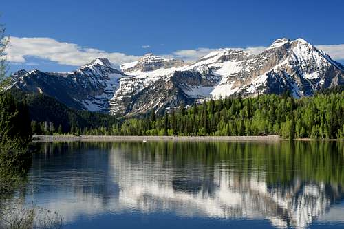
Mount Timpanogos
Mount Timpanogos - (11,750 feet)
This is the second highest and most famous mountain in the Wasatch. It is a prominant mountain with a seven mile long ridgeline of several peaks. It rises abruply for over 6,000 feet above the valley floor and provides an awesome backdrop to the cities below especially during winter. Many people come to climb it each year making it a popular tourist destination. The mountain is primarily dominated by horizontal bands of limestone, quartzite, and dolomite. Heavy glaciation has created at least seven alpine cirques around the mountain. The less traveled cirques provide interesting routes and solitude.
Mountain goats were introduced to Mount Timpanogos in 1981 and have flourished ever since. You are guaranteed to see some of them clinging to the cliffs below the summit wall. Many people will see them right on the trail while climbing up to the ridge. It is obvious that they are not scared of humans and used to seeing hikers on this mountain.
Until 1970, there was an annual Provo event called the "Timp Hike" when thousands of people hiked up the mountain. This event was cancelled after 59 years to help preserve the delicate mountain ecosystem. Remnants of the Timp hike can still be seen, such as a stone shelter built in 1959 near Emerald Lake. A smaller metal shack exists on the summit, built as an observation deck complete with brass rods etched with notches that are aligned with various landmarks.
Is it a glacier or snowfield? A debate has been going on for years over whether the mountain harbors Utah's last glacier. A semi-permanent snowfield feeds Emerald Lake; the snowfield is often misnamed a "glacier." Many people use this snowfield as a quick descent route from the summit. During drought years, the snowfield has melted out completely, exposing a crevasse in the talus. The crevasse revealed solid ice beneath the surface. A Washington State University glaciology team analyzed samples of the ice to determine if it was truly glacial, but the results were inconclusive. Read this Article by Scott.
Timpanogos is a Ute Indian word meaning "river of rock" which may refer to the large talus cones of limestone and sandstone that flow down its face. The Legend of Timpanogos is a tale created in the early 1920s. As the story goes, young Indian princess Utahna, was to be sacrificed to the Great God of Timpanogos. After Utahna made her sacrificial leap from the top of Mount Timpanogos, the brokenhearted Indian warrior, Red Eagle, laid her to rest inside Timpanogos cave. The two hearts melded into one and can now be seen hanging deep inside the cave as the Great Heart of Timpanogos, formed through several stalactites. Other accounts claim the great spirits hung Utahna’s heart within the cave and laid her body on top of the mountain as a warning. Looking closely at the skyline of majestic Mount Timpanogos, the outline of the sleeping princess can be seen.

Second Summit
South Timpanogos/Second Summit - (11,722 feet)
This peak is known as South Timpanogos or Second Summit. It is only 27 feet lower than Mount Timpanogos. This peak can be climbed from the saddle separating it from Mount Timpanogos. A more challenging route goes up Razorback Ridge. It is a long route and one of the most exciting scrambles in the area. It is suggested that you climb this route when conditions are dry. There is considerable exposure so it isn't climbed as often as the standard route.
Southeast Timpanogos
Southeast Timpanogos - (11,607 feet)
The Southeast Summit is located southeast of South Timpanogos. It can be reached directly from Cascade Cirque from its east ridge. This route starts in the vicinity of Stewart Falls and requires steep off trail hiking. Big Provo Hole is located to the southeast of the mountain. It is also be climbed by traversing the ridge from the Southwest Peak of Timpanogos.

The Shoulder
The Shoulder - (11,161 feet)
The Shoulder is located north of South Timpanogos or the Second Summit. It is often photographed because it is so prominent when viewed from the Aspen Grove Trail. The Shoulder provides a nice quiet alternative to the main summit of Mount Timpanogos. The easiest route starts from Emerald Lake and ascends the glacier or talus depending on current conditions. It then goes over the summit of South Timpanogos and follows the ridge north to the Shoulder. A more interesting and exciting route is from Razorback Ridge. It has fun scrambling and exposure.

South Peaks
South Peaks/Cockscomb Ridge - (10,725 feet)
There are three peaks that make up the south ridge of Mount Timpanogos which are close in elevation. They are also referred to as the Cockscomb Ridge. They are located on the ridge south of Southeast Timpanogos. The highest is the Southwest Peak at 10,725 feet. The middle South Peak, 10,715 feet, is a pyramid shaped point. The Southeast Peak is the lowest of the three at 10,645 feet. There are two main routes for traversing the Cockscomb Ridge. One ascends the South Ridge from Provo Canyon and the other ascends Sundance Ridge to the east and also over Arrowhead Peak.

East Peak
East Peak/Elk Point - (10,791 feet)
East Peak/Elk Point is located above Primrose Cirque and the east end of Hidden Lakes Cirque. The mountain is directly across from Roberts Horn. Elk Point is usually hiked as a ridge traverse from Aspen Grove trailhead. The longest route is from Hidden Lakes Cirque where you can climb up the west side of the mountain.
Roberts Horn
Roberts Horn - (10,993 feet)
Roberts Horn is the prominent peak located about 0.3 mile from the trail near Emerald Lake. It just misses the 11,000 foot mark by seven feet. Roberts Horn was named after Gene "Timp" Roberts. He was the folk hero of Mount Timpanogos who started the annual Timp Hike in 1912. The easiest route starts from the Aspen Grove trailhead. The peak is located about 600 feet northeast of Emerald Lake. You can follow the ridge that goes east toward Roberts Horn.

Sundance Peak
Sundance Peak - (7,093 feet)
Sundance Peak is an unofficially peak located above Sundance Ski Resort. It's northeast of another unofficially named peak called Arrowhead Peak, 8,270 feet. Arrowhead Peak has ski lifts leading to its summit while Sundance Peak does not. This peak is best hiked outside of ski season but during winter you can ski it. The route starts from the upper parking area for Sundance Resort. From here, there are service roads below the ski lift leading to a point west of Sundance Peak. From the saddle between the two you can hike east along the ridge to the summit.

Mahogany North Peak
Mahogany North Peak - (8,926 feet)
Mahogany North Peak is located north of Mahogany Mountain. It is a foothill in front of Mount Timpanogos and seems smaller than it is because of this. The more difficult route of two goes up Grove Creek Canyon to the summit of Mahogany Mountain and then farther north to this peak. The second route is the easiest and accessed from American Fork Canyon to Timpooneke Campground. The road continues past the campground to the trailhead. This road is gated in winter until all of the snow melts in early summer. A trail leads to the saddle between Peak 8,905 and the Mahogany North Peak.

Mahogany Mountain
Mahogany Mountain - (9,001 feet)
This is the peak with the long ridgeline northwest of Mount Timpanogos. It can be reached from the Grove Creek trail above the city of Pleasant Grove. The Grove Creek trail heads due east up the canyon alongside a moderate stream. The trail is steep and makes a long switchback to an overlook of Utah Valley. The hike will be about 8 miles round trip with 4200 feet of elevation gain. The mountain helps give perspective to the massiveness of Mount Timpanogos. You can walk north along the road toward the summit of Mahogany Mountain or use a trail across Sagebrush Flat.

G Mountain
Little Mountain (G Mountain) - (7,613 feet)
Little Mountain is located between Grove Creek Canyon to the north and Battle Creek Canyon to the south. To the north is Mahogany Mountain and to the south is Big Baldy. Little Mountain is also known as G Mountain because of the letter G on the side of it. The standard route starts from Kiwanis Park. It goes up Battle Creek Canyon until it meets the Great Western Trail. Then it goes north to a junction with the Timpooneke 4wd road. The trail leading west goes to the summit of G Mountain. There is also a route that is more direct up the west face which can be used as a descent route.

Big Baldy
Big Baldy - (8,756 feet)
Big Baldy is the mountain west of Mount Timpanogos. This is the higher of the two baldy peaks. Several routes used to climb up the west face of Timpanogos go past Big Baldy. It is accessible from the Battle Creek Canyon or Dry Canyon trailheads in Pleasant Grove and Orem. It is usually lost in the shadow of nearby Timp which looms 3,000 feet higher. The highlight of Battle Creek is a pretty waterfall that runs over a sheer rock cliff. This area is very lush and green which makes it very scenic. Big Baldy could be a nice choice for a sunset hike with the sea of lights below.

Little Baldy
Little Baldy - (7,696 feet)
Little Baldy is the lower peak southeast of Big Baldy. They can be climbed together by making a loop of Dry Canyon and Battle Creek Canyons. The best way to access Little Baldy is from the Dry Canyon trailhead near Orem. The first part of the trail goes between two limestone cliffbands known as the Great Blue Gate. Expect to do some bushwhacking on the upper part of the mountain. For most people the highlight of Dry Canyon is the great view of Mount Timpanogos. It should take between two to three hours to get to the summit. It's not a big mountain but the views are good.

North Fork Ridge
North Fork Ridge - (8,626 feet)
North Fork Ridge is located on the backside of Mount Timpanogos. It is west of Deer Creek Reservoir. This is a long ridge that is several miles long. The highpoint is at the north end. It is accessed from American Fork Canyon or Provo Canyon and the Alpine Loop Road. There are several ways to approach the peak, north or south ridge routes, but the route from the west is the shortest. It involves off trail hiking to get to the summit which is surrounded by trees.

Soldier Hollow Peak
Soldier Hollow Peak - (6,510 feet)
Soldier Hollow Peak is located on the west side of Deer Creek Reservoir. It is unnamed but most people call it Soldier Hollow Peak. This peak separates Soldier Hollow to the north from Deer Creek to the south. Soldier Hollow is known as the place where the 2002 Winter Olympic cross country skiing events took place. It is located in Wasatch Mountain State Park. This is a low elevation peak and can be hiked all year. It’s a good peak to snowshoe or ski in winter. During other times of the year, there is a trail that can be followed to the top of the peak.

Chair Hill
Chair Hill - (6,194 feet)
Chair Hill is located at the southeastern area of Deer Creek Reservoir near the end of Provo Canyon. A narrow section of the reservoir wraps around the south side of Chair Hill. It’s a hill and not very high but it sits alone and has a great view of the Southern Wasatch Mountains. It also overlooks Round Valley where Main Creek flows northwest of Wallsburg. This is a nice and short snowshoe in winter from the east. The name of the hill comes from the rock chair on the summit.
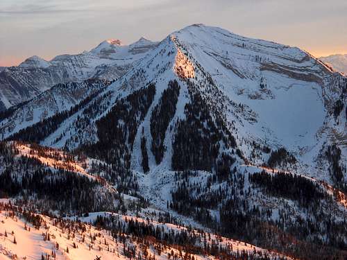
 Provo Peak east ridge - by Rocky Alps
Provo Peak Area
Provo Peak is a large mountain like Mount Timpanogos. It is climbed less often than its more famous neighbor to the north. It has several sub-peaks and foothills. Many of these peaks can be accessed from Squaw Peak Road from Provo Canyon. This road is also known as the Squaw Peak Trail. There are many mountains located on Provo Peak's long ridgeline. I have listed some of them below.

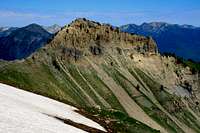
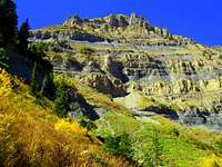
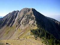
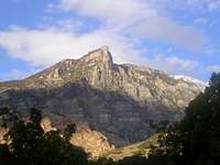
Cascade Mountain
Cascade Mountain - (10,908 feet)
This is the large mountain south of Provo Canyon. It has four points along its summit ridge. The south summit is only 147 feet lower than the actual summit. The first thing that is noticeable about Cascade Mountain is that there are several steep couloirs running down its west face. These couloirs make excellent spring snow climbs. The south ridge from Dry Fork trailhead on Squaw Peak Road has a trail that leads up to the ridgeline. Bunnels Fork is a scenic route that is done less often than the south ridge. The northeast ridge is another possibility that would take most of a day to hike.

Lightning Peak
Lightning Peak - (10,056 feet)
Lightning Peak is located on the ridgeline northeast of Shingle Mill Peak. The Great Western Trail provides access to this peak. Also Shingle Mill Canyon or Water Hollow can be hiked from the South Fork of Provo Canyon. The trail climbs to a high mountain ridgeline called Windy Pass. Lightning Peak will be directly west of the pass. You can also climb Lightning Peak from the Dry Fork Trailhead on Squaw Peak Road. This would be a long day hike. The mountain can be seen in the distance above many of the smaller peaks near Big Springs Hollow to the northwest.

Shingle Mill North
Shingle Mill North - (9,622 feet)
Shingle Mill North is an unnamed peak located north of Shingle Mill Peak. It isn't located on the main ridge but is on a side ridge so that is why it is climbed less. The west side route is from the Dry Fork Canyon trail. This leads to the saddle northwest of Shingle Mill Peak and southeast of Cascade Mountain. From here the route goes north along the ridge to the summit of Shingle Mill North. The east side route is from the Big Springs Trail. It starts at a lower elevation and goes up Shingle Mill Canyon. The trail goes up to the saddle that is south of the peak not far from the summit.

Shingle Mill Peak
Shingle Mill Peak - (10,690 feet)
Shingle Mill Peak is located north of Freedom Peak on the same ridgeline. The standard route for climbing the mountain is from the Dry Fork Trailhead on Squaw Peak Road. The mountain has lines of terraces running across its slopes. The trail traverses these terraces until it gets to the saddle with Shingle Mill Peak and Freedom Peak. Now all you have to do is follow the ridge up to the summit. The last part is steep but not difficult. You might as well climb Freedom Peak while you are there. Shingle Mill Peak can also be reached from Big Springs Trail. This route is longer than the route from Dry Fork.
Freedom Peak
Freedom Peak - (10,801 feet)
This mountain was officially named on June 9, 2005. One of the largest Independence Day celebrations, The Freedom Festival, takes place in Provo. No doubt this had influence on voting to name it Freedom Peak. It is located on the ridgeline north of Provo Peak. The shortest route to the top is from the Dry Fork Trailhead on Squaw Peak Road. This is the same approach for Shingle Mill Peak which you could easily combine with Freedom Peak. The final part up the mountain has some nice scrambling along the ridgeline. You can also continue on the ridge toward Provo Peak.
East Provo & Provo Peak
East Provo Peak - (11,044 feet)
East Provo Peak is located to the east of Provo Peak. It is only twenty-four feet lower and climbed less often than Provo Peak. They are connected by a ridgeline and a saddle. To traverse this ridge you will lose elevation before climbing up to the summit. This is a steep hike that has some loose rock. East Provo has enough prominence to qualify as a separate peak. It is climbed by people wishing to complete the Wasatch Eleveners. East Provo Peak can also be reached by a long ridge hike from Freedom Peak farther north. This route is usually accessed from Squaw Peak Road.

Provo Peak
Provo Peak - (11,068 feet)
Provo Peak is one of the highest mountains above the city of Provo. The route used the most is the west ridge. The trailhead for the west ridge starts from Squaw Peak Road. This road is paved to Rock Creek Campground and then turns into a gravel dirt road after that. The route is difficult to find at the beginning. You'll be walking up steep slopes and along terraces. Once you get to the ridgeline the trail will be easy to see and follow. You can also get there from the Dry Fork Trailhead by taking the same route to Freedom Peak and continuing south along the ridge.
Corral Mountain
Corral Mountain - (10,450 feet)
Corral Mountain consists of several peaks that are located south of Shingle Mill Peak, Freedom Peak, and Provo Peak. To get there, drive on the Squaw Peak Road until you are due west of Corral Mountain. This point can be reached from the north or south on Squaw Peak Road. The best route starts in the vicinity of Kolob Basin Overlook. Corral Mountain can also be climbed from its long south ridge.

Buffalo Peak
Buffalo Peak - (8,020 feet)
This is the easiest peak to reach from Squaw Peak road. The hike is about a mile round trip. Buffalo Peak is located east of Squaw Peak and west of Cascade Mountain and Provo Peak. It is taller than Squaw Peak but doesn't have the dramatic cliffs. If you want a great view with the least amount of effort, than this peak is a good choice. Approaching Buffalo Peak from the west side is recommended if you are looking for a longer distance hike.

Squaw Peak
Squaw Peak - (7,877 feet)
This is the mountain immediately north of the entrance to Rock Canyon. It is a rugged peak with huge cliffs along its south side. The easiest route starts from Rock Canyon trailhead. You can hike up the trail until you come to a fork. The left fork heads up to Squaw Peak. The trail goes up and around the east and north side of the peak. Another route is from the west ridge. This is a steeper and more direct route that starts near the mouth of Rock Canyon.

Y Mountain
Y Mountain - (8,568 feet)
You'll recognize this mountain because of the letter Y painted on it. It represents Brigham Young University which is located below it. The Y is located about one-half mile east of campus and halfway up the mountain. From the parking lot walk up the dirt road to the Block Y. The trail goes south into Slide Canyon and ends up at the First Meadow. Turn north into the drainage above and walk along the dry creek bed. The summit is flat so you'll have to walk along the edge of it to get a great view of the Utah Valley. The northern edge has views of Squaw Peak and Rock Canyon.

Maple Mountain
Maple Mountain - (9,089 feet)
Maple Mountain is located southwest of Provo Peak between Slate Canyon and Slide Canyon. You can climb the mountain from either route. A trail goes to the saddle between Maple Mountain and Lion Head. Route-find your way up the east side of Maple Mountain. The trail thats goes up Slide Canyon trailhead is probably the best route to climb the mountain. It is located on the north side of the mountain. Y Mountain is located to the northwest. The trail meets up at the same saddle from Slate Canyon where you can climb up the east side.

Lion Head
Lion Head and Peak 8,753 - (9,001 feet)
These two mountains are located west of Provo Peak. Peak 9,001 is known locally as Lion's Head or Lion Head. It is northwest of Maple Mountain and southeast of Y Mountain. On some maps it is labeled as Heritage Mountain. During summer, you can follow a trail that goes up Slide Canyon toward Squaw Peak Road. You can also get there from Slate Canyon farther south. Peak 8,753 is located north of Lion Head. Rock Canyon is accessible all year. In winter, it is easiest to hike all the way to Squaw Peak Road and then go south for over two miles with snowshoes or skis. When the road is open, you can drive near the east sides of both mountains for an easier day of hiking.

Buckley Mountain
Buckley Mountain - (9,502 feet)
Buckley Mountain is located near Horse Mountain and west of Corral Mountain. This are near Squaw Peak Road and you can park due east of both peaks. The best route is to follow the ridge that is located on the east side of Buckley Mountain. Route find west through the brush to the summit. This area is seldom visited. Buckley Mountain has two peaks that are separated by a little over a half mile. The south peak is 9,153 ft, and the north peak is 9,502 ft. Buckley Mountain can also be reached from Slate Canyon trailhead. There is a maintained trail that follows the canyon below the mountain. Another option is to stay in the canyon bottom and climb straight up an avalanche gully.

Powerhouse Mountain
Powerhouse Mountain - (7,990 feet)
Powerhouse Mountain is located at the southern part of the Provo Peak area. It is southeast of Buckley Mountain. Powerhouse doesn’t draw much attention. The mountain forms a long ridge that forms the north side of Hobble Creek Canyon. It has over a thousand feet of prominence and most of the people who climb the peak are prominence peak chasers. You can get close to the mountain with a high clearance vehicle in summer or when the road is dry. This would make it a two mile hike with 1,300 feet gain. Expect to do a longer hike without a high clearance vehicle.

Wallsburg Ridge
Wallsburg Ridge - (9,197 feet)
Wallsburg Ridge is located south of Deer Creek Reservoir above the town of Wallsburg. It is near Round Valley or Little Warm Valley. The town and mountain were named after William Madison Wall. He was an early explorer and settler who helped build the road through Provo Canyon. Wallsburg Ridge is a long ridge running northwest to southeast for many miles. The highpoint is called Hobble Benchmark. It is located north of Bald Knoll and Rattlesnake Mountain.
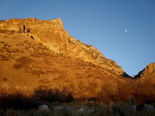
 Loafer Mountain seen from Santaquin Peak - by gjagiels
Spanish Fork to Santaquin
The area between Provo Peak and Mount Nebo is quiet and a nice place to climb is you like solitude. Spanish Fork Peak is north of Santaquin and Loafer Mountain. Those two peaks can be accessed from Nebo Scenic Byway.

Spanish Fork Peak
Spanish Fork Peak - (10,192 feet)
Spanish Fork Peak is usually overlooked because it is located in between two higher groups of mountains. It is near the town of Mapleton and north of Spanish Fork Canyon. The right fork of Maple Canyon is the normal route up the mountain. It starts near the Whiting Campground on Maple Canyon road. It heads south and climbs steadily to Maple Canyon Lake. Then the trail goes up several switchbacks to the ridgeline of Spanish Fork Peak. Cumulative gain will be around 4,800 feet. Crowd Ridge on the west side is the recommended winter route. There is a triangulation structure on top.

Dixon Benchmark
Dixon Benchmark - (9,034 feet)
Dixon Benchmark is located north of Santaquin Peak and Loafer Mountain. This is the cone shaped peak that is easy to recognize because it has communication site on its summit. There is a dirt road that leads toward the antennas. The peak is located east of Woodland Hills. You can hike to Dixon Benchmark from Maple Canyon by following its southeast ridge. The dirt road can also be hiked from Water Canyon on its north side.

Santaquin Peak
Santaquin Peak - (10,685 feet)
This mountain is east of the city of Payson and north of the Nebo Loop Road. Its next door neighbor is Loafer Mountain. These mountains aren't climbed as much probably because Mount Nebo is so close by. There are a couple different routes that can be taken but the one from Payson Lakes trailhead is used the most. This route intersects the Loafer Mountain trail higher up. The Loafer Mountain trail goes northeast toward the west ridge. Then it heads east to the pass between Loafer Mountain and Santaquin Peak. There will be a trail going up the south ridge of Santaquin Peak. The southeast ridge is a good winter route and can be done in one day. Access to this route is near the town of Birdseye north of Mount Pleasant.

Loafer Mountain
Loafer Mountain - (10,687 feet)
Loafer Mountain is two feet higher than Santaquin Peak. It is located to the southeast. They can be climbed together on the same hike. Fewer people go to Loafer Mountain because the summit is a flat plateau and looks less interesting compared to Santaquin Peak. Climb Loafer Mountain from the saddle between Santaquin Peak. Stay on the upper west ridge and walk along a hikers trail to the top. The view from the summit of Loafer Mountain is similiar to the one from Spanish Fork Peak. You can see the line of mountains to the north and Mount Nebo to the south.
 Mount Nebo north summit - by Phenom
Mount Nebo Area
This is the last major area in the Wasatch Mountains. It is at the southern end of the range. Mount Nebo is the highest mountain in the range so it sees quite a lot of traffic. Other mountains in the area don't see many hikers. South of Mount Nebo are the San Pitch Mountains.

Dry Mountain
Dry Mountain - (9,865 feet)
Dry Mountain is located north of Mount Nebo and Bald Mountain. Santaquin Canyon is located to the south and west and Payson Canyon to the north and east which connects to the Nebo Loop Scenic Byway. A dirt road travels near the peak and the south ridge provides a good route to the top. It is about two miles from the start of the trail with 2,000 feet elevation gain. Everyone who has climbed it says there is a great view from the summit. You may also want to hike to Peak 9,596, Dry Mountain South Summit, while you are there.
Bald Mountain
Bald Mountain - (10,913 feet)
From far away, Bald Mountain looks like Mount Nebo's little sidekick. Closer inspection will reveal that Bald Mountain is a big peak that stands on its own. It is almost 11,000 feet tall and located north of Mount Nebo. Climbing it is considerably easier than Mount Nebo because there is a road that goes near the base of the mountain. High clearance vehicles are recommended for driving on the Mona Pole Road. It is a dirt road that goes east to west. The approach to Bald Mountain follows the road until it gets to the base of the ridge. The easiest route is from the south slopes.

North Peak
North Peak - (11,174 feet)
I'm sure that you have already guessed that North Peak is located north of Mount Nebo on the same ridgeline. The normal route starts from the Monument trailhead which is the same trailhead used for the north route up Mount Nebo. North Peak can be included with an ascent or descent of Mount Nebo. It isn't climbed as much because the trail to Mount Nebo doesn't go to its summit. It goes around the west slope of the mountain. It can be climbed by people looking for an easier 11,000+ foot peak in the area. There is a trail up the north ridge and the south side is a steep face barren of trees.
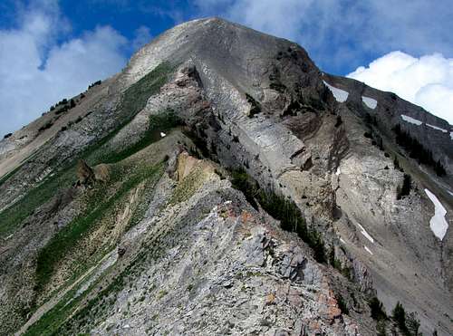
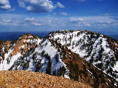
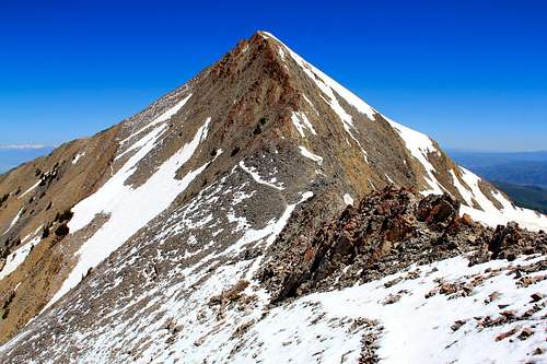
Mount Nebo
Mount Nebo - (11,928 feet)
The Wasatch Range ends with one of its most impressive mountains. Mount Nebo is the southernmost and highest peak in the entire range. It is the centerpiece of the Mount Nebo Wilderness and highpoint of Utah County. Mount Nebo is a large mountain that stands out in all directions. Anyone driving down I-15 will notice it because of its three separate summits. The northern summit is the highest, the south summit is the second highest, and the middle summit is the lowest.
The North Summit is climbed from the Monument Trailhead. This is the easiest route to the top. The traverse of all three summits is rated 3rd class but looks more difficult than it really is. There is some loose rock and the ridge is narrow in a few places. It isn't done much because a car shuttle is needed to do the whole traverse. The ridge is open and exposed to the elements, so it is not a good place to be during a storm. Mount Nebo is one of the most popular mountains to hike to in the Wasatch Range.
Original surveys placed the southern peak as the highest at 11,877 ft. When the mountain was resurveyed in the 1970s, they found out that the northern summit was the highest. Unfortunately, a well maintained trail already led to the south summit. The trail up Andrew's Ridge is considered difficult because of the length of the hike and the substantial elevation gain. The Nebo Loop Scenic Byway goes along the eastern side of the mountain from Payson to Nephi. It is a narrow windy road that provides great views of Mount Nebo and the surrounding mountains. Later in the year, this area is especially pretty during autumn.
Mount Nebo seems more desolate than many of the other Wasatch Mountains. Normally, the oldest rocks are found at the higher elevations and the youngest rocks are found at the lowest elevations. As Mount Nebo formed, it was inverted by a huge thrust fault, reversing the process of rock layering, and exposing the youngest rocks on top. Indians once built signal fires on the summit of Mount Nebo which was named by the early Mormon pioneers after the Mount Nebo in Palestine. The name Nebo means "Sentinel of God." In 1869, William W. Phelps was the first settler recorded to ascend the mountain. Phelps was an important early leader of the Latter Day Saint movement. He was an assistant president of the church in Missouri and a scribe to Joseph Smith.
 Mount Nebo seen from Bald Mountain - by gjagiels
San Pitch Mountains
The San Pitch Mountains are where the Wasatch Mountains and Wasatch Plateau meet. These mountains are composed of different rock than the main crest of the Wasatch Mountains but also run in a north to south direction. They are located to the east of Interstate-15 from Nephi to Gunnison. If you have a high clearance 4-WD vehicle, you can drive close to the summits of all of these mountains. Dirt roads lead to the top of the ridge and many side roads are located across the entire range. The highest mountains rise above 9,000 feet at the north end and become lower toward the south end of the range.

Maple Canyon
Maple Canyon
The name San Pitch comes from Sanpete Valley on the east side of range. The name San Pitch originated from a Ute Indian Chief who was known as Sanpitch. Mormon settlers spelled his name as Sanpitch but some maps show San Pitch spelled as two words. The name Sanpete was a common spelling of Sanpitch by early settlers. So the name was used in books and other sources. Like many other places in the Wasatch Mountains, there are incorrect spellings of names which are used today.
Maple Canyon is famous for its conglomerate cobble rock climbing. There are hundreds of routes that line its walls. During winter, there may be over fifty routes that develop during a good snow year. The most popular routes are in the Main Canyon, Box Canyon, Left Hand Fork, and Right Hand Fork. To get to Maple Canyon from Salt Lake City drive south on the I-15 until Nephi.
Take exit 225 south east towards Ephraim/Manti. In Fountain Green you'll see a sign for Maple Canyon, just start following those. From Ephraim you head back along the 132 to Moroni. In the city of Moroni, you'll see a sign pointing toward Maple Canyon. In winter, it is recommended that you have a 4-wheel drive vehicle. During summer, any vehicle can be driven to the main campground. Roads become rougher beyond that area.
Maple Canyon Rock Climbing: - Heart Rock / Tachycardia
San Pitch Mountains:
Salt Creek Peak - (9,997 feet) - This is the highpoint of the San Pitch Mountains. It is also known as Salt Benchmark. It is located near the north end of the range. Log Hollow Road provides access to the peak from Fountain Green. It can also be accessed from Maple Canyon.
Maple Peak - (8,525 feet) - Maple Peak is located on the south side of Maple Canyon. It can be accessed by the left fork of the canyon. The peak is directly west of the town of Freedom and near the city of Moroni.

Salt Creek Peak
Levan Peak - (8,353 feet) - Levan Peak is west of Horse Heaven Mountain. It was named after the city of Levan on the west side of the range. There is a dirt road that goes from the cities of Levan to Wales.
Horse Heaven Mountain - (8,475 feet) - Horse Heaven Mountain is east of Levan Peak. It can be climbed from Chicken Creek Campground to the north. Deep Creek is on the south side of the mountain.
Little Red Hill - (6,836 feet) - Little Red Hill is south of Horse Heaven Mountain. It can be access from Salt Creek in Juab Valley. There are dirt roads near the summit. Deer Gulch and Bear Canyon are below the peak.
Big Mountain - (7,728 feet) - Big Mountain is northwest of Ephraim. It is above Sanpete Valley and several dirt roads located on the summit. To the north is Petes Canyon, to the west is Rocky Gulch, and to the south is Axhandle Canyon.
Skinner Peaks - (6,468 feet) - The Skinner Peaks are located above Highway 28 and Juab Valley. The peaks are a thousand feet above the road and can be climbed from any direction. There is a jeep trail on the north side of the peak.
Horse Mountain - (7,448 feet) - Horse Mountain is above Sanpete Valley and west of the city of Ephraim. A jeep trail leads to its summit via Rock Canyon. Old mining operations can be seen on the south and east side of the mountain.
Big Baldy: Ephraim BM - (8,775 feet) - Big Baldy is located west of Horse Mountain. The benchmark on the summit was named after the city of Ephraim. On the east side of the peak are Rock Canyon and Dry Canyon.
Revoe Peak - (6,945 feet) - Revoe Peak is on the west side of the range. It sits east above Flat Canyon Valley. To the north is Pierce Canyon and to the south is Timber Canyon. There is a jeep trail on the north side of the peak.
Mellor Peak - (6,672 feet) - Mellor Peak is on the southeast end of the range. It sits to the west of Gunnison Reservoir and above Antelope Valley. The mountain forms a long ridge with a 300 foot cliff on its east face.
The Caterpillar - (6,231 feet) - The Caperpillar is located at the south end of the San Pitch Mountains. It forms a ridge of three peaks running northeast to southwest. They are Peak 6,231, Peak 6,165, and Peak 6,039.
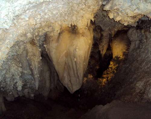 Timpanogos Cave National Monument - by Fleshj27
Caves & Arches
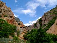
The limestone rock in American Fork Canyon and surrounding areas is where you will find several caves, sinkholes, and arches. Some of these overhanging walls and caves are the location of difficult rock climbing routes. Timpanogos Cave is well known and visited by many. Devil's Eye is located on the south ridge of Willow Canyon Peak. I'm not going to name any of the lesser known caves and will leave exploring to you.
Timpanogos Cave National Monument
Devil's Eye
Timpanogos Cave National Monument is located about ten miles up American Fork Canyon. It's a small national monument but has one of the most scenic caves in Utah. It's a popular tourist attraction that you can take the whole family on. A short but strenuous hike of 1.5 miles is required to reach the cave, located 1,000 feet above the canyon floor. Temperatures inside are about 45 degrees so a light jacket is recommended. The cave is usually open from mid-May through mid-October depending on conditions. In summer, you will have to wait in line because it can only be visited as part of a ranger-led guided tour. Tickets must be purchased at the visitor center before starting your hike to the cave. The cave system consists of three beautiful caverns that have different colors and formations.
Devil’s Eye - (8,500 feet)
Devil’s Eye is located on the south ridge of Willow Canyon Peak. It is an arch on top of a rock knob. Devil's Eye is known mostly by people that live nearby. You could climb both the peak and the arch via the same route if you wanted to. It is an interesting feature in the area and will require strenuous hiking to get to it. This keeps it from being too crowded. You can actually see the arch from a distance in few places, including about a mile east of the Timpanogos Cave TH and from the Pine Hollow TH parking lot. The route to Devil’s Eye follows washes and ascends steeply up to the ridge above Preston Canyon. There isn’t a maintained trail and you can expect over 3,000 feet elevation gain. You should have a good view of Willow Canyon Peak, Box Elder Peak, and other mountains.
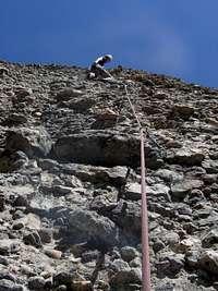
 Squaw Peak and Rock Canyon - by Zeejay
Rock Climbing
American Fork Canyon
American Fork Canyon
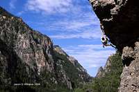
American Fork Canyon is located south of Box Elder Peak and north of Mount Timpanogos. It is home to some of the hardest rock climbing routes in Utah. Most climbing is on steep pocketed limestone cliffs. Rock climbing in the canyon was first discovered in the early 1970's but the first bolted routes didn't come until the late 1980's. Three energetic climbers, Bill Boyle, Jeff Pedersen, and Boone Speed, helped transform most of the routes into serious climbing areas. The area has recieved national attention from many climbers who came to climb the most difficult routes.
The greatest concentration of hard routes is probably in the Hell Cave Area although many other areas have similiar difficulty. American Fork Canyon has become a modern sport climbing area and there are now over 300 routes lining its walls. A rope, harness, and full set of quickdraws is almost all of the equipment you will need. There are a few moderate routes but most of climbing is in the 5.11 - 5.13 range. There are also some 5.14 climbs.
Rock Canyon
Rock Canyon
Rock Canyon is near the city of Provo. It is located in between Squaw Peak and Y Mountain. Large rock walls and buttresses line the canyon. Rock Canyon was first explored for potential routes in the early 1970's by several climbers who were attending BYU. They would team up and climb dozens of routes in one afternoon. All of the most obvious lines were climbed in the canyon. By the 1980's, Jeff Pedersen and Boone Speed began climbing all of the hardest routes in the area.
You'll find plenty of difficult routes on the overhanging quartzite and steep limestone cliffs. Rock Canyon has more moderate routes compared to American Fork Canyon. The quatzite is good quality with nice cracks and ledges. Several beginner routes can be found here too. All hiking begins at the Rock Canyon trailhead and vehicles are not allowed on the dirt road. You'll find solitude on crags that have strenuous approaches.
ALPINE CLIMBING
Wasatch Alpine Climbs List
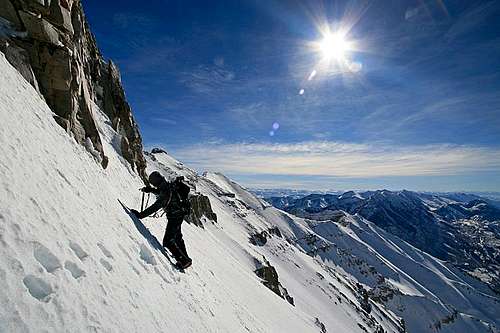
The Wasatch Mountains also have a lot of alpine routes to choose from. Many of these climbs are classic routes that shouldn't be missed. This is a good page to look at if you want to climb something more challenging than the regular route up every mountain. Difficulty and quality ratings are stated on the page originally created by Glenn Merrill. They range from rock scrambles to snow and ice climbs. Winter ascents up a lot of the higher peaks have been done by some of the Utah SPers. Mount Nebo, Mount Timpanogos, and Box Elder Peak are a few of them. Check out some of their winter climbing pictures.
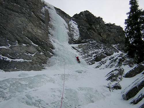 Ice Climbing in Santaquin Canyon - by Shirley Lam
Ice Climbing
Stairway to Heaven
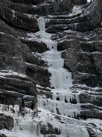
Provo Canyon is located south of Mount Timpanogos and north of Cascade Mountain. It is known for ice climbing rather than rock climbing. The area has the most accessible ice climbs around the Salt Lake and Utah county area. This is why so many visiting ice climbers make Provo Canyon their first destination. There are numerous routes on both sides of the canyon. The routes are on the south side get less sunlight and have thicker ice. The best ice climbing last from about December to late February. The two most popular areas in the canyon are Bridal Veil Falls and Stairway to Heaven. Greg Lowe made a solo ascent of Bridal Veil Falls in 1971. This was the first major ice route in Provo Canyon. Soon climbers began to notice the potential for high quality routes in the canyon. Certain areas have gotten crowded over the years but there is still plenty of ice for everybody to climb.
Santaquin Canyon
Santaquin Canyon is a good alternative to Provo Canyon. It is located about 20 miles south of the city of Provo. This is south of Dry Mountain and Payson Canyon and north of Bald Mountain and Mount Nebo. There is a large amount of ice climbs ranging from moderate to difficult. In more recent years, mixed climbing has become popular. Ice climbing began in Santaquin Canyon in the 1970’s. Doug Hansen and his friends climbed the routes Squash Head and Backoff. In the early 1980’s, the routes Candlestick and Automatic Control Theory were climbed. Then more difficult mixed routes were put up by several climbers in the 1990’s.
Here are a few more ice climbing areas. They are located south of the Southern Wasatch Mountains. Maple Canyon is located in the San Pitch Mountains west of the city of Moroni. Joes Valley is located west of the city of Huntington near the Wasatch Plateau and the San Rafael Swell.

Donorcicle
Maple Canyon
Maple Canyon is famous for its conglomerate cobble rock climbing. In winter, several ice routes form on these walls. There may be over 50 routes that develop during a good snow year. The most popular routes are in the Main Canyon, Box Canyon, Left Hand Fork, and Right Hand Fork. To get to Maple Canyon from Salt Lake City drive south on the I-15 until Nephi. Take exit 225 south east towards Ephraim/Manti. In Fountain Green you'll see a sign for Maple Canyon, just start following those. From Ephraim you head back along the 132 to Moroni. In the city of Moroni, you'll see a sign pointing toward Maple Canyon. It is recommended that you have a 4-wheel drive vehicle to drive into the canyon. You will usually have to hike or ski in to approach the ice routes.
Joes Valley
Joes Valley is one of the most popular places to go bouldering in Utah. It is also a great ice climbing area. It is located in a beautiful valley near the Wasatch Plateau. Many routes are within a short distance of a paved road. The sandstone rock contrasts with the ice that forms in winter. Doug Coats was an early ice climbing pioneer in Utah and made many of the first recorded ascents in Joes Valley. From the city of Price, travel south on State Road 10 for 22 miles to the city of Huntington. From Huntington continue south on State Road 10 for 6 miles to a sign on your right pointing the way to Orangeville and Joes Valley on State Road 29. Follow State Road 29 east for 4 miles until you get to a junction. Turn north which is right at the junction and continue following State Road 29 east as it climbs toward Straight Canyon.
 Skiing down the Northwest Couloir of Mount Nebo - by marauders
Skiing History
Mount Timpanogos
Timpanogos Avalanche

Emerald Lake Skiing
The Stewarts were a family of Scottish immigrants that settled in Provo Canyon in the early 1900s. In the 1950s, the Stewarts opened Timphaven, a local ski resort which boasted a chair lift, a rope tow, and a burger joint. In 1969, actor Robert Redford bought Timphaven and much of the surrounding land from the Stewart family.
Robert Redford decided to reject advice from New York investors about filling the canyon with expensive hotels and condominiums. He saw his newly acquired land as an ideal place for environmental conservation and artistic expression. Years of experimentation had ultimately resulted in what is now called Sundance. There is the Sundance Institute, the spectacular skiing, and nice accommodations that make it a unique place. Sundance Ski Resort is located on the slopes of Mount Timpanogos in the North Fork of Provo Canyon. It is about 50 miles southeast of Salt Lake City.
Sundance Ski Resort has a vertical drop of about 2,150 feet and elevation level of 8,250 feet. It offers a lot of skiing, including one of the finest intermediate-expert bowls in the Wasatch range called Bishop's Bowl. Mount Timpanogos serves as the beautiful background in the distance. Sundance has a quad lift and two triple-chair lifts that allow access to over forty different runs with varying terrein of bumps, bowls, and chutes. Sundance receives an average of 320 inches of snow a year. There are over 450 acres of wilderness that is a skiers and snow boarders paradise. The skiing is quite good at Sundance, and although the steepness and vertical drop cannot rival that of Snowbird, the crowds don't match those of the Cottonwood Canyons.
The Southern Wasatch Mountains may not be as popular as the Central Wasatch above Salt Lake City. This is where backcountry skiers and snowboarders go to get away from the crowds. Mount Timpanogos is a sought after goal for climbers and skiers with 4,000 feet of skiing. The bowls on the east side of Timpanogos offer good terrain. There have been some accidents and fatalities from avalanches so it is a good idea to check the conditions before you go. Alpine Scenic Loop Road is a good place for cross-country skiers or snowshoers during winter. The road has many switchbacks and the scenery is hard to beat. American Fork Canyon is usually plowed to Granite Flat.
 Emerald Lake at Dawn - by Bob Sihler
Rivers, Waterfalls & Lakes
RIVERS:
American Fork River
The American Fork River is about 35 miles southeast of Salt Lake City. It is located in Utah Valley. The river’s headwaters are located on Mount Timpanogos. It continues down through American Fork Canyon. On the way it passes through the Uinta National Forest and then Timpanogos Cave National Monument. The river runs through northern Utah County after it exits American Fork Canyon. Then it empties into Utah Lake on the north shore. The city of American Fork is named after this river. It was named American Fork to avoid confusion with the Spanish Fork River farther south. The Dominguez and Escalante party originally named this river the El Rio de Santa Ana. Before the Mormons entered the valley, it may have been named by American gold prospectors who camped there while passing through on their way to California.
Provo River
The Provo River is about 70 miles long. It originates in the Uinta Mountains. The river collects water at Jordanelle Reservoir and Deer Creek Reservoir before arriving at Utah Lake. Between these two reservoirs, the Provo River flows through Heber Valley which is a popular place to go fishing. The river has brown, rainbow, and cutthroat trout and is primarily a fly-fishing area. The two main branches of Provo River are North Fork and South Fork. Deer Creek Dam on the Provo River impounds Deer Creek Reservoir, which was built in 1941. It is further impounded by Jordanelle Reservoir to the north. The river was originally called the Rio San Antonio de Padua and the Timpanogotzis, an American Indian tribe, were living on its bank. Early Mormon settlers named it the Provo River in honor of explorer and trapper Etienne Provost for whom the city of Provo is also named.
Spanish Fork River
The Spanish Fork River originates at the junction of Soldier Creek and Thistle Creek near the ghost town of Thistle. The river goes through Spanish Fork Canyon and empties into Utah Lake. Early Spanish explorers Dominguez and Escalante named the river El Rio de Aquas Calientes which means the Fiery River. This might be due to them seeing the nearby hot springs. The river’s name was later changed to the Spanish Fork River as a reflection to the region's early Spanish history. Spanish Fork River Park is located in the canyon. Overnight camping and individual picnicking are available on a first come first served basis. Trails and primitive areas are on site. You can fish in the Spanish Fork River which has Brown and Rainbow Trout.
 Aspen Grove Falls Aspen Grove Falls |
 Aspen Grove Falls Aspen Grove Falls |
 Stewart Falls Stewart Falls |
 Stewart Falls Stewart Falls |
 Scout Falls Scout Falls |
|---|
WATERFALLS:
Waterfalls of the Wasatch List - by andrew david
Scout Falls
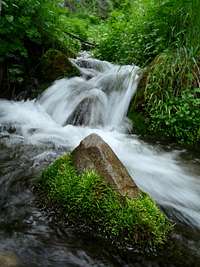
Scout Falls is located on the Timpanooke Trail leading to Mount Timpanogos. After a short distance of walking, the trail makes a sharp right. You’ll enter a cirque which has a good size stream in it during spring and early summer. At the top of the cirque you will see Scout Falls. At the first switchback, there is a small trail that leads to the bottom of Scout Falls. On the third switchback, there is a sign for Scout Falls which is a short distance from the main trail.
Aspen Grove Falls
Aspen Grove Falls are a series of waterfalls located on the Aspen Grove Trail to Mount Timpanogos. These falls have a high flow after the snow melts. The first waterfall is reached after only a mile of walking. The trail goes right next to it via several switchbacks. The trail follows the creek which cascades nearby. It then goes up Primrose Cirque on its way toward Emerald Lake.
Stewart Falls
Stewart Falls is also known as Stewart Cascades. It is located south of Aspen Grove trailhead. The trail meanders southwest to the ridge above the falls with good views along the way. From the ridge you can clearly see the falls but you’ll want to keep going. Now follow the trail down to the base of the falls which has two tiers. There will be a lot of water early in the season when you can feel the spray of the falls.
 Grove Creek Grove Creek |
 Battle Creek Falls Battle Creek Falls |
 Bridal Veil Falls Bridal Veil Falls |
 Bridal Veil Falls Bridal Veil Falls |
 Bridal Veil Falls Bridal Veil Falls |
|---|
Grove Creek Falls
There are two waterfalls in Grove Creek Canyon and several smaller cascades that can be easily seen. Grove Creek is located in the canyon north of Battle Creek Canyon. They are separated by Little Mountain aka G Mountain. The lower waterfall can be seen from the trail that traverses above on the north side of the canyon. The upper waterfall can be seen from the trail near a memorial bench. A smaller side trail leads down to the falls but it is not recommended because it is loose and steep. Most people view the falls from above.
Battle Creek Falls
Battle Creek Falls is located in Battle Creek Canyon above the city of Pleasant Grove. There are actually three waterfalls. The most impressive is the lowest one which is a short distance from the trailhead. Battle Creek received its name because it had the first battle between Mormon settlers in Utah and the Ute Indians who lived there. The Utes were outnumbered and outgunned so they lost the battle against the Deseret Militia in March 5, 1849. The Mormon settlement of Utah Valley occurred shortly after the battle.
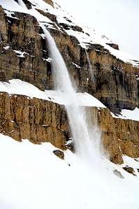
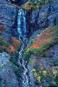
Bridal Veil Falls
Bridal Veil Falls is probably the most well known waterfall in the Southern Wasatch. It is highly visible to anyone driving up Provo Canyon. In winter it becomes a popular ice climb. An aerial tramway was built to the top of the falls in 1967. The small tram functioned as a tourist attraction and went to a restaurant that was situated on a cliff at the top of the falls. An avalanche destroyed the tram in 1996. This wasn’t the first time an avalanche destroyed the tram. So they decided not to rebuild it. Then in July 2008, a fire burned the ruins, and very little remains.
 Emerald Lake Emerald Lake |
 Emerald Lake Emerald Lake |
 Emerald Lake Emerald Lake |
 Emerald Lake Emerald Lake |
 Hidden Lakes Hidden Lakes |
|---|
LAKES:
Emerald Lake
Emerald Lake is the crown jewel of the Southern Wasatch. There are not many alpine lakes in this area to begin with so that makes it even more special. Emerald Lake is located at 10,380 feet elevation below Mount Timpanogos. Emerald Lake is usually reached from the Aspen Grove trail. At the lake you will see a small hut. Roberts Horn is to the northeast and Timpanogos summit is to the west.
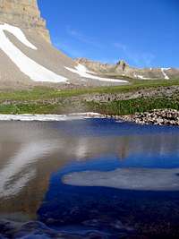
Hidden Lakes
Hidden Lakes are actually a couple of ponds located in Hidden Lake Cirque near 9,800 feet elevation below Mount Timpanogos. They can be reached by the Aspen Grove trail. They are in the basin below Emerald Lake and the trail goes near them. They are not hidden if you know where to look. The East Peak of Timpanogos can be climbed from the lakes. The ridge located to the south divides Hidden lakes Cirque from Cascade Cirque.
Maple Lake
Maple Lake is also known as Maple Canyon Lake. It is located below Spanish Fork Peak at 8,700 feet elevation. This lake is largest during spring and early summer. It then dries out and resembles a pond later in the year. It is seen by people hiking up to Spanish Fork Peak via the Right Fork of Maple Canyon which is the standard route up the mountain. The trailhead is located east of the city of Mapleton.
Payson Lakes
Payson Lakes are located on the Nebo Loop Scenic Byway. There are three lakes, McClelland Lake, Box Lake, and Big East Lake. All of the lakes offer good fishing. Big East Lake is the largest of the three and the most popular because it is closest to the campground. There is also a large day use area. These lakes offer other outdoor activities besides fishing, including swimming, picnicking, camping, and wildlife viewing.
 Maple Lake Maple Lake |
 Box Lake Box Lake |
 Payson Lakes Payson Lakes |
 Silver Lake Silver Lake |
|---|
RESERVOIRS:
Tibble Fork Reservoir
Tibble Fork Reservoir is located in American Fork Canyon. The dam for the reservoir was created in 1966. Fishing includes brown and rainbow trout. This is also the trailhead for Box Elder Peak. The area is good for cross-country skiing and snowhoeing in winter. It is about one hour round trip to ski to Granite Flat, and two and half hours roundtrip to ski to Silver Lake Flat Reservoir.
Silver Lake Flat Reservoir
Silver Lake Flat Reservoir is a beautiful lake located in American Fork Canyon farther past Tibble Fork Reservoir. The lake offers a great view of Mount Timpanogos and the surrounding mountains. Silver Lake Flat is drained low by the end of the summer during most years. The lake is stocked throughout the summer with fish. Good trails lead past the reservoir higher into the mountains and to other lakes.
Deer Creek Reservoir
Deer Creek Reservoir is a large reservoir located at the southwest corner of Heber Valley. The entire shoreline of Deer Creek is publicly owned, and access is unrestricted. There are two main boat ramps, one at the state park, and the other at Rainbow Bay. The water fluctuates every year based on snow and runoff levels as well as water usage by downstream water users for both culinary and agricultural uses. This usually affects fish populations.
Jordanelle Reservoir
Jordanelle Reservoir is located north of Deer Creek Reservoir between Park City and Heber City. Jordanelle Reservoir provides excellent fishing for rainbow trout, cutthroat trout, and smallmouth bass. The population of brown trout is also expanding. Jordanelle State Park opened June 29, 1995. The park consists of Hailstone Recreation Site and Rock Cliff Recreation Site. The reservoir is a future water supply for Utah.
 Mount Timpanogos seen from Silver Lake Flat Reservoir - by EJBean
Utah Lake

Timp & Utah Lake

Utah Lake & West Mountain
This is Utah's largest fresh water lake. It is unique because it is one of the largest freshwater lakes in the West but is located in an arid region that receives only about 15 inches of rainfall a year. This is the prominent lake west of Utah Valley. Many cities are near the lake which is located south of Lehi, west of Provo, and north of Payson. The Wasatch Mountains provide a nice backdrop to people who live near it. On the western side of the Utah Lake are the Lake Mountains. This is a low elevation, flat top, mountain range with the highest mountain being Lake Mountain Peak. The lake is a remnant of Lake Bonneville that occupied much of the western half of Utah.
Boaters were interested in construction of a facility on the lake that would permit them to launch boats year round. In 1933, an application was made requesting the help of the Civilian Conservation Corps and a marina was completed within a few years. Provo City constructing shoreline picnic and camp facilities after its completion. Recreation on the lake is very popular today and includes boating, sailing, water skiing and fishing. There are newly renovated facilities at Utah Lake that include four boat launch ramps, a visitor center, and several campsites.
Utah Lake has a surface area that occupies 96,600 acres. Despite its large surface area, Utah Lake is very shallow; it has a maximum depth of 18 feet, and an average depth of about nine feet. The lake suffers from large seasonal algae blooms, which are compounded by industrial effluent from an old steel mill located on its eastern shore. The smell is similiar to the lake stink that is experienced from the Great Salt Lake.
Utah Lake State Park is located on the eastern shore, at the location where the Provo River empties into the lake. The lake is fed by creeks and streams as well as the Provo River, Spanish Fork River, and American Fork River. Utah Lake's outlet is the Jordan River, located at the lake's north end. Utah Lake's wetlands are an important stopover and nesting area for migratory birds. Utah Lake Wetland Preserve is located at the south end of the lake, in and around Goshen Bay. More than 220 species of birds use the wetland areas. The June sucker is an endangered species of fish that lives naturally in Utah Lake. Its numbers have gone from being in the millions in the early 1800's, to less than 1,000 today. During the summer of 2005, over 8,000 June suckers were released into Utah Lake to help the population grow.
 Southern Wasatch and Utah Lake - by TyeDyeTwins
Utah Valley

Utah Valley
Utah Valley & Utah Lake
Utah Valley is the name given to the area located south of Salt Lake City. It is often referred to as Happy Valley. This was the home of the Ute Indians. They settled in villiages that were close to Utah Lake for protection from other tribes to the northeast and to be close to their primary source of food, fish from the lake. The Utes were also known as the Yuta or Uta Indians. As you can see, the state of Utah was named after the Ute Indians. The Wasatch Mountains acted as a natural barrier against their enemies. Two of the earliest men to explore the Provo area were Fray Francisco Atanasio Dominguez and Fray Silvestre Velez de Escalante, who visited Utah Valley in 1776.
Utah Valley & Utah Lake

Utah Lake
Provo is the largest city in the area and the second largest city in the state of Utah. It is located west of the Wasatch Mountains and on the eastern side of Utah Lake. Provo was given its name in honor of an early trapper named Etienne Provost. Sometimes his name was spelled with different variations like Proveau and Provot. He was a well known fur trader and explorer from Quebec, Canada. Provost was considered to be a knowledgeable, skillful, and successful mountain man. He is recorded as being the first person to go far enough north to see the Great Salt Lake. Etienne Provost also established a trading post on the shores of Utah Lake. Provo River and Provo Canyon were also named after him.
From approximately 1825 to 1847, various fur trappers and mountain men spent time in Utah Valley, but the first permanent settlers were Mormon pioneers sent south from the Salt Lake Valley by their leader, Brigham Young. Provo was settled by the Mormons in 1849, and was the first large Mormon colony in Utah outside of Salt Lake Valley. Historically, Provo has served as an important focal point of Utah Valley industry, commerce, and government. When the first transcontinental railroad was completed in 1869, it only took four more years until a line was extended to Provo and then later south and east. This eventually gave rail connections throughout the Western United States.
Many of the other communities were officially founded soon after and including Alpine, American Fork, Lehi, Pleasant Grove, Payson and Springville. The City of Orem was named after W.C. Orem, builder of the railroad which ran through the town. Payson was named after an early settler, James Pace. The community was previously known as Fort Peteetneet after a Ute Indian chief. Lehi was named after the people of Lehi, in the Book of Mormon, who had frequently moved, like the pioneers. Nephi is located at the southern end of the Wasatch Mountain below Mount Nebo. It was named after a Book of Mormon prophet.
 Provo Peak Sunset - by marauders
Provo Weather
Mount Nebo

Box Elder & Timp
The city of Provo is in Utah Valley. It has a warm, arid, and sunny climate during summer and cold snowy weather during winter. The mountains are generally about 15 to 20 degrees cooler. Winter bring huge amounts of snow to the mountains with an average of 500" of the white stuff. The city gets about 60" of snow a year and daily temperatures are usually relatively mild. It is located in a large valley that is separated by the Wasatch Mountains to the east and Utah Lake to the west. The metro area below the mountains is known commonly as the Wasatch Front. The Wasatch Fault runs along the eastern benches of the city along the foothills. The valley floor is the lake bed of the ancient Lake Bonneville which the Great Salt Lake is a remnant.
Squaw Peak

Dry Canyon
In Summer the season last from June through mid-September. The hottest months of the year are July and August, when daytime temperatures can reach around 90 °F, followed by cool nights. Summer thunderstorms can occur, with wet weather and occasional downpours. The low humidity and the altitude combine to produce a large daily range in temperatures, and rather cool nights in summer. The warmest month is July with the high temperature being around 92 °F and the low is 60 °F.
During Spring the weather and climate can be variable, with sudden showers occurring. At this time, temperatures warm up drastically and days are marked by the highest humidity and some of the wildest daily temperature swings of the year. The first summer-like weather usually comes in mid-to-late May. Snowfall is common through mid-March, but the last snowfall of the season usually occurs in early or mid-April. In April, the average high is 66 °F and the average low is 39 °F. In May, the average temperature is 74 °F with 46 °F for the low. Measurable snow falls on average from November through mid-April.
Autumn weather and climate begins in September through November. Unsettled weather and storms can be expected. The wet weather doesn't last long and it is usually a pleasant season with warm, sunny days and cool nights. During Fall, temperatures drop drastically, with a 50 °F maximum average temperature drop being experienced within three months. The first winter-like weather is usually experienced in early-to-mid October. Provo's high temperature in October is 67 °F and the low is 39 °F. The freeze-free period lasts an average of 167 days, from April 30 to October 15.
The Winter season in Provo is from November through through the month of March. The coldest months are December and January, when daytime temperatures drop to around 37 °F. Night temperatures are much colder and snowy weather occurs from December onwards, with heavy snowfalls in the mountains, but much less in the city. Winter temperatures are moderated by the Great Salt Lake to the north and Utah Lake to the west of the city. The Rocky Mountains to the north and east of the state serve as barriers to frigid arctic air. The temperatures in Provo seldom fall below 0 °F for any length of time. January is the coldest month in the city. In winter, the high temperature is around 37 °F and the low is 19 °F.
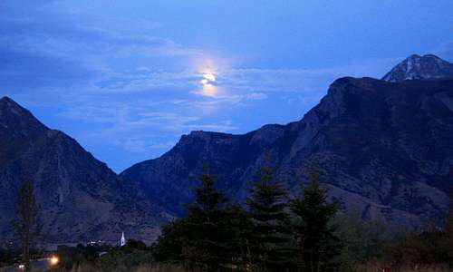 Moonrise over American Fork Canyon - by Dean
Mountain Conditions
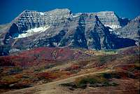
Mount Timpanogos

Provo Peak & Y Mtn
The best weather usually last from the months of July to mid-September. Summer is the normal season for these mountains but experienced climbers can climb year round. Summer temperatures can range from near 90 degrees in the daytime to 30 degrees at night. Occasional summer thundershowers can be expected.
In winter, temperatures are 30-40 degrees but can be much colder in the higher elevations. Be prepared with full winter gear if you plan on climbing any mountains.
Here is the local weather forecast for the city of Provo and the NWS website
Here is the local weather forecast for Spanish Fork and Nephi
Red Tape
These mountains are located in Wasatch-Cache-Uinta National Forest
Rules: Group size of 10 or less, no shortcutting trail switchbacks, and no disposing of garbage.
The Nebo Loop Scenic Byway is closed during winter.
Current Road Conditons in Utah can be found here
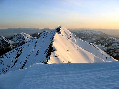
Mount Nebo Summits - by Joe Bullough
American Fork Canyon / Alpine Loop
American Fork Canyon / Alpine Loop requires a fee at the entrance station.
$6.00 - 3 Days
$12.00 - 7 Days
$45.00 - Annual Pass
Contact information can be found here
Uinta National Forest Supervisor's Office
88 West 100 North
PO Box 1428
Provo, UT 84601
Phone: (801) 342-5100
Spanish Fork Ranger District
44 West 400 North
Spanish Fork, UT 84660
Phone: (801) 798-3571
Spanish Fork Ranger District - Nephi Office
635 North Main
Nephi, UT 84648
Phone: (435) 623-2735
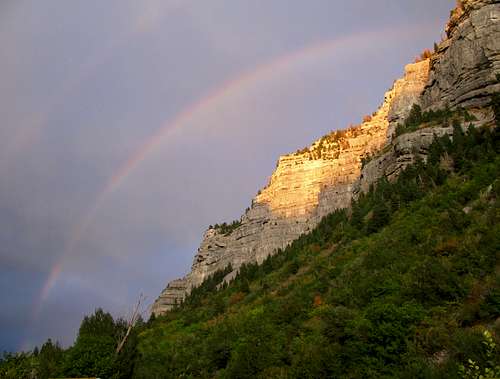 Cascade Mountain Rainbow - by Rocky Alps
Camping
American Fork Canyon

Buffalo Peak
There are a lot of picnic areas in American Fork Canyon. Grey Cliffs picnic area is at 6,000 feet. It is near the cliffs that it is named after and is popular with rock climbers. This area has the most picnic sites in the canyon. Echo picnic area is also at 6,000 feet. Martin and Roadhouse picnic areas are both at 6,200 feet. Mile rock picnic area is located farther up in the canyon. All of these picnic areas have about 5 to 6 sites each. They are free except for the fee at the entrance.

Box Elder Peak
The first campground in American Fork Canyon is the Little Mill campground. Little Mill is located about a mile and a half past the Timpanogos Cave visitor’s center. The campground parallels the road, as well as American Fork Creek. There are 66 campsites and numerous picnic areas. The sites are quite small and a few of them are located very close together. If you continue Northeast on 144 you’ll come to Tibble Fork Reservoir. A paved road leads from Tibble Fork to the Granite Flat camp ground. Granite Flat features 64 individual sites and several group areas. Most of the campsites are fairly spacious and well spaced. There are also three group campsites here. The individual campsites are $16.00 per night.
American Fork Canyon and Provo Canyon Campgrounds Overview
Campground reservations can be made for Granite Flat Campground
Campground Reservations can be made for Little Mill Campground
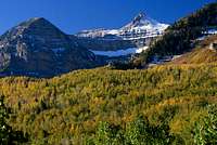
Mount Timpanogos
Group campsites can be reserved for Altamont Campground
Provo Canyon Campgrounds

Cascade Mountain
Theater in the Pines picnic area is a favorite area for people driving down Provo Canyon road. There is also a large group campsite here as well. Mount Timpanogos Campground is located 6 miles past the Sundance Ski Area and Aspen Grove. This is a good campground for people wishing to climb Mount Timpanogos the next day. The campground has 27 individual sites. The fee is $16.00 a night.
Campground reservations can be made for Mount Timpanogos Campground
Group campsites can be reserved for Theater In The Pines Campground

Rock Canyon
Squaw Peak Road Campgrounds
Squaw Peak road is the main access to many of the mountains around Provo. There are a few campgrounds in the area. Hope Campground sits at 7,700 feet and makes a good basecamp for a couple nights. There are 24 sites at this campground. Rock Canyon Campground has four large group campsites.
Campground reservations can be made for Hope Campground and Rock Canyon Campground
Spanish Fork Peak Campgrounds

Powerhouse Mountain
Whiting Campground is a few miles from the town of Mapleton. To get there, drive on I-15, and take the South Springville exit. Continue 2 miles to intersection of Main Street and 400 South. Turn south onto Main Street, staying in the right lane toward Highway 89/Price. Turn north onto Main Street, follow it to 400 North. It is the regular trailhead for Spanish Fork Peak. This area is nice and never seems very crowded. There are about 25 sites available here. The fee is $17.00 a night.
Spanish Fork to Mount Nebo Campgrounds Overview

Y Mountain
Campground reservations can be made for Whiting Campground
Nebo Scenic Byway Campgrounds
Nebo Scenic Byway has many places to camp. Maple Bench campground is located down low on the scenic loop. It has ten sites on a first come - first serve basis. Bear Canyon campground is at 6,800 feet and has group campsites and a few individual sites. Payson Lakes Campground is a good place to stay if you want to climb Santaquin and Loafer Mountain or Mount Nebo. There are over 100 sites available and a few group campsites as well. Blackhawk Campground is located at 8,000 feet. There are a dozen single sites and group sites here. Ponderosa Campground is located at 6,200 feet and is near the trailhead to Mount Nebo.
Campground Reservations can be made for Blackhawk Campground
Campground Reservations can be made for Bear Canyon Campground
Campground Reservations can be made for Payson Lakes Campground and Ponderosa Campground
Backcountry Camping Regulations:
1) Camp 1/2 mile from any road, 200 feet from any water source, and 200 feet from any trail.
2) Group size of 10 or less people.
3) Practice leave no trace techniques.
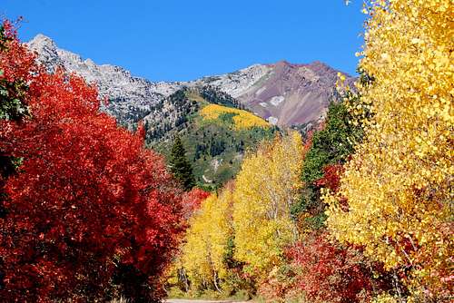 Autumn in American Fork Canyon - by Delta9Explorer
Wasatch Autumn
The Wasatch Mountains are covered with gnarled juniper trees, pinion pines, and limber pines. Higher mountains have an abundance of blue spruce, ponderosa pine, lodge pole pine, Douglas fir, alpine fir, and fields of aspen. Willows grow along mountain streams, and in the valleys several species of cottonwoods line the banks of streams and canals. In the lower mountains sagebrush mixed with maple oak, chokeberry, and serviceberry can be found. Juniper and Mountain Mahogany are dominant on the south and west facing slopes.
 Alpine Loop Alpine Loop |
 Nebo Scenic Byway Nebo Scenic Byway |
 Mill Canyon Peak Mill Canyon Peak |
 Timp Aspens Timp Aspens |
|---|---|---|---|
 North Timpanogos North Timpanogos |
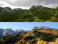 Box Elder Season Contrast Box Elder Season Contrast |
 Squaw Peak Road Squaw Peak Road |
 Provo Peak Provo Peak |
Aspen, oak and maple trees bring fall color to the Southern Wasatch Mountains. This area is among the best in Utah for beautiful scenary. Trees usually start to change color by mid-September. They cover the canyons and mountain slopes for only a few weeks. The aspen trees turn a bright yellow-gold, interspersed with red oaks and maples. The quaking aspen have thin and translucent leaves that shimmer in the breeze.
There are several scenic drives near Utah Valley that are accessible to anyone. American Fork Canyon is a popular place to see the autumn foliage. The Alpine Loop and Nebo Scenic Byway are your best choice for longer drives. Provo Canyon and Aspen Grove are good places. Squaw Peak road below Provo Peak always has nice colors. The best views are seen by those who go hiking into the backcountry.
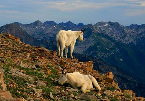 Mountain Goats on Bomber Peak - by Phenom
Wasatch Fauna
The Southern Wasatch has a wide range and variety of animals. Bear, elk, moose, deer, cougars, mountain goats, and bighorn sheep are among the larger animals. Bobcats, coyotes, fox, porcupines, raccoons, beaver, badgers, rabbits, weasels, squirrels, chipmunks, marmots, and pikas are some of the smaller animals. There are many species of birds that live here, including eagles, owls, and hawks. Other animals include lizards and snakes along with spiders and insects.
The Billy Goats of Mount Timpanogos Album - by TyeDyeTwins

Mountain Goat
Bighorn Sheep
Mountain goats are occupants of the highest alpine environments in Utah. Even in winter, they may live as high as as 11,000 feet on windblown ridges. Both male and female mountain goats have beards, short tails, and long black horns. They are protected from the elements by their woolly white coats of fur. During winter, their coats help them to withstand temperatures as low as -50 degrees and winds of up to 100 mph. Mountain goats prefer extremely steep and rugged areas above the timberline, and are excellent rock climbers. They typically migrate to lower elevations in the winter. Females give birth during the months of May or June. Interestingly, young baby goats are able to follow their mothers through rocky cliffs shortly after birth.
In 1967, two yearling male and four adult female goats were brought to Utah from the Cascade Range in Washington and released on the northern side of Little Cottonwood Canyon near Broads Fork Twin Peaks. For years, wildlife biologists looked for signs of the new residents but had no firm sightings. Then, in the mid-1970s, a group of goats were spotted climbing the cliffs on southern side of the canyon. Since that time goat sightings have been common. No official count is available but biologists suggest there are now hundreds of goats in the canyon. After the initial transplant in 1967, several more goats were obtained from Olympic National Park and put onto the steep slopes of Mount Timpanogos. They have flourished well on the mountain. Mountain goats are often seen climbing on the rocky cliffs and in the meadows below the summit. Encounters between mountain goats and humans are common but attacks are rare. It's a good idea to keep a safe distance.
Rocky Mountain bighorn sheep can be seen is several areas of the Southern Wasatch Mountains. Utah is home to more than 4,000 bighorn sheep. That total includes more than 3,000 desert bighorns, more than 1,000 Rocky Mountain bighorns, and about 200 California bighorns. Most of Utah's desert bighorn sheep live farther south in the warm desert areas especially along the Green River from Flaming Gorge to the city of Green River. In the Southern Wasatch, Rocky Mountain bighorn sheep can be found in American Fork Canyon and Rock Canyon and in other areas near Provo Peak, on the rocky slopes and canyons of Mount Timpanogos, and on Mount Nebo. The California bighorn sheep live on the Newfoundland Mountains and Antelope Island State Park in northern Utah.
In the Wasatch Mountains, black bears are present in most of the forested areas and canyons. A few exceptions include the Raft River Mountains, Pilot Range, Deep Creek Mountains, and Henry Mountains. There are about 8.7 million acres of black bear habitat that is mostly on National Forest land. Utah has a low black bear population of about 800 to 1,000 black bears. Nevada has the lowest black bear population of all the western states with about 300 total. About 80% of the black bear sightings in the Wasatch Mountains have occurred between 7,000 feet and 10,000 feet in elevation.
 Bighorn Sheep Bighorn Sheep |
 Bighorn Sheep Bighorn Sheep |
 Mountain Goats Mountain Goats |
 Mountain Goat Mountain Goat |
 Mountain Goat Mountain Goat |
 Mountain Goat Mountain Goat |
 Mountain Goats Mountain Goats |
|---|
The mule deer is seen throughout the state of Utah. They can be found in many types of habitat, ranging from open deserts to high mountains to urban areas. Mule deer often migrate from high mountainous areas in the summer to lower elevations in the winter to avoid deep snow. The white-tailed deer is rarely seen in Utah. Elk are common in most mountainous regions of Utah, where they can be found in mountain meadows and forests during the summer, and in foothills and the valley grasslands during the winter. The seasonal changes in elevation allow elk to avoid deep snow and find food year-round. Elk may be active during both day and night, but most activity occurs at dusk and dawn.
These mountains have a high moose population. If you do enough hiking in the area you are guaranteed to see a few of them. Moose are docile animals and do not usually bother people. There are some circumstances when moose can become dangerous like getting too close to a cow moose and her calf. Their parental instincts make the cow moose protective of its offspring and these situations should be avoided. Not only are the cow moose dangerous, but the bull moose commands respect as well. If you see one it's a good idea to keep a safe distance. They are sometimes spotted at low elevations along the Wasatch Front.
Mountain lions can also be found in the Wasatch Mountains. Utah has an alpine and desert environment so it is an ideal place for them to live. The chances of seeing a mountain lion are low and they are sure to see you before you see them. They are common in some areas but are extremely shy and secretive. However, mountain lions occasionally wander into cities or other areas where they may come into contact with people. Mountain lions are found distributed throughout the state except in the barren salt flats west of the Great Salt Lake. They are most often found in habitats where there is abundant prey.
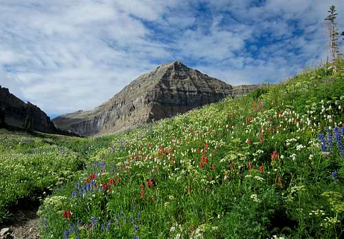 Timpooneke Trail Wildflowers - by Dean
Wasatch Flora
In the Southern Wasatch Mountains, mountains and plateaus are covered with trees and vegetation. The most popular place to see wildflowers is Mount Timpanogos. Wildflowers cover the mountainsides with color from April to September. Some of the flora that can be found in this area include lupines, sego lilies, Indian paintbrush, arrowleaf balsamroot, dogtooth violets, goosefoot violets, sunflowers, monkshood, clematis, mallow, spring beauty, white geranium, columbine, fireweed, scarlet monkey flower, wild rose, prickly pear, sweet pea, iris, western wallflower, flax, yarrow, and mountain aster.
The Wildflowers of Mount Timpanogos Album - by TyeDyeTwins
 Stewart Falls Flowers Stewart Falls Flowers |
 Geranium Geranium |
 Columbine Columbine |
 Timpanogos Flowers Timpanogos Flowers |
 Jacobs Ladder Jacobs Ladder |
 Columbines Columbines |
|---|---|---|---|---|---|
 Timpanogos Flower Timpanogos Flower |
 Rose with Bee Rose with Bee |
 Timpanogos Flower Timpanogos Flower |
 Dandelion Dandelion |
 Purple Geranium Purple Geranium |
 Timpanogos Fern Timpanogos Fern |
Trees include Englemann spruce, Limber pines, Lodgepole pines, Douglas fir, Alpine Fir, and Aspen. Willows grow along mountain streams, and in the valleys several species of cottonwoods line the banks of streams. Maple Trees are a small to medium sized deciduous tree growing to 10 to 15 meters tall. The bark is dark brown to gray, with narrow fissures and flat ridges creating plate-like scales that are thin and easily damaged. Aspen Trees are also known as Quaking Aspen. The unusual ability of their leaves to twist and bend helps protect the trees from severe winds and to help dissipate energy more efficiently.
In the lower elevations you will find Cottonwood trees, Box Elder trees, sagebrush mixed with maple oak, chokeberry, and serviceberry. Pine trees will be seen on almost every mountain in the Wasatch Range. The Limber Pine is typically a high elevation pine. It is usually found near timberline by itself or with other trees such as Whitebark Pine, Bristlecone Pine, or Lodgepole Pine. Juniper Trees vary in size and shape from tall trees, about 20 to 40 meters tall, to columnar or low spreading shrubs with long trailing branches. They are evergreen with either needle like and scale-like leaves.
 Morning Sun on Mount Timpanogos - by JDrake
Sunsets & Sunrises
Sunsets-and-Sunrises-of-the-Wasatch Album - by TyeDyeTwins
The Southern Wasatch Mountains offer a great setting for photographing sunrises and sunsets. They create incredible colors of yellow, red, and orange hues. Twilight happens between sunset and dusk and may produce a purple and blue hue of color. Alpenglow usually happens when the sun is just below the horizon. This is when you will see mountains illuminated with light for a short period of time. Of course, we also have inversions which occur most notably in winter. This isn’t a good thing but it does make for interesting photos. Winter has the shortest days while the longest days happen in late June through July. Any of the mountains in the Southern Wasatch will be good for taking photos of the sunrise or sunset but Mount Timpanogos is the most popular. Check out the album by SP member TyeDyeTwins: Sunsets and Sunrises of the Wasatch. Here are a few more photos below.
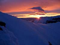 Timp Summit Ridge Sunrise Timp Summit Ridge Sunrise |
 Timpanogos Basin Sunrise Timpanogos Basin Sunrise |
 South Peak Timp Sunset South Peak Timp Sunset |
 South Peak Timp Sunset South Peak Timp Sunset |
|---|---|---|---|
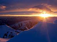 Timpanogos Sunrise Timpanogos Sunrise |
 Box Elder Peak Sunset Box Elder Peak Sunset |
 Utah Lake Sunset Utah Lake Sunset |
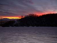 Dry Canyon Sunset Dry Canyon Sunset |
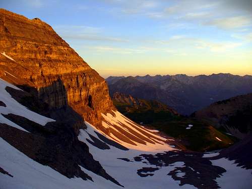 Timpanogos Sunrise - by Dmitry Pruss
Peak Lists
Here are links to several Wasatch and Utah Peak Lists. They include the Wasatch 11,000 foot Peaks List, the Utah County Highpoints List, Utah’s 2,000 foot Prominence Peaks List, Utah's 100 Most Prominent Peaks List, and Ultra-Prominence Peaks of the 48 States List. These lists should keep most people busy for a while.
Wasatch 11,000 foot Peaks List
This is a list of the 11,000 foot Peaks in the Wasatch by SP member Ammon Hatch in the Southern and Central Wasatch Areas.
Utah County Highpoints List
This is a list of the Utah County Highpoints by SP member Dean. The highest peak in Utah County is Mount Nebo.
Utah’s 2,000 foot Prominence Peaks List
This is a list of Utah’s 2,000 foot Prominence Peaks by SP member redsplashman23. There are over 80 of these peaks in Utah.
Utah’s 100 Most Prominent Peaks List
The 100 most prominent peaks in Utah by SP member redsplashman23. Some are located on private land so this is difficult to complete.
Ultra-Prominence Peaks of the 48 States List
This is a list of Ultra Prominence Peaks by SP member rfbolton. This includes Mount Nebo and Mount Timpanogos.
This is a list of 11,000 foot peaks in the Southern Wasatch Mountains. A worthy goal is to climb all of them. This area has the highest mountains in the range. Several other peaks over 11,000 feet are located in the Central Wasatch Mountains. The ratings I listed are during summer when the routes are the easiest to climb. During winter, and early or late in the season, expect these mountains to be more difficult to climb with changing conditions.
| SOUTHERN WASATCH 11,000 FOOT PEAKS | ||
| Mountain | Elevation | Standard Route |
|---|---|---|
| North Mount Nebo | 11,928 | Class 1-2 |
| South Mount Nebo | 11,877 | Class 1 |
| Middle Mount Nebo | 11,824 | Class 2-3 |
| Mount Timpanogos | 11,749 | Class 1 |
| South Timpanogos / Second Summit | 11,772 | Class 2 |
| North Timpanogos | 11,441 | Class 2 |
| Bomber Peak | 11,347 | Class 2 |
| South Bomber Peak | 11,288 | Class 2 |
| North Peak | 11,174 | Class 2 |
| The Shoulder | 11,161 | Class 2-3 |
| Provo Peak | 11,068 | Class 2 |
| East Provo Peak | 11,044 | Class 2 |
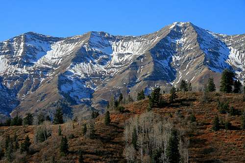 Mount Nebo - by Phenom
This is a list of mountains in the Southern Wasatch. I listed them from the highest to lowest elevation.
| SOUTHERN WASATCH MOUNTAINS | ||
| Mountain | Elevation | SP Page |
|---|---|---|
| 11,000 foot Peaks | ||
| Mount Nebo | 11,928 | Page |
| Mount Timpanogos | 11,749 | Page |
| "South Timpanogos / Second Summit" | 11,722 | Page |
| "North Timpanogos" | 11,441 | Page |
| "Bomber Peak" | 11,347 | Page |
| "North Peak" | 11,174 | Page |
| "The Shoulder" | 11,161 | Page |
| Box Elder Peak | 11,101 | Page |
| Provo Peak | 11,068 | Page |
| "East Provo Peak" | 11,044 | Page |
| 10,000 foot Peaks | ||
| Roberts Horn | 10,993 | Page |
| Bald Mountain | 10,913 | Page |
| Cascade Mountain | 10,908 | Page |
| Freedom Peak | 10,801 | Page |
| East Peak / Elk Point | 10,791 | Page |
| "South Peaks / Cockscomb Ridge" | 10,725 | |
| Shingle Mill Peak | 10,690 | Page |
| Loafer Mountain | 10,687 | Page |
| Santaquin Peak | 10,685 | Page |
| "Box Elder South Peaks" | 10,626 | Page |
| "Forgotten Peak" | 10,509 | Page |
| Corral Mountain | 10,435 | Page |
| Mill Canyon Peak | 10,349 | Page |
| Spanish Fork Peak | 10,192 | Page |
| Lightning Peak | 10,056 | Page |
| 9,000 foot Peaks | ||
| Dry Mountain | 9,865 | Page |
| Ant Knolls | 9,850 | Page |
| "Shingle Mill North" | 9,622 | Page |
| Buckley Mountain | 9,502 | Page |
| Bald Knoll | 9,343 | |
| "Dharma Peak" (Willow Canyon Peak) | 9,237 | Page |
| Wallsburg Ridge | 9,197 | |
| Maple Mountain | 9,088 | Page |
| Mount Baldy | 9,049 | |
| Dixon Benchmark | 9,034 | |
| "Lion Head" | 9,001 | Page |
| Mahogany Mountain | 9,001 | Page |
| 8,000 foot Peaks | ||
| "Mahogany North Peak" | 8,926 | Page |
| Rattlesnake Mountain | 8,840 | |
| Big Baldy | 8,756 | Page |
| Peak 8,753 | 8,753 | Page |
| Salem Peak | 8,746 | |
| "North Fork Ridge" | 8,626 | Page |
| Y Mountain | 8,568 | Page |
| Dick Benchmark | 8,486 | |
| "Pine Hollow Peak" | 8,460 | Page |
| "Arrowhead Peak" | 8,270 | |
| Pumphouse Hill | 8,238 | |
| Red Pine Knoll | 8,198 | |
| "Buffalo Peak" | 8,020 | Page |
| Peaks below 8,000 feet | ||
| Powerhouse Mountain | 7,990 | Page |
| Squaw Peak | 7,876 | Page |
| Little Baldy | 7,696 | Page |
| Grindstone Ridge | 7,634 | |
| Little Mountain (G Mountain) | 7,613 | |
| Granger Mountain | 7,258 | |
| "Sundance Peak" | 7,093 | Page |
| "Soldier Hollow Peak" | 6,510 | Page |
| "Chair Hill" | 6,194 | Page |
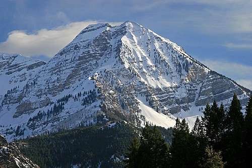 North Timpanogos seen near Tibble Fork Reservoir - by marauders
Utah County Peaks with over 2,000 feet of prominence

Utah County Prominence Peaks Map
Dean has added the following information: I noted that Utah County has 8 of Utah's prominence peaks with over 2000 feet of prominence and that 3 of the 8 Utah ultras are in Utah County, a very high concentration. Of those 8 peaks, 5 are in the Southern Wasatch. I put together a map showing these peaks and the information included on the map seen on the right.
From the map: You will notice that the state of Utah has over 80 prominence peaks that have at least 2000 feet of prominence. Summitpost member Bob Bolton described it best when he stated that "Topographic prominence” allows all mountains to be measured on a level playing field. It measures how far a mountain rises above the highest saddle, its "key saddle", that connects the peak to a higher peak. Another way to think of prominence is to imagine water rising around a peak. As the water rises to the elevation of the key saddle, the mountain's summit becomes the highest point on an island. The prominence of the mountain is the same as the height of that imaginary island. The prominence of the highest points on land masses is measured as the elevation of the highpoint above the level of the surrounding water."
Ultra Prominence Peaks List: Utah County has eight of these peaks within its boundaries and those eight include three that are considered peaks with over 5,000 feet of prominence. Again, here is good information quoting Bob Bolton, "By definition an Ultra-prominence peak rises at least 1,500 meters (4,921 feet) above its key saddle or surrounding water. The traditional threshold for Ultras in the U.S. has been 5000 feet of prominence, and there just happen to be no peaks in the 48 states whose “clean” prominence is between 1,500 meters and 5,000 feet. Clean prominence is a peak’s minimum prominence when exact saddle and/or summit elevations are not known."
The three "Ultra" prominence peaks are Mount Nebo, Mount Timpanogos, and Flat Top Mountain (in the Oquirrh Mountains). Another peak that is near the Utah county line is Boulter Peak but showing it on this map is just for orientation. See the list of the eight peaks below.
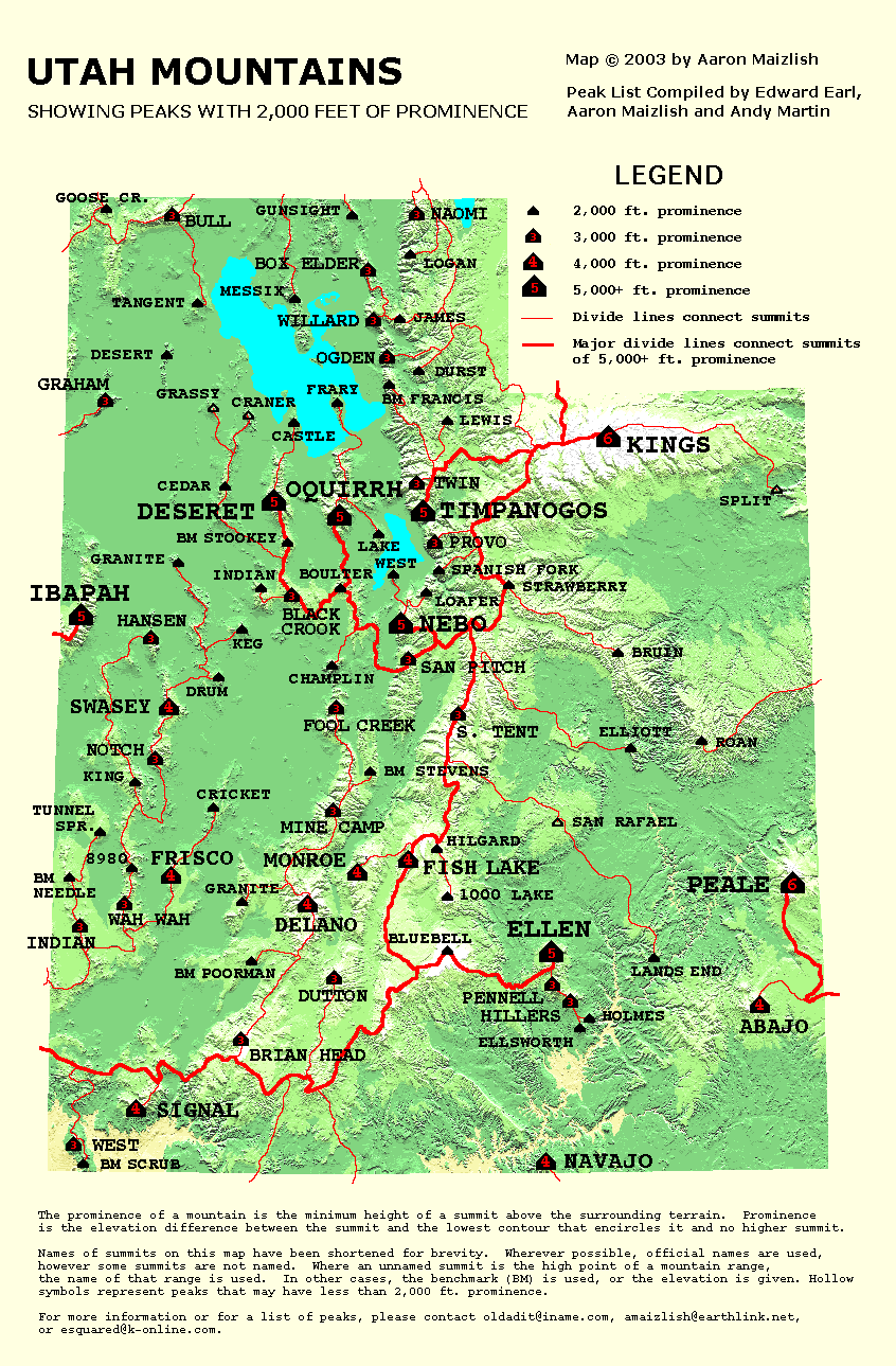
| UTAH COUNTY PEAKS WITH OVER 2,000 FEET OF PROMINENCE | |||
| Mountain | Elevation | UT Ranking | Prominence |
|---|---|---|---|
| In the Southern Wasatch Mountains | |||
| Mount Nebo | 11,928 | 5th | 5,488 |
| Mount Timpanogos | 11,749 | 7th | 5,269 |
| Provo Peak | 11,068 | 28th | 3,428 |
| Spanish Fork Peak | 10,192 | 41st | 2,952 |
| Loafer Mountain | 10,687 | 44th | 2,887 |
| Outside the Wasatch Mountains | |||
| Flat Top Mountain | 10,620 | 6th | 5,370 |
| Lake Mountain Peak | 7,690 | 49th | 2,710 |
| West Mountain | 6,904 | 74th | 2,104 |
Books and Maps
1) Utah Mountaineering Guide
By Michael R. Kelsey. Descriptions are brief but this is the best book available for an overall guide to many of the major mountains in Utah. There is a sketch map and photo of each peak. He also describes winter routes up many of the mountains.
2) Climbing and Exploring Mount Timpanogos
By Michael R. Kelsey. This book has everything you ever wanted to know about Mount Timpanogos. It has hiking and climbing information for the whole area and a complete history of the mountain.
3) Wasatch Eleveners Climbing Guide
By Randy Winters aka Summitpost member rmjwinters. This book is about climbing all of the 11,000 foot peaks in the Wasatch Mountains.
4) High In Utah (County Highpoints)
By Michael Weibel. Utah County Highpointers book has information on hiking every county in the state.
5) Utah Atlas and Gazetter
Delorme Atlas Book that is very detailed and is a must for anyone planning on doing a lot of hiking and climbing in Utah.
External Links
Utah Avalanche Center
Avalanche conditions, advisories, lists, and accidents for the Wasatch Range. Updated every morning during winter.
Mick's Mountain Page
Mick's website has trip reports and photos for mountains in every area in the Wasatch.
Marauders Mountain Album
The Mauraders website has trip reports and photos for the Southern and Central Wasatch Mountains and other places as well.
Hyrum Wright's Website
Hyrum's website has reports and photos for mountains in the Southern Wasatch.
Lane Pollock's Website
Lane's website has a lot of photos in the Wasatch Mountains and in many other states and places.
Eric Willhite's Website
Eric Willhite has trip reports on many mountains in the Southern Wasatch and in other areas in Utah.