

-
 36245 Hits
-
 76.1% Score
-
 15 Votes
|
|
Mountain/Rock |
|---|---|
|
|
9.26733°S / 77.48435°W |
|
|
Mountaineering |
|
|
20302 ft / 6188 m |
|
|
Overview
Copa is a 6188 m (20,302 ft) high mountain with a moderately difficult (PD/AD) ascent, and its western slopes offer a good spot for skiing at high elevations. However, don't underestimate the crevasse risk, especially with continued global warming.
Approach and Camping
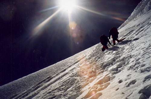
Slope on the upper section of Copa
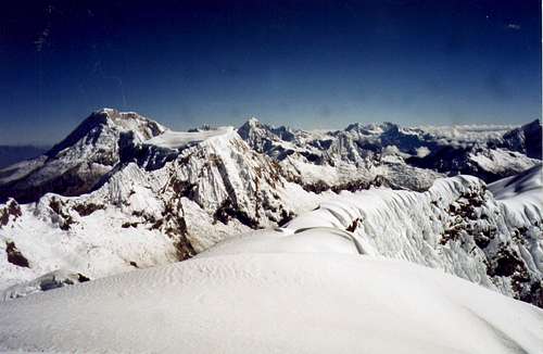
View from the summit of Copa
Climbing

Crevasses on the upper section of Copa

Mount Copa as seen from the east
From here find the path of least resistance through the couloir. In the late '90's this was towards the left side. Gaining the plateau at 5100m skirt the worst of the crevasses gaining good campsites if you would like to camp here before proceeding to the summit. Depending on how the crevasses are, from here a large crevasse can be skirted on the right (late 90's beta nd it will change). From here follow the right side of the broad gentle slope, until it becomes very steep. Continue up left up the steep slope, skirt around a few crevasses, and the ridge will narrow forcing you to turn left as you gain a short, moderate slope leading to the final summit ridge.
Red Tape
Mount Copa, as most of the peaks in Cordillera Blanca, is located within Huascarán National Park. The entrance fee for more than 1 day is 65 soles (19.50 USD approx.), and it is valid for a month.
Further Reading
- Biggar, John. (2015). The Andes: A Guide for Climbers. Andes.
- Johnson, Brad. (2009). Classic Climbs of the Cordillera Blanca, Peru. Peaks & Places Publishing. -- Accurate info on approach.
- Oesterreichischer Alpenverein. (2005). Alpenvereinskarte 0/3a. Cordillera Blanca Nord (Peru). 1:100 000.