
-
 7089 Hits
-
 85.36% Score
-
 20 Votes
|
|
Mountain/Rock |
|---|---|
|
|
45.85911°N / 7.11845°E |
|
|
Mountaineering |
|
|
9888 ft / 3014 m |
|
|
Overview
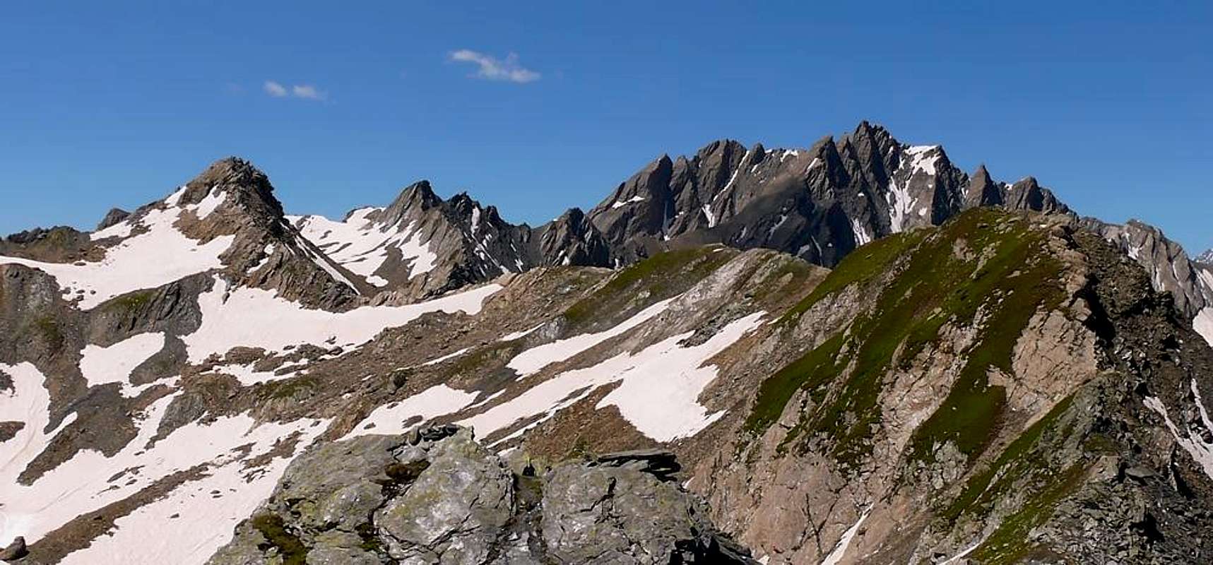
Situated on the border ridge between the Gran San Bernardo pass (2.469m) and the Grand Golliaz (aka Golliat) (3.237m), the highest summit before the Mont Blanc Group. Famous ski-mountaneering goal with a good hiking possibility along its Eastern side. Wonderful panorama over Mont Dolent, Tour Noire, Aiguille de l'Argentière, Swiss Val Ferret, Grand Combin, Mont Vélan and Mont Gèle.
Montagna posta sulla cresta di confine tra il Colle del Gran San Bernardo (2.469 m) e il monte Grand Golliaz o Golliat (3.237 m), vetta più elevata prima della Massiccio del Monte Bianco. Gita sci-alpinistica ormai conclamata con ottime alternative escursionistiche per il suo versante Est. Bellissimo panorama sul Mont Dolent, Tour Noire, Aiguille de l'Argentière, sulla Val Ferret Svizzera, Grand Combin, Mont Vélan e Mont Gèle.
First Ascents
- First on the summit: J. L. Tod-Mercer and Giuseppe Perrod, (Aug 02th, 1899).
- In winter: Unknown.
- E Slope (normal route): J. L. Tod-Mercer and Giuseppe Perrod, (Aug 02th, 1899).
- S-SW Slope: Unknown.
- E-SE Arête (from Saint Rhémy Pass): Osvaldo Cardellina, (Sep 24th, 2000).
- E-SE Arête: Ch. de La Harpe, Louis and Marcel Kurz, (Aug o4th, 1901).
- N-NW Wall: Unknown.
- N-E Arête: Osvaldo Cardellina and Emilio Bertona, (Sep 10th, 2000).
Getting There
BY CAR:- From Torino, Milano, etc: motorway A5. Exit Aosta Est.
- From Switzerland: through the Grand St. Bernard Tunnel or the homonym pass.
- From France: through Mont Blanc Tunnel or Petit St. Bernard Pass. It isn't necessary to enter in motorway A5, you can drive through SS.26 Aosta direction.
- Aeroporto "Corrado Gex" Saint Christophe (Aosta).
Itinerary
From Aosta (583m) along the SS.27 of Gran San Bernardo, and, after passing Gignod (988m), Etroubles (1.264m), and Saint Oyen (1.373m) leaving to the left the road to the Tunnel, go toward Saint Rhémy en Bosses (1.632m) along the valley leading to the Pass. After many hairpin bends you get the Pra di Arc Pasture (1.992m) where you start, on foot, the climb to the Aiguille de Leisasse.Dalla Città di Aosta (583 m) salire lungo la SS.27 del Gran San Bernardo, e, dopo aver superato i Paesi di Gignod (988 m), Etroubles (1.264 m), e Saint Oyen (1.373 m), lasciare sulla sinistra la strada che porta al Tunnel del Gran San Bernardo. Salire verso Saint Rhémy en Bosses (1.632 m) continuando lungo il vallone che porta al Colle, dopo numerosi tornanti si raggiunge l'Alpeggio di Pra di Arc (1.992 m), dove inizia la salita All'aiguille de Leisasse.
Route
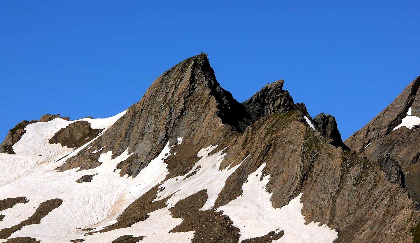
From the hairpin (2.079m), west of Pra di Arc Pasture (1.992m) follow the stream on the bottom of the valley and, after passing some ruins, follow a secondary small valley ending with a debris channel leading to the Colle del Fourchon. After crossing the Summits 2.833m - 2.880m - 2.908m you get the aerial and panoramic summit (3h'00).Descent along the S ridge and a steep channel to the East.Dal tornante (2.079 m) ad ovest dell'Alpeggio di Pra di Arc (1.992 m) seguire il corso d'acqua sul fondo del vallone e, dopo aver superato alcuni ruderi, continuare in un valloncello secondario fino a raggiugere per un ripido canalino detritico il Colle del Fourchon. Dopo aver superato le Quote 2.833 m -2.880 m -2.908 m si raggiuge l'aerea e panoramica vetta (3h'00). Discesa dalla cresta Sud e per un ripido canalino ad Est.
Difficulty
F+PD- (some exposure here and there).Da Escursionismo.
Campings
Remember that free camping is forbidden (except for emergency reasons, over 2.500m, from darkness until dawn).Mountain Conditions
- You can get meteo information at the official site of the Regione Valle d'Aosta:
- Valle d'Aosta Meteo
Webcam
- WEBCAM on Aosta Valley:
- Webcam
Books and Maps
BOOKS:- "Guida delle Alpi Occidentali", di Giovanni Bobba e Luigi Vaccarone C.A.I. Sezione di Torino Volume II (parte II), 25 Maggio 1896.
- "Guida dei Monti d'Italia-Alpi Pennine" (Vol. I°) di Gino Buscaini-Club Alpino Italiano/Turing Club Italiano, Luglio 1971 (in Italian).
- "Diari Alpinistici" di Osvaldo Cardellina e Indice Generale accompagnato da Schedario Relazioni Ascensioni 1964-2019 (unpublished).
- "Pelli di Foca in Valle d'Aosta", di Franco Lenzi Editoriale Pedrini,Torino 1988.
- "Guides des Alpes Valaisannes", C.A.S. volume I°, 1963.
 |
 |
- Kompass "Monte Bianco Valle d'Aosta Sentieri e Rifugi" Carta turistica 1:50.000.
- L'Escursionista "Gran San Bernardo Ollomont" Ed. Rimini (n° 5) 1:25.000.
- I.G.C. Istituto Geografico Centrale Torino "Massiccio del Monte Bianco" (n° 4), Torino, 1998 1:50.000.
- Studio F.M.B. "Monte Bianco-Mont Blanc", Bologna 1988 1:50.000
Important Information
- REGIONE AUTONOMA VALLE D'AOSTA the official site.
- FONDAZIONE MONTAGNA SICURA Villa Cameron, località Villard de la Palud n° 1 Courmayeur (AO) Tel: 39 0165 897602 - Fax: 39 0165 897647.
- SOCIETA' DELLE GUIDE DELLA VALPELLINE Etroubles-Strada Nazionale, n° 13 - Tel +39 0165 78559 - Valpelline-Loc Capoluogo, n° 1 - Tel +39 0165 713502 (AO) Italia.
- A.I.NE.VA. (Associazione Interregionale Neve e Valanghe).
Useful numbers
- Protezione Civile Valdostana località Aeroporto n° 7/A Saint Christophe (Ao) Tel. 0165-238222.
- Bollettino Meteo (weather info) Tel. 0165-44113.
- Unità Operativa di Soccorso Sanitario Tel. 118.