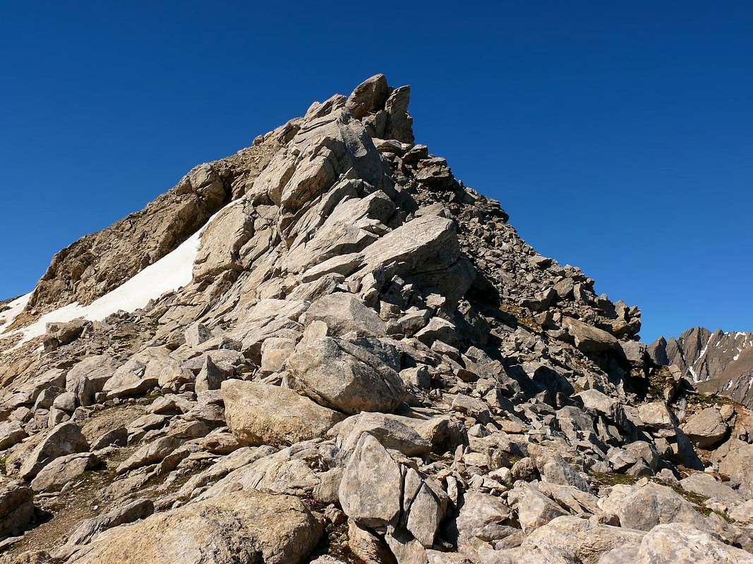
From Southern side it looks like a pitchfork, it is the main summit of the Arête de Vans, very popular for hiking and ski-mountaneering. From its summit great views on Mont Blanc Group, on Grand Combin, on Vaud Alps and, of course, on the close Grand Golliaz.
Montagna a forma di forcone se vista dal lato meridionale; punto culminante dell'Arête de Vans, molto frequentata per l'escursionismo e lo sci alpinismo. Dalla sua sommità si gode una splendida veduta dalla Catena del Monte Bianco, Grand Combin, Alpi del Vaud e sul vicino Grand Golliaz.
First Ascents
First on the summit: Unknown.
In winter: Unknown.
Getting There
BY CAR:
From Torino, Milano, etc: Motorway A5. Exit Aosta Est.
From Switzerland: through the Grand St. Bernard Tunnel or the homonym pass.
From France: through Mont Blanc Tunnel or Petit St. Bernard Pass. It isn't necessary to enter in Motorway A5, you can drive through SS.26 Aosta direction.
BY PLANE:
Aeroporto "Corrado Gex" Saint Christophe (Aosta).
Itinerary
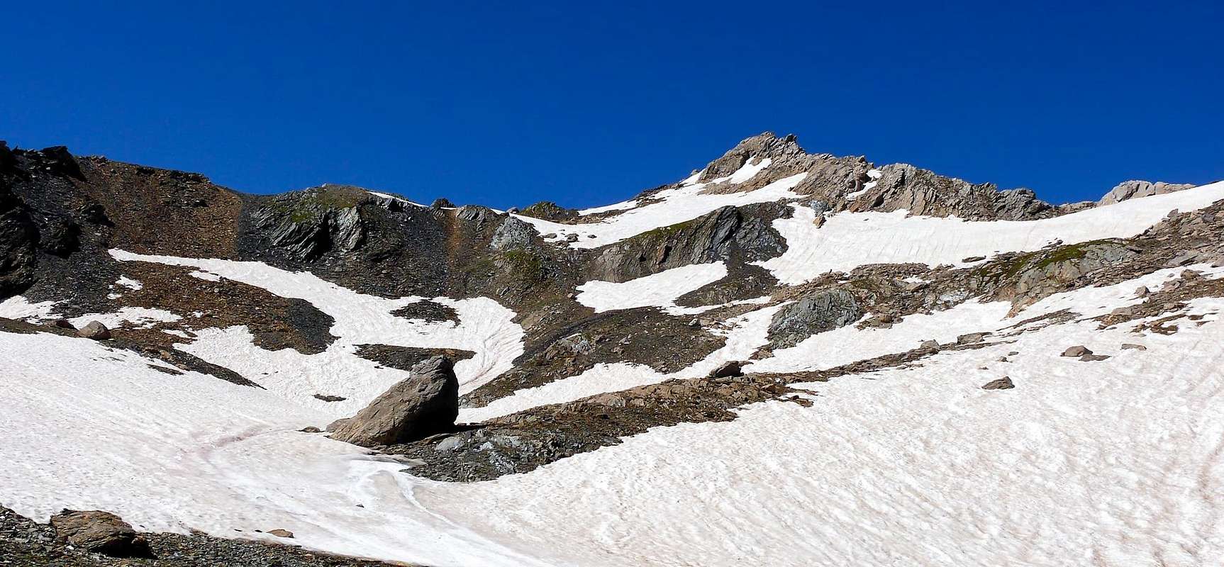
From Aosta (583m), along the SS.27 of Gran San Bernardo, pass through the small Towns of Gignod (988m), Etroubles (1.264m) and Saint Oyen (1.373m) and, leaving on the left the Gran San Bernardo Tunnel road, follow toward Saint Rhémy en Bosses (1.632m) along the road in the valley leading to the pass. After many hairpin bends, passing the Pra di Arc (1.992m) Pastures and the Cantina Reggia Dogana (2.203m), you get the small car parking area near the Alpe Baou (2.356m) wherefrom the route to Mont Forchon starts.
Dalla Città di Aosta (583 m) salire lungo SS.27 del Gran San Bernardo, e, dopo aver superato i Paesi di Gignod (988 m), Etroubles (1.264 m), e Saint Oyen (1.373 m), lasciare sulla sinistra la strada che porta al Tunnel del Gran San Bernardo. Salire verso Saint Rhémy en Bosses (1.632 m) continuando lungo il vallone che porta al colle; dopo numerosi tornanti si supera l'Alpeggio di Pra di Arc (1.992 m), la Cantina Reggia Dogana (2.203 m) e, raggiunto un piccolo parcheggio nei pressi dell'Alpe Baou (2.356 m), si inizia la salita al Mont Fouchon.
Route
From Alpe Baou (2.356m), to the left up to the fork leading to the Fenêtre de Ferret (2.685m), turn to the left, cross the stream and follow toward the wide open valley under the Pain de Sucre (2.919m) and the Mont Fourchon (2.902m). Now, to the left on little marked and steep tracks up to the wide ridge. Turn to the right and, on easy but somewhere exposed rocks, straight to the summit (2h'30/3h'00).
Dall'Alpe Baou (2.356 m), innalzarsi sulla sinistra sino a raggiungere il bivio che conduce alla Fenêtre de Ferret (2.685 m); svoltare sulla sinistra e, dopo aver oltrepassato il torrente, dirigersi verso l'ampio e aperto valloncello sottostante il Pain de Sucre (2.919 m) e il Mont Fourchon (2.902 m). Da questo punto, sempre a sinistra, su tracce di sentiero ripide e poco evidenti si raggiunge la larga cresta; svoltare decisamente a destra e su facili rocce, però abbastanza esposte, si guadagna la vetta (2h'30/3h'00).
Difficulty
F+ (some exposure here and there).
F+ (tratti esposti).
Gear
Hiking gear.
Da Escursionismo.
Campings
Remember that free camping is forbidden (except for emergency reasons, over 2.500m, from darkness until dawn).
Mountain Conditions
You can get meteo information at the official site of the Regione Valle d'Aosta:
FONDAZIONE MONTAGNA SICURA Villa Cameron, località Villard de la Palud n° 1 Courmayeur (AO) Tel: 39 0165 897602 - Fax: 39 0165 897647.
SOCIETA' DELLE GUIDE DELLA VALPELLINE Etroubles-Strada Nazionale, n° 13 - Tel +39 0165 78559 - Valpelline-Loc Capoluogo, n° 1 - Tel +39 0165 713502 (AO) Italia.
A.I.NE.VA. (Associazione Interregionale Neve e Valanghe).
Useful numbers
Protezione Civile Valdostana località Aeroporto n° 7/A Saint Christophe (Ao) Tel. 0165-238222.
Bollettino Meteo (weather info) Tel. 0165-44113.
Unità Operativa di Soccorso Sanitario Tel. 118.
Acknowledgements
I am greatly indebted to my friend "Osva" for the detailed description of the route. In addition I want to thank Gabriele Roth for the translation of the text from italian.
Parents refers to a larger category under which an object falls. For example, theAconcagua mountain page has the 'Aconcagua Group' and the 'Seven Summits' asparents and is a parent itself to many routes, photos, and Trip Reports.

 7365 Hits
 87.31% Score
 24 Votes