
|
|
Mountain/Rock |
|---|---|
|
|
40.83100°N / 106.663°W |
|
|
Hiking, Mountaineering, Trad Climbing, Toprope, Bouldering, Scrambling, Skiing |
|
|
Summer, Fall |
|
|
12180 ft / 3712 m |
|
|
Overview
Simply put, Mount Zirkel is one of the best mountains in Colorado. At 12,180 feet, it is the high point in Colorado's Park Range, Routt County, and its namesake wilderness. It also ranks number fourteen among Colorado's most prominent peaks. A decent number of accolades for a mountain in a state which contains over 1,000 higher peaks.
German geologist Ferdinand Zirkel did some work in the area and his name is attached to the mountain and the wilderness that encompasses it. A fitting name for an area with some geologic character. Glacially carved cliffs lead upwards to broad alpine plateaus larger than maps would lead one to believe. Lower down, streams, lakes, and meadows are the rule and make the wilderness a popular destination for hikers, fishermen, and hunters.
In 1997 a severe wind event blew down millions of trees in the area. Forest fires and an epidemic of pine beetles soon followed. Some trails in the area are still affected by the downfall. Standing victims of the fires and beetles abound. The large number of beetles in the trees has also made the area a popular destination for woodpeckers who can be observed working their unique craft.
The normal route for climbing Zirkel is an approach up Gold Creek to Red Dirt Pass and then a hike over the peak's summit plateau followed by a short class two scramble to the top. Other approaches to the plateau are possible from different drainages to the east and west. The north ridge looks like it would go with a bit of tougher climbing right at the top. The east and west faces harbor potential for steep climbs on snow and rock.
Park Range: 11,000+ Foot Peaks with 300+ feet of Prominence
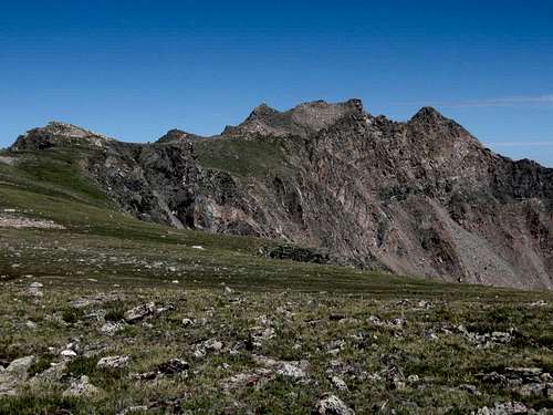
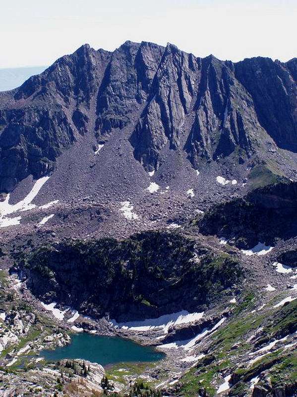 West face of Mount Zirkel from the summit of Big Agnes.
Getting There
Slavonia Trailhead
From Steamboat Springs head two miles NW on US 40 to CR 129 (Elk River Road) and turn right at the stoplight. Head about eighteen miles north, past Clark, to Glen Eden, and turn right again at Seedhouse Road ( AKA CR 64 and FR 400) and follow the road and signs ten miles to the trailhead. Seedhouse Road is passable for passenger cars to the trailhead.
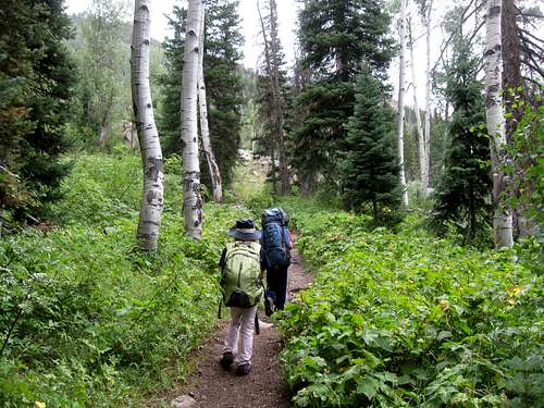 Gold Creek not far from the trailhead.
Routes Overview
Mount Zirkel offers a variety of routes that will suit hikers and climbers of various experience levels.
The standard and the easiest route to Mount Zirkel is the Slovenia Basin/Red Dirt Pass Route. While this route has few technical difficulties, it does have two river crossings which can be very challenging into early August.
This route is class 2 in difficulty and 17.2 miles round trip with about 3800 feet elevation gain. See the route page for details.
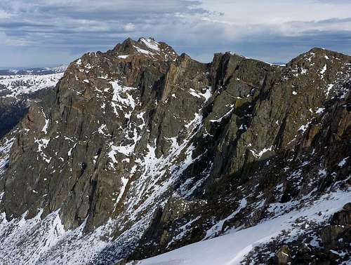
 The final section of the route up Mount Zirkel from Red Dirt Pass.
The second most popular and second easiest route up Mount Zirkel is the Gilpin Creek Route. This route is slightly shorter and slightly harder than the Slovenia Basin/Red Dirt Pass Route. From Gilpin Lake, this route climbs Point 12006 and then follows the ridge north to the summit.
 Mt Zirkel from Pt 12006.
Other Routes
Red Dirt Pass can also be climbed from the east via the little used Frying Pan Basin trail and route. Much of the trail has faded away, but it would be a good route for those seeking solitude.
The West Face of Mount Zirkel offers many steep snow and ice couloir routes as well as many fine rock climbs. Unlike most other ranges in the area, the rock here is relatively solid and many spectacular, but seldom done rock routes have been established here.
The East Face also holds potential for more difficult routes as well, but doesn't appear to be as solid as the west face.
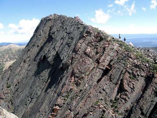
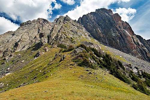
 The Upper Southeast Ridge of Mount Zirkel. The East Face is to the right.
Red Tape
No permits are reqired. Standard wilderness regulations apply.
Additional Regulations:
Camping is prohibited within 100 feet of any trail, wilderness lake or stream. Camping is prohibited within 1/4 mile (1320 feet) of Gilpin Lake, Gold Creek Lake and Three Island Lake. Camping, leaving camping equipment or personal property or otherwise occupying national forest system lands for a period longer than 14 days within a 30-day period on a ranger district is prohibited. Camping within 200 feet of a posted sign reserving a site for a commercial outfitter is prohibited.
Storing equipment, personal property or supplies is prohibited within the wilderness for more than 14 days within a 30-day period, including time the area was used for camping.
Building, maintaining, attending or using campfires is prohibited within 100 feet of any trail, wilderness lake or stream. Building, maintaining, attending or using campfires is prohibited within 1/4 mile (1320 feet) of Gilpin Lake, Gold Creek Lake and Three Island Lake.
Dogs must be leashed or under control.
Possessing, discharging or using any kind of firework or pyrotechnic device is prohibited.
The maximum group size is a combination of 25 persons and/or pack/saddle animals, with the maximum number of persons being 15.
Shortcutting switchbacks is prohibited.
 Make sure to tread lightly in this beautiful area.
When To Climb
August and early September is the most popular time to climb here. July is fine too, but this area gets more snowfall than anywhere else in Colorado, so winter snows tend to stay late and through most of July. Stream crossings can be very problematic in June and July.
June and July would be the ideal time of year for the west side couloirs and other snow routes.
Fall is a fine season as well, but wear blaze orange during the hunting season. Big snowfalls usually don’t come until late September or early October.
Winter ascents of Mount Zirkel are certainly possible, though it’s a long trek in when the road is closed. Because of heavy snowfall, trail breaking will not be easy and be aware of avalanche danger. For the well prepared climber, a winter ascent would prove a worthy challenge.
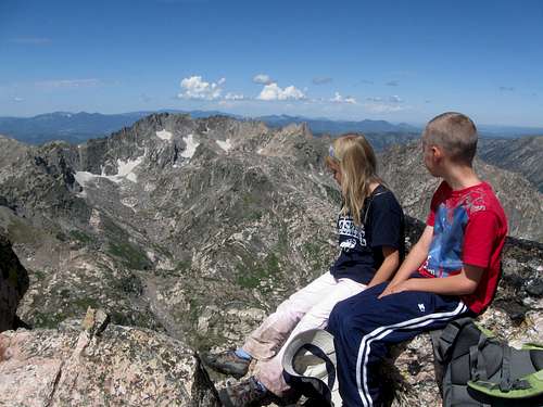 The summit of Mount Zirkel on July 28 2012. 2012 was an extreme drought year, so usually there is much more snow in the mountains.
Camping
There are several developed campgrounds along Seedhouse Road for those making the standard approach.
Gold Creek, Slovenia Basin and Gilpin Creek all have good campsites, but camping is not allowed within 1/4 of a mile of Gold Creek Lake and Gilpin Lakes.
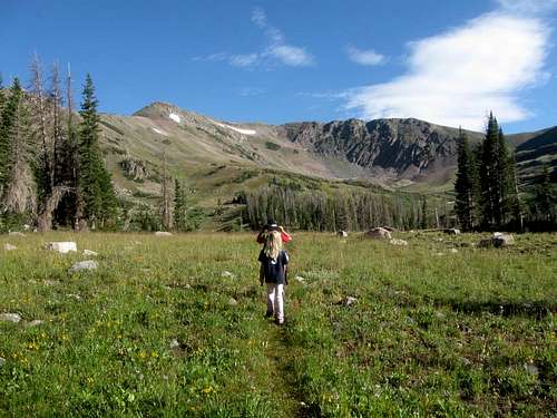 Upper Slovenia Basin.
Mountain Conditions
For current information, contact:
HahnsPeak/Bears Ears Ranger District
925 Weiss Drive
Steamboat Springs, CO 80487-9315
970-879-1870
FAX 970-870-2284
CLICK HERE FOR THE WEATHER FORECAST FOR MOUNT ZIRKEL
Below is the National Weather Service Climate Summary of Steamboat Springs. The data is from 1908-2012. This is the closest long term weather station, but be aware that higher elevations will be much wetter and colder. Steamboat Springs is at 6695 feet elevation, so expect the temperatures on Mount Zirkel to be 15-20 degrees colder than in Steamboat (except for cold winter nights).
| MONTH | AVE HIGH | AVE LOW | REC HIGH | REC LOW | AVE PREC (in) |
| JAN | 29 | 1 | 57 | -54 | 2.47 |
| FEB | 34 | 4 | 59 | -48 | 2.24 |
| MAR | 42 | 13 | 70 | -34 | 2.11 |
| APR | 54 | 24 | 79 | -15 | 2.28 |
| MAY | 65 | 31 | 88 | 8 | 2.08 |
| JUN | 75 | 36 | 96 | 19 | 1.49 |
| JUL | 82 | 41 | 97 | 25 | 1.54 |
| AUG | 80 | 40 | 98 | 20 | 1.60 |
| SEP | 72 | 33 | 93 | 6 | 1.81 |
| OCT | 60 | 24 | 89 | -16 | 1.89 |
| NOV | 43 | 14 | 72 | -28 | 1.97 |
| DEC | 31 | 3 | 64 | -44 | 2.38 |