
-
 48159 Hits
-
 97.38% Score
-
 68 Votes
|
|
Mountain/Rock |
|---|---|
|
|
46.43600°N / 13.43630°E |
|
|
Mountaineering, Trad Climbing, Scrambling, Via Ferrata |
|
|
Summer, Fall |
|
|
9035 ft / 2754 m |
|
|
Overview
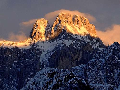 Montaz summit from the west
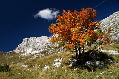 Gangolf Haub - Autumn view (southern side)
  Yet another view from Pecol meadow
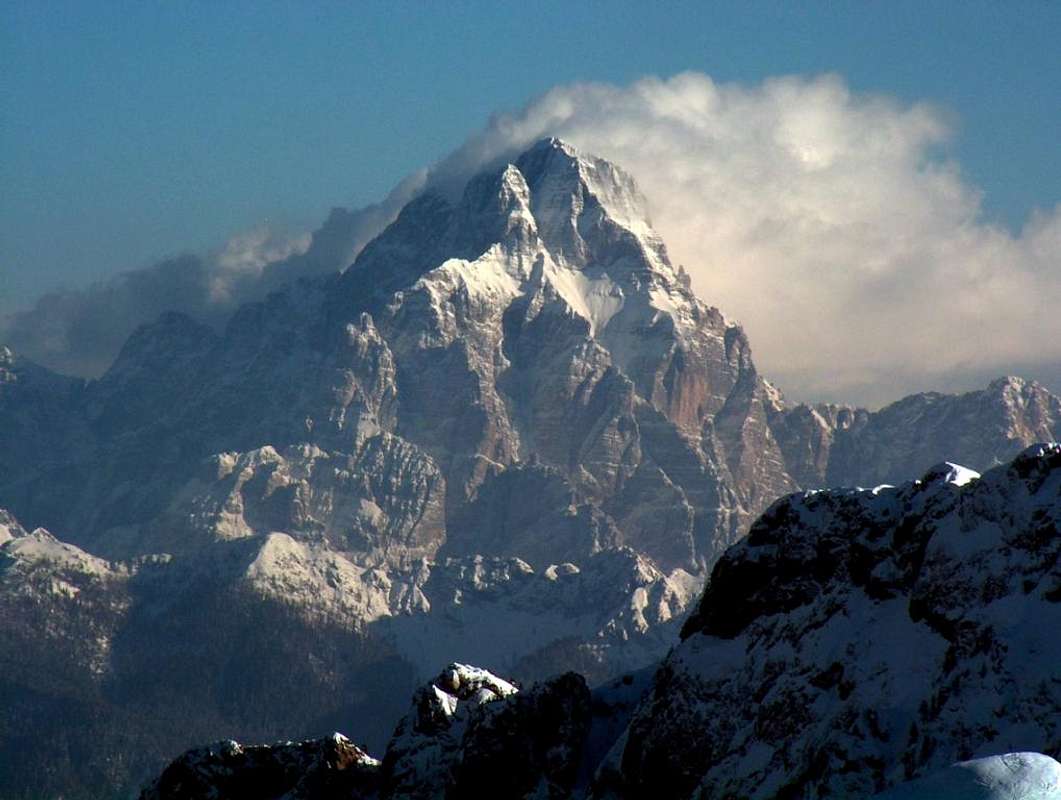
 From the distance (NW)
 haubi - Horizontal limestone strata
The Name
The name of our mountain is pronounced Montazh. It is in Friulian language (which has also a character for zh - i.e. z with a circumflex) and also we Slovenians call it so several times. Otherwise the original Slovenian name is Špik nad Policami (the cone peak above bands).
Montaz Gets Presented
Montaž is a magnificant mountain, one of most remarkable landmarks in Julian Alps. When the poet of Julian Alps (and a distinguished alpinist and explorer) Julius Kugy was asked if in comparaison with Triglav (Eastern Julian Alps) he would consider Western Julian Alps with Montaž as more remarkable, he hesitated a little. All right, his famous answer then was: "Triglav is not a mountain, it is a kingdom", but this illustrates how close in his priority list Montaž was. And indeed on Montaž Kugy did a great job, opening many new routes in summer and winter time.
As all main Julian Alps peaks also Montaž has high, steep dolomitic and limestone walls, beautifully rising above deep green valleys. Montaž lies at the end of a long crest, arriving (or going to) from the south east. Towards the north its huge walls fall about 1100 m towards Zajzera (Valbruna) valley and altogether 1700 m to the end of the road on beautiful alpine meadows. Towards the south first steep rocky walls fall around 600 m to a plateau with high alpine meadows (Altipiano del Montasio), after which steep slopes, covered with woods fall again 900 m in the depths of Raccolana / Reklanica valley. It is no doubts the western side of the mountain which is the most beautiful one. Like a strong deer horn, made of white limestone, falls the western wall more than 1600 m down into the wild Clapadorie gorge. If you travel by car or train through Val Canale and have luck to catch in few seconds the view to Montaž, you will hardly recover from this breath-taking experience - the experience which also Kugy described so beautifully. But driving up the valley of Dogna/Dunja by car, you have the west walls of Montaž all the times in front of you. Towards the east and later south-east a long crest goes. By it one of the most beautiful ferrattas in Julian Alps goes, visiting several high peaks.
The summit of Montaž is mostly climbed in summer. The winter ascent is a difficult alpine endeavor. But because of its marked routes and a suitable trailhead on Pecol meadow, Montaž summit is also highly desarable and in summer the tour is also quite frequently done. In spring, southern meadows (till the rocky section or from the notches in the main ridge) offer also nice possibilities for tour skiing.
Geology
Montaž is interesting also due to its geological composition. The big majority of the mountain (and its crest towards the SE) is made of triassic dolomia principale. If you have a look on the top leftmost picture, these are the sheer rocks from Dogna valley up to the big ledge (Grande Cengia), approximately where the border of light lies. But the upper part of the mountain is made of a bit younger (also triassic) dachstein limestone. Climbing up by Findenegg couloir you will notice characteristic, more distinct horizontal strata and also the rock is more friable. These characteristics can be noticed on all the summits of the SE crest as well. It is worth mentioning also that the nice landscape of the southern terrace (Altipiani del Montasio) was made by glaciers, carving those slopes. Also the deep valleys around Montaž were significantly carved by big glaciers. Remember - in times of biggest glaciation the whole area was covered by up to 1500 m thick glaciers, so that only the highest summits were peeking out.
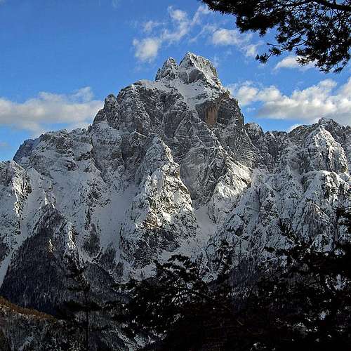
Portraits of Montaž
|
MONTAŽ
From all sides Montaž looks like a strong, limestone fortress. |
||
 from the NW
 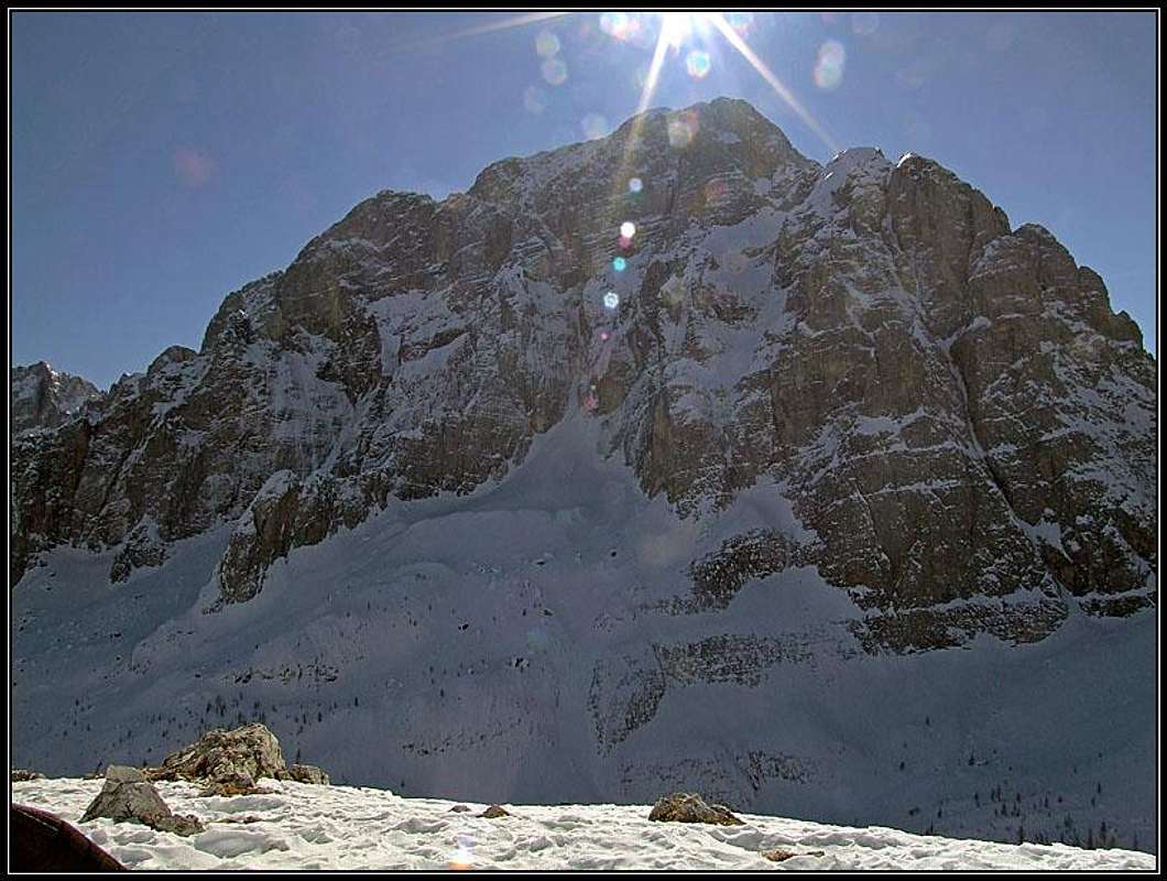 from the N
 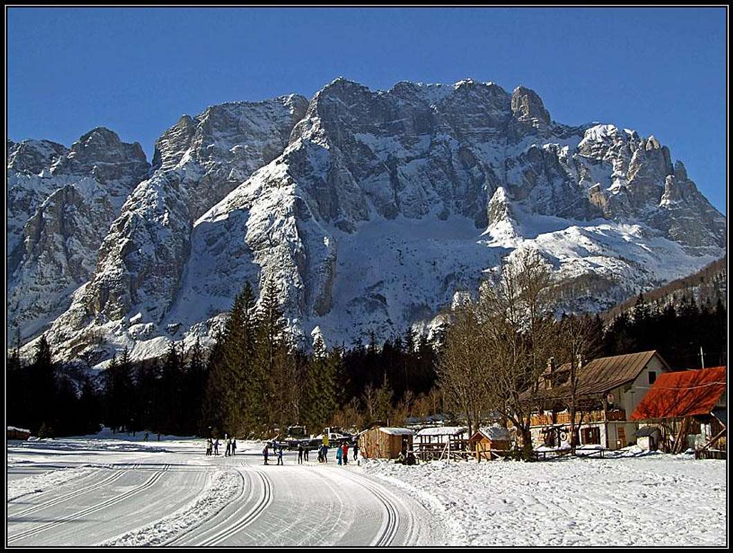 from the NE
 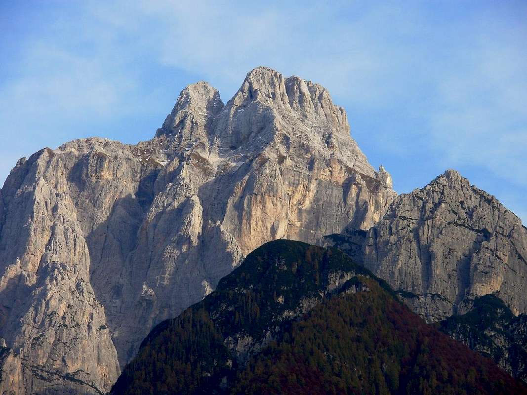 from the W
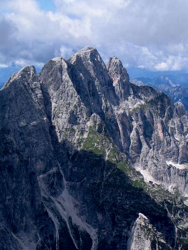
 from the SW
 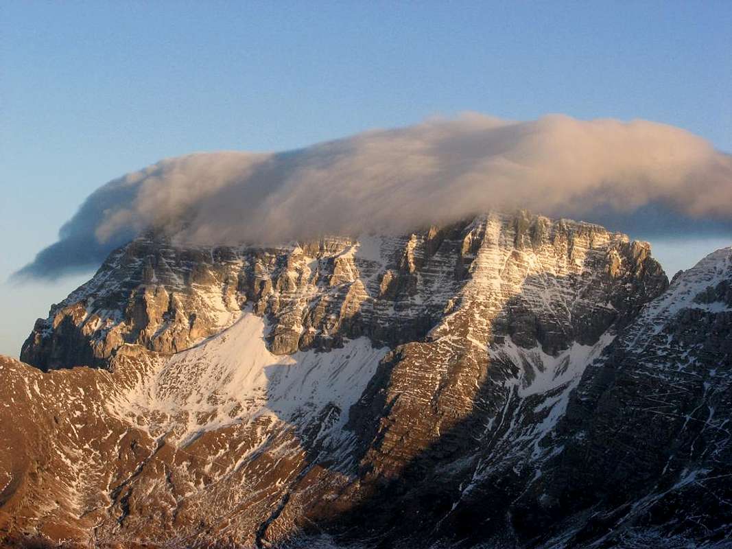 from the S
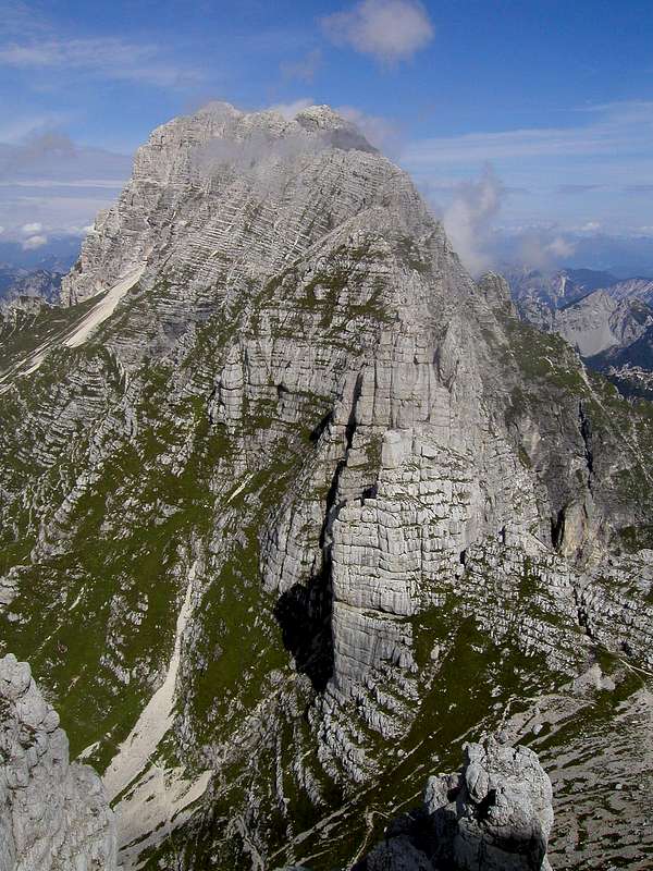
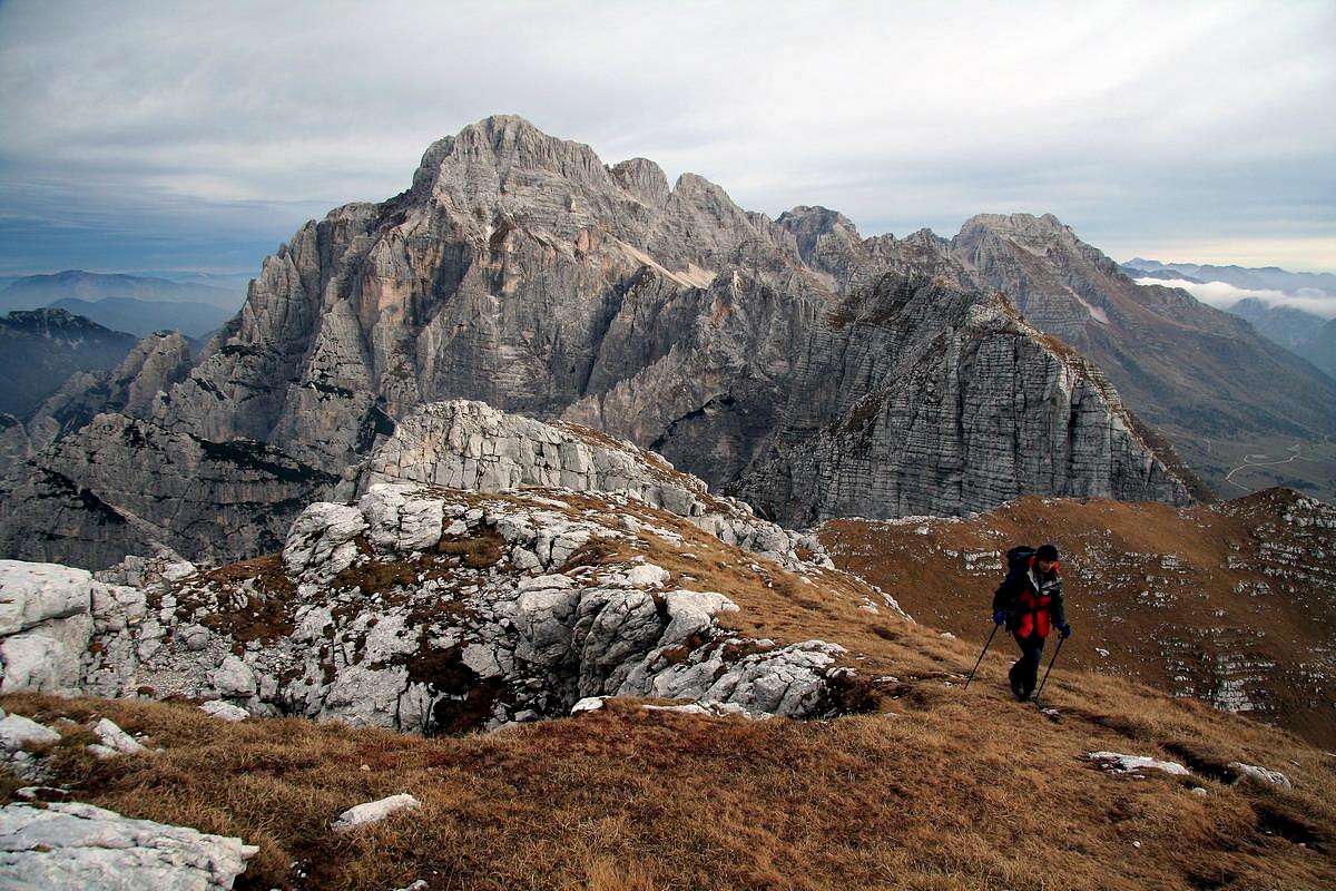
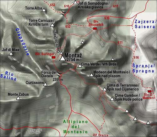
Other Summits of the Narrow Group
 Torre Carnizza / Krnični turn
 Cima Verde / Vrh Brda
Montaž as a mountain is very broad and complex, so a few peaks, rising on its ridges are quite independent summits. One such is the hardly approachable northern tower - Torre Nord / Nordturm, 2680 m. East of the main summit, at the end of the summit ridge is Cima Verde / Vrh Brda, 2661 m. This fine panoramic peak can be quite easily reached (a short scramble) from the eastern variant of the normal south approach. Even further towards the SE stands Modeon del Montasio, 2573 m, a very sharp and hardly reachable rock structure, which even ferratas, going by the whole SE ridge, avoid. Other summits in the SE are already more remote and can be considered independent. On the side ridges, which fall down in the surrounding valleys, there are a few peaks, which also have names. But they are less important. Especially the northern ridge consists of several peaks, that is why it is called Cresta dei Draghi - the Dragon Crest. Such towers are: Torre Alba, Torre Carnizza, Torre Amalia. From the N wall a side crest goes in the NE direction, finishing below with Torre Paliza. Such a strong ridge goes towards the NE also from Cima Verde. It finishes above Saisera with Torre Genziana. Between the N crest and Torre Paliza there is a dark corner, hosting a small, decaying glacier. As elsewhere in Europe, glaciers in Julian Alps are disappearing. The glacier of Montaž is important to be considered if you attempt the direct northern ascent (Kugy route), which starts from this glacier. The bergschrund can often make quite some difficulties and due to low level of snow, the first pitches of the route are quite hard.
A short alpine history
 The north-western side
The summit of Montaž was long considered as unreachable, but anyway all major routes were done in the classical age of alpine history.
First ascents
The first ascent was done on August 18th, 1877 by Findenegg and Brussofier from the Sella Nevea (southern) side and then over the upper part of the west wall (through today called Findenegg's couloir). The west wall above the Dunja valley was first climbed in 1882 by count Brazza & Co. (he also found the route of today's normal southern approach), Siega and Marcon in 1882.
The Direct north route
The majority of northern approaches was discovered by the great explorer of Julian Alps Julius Kugy, of course always with his excellent local guides: Komac, Ojcinger and Pesamosca. His direct approach over the north wall was one of heroic episodes of classical alpine age. It was August 24th, 1902. A very difficult route was climbed (only by fair means, of course) but on the hardest part the first climber, guide Ojcinger, got stucked. He couldn't proceed, nor retreat. In case of his fall, all climbers would fall several hundreds of meters. The only possibility was, that the second guide, the strong Jože Komac unroped and climbed by an even harder, parallel passage. Seconds of tension prolongated into minutes, Ojcinger was keeping himself only with last bits of power, every few minutes Kugy sent him a calm, encouraging message, and finally the head of Komac appeared above him and the strong hand rescued all three lives. Today this passage is named Passo Ojcinger, but many think that actually it should be named Passo Komac. Unfortunately, later this route was artificially secured with pegs and cable ropes, but it still today represents a hard ascent. The first winter ascent was done by J. Kugy, A. Ojcinger and G. Pesamosca on February 6th, 1905.
Skiing
Ski descents over the W wall and to the N (Via Amalia) were done at the end of 20th century (Mauro Rumez). In 2009 Luca Vuerich did the first ski descent over the S face.
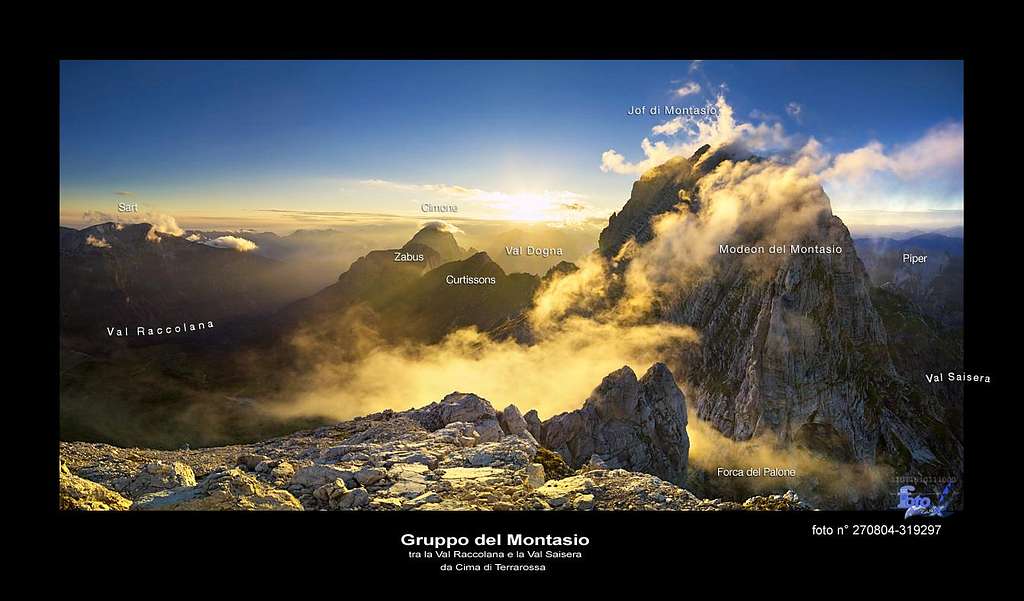
Summit Panoramas
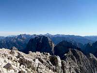
Surpassing all its neighbours so much, Montaž is well known by its immense panorama. Julian Alps on the East, Carnic Alps and Dolomites on the West, Hohe Tauern and Gailtal Alps on the NW and North, and considerably lower summits towards the South, where Alps lower down to the Po river plane. The most beautiful are the views in depths and the ridges of Montaž and Viš group itself.
 Towards the SW Towards the SW |
 Towards the E Towards the E |
 Saisera over the N walls Saisera over the N walls |
Getting There
The approach valley to the Western Julian Alps will probably be the highway through Val Canale (Udine - Tarvisio). But of course it doesn't reach the heart of this mountain group.
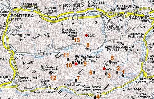
1. For the southern ascent you must deter from the highway in Chiusaforte and travel through Raccolana / Reklanica valley to Sella Nevea (Nevejsko sedlo) pass, 1142 m. This pass can also be reached from Tarvisio towards the south through Valle Rio di Lago (Jezerska dolina). On Sella Nevea you turn towards the north-west and drive by a narrow alpine road to Malga Pecol, 1520 m.
2. For the western ascent (it is extremely rarely done) you deter from the highway towards the east in Dogna and drive through the Dogna (Dunja) valley towards Sella di Somdogna (Rudni vrh) pass, 1398 m. The trailhead starts down in the valley.
3. For the northern ascent you deter from the highway some seven kilometers west of Tarvisio and drive south into Valbruna (Zajzera) valley. The road ends on an alpine meadow on the altitude of 1000 m. Tarvisio and Valle Rio di Lago (Jezerska dolina) can also be reached from the east, from Slovenia (from the Sava valley or over Predel (Predil) pass and of course also from the north, from Austria (from Villach).
Maps: Tobacco Map 019 - 1:25.000 - Alpi Giulie Occidentali Tarvisiano. Julijske Alpe - Zahodni del (Western part). Planinska zveza Slovenije. 1:50.000.
Routes Overview
 West face
Hikes, Ferratas and Easy climbs
Here is a short list of marked and secured routes. See more details in their descriptions.
Normal south ascent
This is the usual and easiest ascent on top. Route description here. The route is a medium hard marked path, protected on many places and also requiring some easy climbing. The ascent on the east ridge has two variants. One goes over the so-called Pipan's ladder - a 60 m high, completely vertical ladder. 3 h 30 min for ascent, 3 h for descent.
 |
 |
 |
Ferrata Leva
This route does not go on top of Montaž, but rather crosses the slopes of the nearby Cima di Terra Rossa. It is a medium hard ferrata, very picturesque, if you use it for the ascent on Montaž, it is about 1 h longer than the normal ascent, finally bringing you on the southern route below Pipan's ladder.
 |
 |
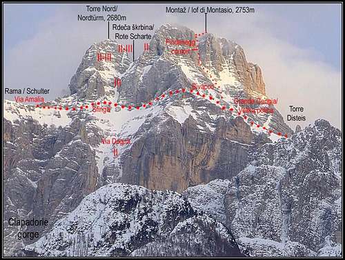
Findenegg Couloir
This route. goes on top from Suringar bivouac. It can be reached either from the south (Forca del Disteis) or from the north (Via Amalia). Amalia is a hard ferrata. The upper part of the west wall is a steep couloir, through which a marked ascent goes (UIAA I.-II.). From the south 4 h for ascent. From the north 6 hours for ascent.
 |
 |
Via Amalia
As said this route is the easier of the two northern approaches, but still a hard ferrata. The route is called also as the 'Route of Italian Hunters'. Some 6 hours on top.
 |
 |
Kugy route
This is the direct ascent from the north, first done by J. Kugy and his guides on August 24th, 1902. Already in 1910 it was secured into a protected route (on Kugy's big dissatisfaction). But since 1960 security devices were not renewed any more. Especially they are devastated in the lowest part, above and in the crux (Passo Oitzinger) it's better. Even if it is protected, it is today considered to be a quite demanding clibing route (UIAA III+/III, II). Cca 6 hours, 700 meters of a sheer wall. Even in summer the approach to the route requires crampons and ice axe.
 haubi - from the west
West approach from Dunja
Also this route over the west wall has several hundreds of meters of climbing of UIAA II degree. Altogether 1750 m, 7-8 hours for ascent, the whole tour 13-14 hours. If we summit Montaž from the north or west, we should consider our return. It is highly unlikely that we shall return on the same side of the mountain (this can be hardly done in one day). So if we shall descend by the south side, we shall find ourselves far away from the car, waiting probably in one of the other two valleys.
Normal Ski Tours
Montaž is not a mountain for easy tour skiing. All descents from it summit are hard alpinistic ski tours. Normal tour skiing is done from the notches above Pecol alpine meadow, from Forca del Disteis and from Forca del Pallone. Skiing is possible also on the northern side, from certain points above Saisera / Zajzera valley. In Saisera / Zajzera every winter they also arrange long tracks for cross country skiing.
War On High Mountains
 Montaz from Dogna/Dunja valley
In the World War I Italians were holding the summits: Iof di Miezegnot and all other summits of Catena di Malborghetto towards the west, Iof di Sompdogna and Montaž, while Austro-Hungarian army was holding Iof di Miezegnot Piccolo, Nabojs and Viš. Val Canale was very important for Austrians as it was openening, just like in the times of Ancient Romans or Napoleon, the door into Drau valley and further towards Vienna. Italian heavy guns in Dogna were strongly shelling the Austro-Hungarian positions and something had to be done. Engineer Ferdinand Horn, yes, that's the one who climbed solo the popular route on Jalovec, volunteered for the mission. With a few friends he ascended over no one's land above Saisera, just below the walls of Montaž's Dragon ridge. They just entered the walls and started to climb up, when an Italian patrol came below the walls. In a hard position they took shelter, then despite being in a crumbly terrain they climbed further up. Still unnoticed, they reached a notch in the ridge, from where they could clearly see the Italian positions in Dogna. Austro-Hungarian artillery started to shell. After each shot the Horn's group sent agreed light signals across Saisera valley towards Nabojs Notch, where observers caught them and then passed information further on. The artillery fire began more and more precise and Italian heavy guns were forever silenced one after another.
Red Tape
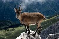 flow - Ibex
No limitations or special permits.
 |
 |
 |
 |
 |
When To Climb
 Velebit - Summer on the normal route
 Montaž in winter
Summer and autumn are the best seasons. In Julian Alps in summer a stable weather usually starts somewhere in July and months from August to October are the best. In early July on some parts of north and west routes dangerous snow rests can lie. For winter ascents you need full winter equipment. You'll probably come from Nevea pass, so tour skis will be a great advantage till the S walls. From there you go on foot to the top (exposed, good conditions required). Normal tour skiing from the summit of Montaž is not possible. All descents are hard and exposed alpinistic skiing endeavors. The slopes are constantly steep - above 45 degrees, while the hardest passages reach 55 degrees. Skiing through Findenegg couloir is possible, but then you must horizontally cross the 'Big Ledge', to come out on the S slopes. WebCam from south, from Nevejski preval/Sella Nevea: click here.
Camping
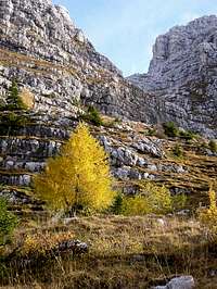 Lupino - 'Yellow Tree'
A one-day ascent is a hard endeavor (except from south) so around Montaz there are many alpine huts, which can be used. On the southern side:
- Rif. Brazza, 1660 m (parking place just below it).
On the northern side:
- Rif. Attillio Grego, 1385 m (parking place 400 m below it in Valbruna or on Sella di Somdogna, 15 minutes away).
- Bivacco Carlo Stuparich (bivouac), 1587 m, just below the north wall.
On the western side:
- Bivacco Muschi, 1955 m,
- Bivacco Suringar, 2430 m, (in the middle of the west wall).
 |
 |
 |
 |
Farewell
And finally, I would like to conclude this page with one of the most stunning pictures of Montaž. Thank you, Claudio
Outside links
- Montasio, sulla Nord del Drago - an excellent 30 min movie about Julius Kugy and his ascent on Montaž. In Italian language. FVG TV Regione Autonoma Friuli Venezia Giulia.
- Montaž po severni strani Zmaja - an excellent 30 min movie about Julius Kugy and his ascent on Montaž. In Slovenian language. FVG TV Regione Autonoma Friuli Venezia Giulia.
- Montasch im Norden des Drachen - an excellent 30 min movie about Julius Kugy and his ascent on Montaž. In German language. FVG TV Regione Autonoma Friuli Venezia Giulia.
Your help is needed
To improve this page, I am asking you to:
- Add descriptions of harder climbing routes.
- Add reports and pictures from winter ascents.
- Contribute important information in "Additions & Corrections" - I will incorporate it, crediting you.