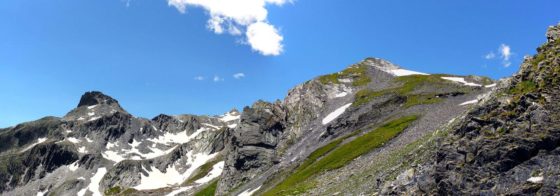
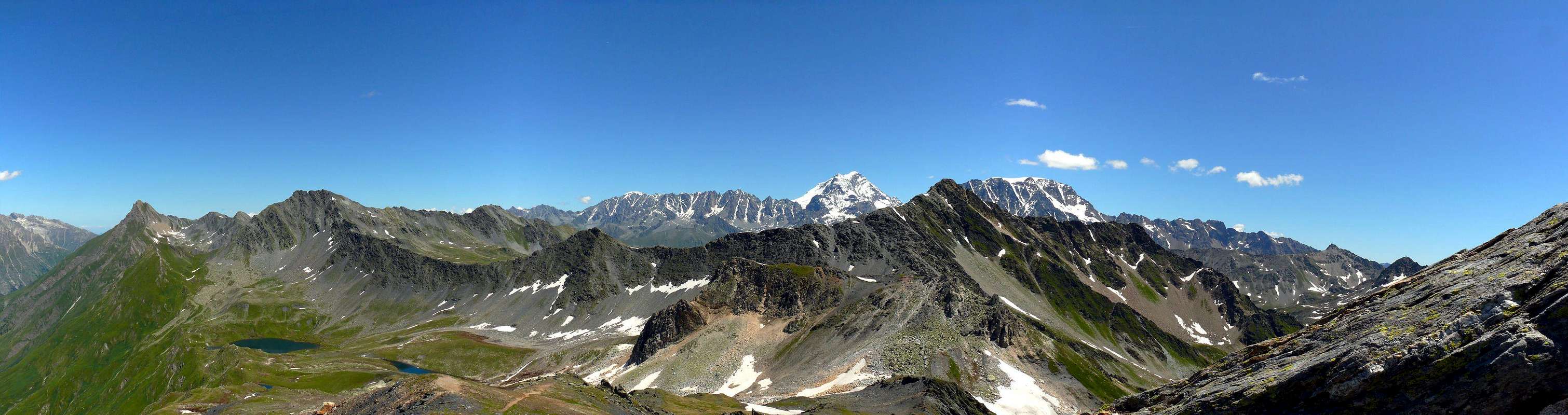
This small summit is located on the crest of the Swiss-Italian border and more precisely between the Fenêtre de Ferret (2.698m; to the East) and the Mont Fourchon (2.902m) more to the Southwest; from this last one it is separated from the modest altitude 2.855 meters, where the watershed definitely heads towards South towards the Mont Fourchon. Beautiful and easy walk that gives beautiful views of the Mont Blanc Chain, especially in the Northeastern sector and on the nearby Mont Velan and Grand Combin Groups, see non their South-west side.
Questa minuscola Sommità si trova collocata sulla cresta del confine Italo-Svizzero e più precisamente tra la Fenêtre de Ferret (2.698 m; verso Est) ed il Mont Fourchon (2.902 m) più a Sudovest; da questo ultimo risulta separato dalla modesta altitudine 2.855 metri, dove lo spartiacque si dirige decisamente a Meridione verso il Mont Fourchon. Bella e facile passeggiata che offre splendidi panorami sulla Catena del Monte Bianco, soprattutto nella parte Nord orientale, e sui vicini Gruppi del Mont Velan e del Grand Combin, visti sul loro lato Sud ovest.
First Ascents
First on the summit: Unknown.
In winter: Unknown.
Getting There
BY CAR:
From Torino, Milano, etc: Motorway A5. Exit Aosta Est.
From Switzerland: through the Grand St. Bernard Tunnel or the homonym pass.
From France: through Mont Blanc Tunnel or Petit St. Bernard Pass. It isn't necessary to enter in Motorway A5, you can drive through SS.26 Aosta direction.
BY PLANE:
Aeroporto "Corrado Gex" Saint Christophe (Aosta).
Specific Road, Approach and Route
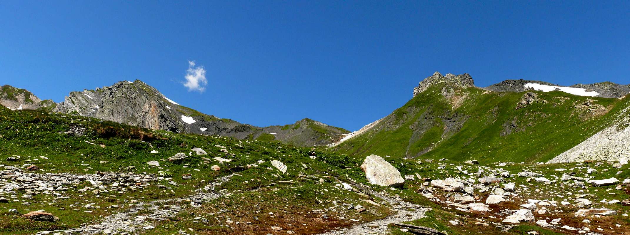
From Aosta (583m) drive along the GranSan Bernardo State Road (SS.27) and, after Gignod (988m), Etroubles (1.264m) and Saint Oyen (1.373m) Municipalities you must leave to your left the road to the Tunnel driving toward Saint Rhémy en Bosses along the valley ending to the pass. After many hairpins and passing Pra di Arc Pastures (1.992m), and the Cantina Reggia Dogana (2.203m) youget a small car parking near the Alpe Baou (2.356m) where from starts the route to Italian Vallon Fenêtre through the Standard Via crossing the long valley. At the crossroads 2.557 meters with the small trail n° 13A, abandoned left (West) the unnumbered path thatrises along the entire valley and direct you in stead to Northwest with the first. Reaching the Fenêtre de Ferret (2.698m). Follow the watershed border quickly through debris or sparce blocks and enough wide grassy fields. (E/F; 0h'20 from the hill; 1h’30/1h’50 overall).
Dalla Città di Aosta (583 m) salire lungo la SS.27 del Gran San Bernardo e, dopo aver superato i Comuni di Gignod (988 m), Etroubles (1.264 m), e Saint Oyen (1.373 m), lasciare sulla sinistra la strada che porta al Tunnel del Gran San Bernardo. Salire verso Saint Rhémy en Bosses (1.632 m) continuando lungo il vallone che porta al Colle e, dopo numerosi tornanti, si supera l'Alpeggio di Pra di Arc (1.992 m), la Cantina Reggia Dogana (2.203 m), e, raggiunto un piccolo parcheggio nei pressi dell'Alpe Baou (2.356 m), si inizia la salita nell'italiano Vallone di Fenêtre per la Via Normale snodantesi attraverso il lungo e vasto vallone fino a raggiungere il Mont Fourchon e il Pain de Sucre. Raggiunto il bivio 2.557 metri con il sentierino n° 13A, abbandonare a sinistra (Ovest) quello non numerato che sale lungo tutto il vallone ed indirizzarsi invece a Nordovest con il primo, raggiungendo la larga e spaziosa Fenêtre de Ferret (2.698 m). Seguire lo spartiacque di frontiera formato da detriti, blocchi sparsi e larghi pendii erbosi di scarsa pendenza. (E/F; 0h’20 dal colle; 1h’30/1h’50 in totale).
Difficulty
From F to (in winter for BSA= good skiers-mountaineers) F+.
Da F ad (in inverno per BSA o buoni sciatori-alpinisti) F+.
Equipment
For Hiking or with snowshoeing also by ski.
Da Escursionismo o con racchette da neve oppure sci.
Campings
Remember that free camping is forbidden (except for emergency reasons, over 2.500m, from darkness until dawn).
Mountain Conditions
You can get meteo information at the official site of the Regione Valle d'Aosta:
Parents refers to a larger category under which an object falls. For example, theAconcagua mountain page has the 'Aconcagua Group' and the 'Seven Summits' asparents and is a parent itself to many routes, photos, and Trip Reports.

 1306 Hits
 79.78% Score
 11 Votes