
-
 12354 Hits
-
 88.6% Score
-
 27 Votes
|
|
Mountain/Rock |
|---|---|
|
|
37.20495°N / 112.91675°W |
|
|
Scrambling |
|
|
Spring, Summer, Fall |
|
|
6460 ft / 1969 m |
|
|
Overview
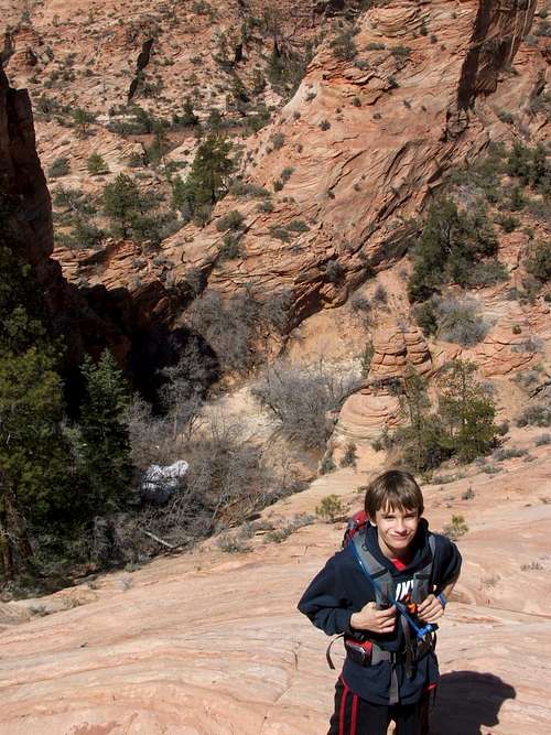
Zion - my favorite national park. The complex and unusual terrain make every trip an adventure for the legs and a feast for the eyes. The small peak 6460 is a backcountry treasure I was introduced to by SPer Courtney Purcell's book 'Zion National Park: Summit Routes', which I highly recommend. Called by Courtney 'Lost Peak', it can be the jewel of a small mileage circuit into the lonely beauty available just off the road in the east part of Zion. This circuit will show off some breathtaking scenery with only a half day's effort. It was perfect adventure for my eighth grade son and I.Getting There
In fact, you can't see this peak unless you get out of your car. From the visitors center, drive toward the east entrance and park on the south side of the road just before the entrance of the second, shorter tunnel. There are only a few places to park here but this is not a popular spot unless someone spots some wildlife nearby.Getting Up
Get out of the car and work your way south down to the the bottom of the wash just a short distance from the road. This small distance is enough to transport you a million mental miles. This is Clear Creek, mostly clear of water when we were there in March 2010 - but it is clear you should check conditions before starting out. Work your way eastward in the wash as it snakes its way through the walls of sandstone.Keep your eye on the right (southerly) side of the canyon, you will first hit the entrance of a slot canyon guarded by a hugh pine - continue past this to the next break in the canyon wall, a brushy entrance into a vast southerly rising sandstone slope. Go up the slope, just steep enough to be fun, for nearly a mile.
Looking back down to entrance to scramble up from Clear Creek.
The initial slopes
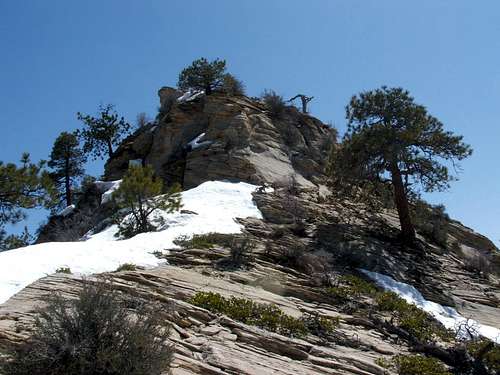
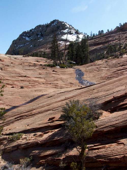
You will see no sign of Lost Peak until you are near at the top of the plateau that the peak sits on. Lost Peak will finally appear to the south-southeast...
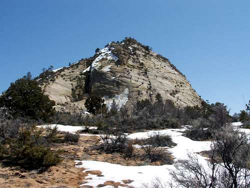
Lost Peak
but do not forget to look around at the rest of the Zion tableau from this spot. It will only get better.
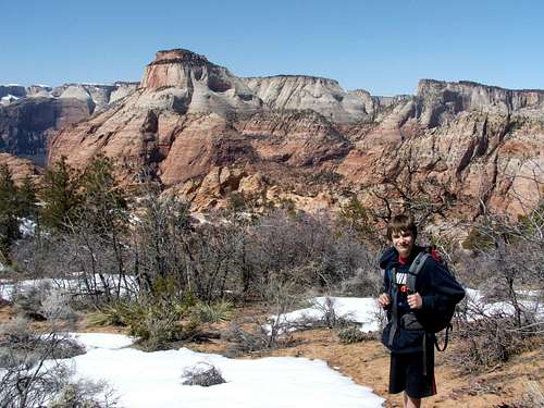
Pausing at the plateau to admire the views
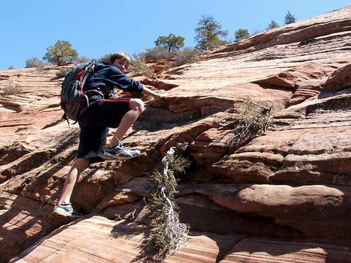
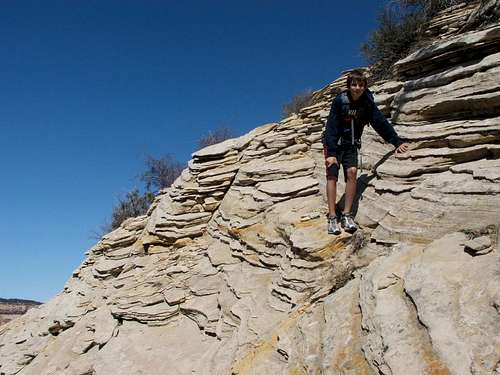
Navigate through light brush to the Northern nose of 6460. The way up this nose is fun and scenic and straightforward.

Fun scrambling and light routefinding
Near the top
Near the top you will reach some rotten rock, dinner plates stacked up and waiting to quickly escort you back down, but it is easy to avoid.
Rotten Rock
The northernmost summit is marked as the highest on the map, but the southern one looks close to it, and it is easy enough to 'make sure'. Take time to scan all around the beautiful east side of Zion and its slickrock beaty.
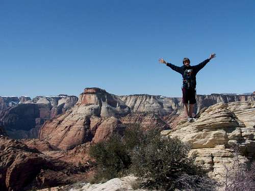
Summit 6460
Getting Down - An Alternate Route back
We returned down the face of the Northern nose. You certainly can return the same way you came, but my son and I decided to make it a loop hike by angling northeast into vast red rock ampitheatre.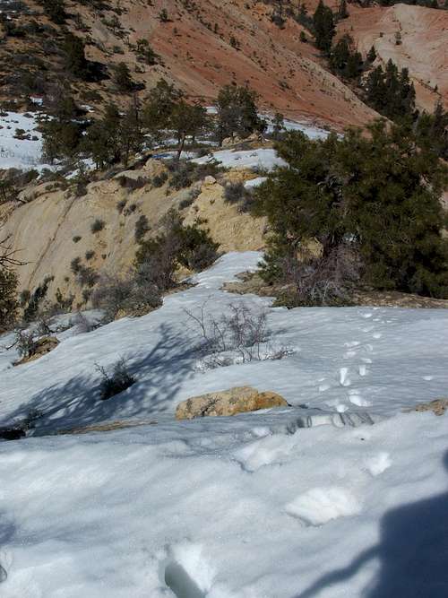
Heading back down the Northern nose - note alternate route back via large red rock bowl to northeast (upper right corner)
You can basically follow the route snowmelt would take as it worked its way down the bowl, eventually ending in Clear Creek.
Follow the water (if it exists) down to Clear Creek
The exquisite red rock area was full of Moqui marbles, and stunning scenery.
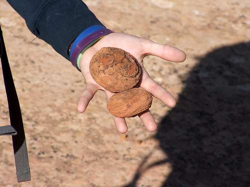
Moqui Marbles
The little tributary creek we were following was joined by other sources of water, and we were forced to stay on the right side as it deepened its flow. We descended through some trees and brush, and a bit of mud, before geting to the brink of Cockeye Falls.
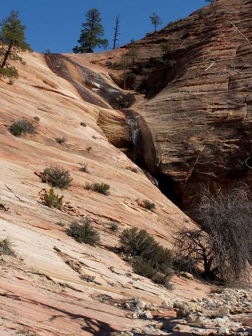
Cockeye Falls
This wonderful fall is visible from the road, and may have its share of people. It is fun tracing its origins from 6460. We had to go some distance North of the fall to be able to safely descend the dropoff. After viewing the fall, simply drop into Clear Creek, and trace it back westward, taking its windy way back to your starting point.
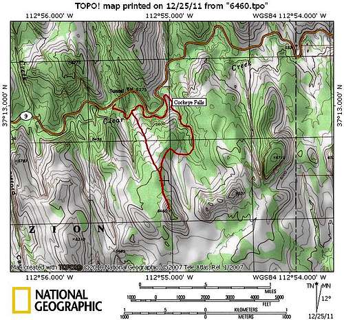
Map of Circuit Route
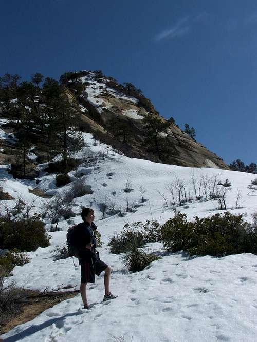
Evan and 6460 - we were glad to have been shown Lost Peak.