Overview
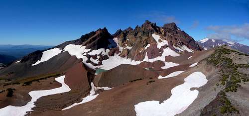
![The Northeastern face...]() The East Face
The East FaceAs stated in
"Fire Mountains of the West" Broken Top is a Pleistocene composite cone comprised of basaltic andesite. Ravaged by the collapse of its magma chamber and subsequent razings by glaciation; the resulting mountain is one of the more rugged and picturesque of the Three Sisters Wilderness in central Oregon. With a summit elevation 1000 feet lower than the adjoining Three Sisters Broken Top has just two dwindling glaciers remaining, the Bend Glacier on the north side and the Crook Glacier within the crater. Although geologically this is one of the older cascade peaks, according to the
USGS website Broken Top is younger than North Sister but has likely not seen an eruption in the last 100,000 years.
Climbing Broken Top: The Northwest Ridge route is the easiest and can be done within a day from the Green Lakes / Fall Creek trailhead, or the Broken Top trailhead a short distance north of Todd Lake on FS380. Once you've reached the climbers path up the Northwest Ridge you will find sections with significant exposure, however the most difficult climbing involved is fourth to low fifth class. With that stated, do not be surprised to find climbers protecting the entirety of the route up and across the summit block.
Getting There
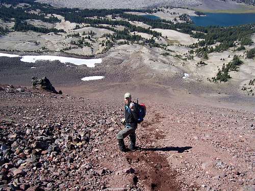
![Broken Top and the Moon:Telephoto from Above Golden Lake]() The Northwest Ridge
The Northwest Ridge
There are multiple ways to access Broken Top, the most popular is the Green Lakes / Fall Creek trailhead roughly 25 miles up the Cascade Lakes Highway from Bend. Dennis Poulin describes a second approach for Broken Top in his trip report that winds around the south face of the mountain meeting up with the climbers path at Green Lakes. This route is also detailed as "Green Lakes via Broken Top" in William Sullivan's 100 Hikes in the Central Oregon Cascades. In winter Broken Top is accessed via the Dutchman Flat parking lot.
Here you can find the
USDA page with current details on fees and restrictions with regards to wilderness passes and camping restrictions.
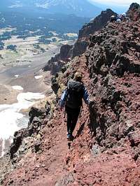
Summit Block from Northwest Ridge
Most climbers choose to summit Broken Top via the Northwest Ridge and are presented with several choices at the landing below the summit block. Many climbers opt to protect this last section to the summit as exposure anywhere around the summit block is significant, use best judgement and be safe.
Catwalk Route
Probably the most popular route on the summit block is via the catwalk. The first obstacle along this route is a 10-15 foot tall solid basalt band with a five inch vertical crack that offers a fairly straightforward approach to the series of ledges and catwalks that can be scrambled most of the way to the mountaintop. Parts of this route are described as 5th class and should not be taken lightly. This initial band of basalt is technically the most difficult part of this path, but the following ledges are very exposed. After climbing that first band of rock, you will find yourself on a wide ledge followed by a much narrower ledge that leads within several feet of the summit. The final 15 feet of this route is a rock-climb with significant exposure off the west face, leading to a smallish summit. Seen in the pictures below, left to right is the initial band of rock at the landing, the catwalk, and the final 15 feet to the summit.
Red Tape
A wilderness pass is required for hiking and camping in the Three Sisters Wilderness. Generally this pass runs around $5 and can be picked up at either of the trailheads. A Northwest Forest Pass is required to park at the trailheads, or a one day pass can be picked up at the trailhead for five bucks.
When To Climb
Typical climbing season is from July-September and some years well into november for the standard route. Several winter couloir routes would are clilmbed throughout the winter, and ideally after snow has consolidated early in the year. The
"Solo Climb of Broken Top" trip report details some of the perils involved in winter climbing. The
"9 o'clock couloir" route page reveals a winter route up the south face of Broken Top. Additional winter route pages, the
"11 o'clock couloir" and the
"South Face Gully"
![Scree skiing!]() Taking the express route down... Scree-skiing!
Taking the express route down... Scree-skiing!Camping
Camping is allowed at the trailhead but it is only for tents/bivis. However, limited camping maybe available four miles in at or around Green Lakes.
Same as above here is the
USDA page with current details on fees and restrictions with regards to wilderness passes and camping restrictions.

 The East Face
 The Northwest Ridge
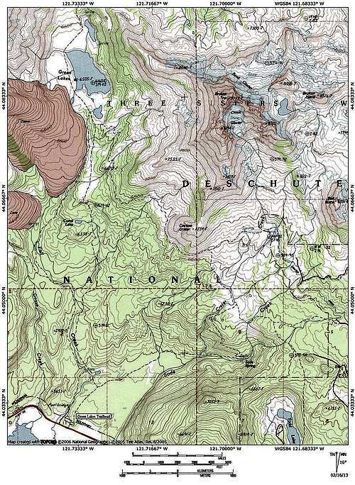


 Taking the express route down... Scree-skiing!