
-
 138181 Hits
-
 95.94% Score
-
 57 Votes
|
|
Mountain/Rock |
|---|---|
|
|
42.44500°N / 122.3142°W |
|
|
Download GPX » View Route on Map |
|
|
9495 ft / 2894 m |
|
|
Overview
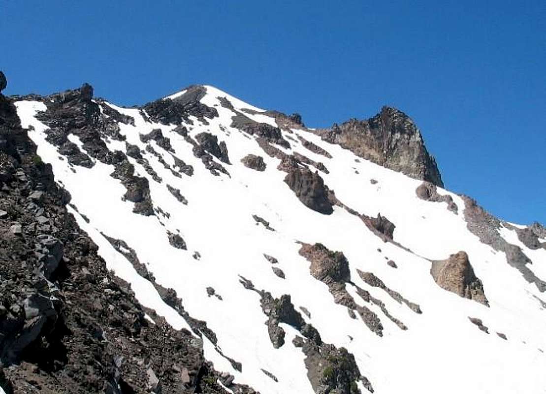
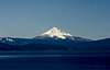
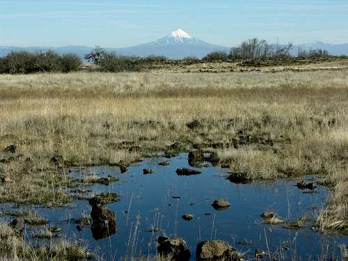
Mount McLoughlin dominates the northeastern sky over Medford, OR much the same way Hood does Portland and Rainier does Seattle, just on a smaller scale in cities and peaks. It's had many names, both native and not. Many still know it as Mount Pitt, named after California's Pit River. It's the sixth highest Cascade peak in Oregon but relatively unknown. From the west it looks like a pretty smooth cone but the north side it has some large gouges with a large thumb-shaped plug. It's a relatively easy hike to the summit with views that can include Shasta and Lassen Peak to the south and Crater Lake/Mt. Thielsen to the north. This is the highest peak between Shasta and South Sister.
There is only one trail to the summit, the Mt. McLoughlin Trail. Click that link for great info regarding the trail and see the route on this page as well.
 |  |  |  |  |
Getting There
Take I-5 to Medford, OR where you pick up Highway 62 east. Take that about 6 miles to Highway 140 and head east about 30-35 miles. From there there are two ways to get to the trailhead. If you have a high-clearance vehicle and can spot the small brown "Trailhead Summit" sign at a Sno-Park lot, you can pick up Four Mile Lake Road 3650. It appears to be a nice gravel road at first but maintenance ends and it becomes a dirt and large rock-filled "road" up to the trailhead. Otherwise, from Highway 140, you can continue east on 140 past the Lake of the Woods Visitor Center where you turn left at a "Fourmile" Lake pointer (Road 3661). Take this 2.9 miles to an intersection with Road 3650 and turn left to the trailhead. This way is on all gravel roads.
Red Tape
You need a Northwest Forest Pass to park at the trailhead. No other permits are required that I am aware of although there is a "climber's register" at the trailhead if you want to sign in.When To Climb
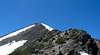
I assume you can climb this year-round as it is a trail although it would be much more challenging in the winter, this area gets a lot of snow and I am not sure how you would find the trail as it was challenging to stay on the official trail along the rock ridge to the summit in perfect summer weather. There are many trails made through the years on this part although the park service has tried to make one main one for about 50 years. |
Camping
There are many campsites in the area along Highway 140 from Fish Lake to Lake of the Woods. There is also a nice camp site at Four Mile Lake along Road 3661 about 2 or 3 miles north of the trailhead. Camping here is $12 per tent and usually full on the weekends. Try mid-week for better results and more open spots. I also spotted a couple tent sites on the trail up near the sandy saddle just below the rock ridge that had excellent views of Mount Shasta.Mountain Conditions
Butte Falls Ranger District800 Laurel St.
Butte Falls, OR 97522-0227
541-865-2700
Or Klamath Ranger District at (541) 885-3400
Sky Lakes Wilderness
keema - Jul 27, 2007 12:18 pm - Voted 10/10
Re: CampingThe cost is now $12 per night at Four Mile Lake and it is almost empty if you go during the week. I stayed on Monday July 23 and there were only 4 occupied sites of the 14 to the left as you enter the campground. The campground host said this pretty standard for mid week
mdaley1008 - Aug 30, 2013 4:42 pm - Hasn't voted
Fee AreaIn 2013 the trailhead is fee area. It is $5, and there is a drop box in the parking area to pay. There is also a very good graphic at the trailhead to show the trail, as it is tricky to follow above the treeline.
Brian Jenkins - Sep 1, 2013 9:33 pm - Hasn't voted
Re: Fee AreaAre you saying this is in addition to the NW Forest Pass? Thanks. Brian
jakeparlay - Jul 21, 2014 1:41 am - Hasn't voted
Re: Fee AreaI was just there in mid-July and purchased both $5 passes because I was unsure, as well. Wish I had spent all that money on bug repellent instead! I've only spent a few weeks total in Oregon and had never encountered many bugs until that morning's climb. From the second I left the car at the trailhead, I was met by some fierce mosquito swarms for the first 2-3 miles, until the trees really started to thin out. Fortunately I bumped into a hiker about halfway to treeline and he had plenty of bug spray. The mosquitos were unrelenting out there until that point. The climb was pretty challenging with some tough weather that day at the the summit, but I really enjoyed the hell out of it. I would be very interested to try it again in winter as I didn't find the vertical exposure too threatening. Would have to check and see if it's avalanche prone though. I found the downclimb and route finding less challenging than it was on the way up the mountain. Hikers should hug the ridgeline and keep that whale-shaped lake in sight as often as possible on the way up, too. Can't wait to do it again.