
-
 2787 Hits
-
 79.04% Score
-
 10 Votes
|
|
Mountain/Rock |
|---|---|
|
|
47.44681°N / 11.40435°E |
|
|
Hiking, Mountaineering, Trad Climbing, Scrambling |
|
|
Spring, Summer, Fall |
|
|
8114 ft / 2473 m |
|
|
Overview

The two Schlichtenkarspitzen are part of Northern Karwendel chain and are located between Vogelkarspitze to the east and Bäralplkopf to the west on the German – Austrian border.
The main summit is called Hintere Schlichtenkarspitze which is located west of Vogelkarspitze. Having a rather dominant aspect when viewed from the west (from Bäralplkopf or from Karwendel valley), Hintere Schlichtenkarspitze has nevertheless a minor prominence of about 50 m to Vogelkarspitze. It is a mere bump in the west ridge of Vogelkarspitze when viewed from there.
To call Vordere Schlichtenkarspitze (2356 m) a summit it even more ridiculous. In fact there is no prominence at all. Vordere Schlichtenkarspitze is an unremarkable point on the ridge between Hintere Schlichtenkarspitze and Bäralplkopf, topped with a huge cairn. I don´t know why this point is named at all.
To the south both Schlichtenkarspitzen are showing steep and somewhat rocky meadows and dwarf pine thickets.
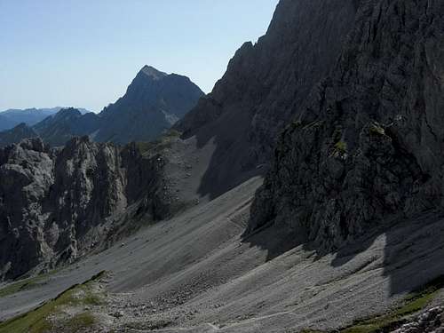
To the north there is a huge rockface dropping down about 700 meters into Wechselgraben valley and Fermersbach valley.
Most people will summit both Schlichtenkarspitzen during the nice traverse from Vogelkarspitze to Bäralplkopf or vice versa. This is, in my opinion, the best normal route to these summits and, to be true, the only reason worth mentioning these mountains. The traverse is a delightful walk on the ridge crest (or near it on the south side) with spectacular views down the north faces. In spring and summer the meadows are full of wildflowers thus adding to the pleasures.
Hintere Schlichtenkarspitze was first summited by Hermann von Barth on 4th of july, 1870 on a traverse from Vogelkarspitze. Due to the late hour he left Hintere Schlichtenkarspitze straight down the south ridge to go back to his overnight shelter near todays Karwendelhaus.
Until now these two mountains have changed only a little. Both summits are still rather unknown, have no marked trails or summit crosses, a guarantee, that your chances to stay alone on these heights and get this special “Karwendel – von Barth – feeling” are rather good.
Getting There
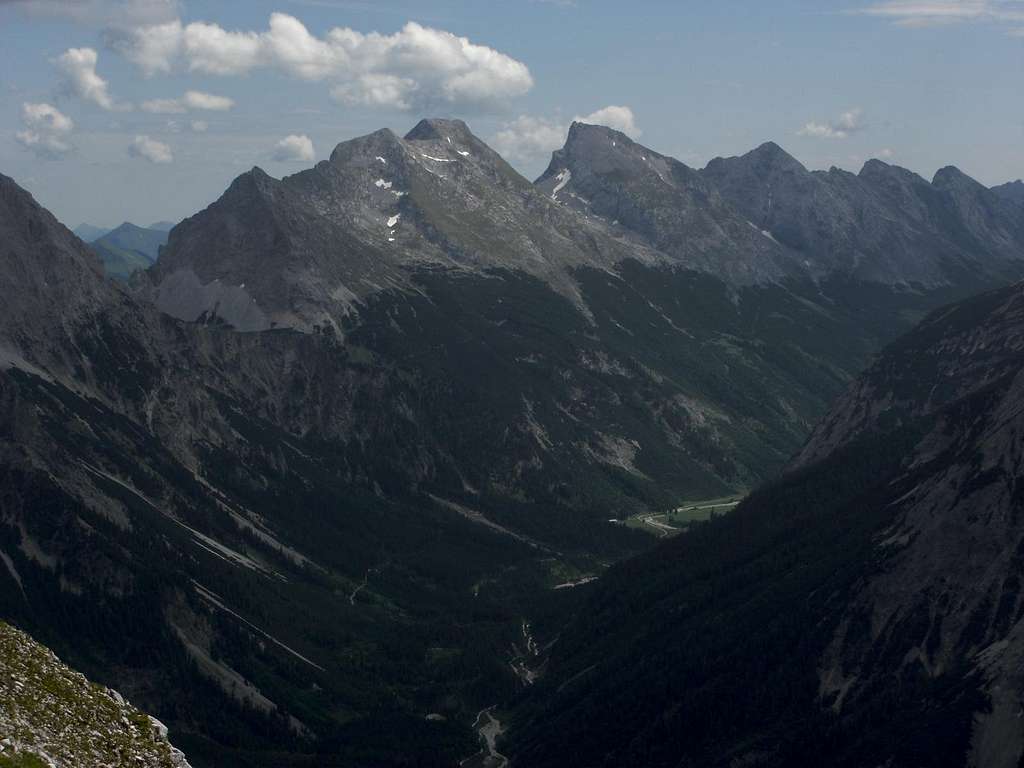
Schlichtenkarspitzen north face
The best trailheads for Schlichtenkarspitzen / normal routes are
You reach Mittenwald or Scharnitz by car:
Scharnitz parking areas:
At the church near Isar bridge take Hinterautalstraße in southern direction. After the undergrade passing of the railways you reach a huge parking area to your left (fees!).
300 m further on there is another small parking area after the bridge across river Isar to your right.
The Karwendelhaus ascent from Scharnitz uses the long Karwendeltal road up to Hochalmsattel, the col between Birkkarspitze and Östliche Karwendelspitze where the huge mountain hut is located.
MTB is nearly a must (otherwise 13 km walk!).
Start at the small parking area, ascend the road to your left and turn immediately to the right. The road uses the lower slopes of Brunnsteinspitze to enter into Karwendel valley. Go on nearly level or with a very moderate grade to former Larchetalm (unfortunately demolished after a quarrel about how to run this former mountain hut within the National Park of Karwendel) and further on to Anger Alm. After passing Anger Alm meadows the road ascends with some switchbacks to Hochalmsattel. Take the right hand road at the Hochalmsattel road junction to reach Karwendelhaus.
Karwendelhaus can be reached, too, from
Bäralplkopf (left) with Schlichtenkarspitzen and Vogelkarspitze
Mittenwald parking area:
Follow road B 2 until it crosses Isar river north of Mittenwald. Turn left (right when coming from Innsbruck) before the road crosses Isar again, and follow this road until you reach the hiker parking area.
From the parking area follow the forest road north of Seinsbach valley up to Fereinalm and Krinner-Kofler-Hütte; alternatively take Jägersteig trail south of Seinsbach valley to the same destination.
For Hochlandhütte follow the signposts at road B 2 to the Mittenwald barracks. Turn on the road to the barracks and go straight on to the undergrade passing of road B 2. Turn right to park your car on the parking area.
Follow the forest road in southern direction. At the first trail junction take the left hand trail and ascend on that trail, partly using some forest roads further up the slope, to Hochlandhütte.
Scharnitz and Mittenwald can be reached with railway, too.
See the railway schedule here .
Main Routes Overview
Traverse route from Karwendelhaus
Starting at Karwendelhaus you first follow the route to Vogelkarspitze (see Vogelkarspitze page for more detailed information):
Supply road to Hochalmsattel - jeep track - trail traversing Grabenkarspitze south slopes - dry rundown chute of Grabenkar cirque - straight on to a meadow - upper end of a second meadow - trail up to Vogelkar - narrow foot track to southeast ridge of Vogelkarspitze east summit – ascent on that ridge to Vogelkarspitze east summit.
 Looking down from Vogelkarspitze west to Schlichtenkarspitzen Looking down from Vogelkarspitze west to Schlichtenkarspitzen |
 Hintere Schlichtenkarspitze as seen from traverse from Vogelkarspitze Hintere Schlichtenkarspitze as seen from traverse from Vogelkarspitze |
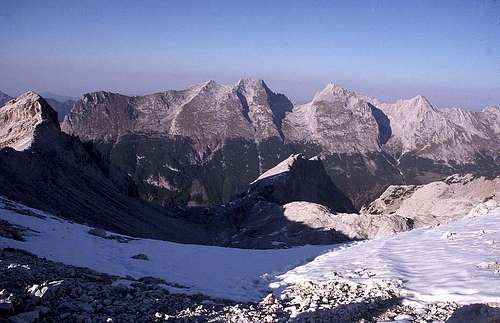
 Traverse part Hintere and Vordere Schlichtenkarspitze to Bäralplkopf Traverse part Hintere and Vordere Schlichtenkarspitze to Bäralplkopf |
Traverse the full Vogelkarspitze summit ridge easily from east to west summit (rock scramble, scree). Descend the southwest ridge of Vogelkarspitze first near the ridge crest later by zigzagging down the steep south slope until you regain the ridge at the col between Vogelkarspitze and Hintere Schlichtenkarspitze.
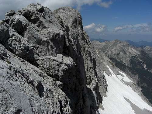
Traverse the col on the ridge crest and ascend Hintere Schlichtenkarspitze south of the ridge (easy rocks), regaining the ridge crest near the summit. Scramble up easily to the summit cairn.
The traverse to Vordere Schlichtenkarspitze is made by following the ridge crest to the west – easy rock scramble, meadows and scree.
Traverse Bäralplkopf - Vogelkarspitze
Follow the ridge crest or slightly south of it from Bäralplkopf to Vordere and Hintere Schlichtenkarspitze. (Steep meadows, some easy rock scramble). Descend the easy rocks on the east side of Hintere Schlichtenkarspitze into the col between that mountain and Vogelkarspitze. Ascend the southwest ridge of Vogelkarspitze over easy rocks (grade I scramble, some loose rocks) by following the cairns. Traverse Vogelkarspitze summit ridge from west to east to the summit cross.
South route
This is the descent route of Herrman von Barth on his first ascent to Schlichtenkarspitze. I do not recommend this route – it is better to summit Bäralplkopf or Vogelkarspitze first and do the above mentioned traverse of the whole ridge.
The problem is the dwarf pine thicket at the bottom of the mountain. Coming from Krinner-Kofler-Hütte or from Karwendelhaus: use the Gjaidsteig, the connecting trail between these two mountain huts. Below the south ridge of Hintere Schlichtenkarspitze is a dwarf pine free zone nearly reaching down to Gjaidsteig. The problem is to recognize the right place to leave the trail and to fight oneself up through the dwarf pines to this pine free zone:
 South route (right) to Hintere Schlichtenkarspitze South route (right) to Hintere Schlichtenkarspitze |
 Traverse route from Bäralplkopf to Schlichtenkarspitzen Traverse route from Bäralplkopf to Schlichtenkarspitzen |
 Traverse route from Bäralplkopf to Schlichtenkarspitzen Traverse route from Bäralplkopf to Schlichtenkarspitzen |
Below Vogelkar cirque (coming from Karwendelhaus) Gjaidsteig crosses a broad meadow. It then traverses two scree chutes. 100 to 150 m after the second one look for some gaps in the dwarf pines and try to break through to the dwarf pine free zone. From there ascend first straight up and then more to the left to gain the south ridge to Hintere Schlichtenkarspitze.
North routes
I think that these north routes are rather unusual climbs:
Red Tape & Accommodation
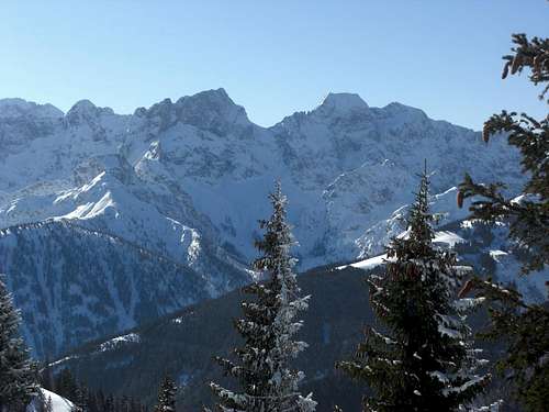
Schlichtenkarspitzen (right) with Vogelkarspitze and Östliche Karwendelspitze
Red Tape
Schlichtenkarspitzen are part of the “Alpenpark Karwendel”, an important and strictly protected national park.
There is no entrance fee for the park but many regulations to follow. Please respect the following rules in the National Park:
There is a National Park Information Center at Hinterriß.
The parking areas at Scharnitz require a parking fee!
Accommodation
Food and lodging can be found at
Camping is not allowed within Alpenpark Karwendel.
Mountain huts
Gear & Mountain Condition
Schlichtenkarspitzen as seen from Wörner ascent
Schlichtenkarspitzen are climbed in late spring, summer and autumn until the first snow falls. Winter ascents are unusual.
The normal / traverse routes are a partly off-trail outing which requires a steady step in steep meadow terrain without any tracks or trails, some route finding qualities and scrambling abilities, especially for the traverse Bäralplkopf - Vogelkarspitze.
You need good hiking gear, good shoes, ski poles are recommended. Take lots of water with you, especially for the traverse. There is no water between Karwendelhaus and Bäralplsattel!
The north routes require an experienced mountaineer and climbing abilities in mostly unstable terrain.
Current Weather:
Maps & Guide Books
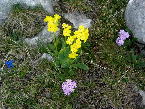
Wildflowers on the south slopes of Schlichtenkarspitzen
Maps
Alpenvereinskarte 1 : 25.000
Blatt Nr. 5/2, Mittleres Blatt
Online Shop Deutscher Alpenverein
together with
Alpenvereinskarte 1 : 25.000
Blatt Nr. 5/1, Westliches Blatt
Online Shop Deutscher Alpenverein
Bayerische Topographische Karte 1 : 50.000
Karwendel, UK 50/51 Landessamt für Vermessung und Geoinformation, München
Guide Books
Walter Klier
Alpenvereinsführer Karwendel alpin
Bergverlag Rother, München
for rock climbing:
Walter Klier
Alpenvereinsführer Karwendel extrem
Bergverlag Rother, München
(out of stock)
Available only in German