
-
 3939 Hits
-
 80.49% Score
-
 12 Votes
|
|
Mountain/Rock |
|---|---|
|
|
47.41014°N / 11.35423°E |
|
|
Hiking, Mountaineering, Scrambling, Skiing |
|
|
Spring, Summer, Fall, Winter |
|
|
8337 ft / 2541 m |
|
|
Overview
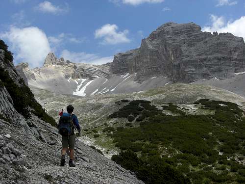
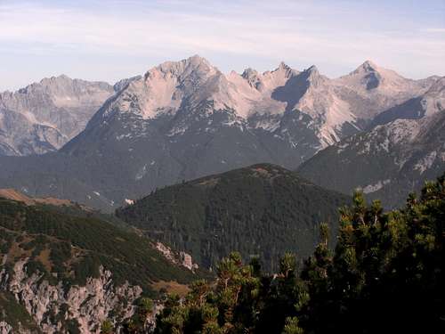
Larchetkarspitze and Mitterkar cirque
The Karwendel main ridge has some peaks which are rarely summited; Larchetkatspitze surely is among them.
Dominating the lonely Mitterkar cirque, this tooth – shaped peak can only be reached on routes without marked trails or foot tracks. Only one trail passes nearby, the “Toni Gaugg Höhenweg”, connecting Pleisenhütte with Karwendelhaus, two important alpine huts within the Karwendel main ridge.
Larchetkarspitze is located between well known Pleisenspitze to the west and the rather unknown and remote Große Riedelkarspitze to the east. The north ridge drops down to Kleine Riedelkarspitze and to the Karwendel valley, separating Großes Riedelkar cirque in the east from Larchetkar cirque to the west. The south ridge of Larchetkarspitze culminates at Gauggturm, a huge and broad rock feature, separating Mitterkar to the west from Hinterkar to the east.
Larchetkarspitze was first summited by Hermann von Barth on August, 3., 1870. His route is no longer popular. The todays normal route was first tackled successfully by Otto Ampferer and Willy Hammer in 1899.
This normal route is rated as grade II+ to III- in partly bad rock. For that reason the normal route was secured with fixed ropes by the landlord of Pleisenhütte. As Mitterkar cirque is a interesting ski tour location, Larchetkarspitze is consequently summited in winter/spring, too and can be seen as a demanding and beautiful alternative to Pleisenspitze ski tour.
Getting There
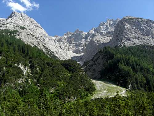
Larchetkar cirque and Larchetkarspitze as seen from Karwendel valley
The best trailhead for Larchetkarspitze is:
Scharnitz and the mountain hut:
Pleisenhütte
You reach Scharnitz by car:
At the church near Isar bridge take Hinterautalstraße in southern direction. After the undergrade passing of the railways you reach a huge parking area to your left (fees!). 300 m further on there is another small parking area after the bridge across river Isar to your right.
Scharnitz can be reached with railway, too.
See the railway schedule here .
The Pleisenhütte ascent follows first Hinterautalstraße to the Wiesenhof inn. Take the forest road to your left at a road junction and stay on that main road (signposts for Pleisenhütte), which zigzags up the southwest slopes of Pleisenspitze. At another road junction take again the left hand road (signposts to Pleisenhütte); this supply road leads up to the mountain hut (about 2,5 to 3 hours from Scharnitz).
MTB is possible, too!
Main Routes Overview
Normal route
Starting at Pleisenhütte follow Toni-Gaugg-Höhenweg to the trail junction with Pleisenspitze normal route. Stay right there on Toni-Gaugg-Höhenweg and ascend slowly to the lower parts of Mitterkar cirque, traversing the south ridge of Pleisenspitze.
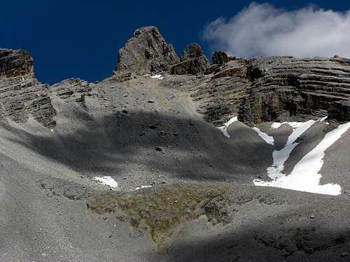
Larchetkatspitze is visible when you reach the lower parts of Mitterkar cirque. Leave the Toni-Gaugg-Höhenweg at the first ditch-like depression coming down from Mitterkar cirque to your left and follow this ditch off-trail in northern direction into Mitterkar cirque. Stay right (east) of a subridge which divides upper Mitterkar cirque and ascend an old end moraine before entering a steep scree field which comes down from Larchetkarspitze south face and its adjacent ridges.
[ Larchetkarspitze and Mitterkar cirque |  Climb to the notch |  Climbing the summit block |
Ascend this scree slope; it is best done in its middle part where more talus and bigger boulders give more foothold. Aim for the northernmost notch of Larchetkarspitze south ridge immediately south of Larchetkarspitze summit block and for the chute coming down from this notch into Mitterkar cirque. Ascend this chute on very bad rock (!!) up to the notch. First fixed ropes are securing your ascent (and descent) in crumbly and frail rocks.
At the notch you enter the steep and exposed east face of Larchetkarspitze. Ascend directly up the now more firm rocks to a traverse to the north on some scree litterend ledges. At the end of these ledges (fixed ropes) there is a climb in a steep rock chimney (crux of the route) which ends in a chute. Climb the chute up to the east arête. Some more steps bring you up to the summit.

Climb above the notch
Summit block of Larchetkarspitze
East ridge
The ast ridge is an alternative route to the normal route. Follow for this Toni-Gaugg-Höhenweg traversing Mitterkar cirque and descending into Hinterkar cirque. Follow the trail until you can enter off-trail the left (western) part of Hinterkar cirque, divided by the south ridge coming down from Große Riedelkarspitze. Go up to the Riedelkar col and enter Larchetkarspitze east ridge. Climb the east ridge (UIAA grade II / III) in partly bad rock to the summit. If you want to avois the ridge you can climb up the steep chute to the above mentioned notch south of the summit and follow the normal route from there. Bad rock, too!
Ski route
The ski route is nearly the same as the normal summer route. The ski track starts below Pleisenhütte and traverses up to the lower Pleisenkar cirque. Leave the Pleisenspitze ski track where it heads in more northern direction into the cirque to traverse the lower Pleisenspitze south ridge.
 Crux of normal route |  Crux of normal route |  Große Riedelkarspitze and (right) Larchetkarspitze |
Enter Mitterkar cirque below the rock faces of Pleisenspitze south ridge to avoid steep terrain. Move up to the ski depot at the beginning of the chute which leads up to the northernmost notch of the south ridge of Larchetkarspitze, where the fixed ropes start. Normally these ropes are at least partly buried below snow in winter / spring.
 Summit view to Pleisenspitze |  Summit view to the east |  Summit view to Hockkarspitze and Wörner |
Unusual and climbing routes:
Red Tape & Accommodation
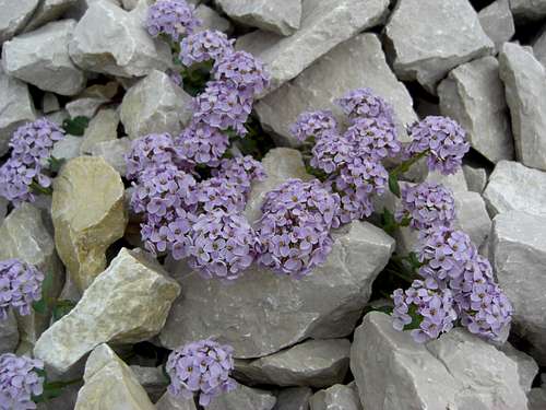
Rundblättriges Täschelkraut (Thlaspi rotundifolia) in the scree slopes of Larchetkarspitze
Red Tape
Larchetkarspitze is part of the “Alpenpark Karwendel”, an important and strictly protected national park.
There is no entrance fee for the park but many regulations to follow.
Please respect the following rules in the National Park:

There is a National Park Information Center at Hinterriß.
The parking areas at Scharnitz require a parking fee!
Accommodation
Camping is not allowed within Alpenpark Karwendel.
Food and lodging can be found at
Mountain huts
Gear & Mountain Condition
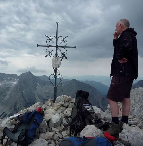
Summit of Larchetkarspitze
Larchetkarspitze can be climbed nearly the whole year.
In late spring, summer and autumn Larchetkarspitze is a lonely outing partly off-trail and requires climbing up to UIAA grade III in frail and crumbly rock at the summit block. Exposure is guaranteed.
The summit block rocks are secured with fixed ropes. A helmet is recommended.
In winter and spring Larchetkatspitze is as ski tour an alternative to normally crowded Pleisenspitze. You need full ski tour and avalanche gear. Helmet, crampons and an ice axe for the summit block is recommended. You have to climb UIAA grade III rocks with snow and ice with ski boots to reach the summit!
Check the Tirol avalanche bulletin here. http://lawine.tirol.gv.at/
Current Weather:
Maps & Guide Books
Pleissenspitze (left) and Larchetkarspitze (to the right) as seen from Solstein ascent
Maps
Alpenvereinskarte 1 : 25.000 Blatt Nr. 5/2, Mittleres Blatt Online Shop Deutscher Alpenverein
For the Karwendelhaus ascents you need: Alpenvereinskarte 1 : 25.000 Blatt Nr. 5/1, Westliches Blatt Online Shop Deutscher Alpenverein
Bayerische Topographische Karte 1 : 50.000 Karwendel, UK 50/51 Landessamt für Vermessung und Geoinformation, München
Guide Books
Walter Klier Alpenvereinsführer Karwendel alpin Bergverlag Rother, München
Walter Klier Alpenvereinsführer extrem Bergverlag Rother, München (out of stock)
Available only in German language