-
 12116 Hits
-
 86.85% Score
-
 23 Votes
|
|
Mountain/Rock |
|---|---|
|
|
39.40405°N / 105.61898°W |
|
|
Download GPX » View Route on Map |
|
|
Park |
|
|
Hiking, Mountaineering |
|
|
Spring, Summer, Fall, Winter |
|
|
11941 ft / 3640 m |
|
|
Overview
CO Peaks Rank: 1339Prominence: 401 ft
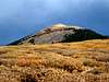
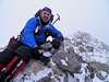
"Platte Peak," which shows up on some maps as point 11,941, resides in the Platte River Mountains of Colorado, which is also in the Front Range. Its summit is one of the nicest in Colorado's Lost Creek Wilderness. Attempts to hike this peak should not be taken lightly. It is class one all the way except for a few class two plus moves to reach the summit block. It is over eleven miles round-trip if you just hike Platte Peak only. This can make for a long day in the winter if you are snowshoeing.
The summit of Platte Peak provides views surrounding peaks to include Mt. Logan to the north, Kenosha Peak to the south, and Shawnee Peak to the East. South Twin Cone is to the west. For a long day you could include hikes to nearby peaks including Shawnee, Kenosha, and South Twin Cone to name a few.
 |  |  |  |  |
Getting There
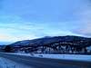
From Denver Drive west on HWY 285. Go through Bailey and then Shawnee. Shawnee is about 33 miles west of the C470/HWY 285 Interchange. Drive about 2 miles west of Shawnee on HWY 285 and you will see a parking area on the south side of HWY 285 with signs for the Ben Tyler Trailhead.Coordinates for parking: 39.43605° N 105.590816° W
 |  |  |
The Hike
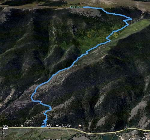
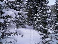
From the parking lot start hiking up the Ben Tyler Trail. There are a series of switchbacks over the first half mile. Hike along the Ben Tyler Trail for approximately 4.5 miles and then you will start heading up the ridge towards Platte Peak.
Coordinates once you head West up the ridge.
39.4151° N
105.6410° W
It is about another 1.3 miles to the summit. Once you get above treeline you will have a false summit and another half mile or so to the true summit.
Round trip Distance: Approx 11.3 miles
Net Elevation Gain: Approx 3,850 ft
| | |  | |
Red Tape & Camping
Platte Peak as well as the Ben Tyler Trail lie within the Lost Creek Wilderness.Camping can be done at Lost Creek Campground.
Weather

National Weather Service
External Links