
-
 17849 Hits
-
 92.04% Score
-
 37 Votes
|
|
Area/Range |
|---|---|
|
|
36.15262°N / 115.52047°W |
|
|
Hiking, Mountaineering, Trad Climbing, Sport Climbing, Toprope, Bouldering, Big Wall, Scrambling |
|
|
Spring, Summer, Fall, Winter |
|
|
8154 ft / 2485 m |
|
|
Overview-- The Crown Jewel of Southern Nevada
Red Rocks is currently under threat from a proposal to build a massive residential and commercial development atop neighboring Blue Diamond Hill. See here for details and for information about how you can get involved.
Obi-Wan Kenobi says this in the original Star Wars. As he does, he is on a high cliff overlooking that den of sin.
He could just as easily have been talking about Las Vegas from a summit in Red Rock Canyon, for from many a peak out there, one can revel in a sandstone wonderland of a setting while looking out upon Sin City several miles away and a few thousand feet below. See for yourself:
 Bridge Point and Las Vegas-- by redsplashman23
To the average visitor to Las Vegas, one or more of the following probably come to mind:
- The Strip
- Strippers
- Casinos and gambling
- Neon
- Concerts and shows
- Cheap buffets
- Strippers
- Billboards with trial attorneys' faces on them
- Sad-looking old people, with buckets of coins, rhythmically feeding the slot machines
- Assorted washed-up celebrities
- Stories that you would never tell to anyone whose opinion of you matters in the slightest, often involving...
- Strippers
If you said that there are people whose eyes light up over the climbing opportunities, you'd probably receive strange looks.
But not far from the glitz of the Strip, maybe as little as a 30-minute drive from there if you hit the endless traffic lights well, is what arguably is Nevada's best outdoor destination and what is unarguably both one of the finest outdoor destinations in the Southwest and one of the premier rock climbing locations in the entire United States: Red Rock Canyon.
 Arch Below Bridge Mountain-- by redsplashman23
The full name is Red Rock Canyon National Conservation Area (RRCNCA). Almost no one calls it that. Most call it Red Rock or Red Rocks or Red Rock Canyon.
It is a pocket, and a pretty big one at that, of wilderness and splendor in a setting that is one of the last places most would associate with wilderness and splendor, at least natural splendor. The superlatives one often hears-- crown jewel and paradise and the like-- are spot on.
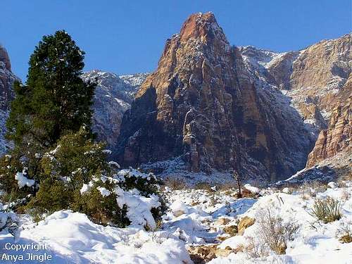
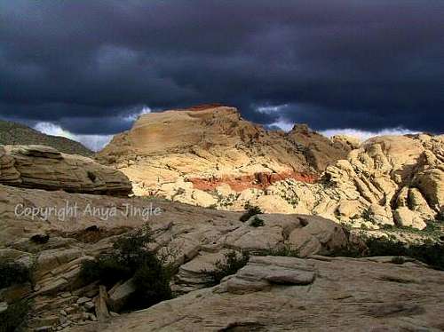
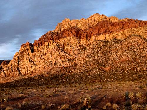
 Mount Wilson in morning light-- by Anya Jingle
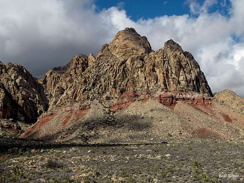
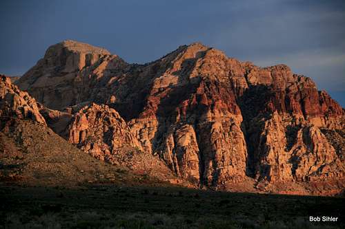
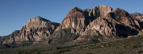
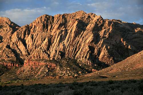
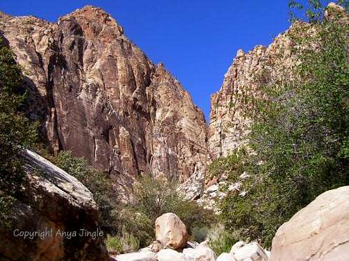
Indisputably, the scenic highlight is the north-south procession of colorful sandstone peaks, from North Peak to Hollow Rock Peak. Almost all of these sandstone peaks are part of a geological formation called the Sandstone Bluffs (some others are in the White Rock Hills), which itself is part of the Spring Mountains, so named for-- you guessed it-- their many springs. Peaks such as Bridge Mountain, Bridge Point, Rainbow Wall, Rainbow Mountain, and Mount Wilson are among the most spectacular peaks in the Southwest. It is this collection of sandstone peaks that houses most of the famous and the best climbing routes. In fact, climbers from all over the world come here for the high-quality Aztec sandstone and the big walls. RRCNCA joins Yosemite and Zion as North America's elite big wall climbing destinations, and well over 1000 established routes, many of them long multi-pitch ones, are like crack to trad climbers. And the sandstone peaks are spectacular objectives for scramblers as well; almost all have a Class 3 or 4 route to the summit, and the routes are usually highly scenic and have plenty of scrambling.
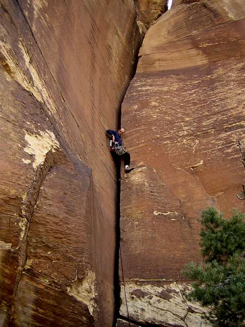 Chrysler Crack-- by Brutus of Wyde Chrysler Crack-- by Brutus of Wyde |
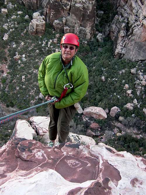 Rappelling off Cat in the Hat-- lisae Rappelling off Cat in the Hat-- lisae |
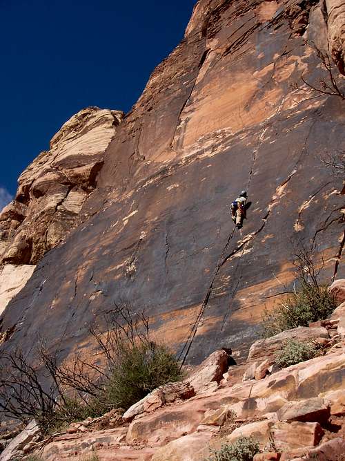 Straight Shooter-- by rpc Straight Shooter-- by rpc |
But there is more. East of the sandstone behemoths are the colorful Calico Hills, a mecca for scrambling and sport and trad climbing; routes are much shorter and most are single-pitch, but it's a great location for climbing on winter afternoons. Between the sandstone peaks are gorgeous canyons; depending on the time of year, canyons such as Pine Creek, Oak Creek, and Black Velvet can be beautiful almost beyond belief. And behind the sandstone peaks are higher limestone peaks, most of them unnamed; the highest peak in the conservation area is a limestone peak, La Madre Mountain. Both the sandstone peaks and the limestone peaks are part of the Spring Mountains. Much of RRCNCA is protected under the Rainbow Mountain Wilderness and the La Madre Mountain Wilderness, and it is adjacent to the Spring Mountains National Recreation Area.
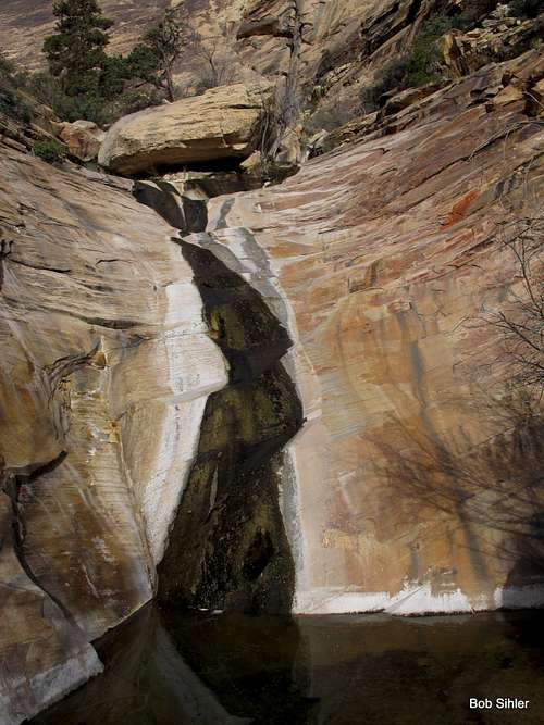 Waterfall in Oak Creek Canyon
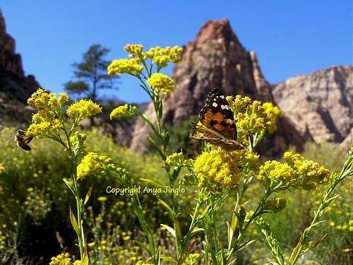
Other draws include the spring wildflowers, the semi-wild horses and burros, the desert tortoises, and the bighorn sheep. The burros and horses are a common sight in the valleys and near roadways; the sheep are often seen in precarious, impossible-looking perches deep in the canyons and high on the peaks. Finally, artwork and artifacts left behind by Native Americans hundreds of years ago await those who want a glimpse and a feel of the distant human past.
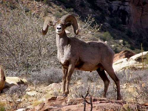 The King of Red Rocks-- by Anya Jingle The King of Red Rocks-- by Anya Jingle |
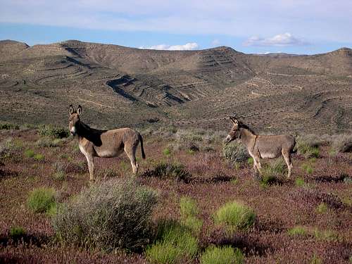 Wild Donkeys-- by Anya Jingle Wild Donkeys-- by Anya Jingle |
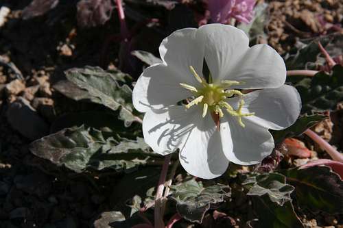 Angel of the Morning Angel of the Morning |
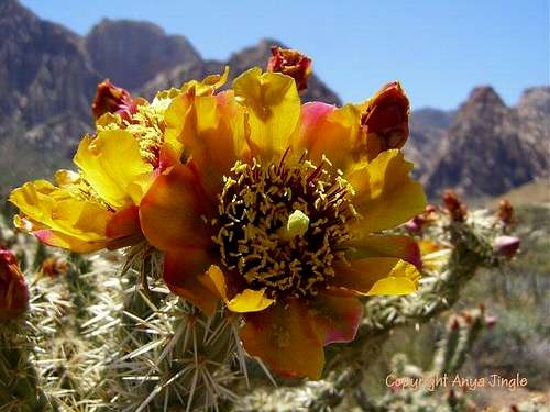 Buckhorn Cholla Bloom-- by Anya Jingle Buckhorn Cholla Bloom-- by Anya Jingle |
Interestingly, most visitors to Red Rock Canyon National Conservation Area never actually enter Red Rock Canyon. The valley that SR 159 cuts through is not Red Rock Canyon. The popular Scenic Loop, which attracts thousands of windshield tourists and is the main access point for many of the peaks, does not go through Red Rock Canyon. Red Rock Wash, which runs through the mostly flat area that the Scenic Loop encloses, is not Red Rock Canyon. In fact, Red Rock Canyon is west of the Scenic Loop and is accessible by an unpaved road that often presents 4wd conditions.
Another misconception is that the entirety of RRCNCA is the area along and around the Scenic Loop, which truly is the conservation area's centerpiece but is hardly all there is to it. There is much more to it, and some of the areas outside the "park" are among the true gems of the region. Just two examples: Black Velvet Wall, a cliff of dark sandstone that is RRCNCA's tallest and home to some of its greatest climbs; and the Monument, an obscure peak with one of the most scenic summit routes of all the peaks.
 The Monument
Park and Protection History
In the early 1900s, there was a quarry operated by the Excelsior Company near the northwestern portion of what is now the Scenic Loop, but it was closed due to being not profitable enough. Today, it is a popular trailhead (Sandstone Quarry), and some large sandstone blocks are evidence of the past. Early prospectors also combed the west-side canyons for valuable ore and minerals but came up mostly empty. Latter-day visitors to this place can only shudder to think what might have happened had the quarrying and/or the prospecting turned out differently.
Livestock grazing also occurred, now symbolized and commemorated by Spring Mountain Ranch and by the remains of a homestead in Pine Creek Canyon (actually a little bit outside the mouth of the canyon proper).
Several decades later, in 1967, the Bureau of Land Management (BLM), which administers the area to this day, established the Red Rock Recreation Lands, consisting of 10,000 acres. 1990 saw the status change to a national conservation area, complete with better funding and more protection. Now the area includes more than 195,000 acres.
If you drive west from Summerlin to the NCA, you will notice that the development abruptly ends and that there is a good deal of empty desert between the city and Calico Basin. This is largely explained by the fact that the Howard Hughes Corporation, which developed Summerlin, helped create a buffer through a land transfer. For now at least, homeowners along the "last row" in Summerlin have some of the best real estate in the entire Vegas area. The celebrities might own palaces closer to the Strip, but the folks in Summerlin have the sweetest views.
Different Pages for Different Purposes
Currently, there exists a list-style page (Red Rock Climbing) delineating the technical climbing routes and their parent peaks in a roughly counterclockwise geographical order. If your primary interest in Red Rock Canyon here on SP is quickly finding information on such routes, then you should go directly to that page; if you are a rock climber and already know exactly what you are looking for, then you should go directly to that page. The page you are viewing now is an overview of the entire area and focuses on the major peaks and sections, recreational opportunities, and logistics. If you are not too familiar with the area and are looking for ways to navigate it, or if your interests include more than just technical rock climbing, then this is the page for you. The children to this page are the peaks of the area, not the various walls and pinnacles, which are appropriately attached as children to their parent peaks.
Another good example of this scenario is that involving the Zion National Park and the Zion Free Route Climbs pages.
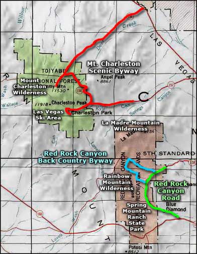
Sections of RRCNCA
For purposes of this page and to help users navigate and concentrate, we'll subdivide the area into 5 sections. These sections are based not on natural geographic lines but rather on points of access. By doing this, I hope to help people plan their time and concentrate their efforts.
The sections:
- Calico Basin
- Red Rock Canyon
- Scenic Loop-- East Side
- Scenic Loop-- West Side
- South of the Scenic Loop
Hopefully, the maps below help illustrate the layout of the area.
 From sangres.com
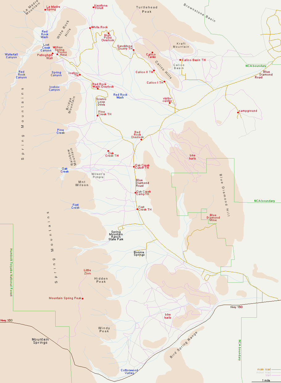 From americansouthwest.net
The following sections go into more detail about peaks and hikes in the areas and how to get to those areas. In some cases, a peak may not truly be a part of the area (example: Pincushion Peak is not really part of Calico Basin), but it is typically or most easily accessed from that location.
Some other things:
- The peaks listed are ones that have SP pages and which are attached as children to this one. Some of those peaks have subpeaks, pages for which are attached to the peak pages. This page does not list all the subpeaks, omitting ones that are more features than true subpeaks that seem to stand apart (admittedly, a very murky distinction to make).
- With each peak is a note about the difficulty rating of its standard hiking or scrambling route. For details about those routes and possible technical routes, please go to the pages themselves.
- Peaks with names in bold are ones the author has climbed. A * by the peak's name means that the author highly recommends it because of the combination of outstanding scenery and an enjoyable route (standard route-- some unstarred peaks, such as Mt. Wilson, have excellent nonstandard scrambling routes); in two instances, I have starred a peak I have not climbed, for those peaks are highly recommended by people who have climbed them. A ? after the route note means the route description does not specifically mention the difficulty and so the author has made his best guess based on the route description given.
- The list of hikes is not a complete one. I've only selected what in my opinion are the best ones. Some of the links in the last section on this page will help you find more hikes.
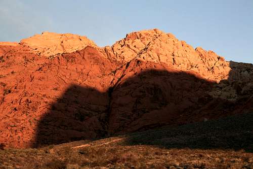
 Bridge Mountain and Bridge Point, Dawn
Calico Basin
Calico Basin has several advantages. There is no fee to enter or to park, two peaks (New and Kraft) are almost within stone-throwing distance from the parking lot, and there is fee-free access to the Calico Hills, accessed by most visitors from the Scenic Drive. One disadvantage is the presence of private property that one must be careful to respect. Another is vandalism; despite the allure of a very early start, if your car is the only one around when you head out, it might be a target, just as mine was.
To reach Calico Basin-- From Charleston Boulevard (Route 159) west of I-215 and Summerlin, turn onto the signed road to Calico Basin; this road is about one mile east of the entrance to the Scenic Drive in RRCNCA. Keep right when you reach the spur to Red Springs Picnic Area and soon bear left onto Sandstone Drive. Follow that road to its end; there is a large and obvious parking area on the left. The distance from 159 to the parking area is about two miles.
 Calico Hills from Calico Basin
Peaks
- New Peak (El Hijo)-- Class 2+
- Kraft Mountain (La Hija)-- Class 3
- Greycap*-- Class 3
- Pincushion Peak (Damsel Peak)-- Class 2+
- Pincushion Pinnacle-- Class 3 with one Class 5 pitch
 New Peak
Hikes
A very nice loop hike is possible here by hiking to the saddle between New Peak and Kraft Mountain and then descending into Gateway Canyon. From there, continue east through the canyon, eventually swinging around the east side of Kraft and then heading back to the parking lot.
 Gateway Canyon sandstone
Scenic Loop-- East Side
The principal attraction here is the Calico Hills, accessible from three turnouts along the Scenic Loop-- First Overlook, Second Overlook, and Sandstone Quarry. To get to these locations, follow SR 159 west through Summerlin and then a few miles beyond to the well-marked entrance to the Scenic Loop, which is a 13-mile one-way drive. The parking areas are all within the first three miles from the gates.
The Calico Hills are a major destination for rock climbers, and the area page attached as a child to this one has several crag and route pages attached to it.
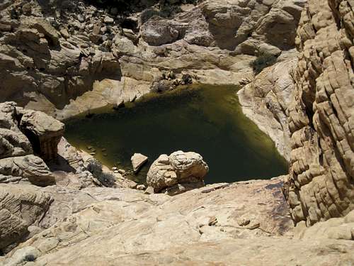
Also hidden among the Calico Hills are numerous tinajas-- depressions that hold water for much of the year and provide crucial habitat for wildlife. The highest peak there has a tinaja just below its summit.
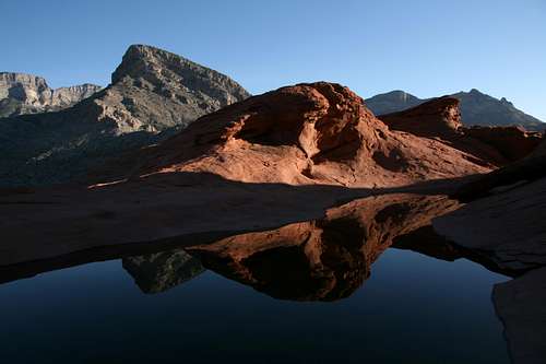 Desert reflections in tinaja below Red Cap summit
Peaks
Roughly south to north:
- Calico Tank Peak*-- Class 2+
- Red Cap (Turtlehead Junior)*-- Class 4
- Turtlehead Peak-- Class 1
- La Madre Mountain-- Class 2-3
South to north:
- Calico Hills-- from any of the three trailheads, one can pick up a trail system that goes along the western base of the Calico Hills. Use trails branch off to access crags and canyons.
- Calico Tanks-- a popular, moderate 2.5-mile (RT) trail to a large tinaja.
- Turtlehead Peak-- a steep but uncomplicated trail to the summit, about 5 miles RT.
 Calico Tank from Calico Tank Peak
Red Rock Canyon
To get there, follow SR 159 west through Summerlin and then a few miles beyond to the well-marked entrance to the Scenic Loop, which is a 13-mile one-way drive. Drive about half of the loop until you reach the Willow Springs area. Turn right onto Rocky Gap Road, which quickly becomes unpaved and quickly after that gets rough. Getting far on this road requires high clearance, and 4wd is probably going to be necessary as well. At Red Rock Pass, 5 miles from the turnoff, is the trailhead that gives access to North Peak and to Bridge Mountain.
Note-- some approach Red Rock Pass from the south via Lovell Canyon. This is almost certainly going to require a road walk to reach the pass, for less than a mile south of the pass, the road is too rough for stock vehicles and probably too rough for many modified ones. Vehicular damage is almost a given if you try driving through this section, so using this route as a way to connect SR 160 and the Scenic Loop is most definitely not recommended.
 Bridge Mountain at Dawn with Clearing Sea of Clouds
Peaks
North to south:
- Snoopy-- Class 3
- North Peak (sandstone)-- Class 2+
- North Peak (limestone)-- Class 2+
- Bridge Mountain*-- Class 3
The trails starting at Red Rock Pass are the only established trails of which I know. Across the sandstone, the routes are cairned, but there is some scrambling involved, particularly for Bridge Mountain. By the way, do not be fooled by the mileage given for Bridge Mountain on the trail signs; the official trail ends at the slickrock area below the dome of the mountain; after that, the summit route begins.
Scenic Loop-- West Side
This is the heart of the area, where the tallest, most spectacular, and most popular sandstone peaks are. Most routes begin from the parking areas that provide access to the canyons between the peaks. To get there, follow SR 159 west through Summerlin and then a few miles beyond to the well-marked entrance to the Scenic Loop, which is a 13-mile one-way drive.
 Mount Wilson, Rainbow Mountain, Rainbow Wall, and Juniper Peak
Peaks
Roughly north to south:
- White Rock Spring Peak-- Class 2+
- White Rock Mountain-- Class 3
- Icebox Peak*-- Class 4+
- Eva's Tower-- Class 3?
- Bridge Vista-- Class 4
- Bridge Point-- Class 3
- Mescalito*-- Class 4
- Yoga Peak*-- Class 4+/5
- Pine Creek Peak-- Class 4
- Juniper Peak-- Class 3
- Gunsight Notch Peak*-- Class 4
- Rainbow Wall*-- Class 3
- Rainbow Mountain*-- Class 4
- Oak Creek Peak-- Class 2+
- Cactus Flower Tower*-- 5.3
- Mount Wilson-- Class 3
 Bridge Point at Dawn
Hikes
North to south:
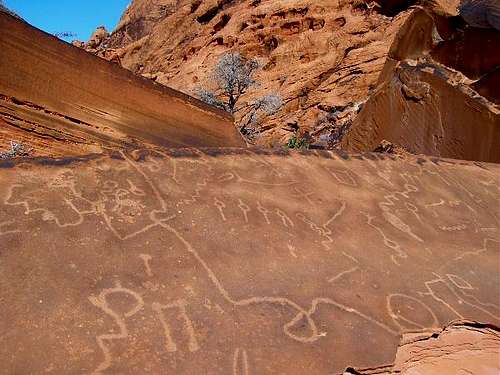
- White Rock/Willow Springs-- There are a few trails here, and you can do a loop of over 6 miles if you wish. Highlights include petroglyphs and agave roasting pits left behind by Native Americans.
- Ice Box Canyon-- About 3 miles RT, the highlight of this trail (actually, it is mostly a boulder-hop and scramble once you enter the canyon proper) is a lovely seasonal waterfall at its end.
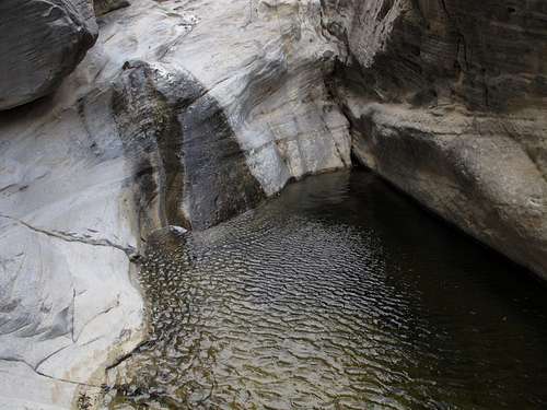
- Pine Creek Canyon-- About 3 miles RT. The official trail ends at the mouth of the canyon, and that is where the real fun begins. Head up either the north or the south fork as far as you like, encountering waterfalls, pools, and dramatic sandstone walls and formations.
- Oak Creek Canyon-- About 2 miles RT. Like the other canyon trails, this trail ends at the canyon mouth and then the fun begins. Oak Creek Canyon has two principal forks and then some smaller forks off the main ones. There are numerous waterfalls in Oak Creek Canyon.
 Butterfly and Mescalito from Pine Creak meadow-- by Anya Jingle
South of the Scenic Loop
Here we have what many refer to as the obscure portion of RRCNCA. Away from all the bustle of the Scenic Loop and farther from Las Vegas as well, the peaks here see a lot less traffic and thus offer more opportunities for solitude and discovery.
For the most part, routes to the peaks begin from trailheads off SR 159 (principally the trailheads for Oak Creek Canyon and First Creek Canyon, both a short distance past the exit of the Scenic Loop) and from unpaved roads (high clearance usually necessary) off SR 160, which effectively marks the southern boundary of RRCNCA even though the conservation area technically extends a bit south of it.
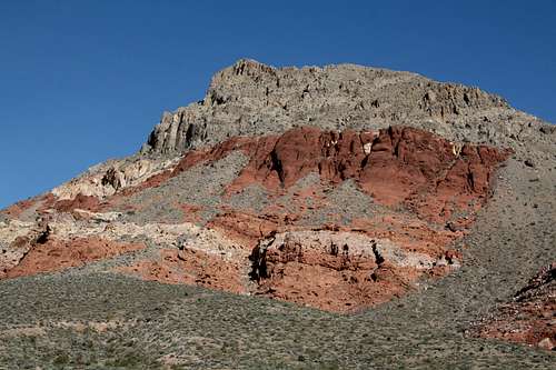
 Sandstone Peak
Peaks
North to south:
- First Creek Peak-- Class 4
- Decision Peak-- Class 4
- Indecision Peak-- Class 3
- Sandstone Peak-- Class 3
- Fork Peak-- Class 3
- Mountain Springs Peak-- Class 2
- Monument Peak (The Monument)*-- Class 4
- East Peak*-- Class 4
- Hidden Peak-- Class 3
- Whiskey Peak-- Class 3
- Black Velvet Peak*-- Class 3 (easiest and shortest route, but there is a much better Class 4 route)
- Global Peak-- Class 3
- Windy Peak-- Class 3
- Hollow Rock Peak-- Class 4
 Black Velvet Wall-- by Anya Jingle
Hikes
- First Creek Canyon-- 3 miles RT, ends at a waterfall outside the mouth of the actual canyon. As is true of the other canyons, adventure awaits for those who go onward. First Creek Canyon is the way most people approach First Creek Peak and Mount Wilson.
- Black Velvet Canyon-- You'll need high clearance to reach the trailhead. The trail is a closed road that approaches the mouth of the canyon. As it narrows into a true trail, the route approaches the mouth of the canyon. Venture beyond even if you're not climbing anything; Black Velvet Canyon is my favorite canyon in RRCNCA even though Oak Creek Canyon is probably the most scenic; what I like so much about Black Velvet Canyon is that in addition to great scenery, once past Black Velvet Wall, the canyon feels very isolated.
 Black Velvet Canyon
Native American History
Because of a concentration of reliable water sources in an otherwise especially dry desert (RRCNCA is part of the Mojave Desert, the hottest and driest in the country), the area has attracted humans for millennia. At least six different Native American cultures have been present here:
- Paleo-Indians-- 11,000-8000 B.C.
- San Dieguito-- 7000-5500 B.C.
- Pinto/Gypsum-- 3500 B.C.-A.D. 1
- Anasazi-- A.D. 1-1150
- Patayan-- A.D. 900-1800s
- Southern Paiute-- A.D. 900 to present
Petroglyphs are abundant; some are easily seen from well-marked trails and others are in "secret" backcountry locations. People have found pottery shards as well. A common "artifact" is an agave roasting pit; there are some that are very easy to see via short, easy hikes on maintained trails.
Removing or disturbing any artifacts is illegal. Even if it were not illegal, messing with them would be truly poor form.
 Indian Rock Art-- by Anya Jingle
Climate, Weather, and When To Go
Don't let the fact that this is the desert fool you into thinking it's a hot wasteland suitable for limited periods during the year. In actuality RRCNCA is an all-season destination, though the prime times vary based on the activity.
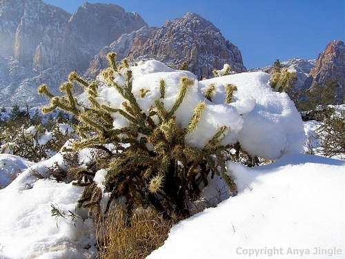
The average high in January is 53 F, with the average low being 29; the record high is 71 and the record low is 0. In July, the average high is 97 and the average low 71, with the record high being 114 and the record low 45. January through March are the wettest months (February precipitation is 2.21" on average), and May is the driest (0.24" on average). Winter frequently sees snow on the peaks and ice in the canyons; most summer precipitation is from thunderstorms, bringing the risk of flash flooding.
Note that the above figures are from the valley floor. It will usually be 10-15 degrees lower on summits, and it often is the case that the peaks are getting rain or snow but the valley stays dry.
Prime seasons:
- Hiking and peakbagging-- January through May, and September through December, for all but the shortest objectives. Even if a summit may be only 85 and you get an early start, the hike back may be through 100 degrees and dry, exposed desert. Some canyons have running water all year and make for refreshing, shaded locations on hot summer days.
- Rock climbing-- March through May, and September through November, but with notable exceptions for places such as the Calico Hills and certain south- and west-facing crags and walls that typically still have favorable climbing conditions in the winter months.
- Mountain biking and road cycling-- this page does not get into the opportunities for these activities, but the non-summer months are best.
- Windshield tourism-- all year, of course.
 Cholla Cactus-- by Anya Jingle
Red Tape
Unfortunately and also unsurprisingly given the explosion in visitation at RR over the past several years, there is so much red tape that I can't list it all and can't keep up with it since it keeps changing.
The daily fees keep going up. During certain periods of the year, you need a reservation to get in on the Scenic Loop. You can't go in early before the gates open, but you'll get ticketed and fined if you're not out by closing time. Late-exit permits are available, but they don't cover you overnight. And it looks as though Calico Basin is going to get a reservation and/or fee system, with gates.
For accurate current information, it's best to check the RRCNCA website.
The combination of sandstone, high visitation, and proximity to a large urban area unfortunately seems to attract vandals. Please do not join the ranks of the jackasses who like to scratch their names, initials, and the like into the rocks. I've even been on one unnamed summit where people used the rock in lieu of a real summit register, and it was a Class 5 peak. What a shame, and what assholes!
Climbing Regulations
It's illegal to install new bolts in the wilderness areas though you can replace existing ones. I think the same holds true for non-wilderness areas now, but if in doubt, please contact management using information from one of the links in the last section.
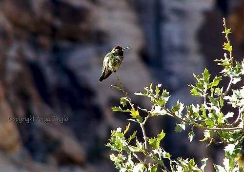 Hummingbird-- by Anya Jingle
Camping
There are no campgrounds off the Scenic Drive in RRCNCA. There is a campground outside it, though; see here for more details. Bivouacs and backcountry camping are permitted, but with permits and restrictions. Use the first link in the next section to find out more.
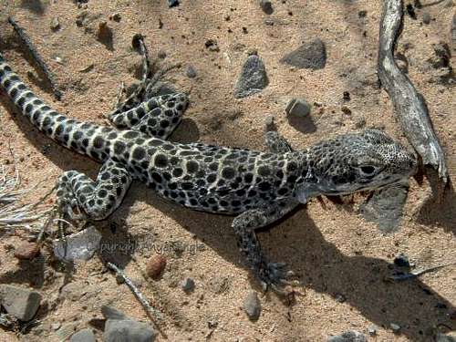 Leopard Lizard-- by Anya Jingle
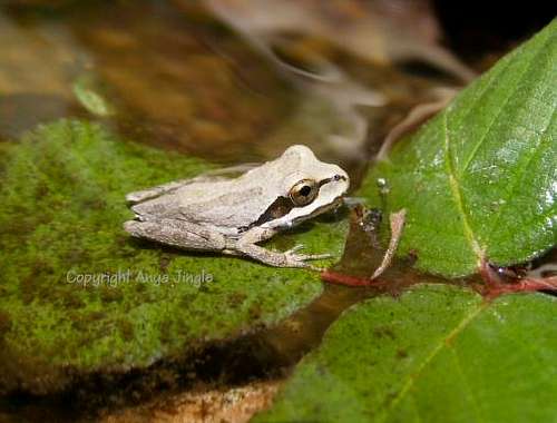 Baby Frog-- by Anya Jingle