

-
 56422 Hits
-
 98.58% Score
-
 85 Votes
|
|
Mountain/Rock |
|---|---|
|
|
45.86380°N / 6.96090°E |
|
|
13126 ft / 4001 m |
|
|
Overview
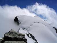
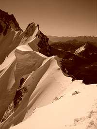
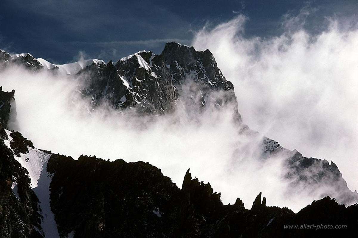 Aiguille de Rochefort above clouds - Photo by allari Aiguille de Rochefort above clouds - Photo by allari |
In memory of Rahel Maria Liu, the former maintainer of this page. Rahel died on the Innominata Spur to Mont Blanc in a snowstorm on August 24th, 2004.
 |
 |
 |
 |
 |
| Rochefort Ridge | Sunset | Sunrise | View of Grandes Jorasses | Sunrise |
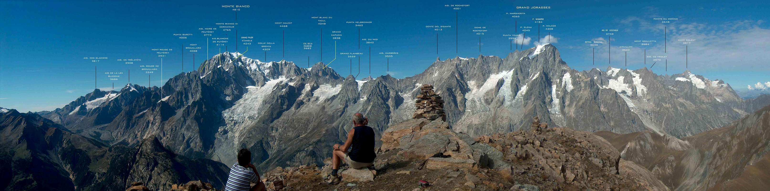
Aiguille de Rochefort - a mountain of the Mont Blanc Massif
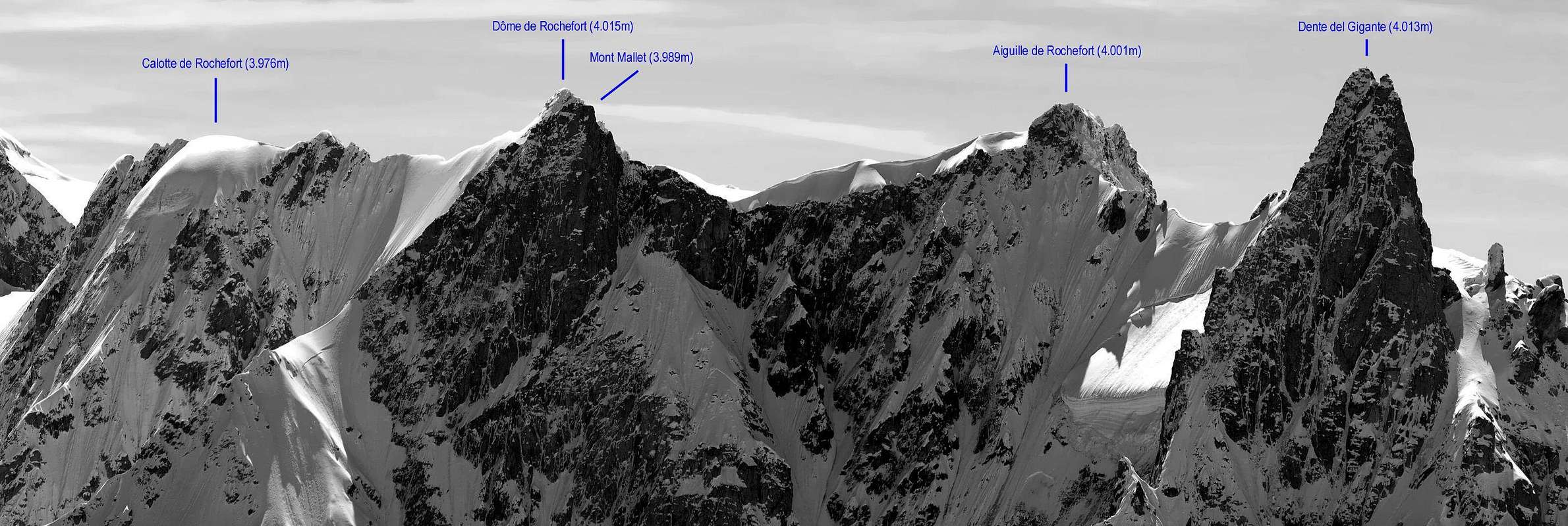
- The Aiguille de Rochefort (4001 m) is an important mountain of the Mont Blanc MASSIF. It is not the highest point of the famous Rochefort Ridge, but the most visited summit. From the Aiguille de Rochefort, you have a wonderful view around. The highest summit of the Rochefort crest is the Dôme de Rochefort with its 4015 m. But it is less visited than the Aiguille de Rochefort which is located about in the middle of the ridge between the Dent du Géant and the Col des Grandes Jorasses.
- About 50 % of the mountaineers who climb the Aiguille continue to the Dôme. There are higher summits with more different shapes in the Mont Blanc region, but there exists only one Rochefort Ridge. Although some people think that the Rochefort Ridge ends at the Aiguille de Rochefort, this is only partly true.
- Viewed precisely, the end of this ridge is not before the Calotte de Rochefort, 3974 m, the NE edge pillar of the crest. But you can leave this summit, unless you want to climb to the Bivacco Canzio at the Col des Grandes Jorasses and to traverse the Grandes Jorasses the next day.
Historical note:
- The first climb of the Aiguille de Rochefort was on 14. August 1873 by the british climber J. Eccles with his french guides M.-C. and A. Payot. 3 years later, these 3 persons also climbed the Dôme de Rochefort for the first time. Not before July 1900, 4 mountaineers continued the Rochefort Ridge in direction of the Dent du Géant. This was the basis of the whole traverse which was undertaken for the first time by Karl Blodig and Max Horten from Bonn on the 2nd of August 1903.
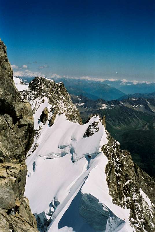 W Side of Aiguille de Rochefort - Photo by Rahel Maria Liu W Side of Aiguille de Rochefort - Photo by Rahel Maria Liu |
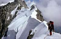
On the Rochefort Ridge
- The Rochefort Ridge is dreamlike. It is as unique as the Bianco Ridge at the Piz Bernina. It is one of the most beautiful and worthwhile tours. Incomparable are the horizontal passages at the part of the mountain massif together with the very exposed passages at the firn crests which seem to be like knives, seen from the Dent du Géant. Very attractive is the whole traverse of the Rochefort Ridge from the Col du Géant to the Col des Grandes Jorasses including the traverse of the Grandes Jorasses. The traverse from the Col des Hirondelles to the Col du Géant is difficult and not often climbed. For this route, very much experience is necessary. The other routes, especially through the NW Face with its seracs, are climbed very scarcely.
Historical note:
- There are routes for extreme climbers: for example the 700m high and 70° steep north-west face - a new route of Hermann Bratschko, Karl Schreiner, Emil and Karl Rupilius, climbed on the 25th of July 1932 in 12 hours. Or the 200m higher south face. On the 16th of July 1935, Francesco Ravelli and Maria de Benedetti from Torino opened a new direct route through the crumbling rock of this face. The Dôme de Rochefort N Face has been climbed by Angelo Piconi and Luciano Pasi in 3 hard days from the 17th to the 19th of September 1971: the "Toni Gobbi memory route" in memory of the famous guide from Courmayeur (first winter climb of the Grandes Jorasses Hinrondelles ridge, Aiguille Noire S Ridge, "Major route" through the Mont Blanc Brenva flank). He died with the age of 65 years 1970 in an avalanche at the Sassopiatto (Plattkofel - Dolomites).
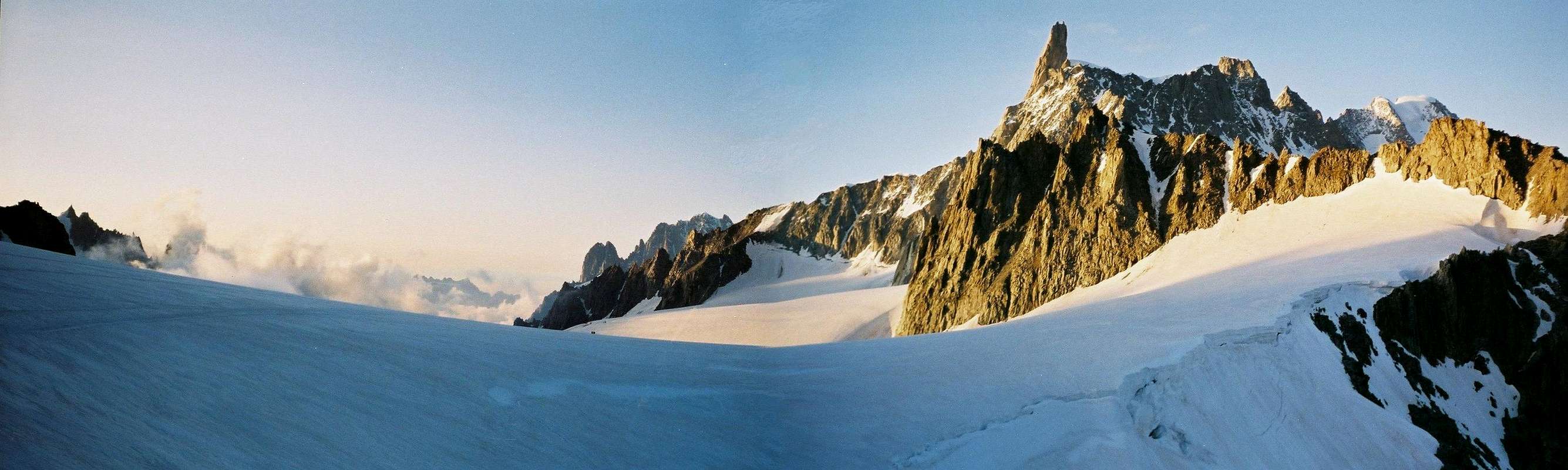
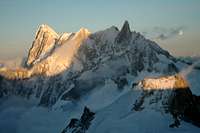
 South Side of Aiguille de Rochefort - Rochefort Ridge and Grandes Jorasses - Photo by SalVal South Side of Aiguille de Rochefort - Rochefort Ridge and Grandes Jorasses - Photo by SalVal |
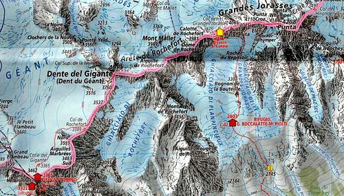
Peaks on the way:
- Dent du Géant (4013 m) - Aiguille de Rochefort (4001 m) - Dôme de Rochefort (4015 m) - Calotte de Rochefort (3974 m)- Pointe Walker (4208 m) Photos by andrea.it - Antonio Giani - Rahel Maria Liu
 |
 |
 |
 |
 |
| Dent du Géant | Aiguille de Rochefort | Dôme de Rochefort | Calotte de Rochefort | Pointe Walker |
Route Overview
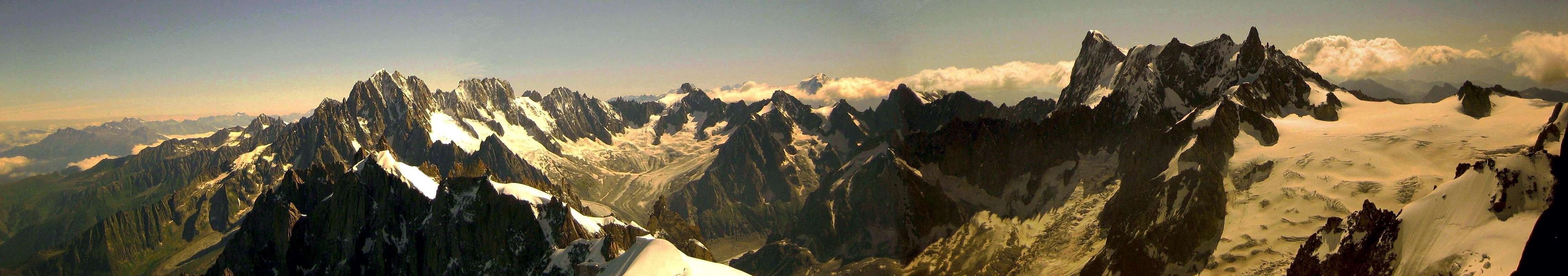
 Dent du Géant - Rochefort Ridge - Grandes Jorasses - Photo by Gangolf Haub Dent du Géant - Rochefort Ridge - Grandes Jorasses - Photo by Gangolf Haub |
W Ridge
- AD, II and I, 200 hm, length: 800m, 3 1/2-5 h from Rif. Torino, 1 1/2 h from the beginning of the ridge, as descent 1 h less (Eberlein)
- AD, 2 h from the col to the 'dining room'. 1-2h from the 'dining room' to the Aig. de Rochefort, 816 hm Rébuffat
- III, AD, 4 h from the hut (Laroche/Lelong) III, AD (Damilano/Perroux)
- route from 1972: IV 3. 600 m (Damilano/Perroux) 'Bye Bye Baby: VI 6. 600 m. Seracs (Damilano/Perroux)
- Route from 1932: V 3. 600 m (Damilano/Perroux)
* Route from Rifugio Torino to Aiguille de Rochefort
 |
 |
 |
 |
 |
 |
 |
 |
 |
Descent over the glacier de Leschaux to Montenvers:
- PD, 6-7 h to Montenvers (Eberlein)
NE Face
- Classic route: II, AD (Damilano/Perroux) Over the glacier du mont Mallet: III, AD, 300 m (Damilano/Perroux)
Traverse Aiguille de Rochefort - Grandes Jorasses (4208 m)
- IV, 6-8 h from the Col du Géant to the Col des Grands Jorasses; 6-8 h from the Col des Grands Jorasses to the Pointe Walker. 5-6 h from the Pointe Walker to the Col des Hirondelles, 850 hm, long mixed route of which the second part is very committing (Rébuffat). From Col des Grandes Jorasses to Calotte de Rochefort: IV D, 5c (Damilano/Perroux)
* Climbing the Rochefort Ridge
 |
 |
 |
 |
 |
|
 |
 |
 |
 |
 |
Getting There
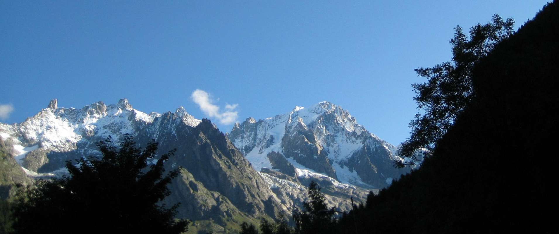
 Aiguille Verte - Dent du Géant - Aiguille de Rochefort - Photo by Rahel Maria Liu Aiguille Verte - Dent du Géant - Aiguille de Rochefort - Photo by Rahel Maria Liu |
To the Aiguille de Rochefort
- You can come from Les Cosmiques. You can come from the Rifugio Torino.
To Les Cosmiques
- In order to reach the hut, you need about 1/2 h from the Aiguille du Midi. If you leave the cable car station via the bridge, you go to the South summit. On the firn ridge, you go down in SE direction of an even ridge platform; then turn right to the S and in SW direction below the S Face of the Aiguille du Midi. Pay attention to crevasses! You reach the Aiguille du Midi with cable car from Chamonix.
To the Rifugio Torino
- You reach the hut directly with the cable car from Entrèves/Courmayeur (Italy). You can reach the hut directly also with the Helbronner cable car from the Aiguille du Midi (to Aiguille du Midi with the cable car from Chamonix. Or you go on foot from the Aiguille du Midi over the Glacier du Géant (3 h): From the foot of the S Face of the Aiguille du Midi you go on the almost even glacier to the Pointe Lachenal, turn left (E) to the glacier valley below the rugged E Face of the Mont Blanc du Tacul. You go along this E Face of the Tacul and the Pointe Adolphe Rey in order to loose only little height. Now you turn to the ESE to the Col des Flambeaux. From here in a few minutes to the Rifugio Torino. It is a very beautiful glacier walk with 200 hm ascent. Difficulty: F.
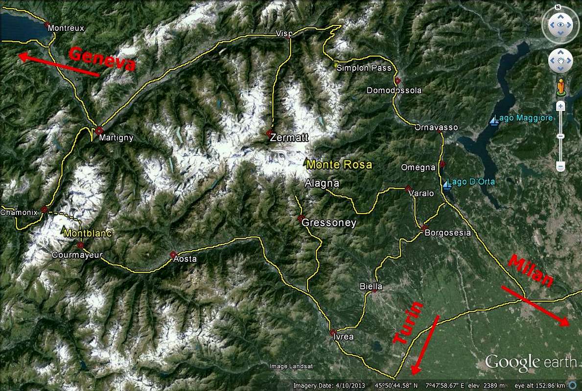
You reach the Chamonix Valley by train
- From Martigny (Switzerland) via Vallorcine. From Geneva (airport) via Annecy (TGV till here) and St. Gervais.
You reach the Chamonix Valley by bus:
- From/via Annecy, Geneva, Grenoble, Courmayeur, Aoste and Turin
 Descent 1868 - Photo from ericvola Descent 1868 - Photo from ericvola |
You reach the Chamonix Valley by car:
- From Geneva (from the NW) on the A40 till St. Gervais and from here on the N205. From Martigny (from the NE, Switzerland) via Vallorcine and the Col des Montets on the road no. N506.
You reach the Val Ferret (Italy) by bus or car:
- From Chamonix through the Mont Blanc Tunnel from the NW. From Torino (from the SE) on the A5 via Villeneuve.
Accomodation
 Panorama Aig. Verte - Aig. de Triolet - Rochefort Ridge (Photo by Hiltrud Liu) Panorama Aig. Verte - Aig. de Triolet - Rochefort Ridge (Photo by Hiltrud Liu) |
Les Cosmiques (3613 m)
 |
The refuge Les Cosmiques is situated on a shoulder between the Col du Midi and the SW ridge of the Aiguille du Midi (Cosmiques ridge). |
- 120 beds guarded from mid-February to mid-October phone: ++33(0)450544016
Rifugio Torino (3322m/3375m)
|
The Rifugio Torino has 2 huts, the lower and older one and the upper, new one. Both huts are connected by a tunnel. |
- 180 beds guarded from mid-February to mid-October
General Information
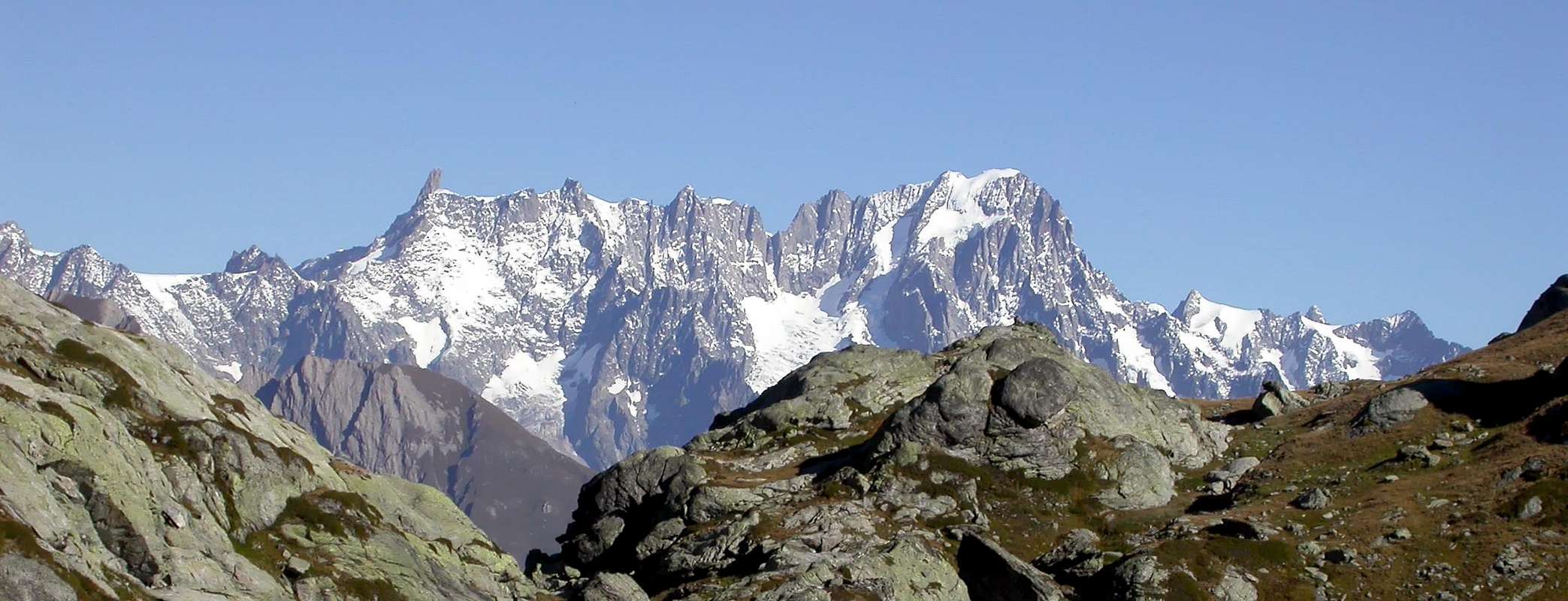
 Aig. Verte - Aig. de Triolet - Rochefort Ridge - Grand Capucin - Mont Blanc du Tacul and Mont Blanc (Photo by Hiltrud Liu) Aig. Verte - Aig. de Triolet - Rochefort Ridge - Grand Capucin - Mont Blanc du Tacul and Mont Blanc (Photo by Hiltrud Liu) |
WEATHER INFOS
- Phone: 0033/836680274 Snowinfo: 0033/836 681 020 (only in France)
GENERAL INFOS
Office de Haute Montagnes (OHM)
- / Phone: 0033450 532 208
- in Chamonix Phone: 0033/450530088
Società Guide Alpine Courmayeur
TRAIN CHAMONIX VALLEY
- Phone: 0033/450 53 1298 - 0033/8 36 35 35 35 0033/450530702 (Train station Chamonix)
BUS CHAMONIX VALLEY
- Phone: 0033/450 53 0555 - 0033/450 53 0115
CABLE CARSChamonix
- Phone: 00390/165.846658, Fax 00390/165.842347 No permits or fees required, no seasonal closure Big parking places in Chamonix and Courmayeur near the Cable Car ground station
CAMPINGPLACES
- There are campingplaces in
* Aiguille de ROCHEFORT - Photos by signorellil, badyl, Jeroen Vels, Hiltrud Liu and allari
 |
 |
 |
 |
 |
| East Side | West Side | North Side | South Side | Back from Rochefort |
Maps&Books
 View of Rochefort Ridge and Grandes Jorasses (Photo by Hiltrud Liu) View of Rochefort Ridge and Grandes Jorasses (Photo by Hiltrud Liu) |
Institut Géographique National
- 1:25000 no. 3630 OT Chamonix - Massif du Mont Blanc
Instituto Geografico Centrale
- 1:25000 no. 165107 IGC Monte Bianco
- 1:30000 Meridiani Montagne “ Monte Bianco” map
 "Monte Bianco” map 1:30.000 from AlbertoRampini
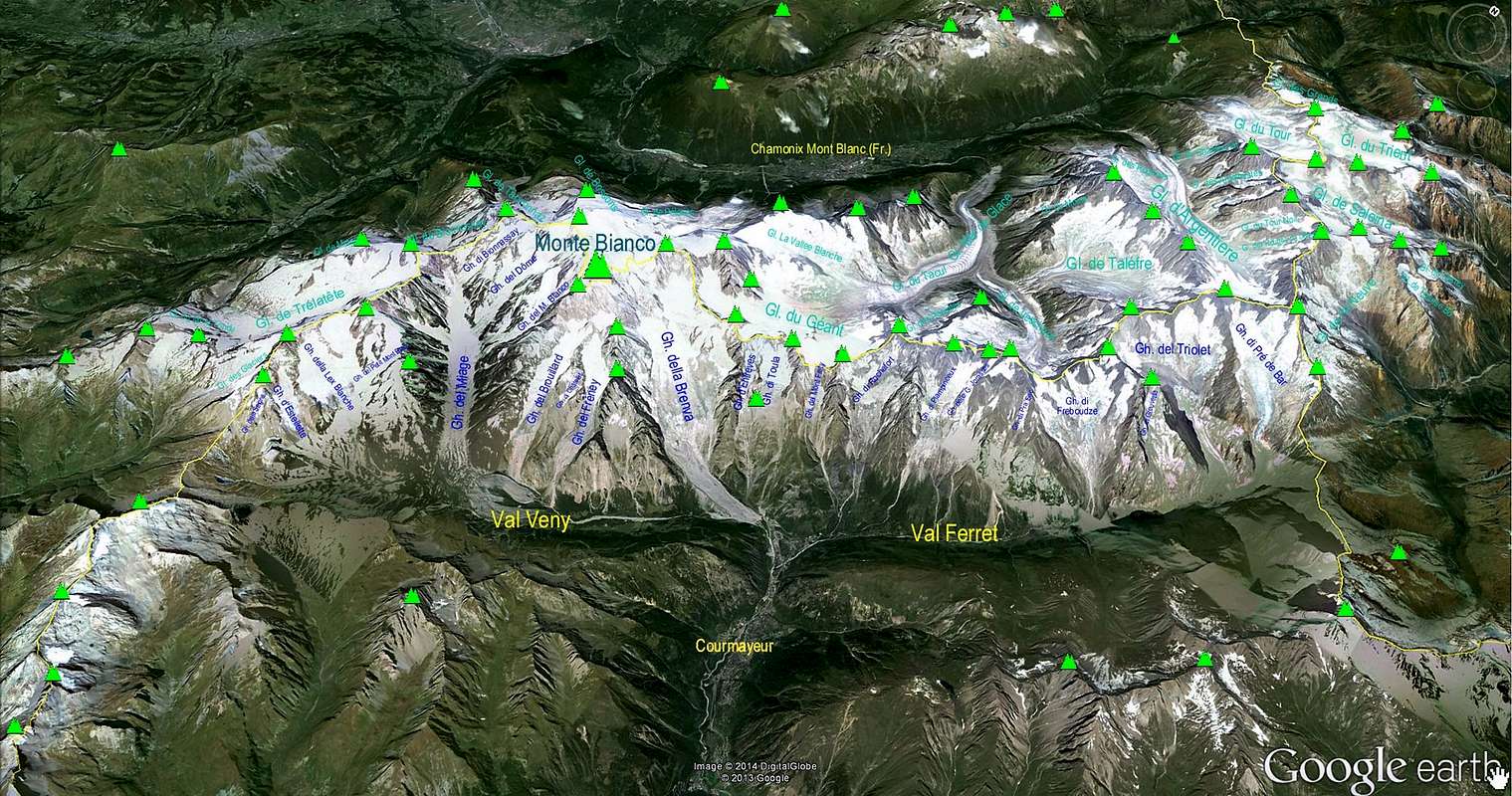
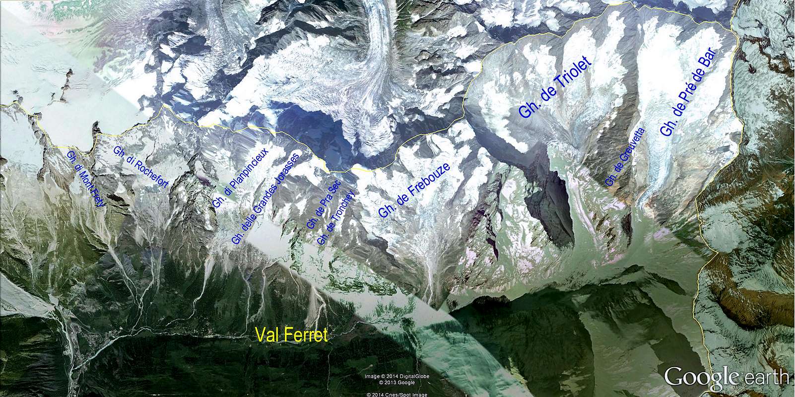 Google earth Glacier de Rochefort in Val Ferret - Photo from Antonio Giani Google earth Glacier de Rochefort in Val Ferret - Photo from Antonio Giani |
BOOKS
Hartmut Eberlein
- , Mont-Blanc-Gruppe. Gebietsführer für Bergsteiger und Kletterer, 2000 or 2012.
Helmut Dumler/Willi P. Burkhardt
- , The High Mountains of the Alps.
Gaston Rébuffat
- : The Mont Blanc Massif. The 100 Finest Routes. London 1996. ISBN 1-898573-03-4.
Hartmut Eberlein
- : Mont-Blanc-Gruppe. DAV-Gebietsführer. 9th ed. Munich 2000. ISBN 3-7633-2414-3.
Helmut Dumler/Willi P. Burkhardt
- , Viertausender der Alpen. 11th ed. Munich 1998. ISBN 3-7633-7427-2.
Laroche/Lelong
- : Die Gipfel des Montblanc. Munich 1999.
Damilano/Perroux
- , Neige, Glace Et Mixte: Mont Blanc. Editions Ice 1996. ISBN 2950986803.
Lindsay Griffin
- , Mont Blanc Massif, Vol. 2 - Published Alpine Club (2002) - ISBN 0-900523-58-1.
Gino Buscaini
- , MONTE BIANCO, Vol. II, Guida dei Monti d'Italia, 1983.
Link MountainArea
 Rochefort Ridge - Phot by Rahel Maria Liu - 2002 Rochefort Ridge - Phot by Rahel Maria Liu - 2002 |
 |
MountainArea |
Società Guide Alpine Courmayeur - Italy
 The Rochefort family N side - Photo by Antonio Giani The Rochefort family N side - Photo by Antonio Giani |
 Monte Bianco Italian Ridge - as seen from Testa di Liconi - Photo by mar.ali Monte Bianco Italian Ridge - as seen from Testa di Liconi - Photo by mar.ali |
Google Map
 Google Map - Photo from markhallam
 Google Earth Mont Blanc Area - Photo from Antonio Giani Google Earth Mont Blanc Area - Photo from Antonio Giani |