

-
 95103 Hits
-
 98.85% Score
-
 91 Votes
|
|
Mountain/Rock |
|---|---|
|
|
45.93550°N / 6.96860°E |
|
|
13523 ft / 4122 m |
|
|
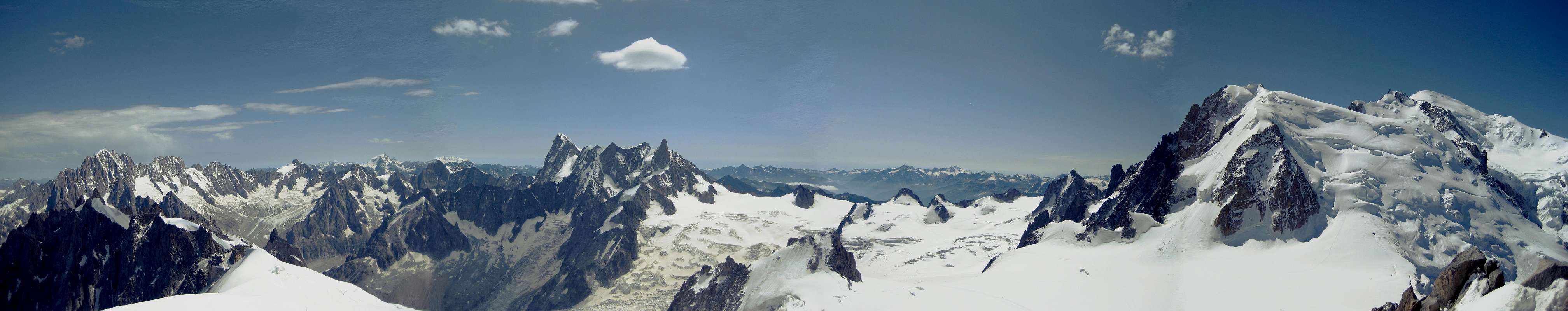
Overview
 West Side of Aiguille Verte - Photo by om
 |
 | 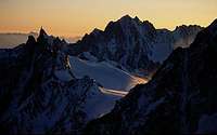 |  |  |  |
| Panoramic View | Good View | Aiguille Verte | Panorama | Aiguille Verte |
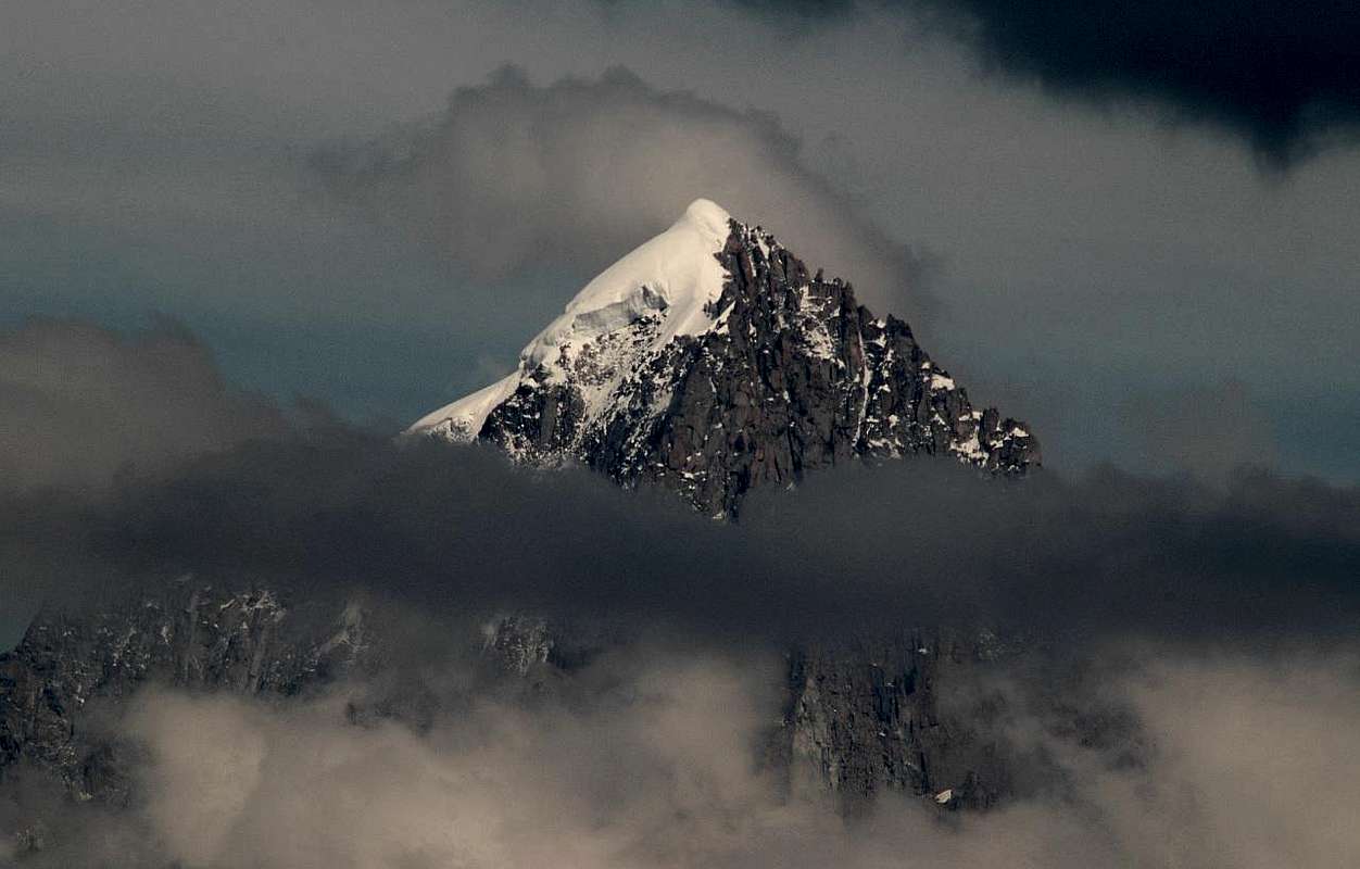
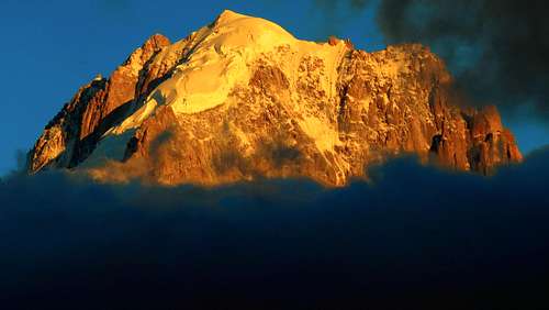
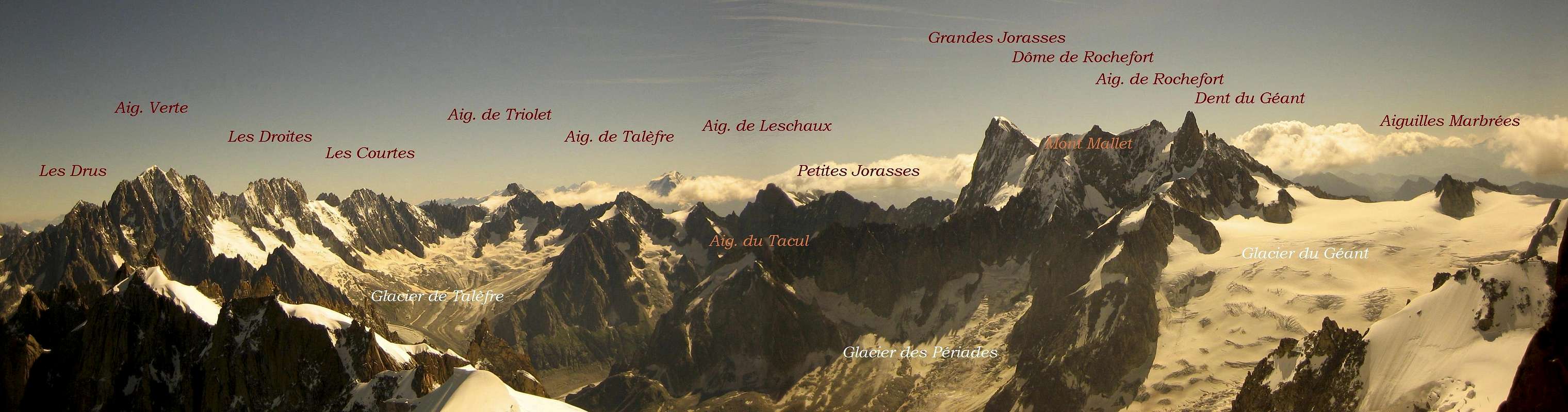
- The Aiguille Verte (4122 m) is one of the most prominent mountains of the Mont Blanc range. It is very visible from Argentière.
Besides Mont Blanc and Grandes Jorasses, Aiguille Verte is one of the most beautiful mountains of the Mont Blanc Massif - because of the huge rigdes.
Eberlein calls it even the most beautiful mountain of the Alps at all (Eberlein, 357).
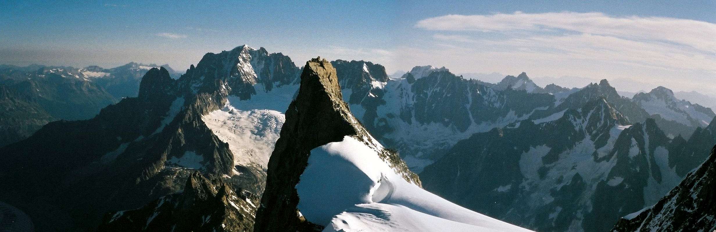
Besides the famous couloirs (NE and NW), the big ridges are interesting for climbers. The most beautiful route is probably the traverse Sans Nom - Jardin Ridge.
Even the Moine Ridge (SW ridge) is not easy. Therefore the Aiguille Verte is the most difficult 4000 m peak of the Alps.
- First ascent: E. Whymper with Ch. Almer and F. Biner on 29. June 1865.
Routes Overview
- 48° in the average, till 55°, 530 hm, AD, 3-6 h (Eberlein, p. 357f.)
- Photos by filova - theboss - albertolazza - Pablo


- III and II, AD, 500 hm, 6-7 h (Eberlein, p. 359f.)
- IV, mostly easier, ice about 50°, D, 700 hm, 6 h (Eberlein, p.360)
- IV+ (1passage), mostly IV and III, D+, 950 hm, 10-15 h (Eberlein, p. 361)
- IV, mostly III, mixed, ice till 58°, average 52°, D+, 900 hm (face), 7-12 h (Eberlein, 363)
- IV+, mostly III and IV, ice till 50°, D, 900 hm (ridge), 10-12 h from Col des Grands Montets (Eberlein, p. 364)
- Cordier Couloir:
55° average, D+, 1000 hm, 7-10 h (Eberlein, p. 367)
- V, mostly IV, ice till 50°, TD-, alltogether 1050 hm (face), 600 hm rock climbing and mixed, 450 hm ice, 8-10 h (Eberlein, p. 367)
- 55° at 300 m, average: 49°, D-, 900 hm (face), 4-8 h (Eberlein, p. 369)
- * Photos by kabernicola - Nader1 - rasto krizan - [X]Bird
 |  |  |  |  |
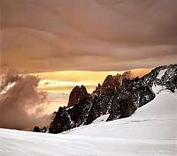
| Route | Couturier | Skiing down | Hut | Sunset |
- IV (2 passages), mostly III and II, D-, 450 hm till Aig. Jardin; from here 300 hm, 8-10 h (Eberlein, p. 371)
- IV+, mostly IV and III, D+, 2 days (Eberlein, p. 372)
- * Photos by SP members - Aiguille Verte - Couloir Whymper - Couloir Couturier
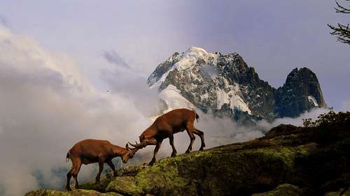
Rahel Maria Liu, Chamonix Man, Jeroen Vels, TodoVertical, Jurgen Mesman and fogliczech
 |  |  |  |  |
Getting There
 Sillhouette of the Drus - Aiguille Verte - Les Droites and Les Courtes - Photo by pvangeenen
 |
- You can come from the Ref. d'Argentiere.
You can come from the Ref. de Couvercle.
- In order to reach the hut, you have 3 possibilities:
From Croix de Lognan (1970 m) in 3 - 3,5 h, to Croix de Lognan with cable car from Argentière: From Croix de Lognan, you go on foot up over the morainecrest till about 2250 m. Than you continue horizontally to the glacier, which you follow on the orographically left side. After about 1 km, the glacier becomes steeper and more torn. You climb onto the morain of the Rognons, first over a slippery shelf, then via a marked way which you follow until you reach the upper end of the ice break. You climb the glacier in SE direction and reach over the moraine the hut.
On foot from Argentière in 5 h: From the ground station of the cable car, you follow the wide aisle of the ski-run. You leave it at the height of about 1750 m and reach the way of the middle station of the cable car (2 h). Now, you need 3 h to the hut.
From Aiguille des Grands Montets (summit station of the cable car from Argentière; last train up: 4:45 p.m.) in 2 h: From the summit station, you go via a stairway to the Col des Grandes Montets. You traverse a bergschrund (maybe with the help of a rope) and go up the steep hang to the Glacier Rognons. You go in ENE direction on the western side along P. 3000 to P. 2754 m. You go down in south-eastern direction of the glacier d'Argentière, which you reach above the ice break. From here in 2 h to the hut.
You reach Argentière by train (from Martigny/CH or Geneva or Annecy - TGV to St. Gervais), bus (from Annecy, Geneva, Grenoble, Courmayeur, Aoste and Turin) or car from Geneva or Martigny (Switzerland) via Vallorcine and the Col des Montets.
- You reach the hut from Montenvers in 3,5 h over the glacier. From Montenvers to the starting point of the hiking way to the Ref. d'Envers des Aiguilles: You have to follow the way in direction of Les Echelles which goes slightly down to the western side of the Mer de Glace. But before you enter the Glacier, you have to follow the way on the western side of the glacier for about 20 min. Now you have to go up the glacier first more on the western side, then just through the middle in SE direction of Les Moulins. Now you do not follow the marking signs to the moraines but continue in S and then E direction of the steep passages at Les Egralets (partly a little bit like a way). You go the steep passages up and via a good way through grass hangs to a moraine, from which you reach the hut soon.
You can reach the hut via a new climbing track below the Flammes de Pierre and the ends of the Aig. du Moine to the Ref. du Couvercle. But because of ice avalanches, some passages of this route have become very dangerous. You have to ask for the actual conditions. 3,5 h from Montenvers to Couvercle.
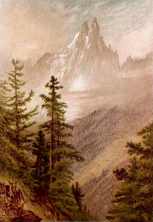 Aiguille Verte - Photo from Elijah Walton 1868
 |
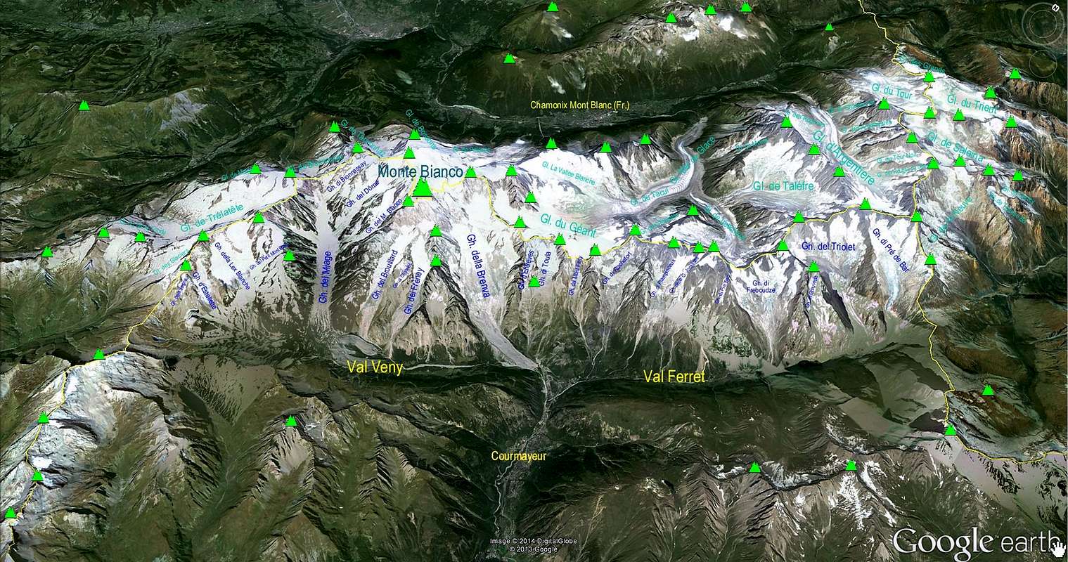
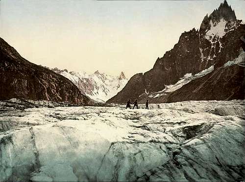 Mer de Glace Mer de Glace | 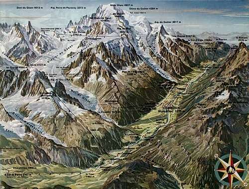 Mont Blanc Massif Mont Blanc Massif |
- From Martigny (Switzerland) via Vallorcine.
From Geneva (airport) via Anncey (TGV till here) and St. Gervais.
- From/via Annecy, Geneva, Grenoble, Courmayeur, Aoste and Turin
- From Geneva (from the NW) on the A40 till St. Gervais and from here on the N205.
From Martigny (from the NE, Switzerland) via Vallorcine and the Col des Montets on the road no. N506.
- From Chamonix through the Mont Blanc Tunnel from the NW.
From Torino (from the SE) on the A5 via Villeneuve.
Mountain Huts
 Ascent (Photo by ericvola)
 |
| Refuge d'Argentière is a modern big hut with a view directly to the north faces on the opposite side: from Aiguille Verte to Mont Dolent. It is situated near the corner where the Glacier d'Argentière and the Glacier des Améthystes come together. |
- Phone: 33 (0)4 50 53 16 92 - Email: refugeargentiere@wanadoo.fr
Guarded: From the end of June to mid-September
Places number: 150
You reach the Refuge d'Argentière:
from Croix de Lognan (1970 m) in 3 - 3,5 h, to Croix de Lognan with cable car from Argentière
on foot from Argentière in 5 h
from Aiguille des Grands Montets (summit station of the cable car from Argentière) in 2 h
| Refuge du Couvercle is situated very nicely in the region of the Aiguille du Moine. It is visited frequently. Instead of the old hut, a new big house was built in 1952. |
- Tél : 33 (0)4 50 53 16 94
Guarded from mid-June to mid-September
Places number: 120
You reach the Refuge du Couvercle:
from Montenvers in 3,5 h via moraines
via the Balcon du Mer de Glace in 3,5 h
Infos
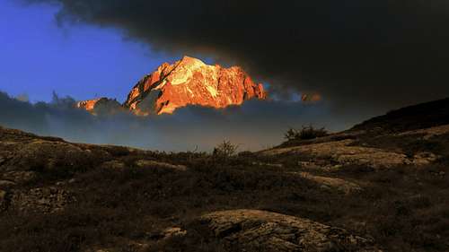
* Aiguille Verte - Photos by Jonathan Griffith, Antonio Giani, Jurgen Mesman, charles and om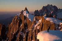 |  | 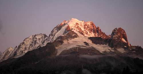 | 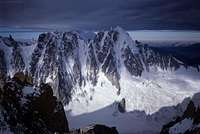 |  |
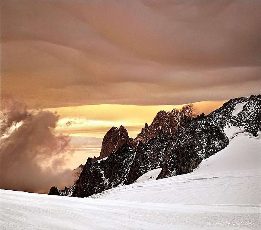
| Sunset | South Side | North Side | East Side | West Side |
- Météo France
Phone: 0033/836680274
Snowinfo: 0033/836 681 020 (only in France)
Chamonix
avalanche-net.com
Meteo Italy
Courmayeur
- Office de Haute Montagnes (OHM)/
Phone: 0033450 532 208
Bureau des Guides in Chamonix
Phone: 0033/450530088
Chamonix
Guide Alpine Courmayeur
Società Guide Alpine Courmayeur
Courmayeur
- Phone: 0033/450 53 1298 - 0033/8 36 35 35 35
0033/450530702 (Train station Chamonix)
Phone of the Montenvers-train: ++33(0)450/531254
Ticket shop
- Phone: 0033/450 53 0555 - 0033/450 53 0115
- Chamonix
Courmayeur
Phone: 00390/165.846658, Fax 00390/165.842347
- There are campingplaces in
Chamonix and Courmayeur
|  |  |
Maps&Books
- 1:25000 no. 3630 OT Chamonix - Massif du Mont Blanc
- 1:25000 no. 165107 IGC Monte Bianco
- Mappa Courmayeur cartina
DAV Shop
cordee.co.uk
Hikr.org - Aiguille Verte
4000er Karte - www.4000er.de
- Hartmut Eberlein, Mont-Blanc-Gruppe. Gebietsführer für Bergsteiger und Kletterer, 2000 or 2012,
Helmut Dumler/Willi P. Burkhardt, The High Mountains of the Alps.
Gaston Rébuffat: The Mont Blanc Massif. The 100 Finest Routes. London 1996. ISBN 1-898573-03-4.
Erich Vanis, Im steilen Eis. 80 Eiswände in den Alpen. Munich et al. 1980. ISBN 3-405-12158-2.
Damilano/Perroux, Neige, Glace Et Mixte: Mont Blanc. Editions Ice 1996. ISBN 2950986803.
Laroche/Lelong: Die Gipfel des Montblanc. Munich 1999. ISBN 3-405-15693-9.
Helmut Dumler/Willi P. Burkhardt, Viertausender der Alpen. 11th ed. Munich 1998. ISBN 3-7633-7427-2.
Lindsay Griffin, Mont Blanc Massif, Vol. 2 - Published Alpine Club (2002). ISBN 0-900523-58-1.
Rother Skitourenführer - Hartmut Eberlein, Mont Blanc (S. 97)
Link MountainArea
| MountainArea |
Google Map
* Google Map - Mont Blanc Area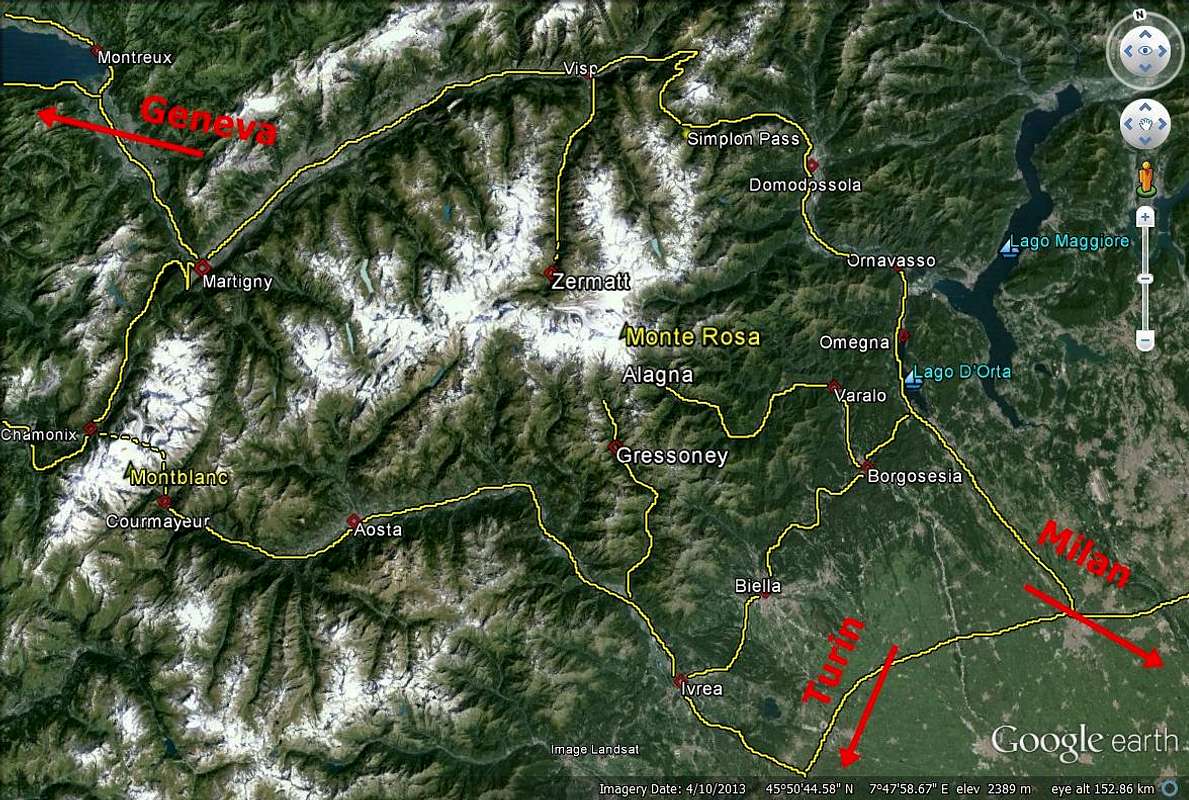
* Google Map - Mont Blanc Area