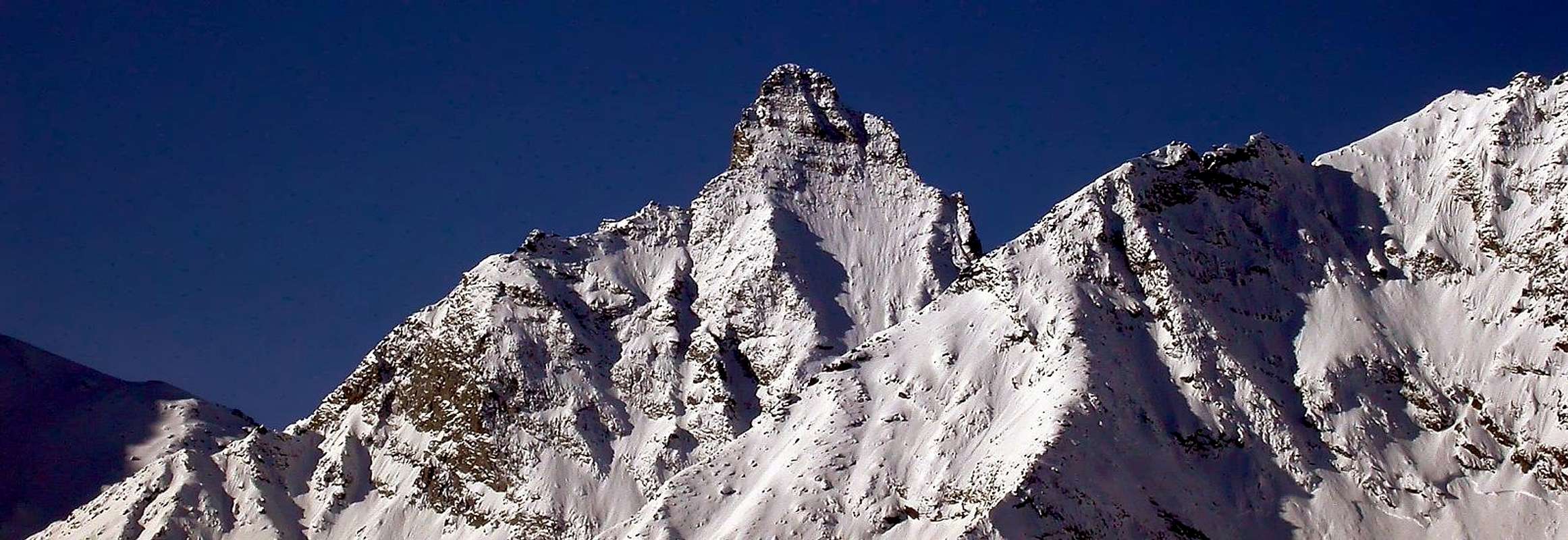
Fine mountain with a slender pyramidal shape and remarkable summital towers. It look like the close Herbetet without having the same glacial mass; the "shadow" of the Grivola (about 500m higher) towers above it throwing its North-northwest and Northeast Slopes into the Gran Nomenon and Trajo Valleys. From its Summit a noteworthy panorama.
Bella montagna a forma di piramide slanciata, con notevoli torrioni sommitali. Somigliante al vicino Herbetet, del quale però non possiede le masse glaciali; inoltre "l'ombra" della vicina Grivola, di ben 500 metri più alta, la sovrasta proiettando i suoi versanti Nord-nordovest e Nordest rispettivamente sui Valloni del Grand Nomenon e del Trajo. Notevole il panorama che si osserva dalla sua Cima.
First Ascents
First on the summit (N Wall eperon N-NE): F. Montaldo, A. Boggiatto and Antonio Castagneri, (Jun 25th, 1877).
First in winter: J. Henry, J. L. Chabod and P. Lavy, (Dec 06th, 1901).
E-NE Arête: F. Chabod, A. Rossi and E. Losero, (Aug 08th, 1920).
S Wall and S Arête: G. Yeld, S. Henry and O. Bougiot, (Aug 07th, 1883), in descent.
SE Wall and S Arête: M. Borelli, N. Borelli, G. A. De Petro and P. Viglino, (Aug 20th, 1917), in ascent.
SE Arête and S Arête: A. Trèves, C. Zucconi U. Dayné and E. Dayné, (Jul 20th, 1912).
W Wall: A. Nay, (Aug 16th, 1911), in descent.
W Wall: S. Glarey, V. Marcoz and R. Chabod, (Jul 29th, 1937), in ascent.
N Arête: G. Yeld, S. Henry and O. Bougiot, (Aug 07th, 1883).
Getting There
BY CAR:
From Torino, Milano, etc: Motorway A5. Exit at Aosta Ovest. Drive to the near Aymavilles. Follow the directions for Valle di Cogne.
From Switzerland: through the Grand Saint Bernard Tunnel or the namesake Pass. Drive to Aosta, then follow the direction for Courmayeur on SS.26. Just after Sarre, turn to the left, in the direction of Valle di Cogne.
From France: through Mont Blanc Tunnel or Petit St. Bernard Pass. It isn't necessary to take Motorway A5: you can drive on SS.26, in the direction of Aosta. Before arriving at the Village of Sarre, turn right following the sign for Valle di Cogne. After Aymavilles, the SR.47 crosses the Villages of Vieyes, or Silvenoire.
BY PLANE:
Aeroporto "Corrado Gex" Saint Christophe (Aosta).
Itinerary
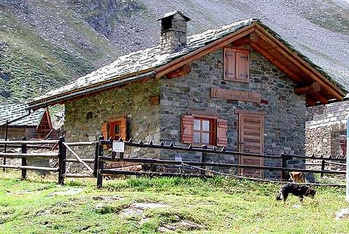
From the small Villages of Vieyes (1.158m), or Silvenoire (1.331m) (Aymavilles) walk up to the Plan Pessey (1.361m) biult up, ascend along the steep hairpins the path bordering the left side of Nomenon Stream up to the Petit Nomenon (1.986m) and the following Grand Nomenon Pastures (2.323 m. Bivacco Mario Gontier and P.N.G.P. Guard Hut).
Dalle piccole Frazioni di Vieyes (1.158 m), o di Silvenoire (1.331 m), nel Comune di Aymavilles, raggiungere le Baite di Plan Pessey (1.361 m); risalire su ripidi tornantini il sentiero fiancheggiante la sponda sinistra del Torrente di Nomenon sino a raggiungere l'Alpeggio del Petit Nomenon (1.986 m) e il successivo di Grand Nomenon (2.323 m Bivacco Mario Gontier e Casotto P.N.G.P.).
Route
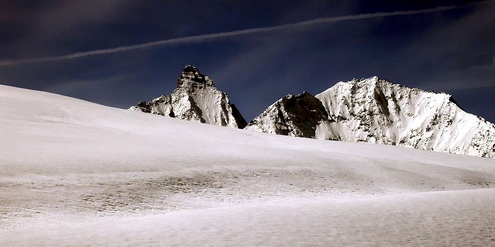
From the Bivouac follow the track west of the small valley between the Mont Favret and the Grand Nomenon toward the Colle di Charbonnière (2.916m); at about 2.600m leave it and, toward South, reach the base of the North Wall. Climb in its middle an evident spur coming down toward North-norteast, and along its easy slopes becoming steeper, up to the summital scaffold made of not difficult rocks that, due to their instability, require attention (7h'00/7h'30).
Descent: Coming down is along the same route or along the N ridge toward the Colle di Charbonnière: in this case avoid the summital towers on the SW side, descending along two short chimneys and getting back the ridge.
Dal Bivacco seguire la traccia ad Ovest del valloncello compreso tra il Mont Favret e il Grand Nomenon in direzione del Colle di Charbonnière (2.916 m); abbandonarla a quota 2.600 m.c. e, puntando decisamente a Sud, portarsi al piede della Parete Nord. Nel suo mezzo risalire un costone abbastanza evidente che scende verso Nord-nordest; seguirlo con facilità, ma con pendenze che vanno sempre più accentuandosi sino al castelletto di rocce terminali, non difficili ma richiedenti prudenza e vigilanza a causa della loro instabilità (7h'00/7h'30).
Discesa: Per la stessa via di salita, oppure per la cresta Nord verso il Colle di Charbonnière; in questo caso evitare i torrioni finali appoggiandosi a SW scendendo due piccoli camini per poi rientrare in cresta.
Difficulties
The difficulty is rateable as PD+/AD-.
L'itinerario è classificato PD+/AD-.
Equipment
High mountain gear: Rope, helmet, etc.
Da alta montagna: Corda, casco, ecc.
Red Tape
Within the borders of the P.N.G.P. (Parco Nazionale del Gran Paradiso), at the moment dogs generally are not allowed, except on a couple of trails, and camping is forbidden (except for climbers from sunset till dawn). No fees are due.
"Guida dei Monti d'Italia-Gran Paradiso Parco Nazionale" E. Andreis, R. Chabod, M. C. Santis, Club Alpino Italiano/Touring Club Italiano, prima Ed. 1939; seconda Ed. 1963; terza Ed. 1980.
"I Rifugi della Valle d'Aosta" di Stefano Ardito, Ed. Guide iter, Febbraio 2003.
"Parco Nazionale del Gran Paradiso" di Stefano Ardito, Ed. Guide iter, Novembre 2001.
"Guida delle Alpi Occidentali", di Giovanni Bobba e Luigi Vaccarone C.A.I. Sezione di Torino Volume II (parte II), 25 Maggio 1896.
"Rifugi e bivacchi in Valle d'Aosta", di Cosimo Zappelli aggiornata da Pietro Giglio, Musumeci Editore, Luglio 2002.
"Guida della Regione Autonoma Valle d'Aosta" di Mario Aldrovandi,Ed. S.P.E. di Carlo Fanton, Torino 31 Dicembre 1964.
"Gran Paradiso itinerari escursionistici" di Franco Brevini, Ed. Musumeci, Luglio 1982.
MAPS:
Kompass "Gran Paradiso Valle d'Aosta Sentieri e Rifugi" Carta Turistica 1:50.000.
Enrico Editore Ivrea-Aosta "Gruppo del Gran Paradiso" 1:50.000.
L'Escursionista "Valle di Cogne Carta dei Sentieri" 1:25.000.
L'Escursionista "Tour de la Vallée de Cogne Grand Paradis" 1:25.000.
I.G.C. Istituto Geografico Centrale "Parco Nazionale del Gran Paradiso" 1:50.000.
A.I.NE.VA. (Associazione Interregionale Neve e Valanghe).
A.IA.T. Cogne Gran Paradis via Bourgeois n° 34 Tel. 0165-74040. E-mail: aiat@cogne.org
Ezio Sport articoli sportivi - via Bourgeois n° 64 Tel. 0165-74204.
Useful numbers
Soccorso Alpino Cogne (SAR) Tel. 3482685406.
Protezione Civile Valdostana località Aeroporto n° 7/A Saint Christophe (Ao) Tel. 0165-238222.
Bollettino Meteo (weather info) Tel. 0165-44113.
Bollettino Valanghe Tel. 0165-776300.
Unità Operativa di Soccorso Sanitario Tel. 118.
Acknowledgements
I am greatly indebted to my friend "Osva" for the detailed description of the route and all texts. In addition i want to thank Gabriele Roth for the translation of the text from italian.
Parents refers to a larger category under which an object falls. For example, theAconcagua mountain page has the 'Aconcagua Group' and the 'Seven Summits' asparents and is a parent itself to many routes, photos, and Trip Reports.

 11244 Hits
 86.85% Score
 23 Votes