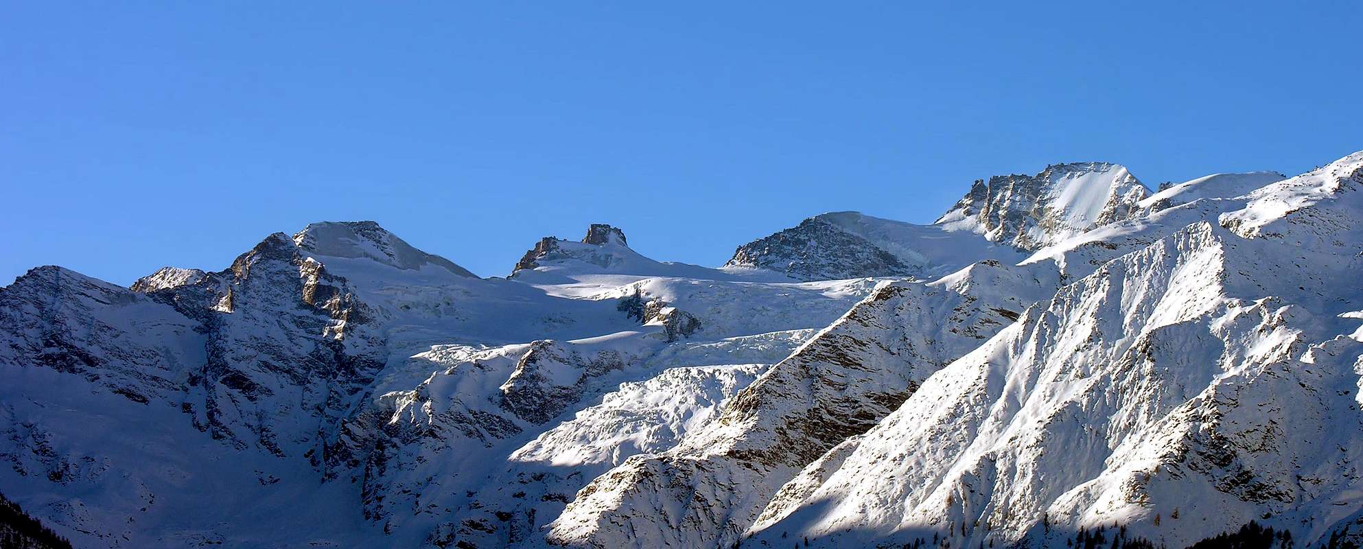
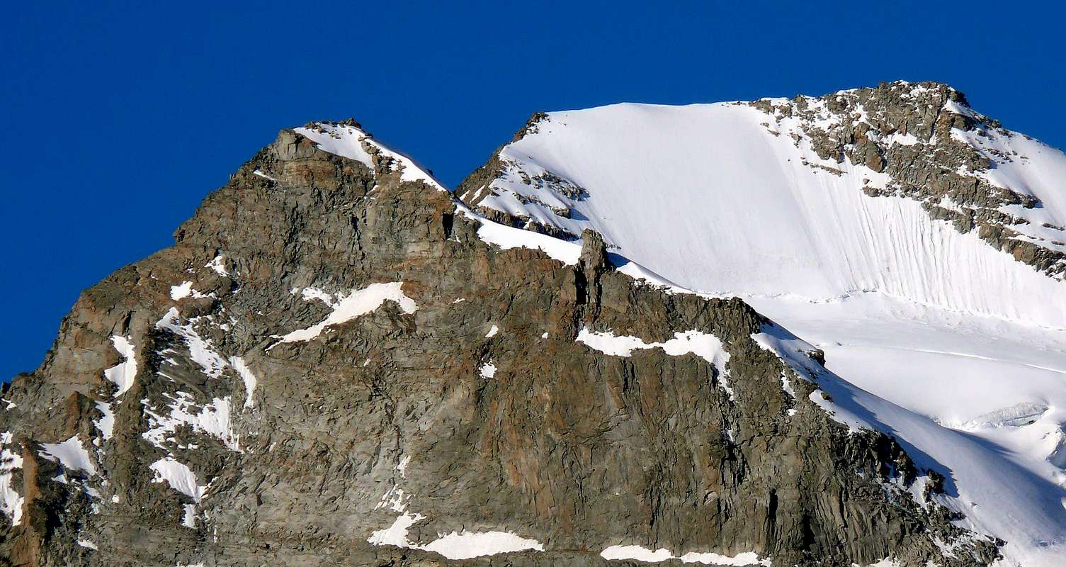
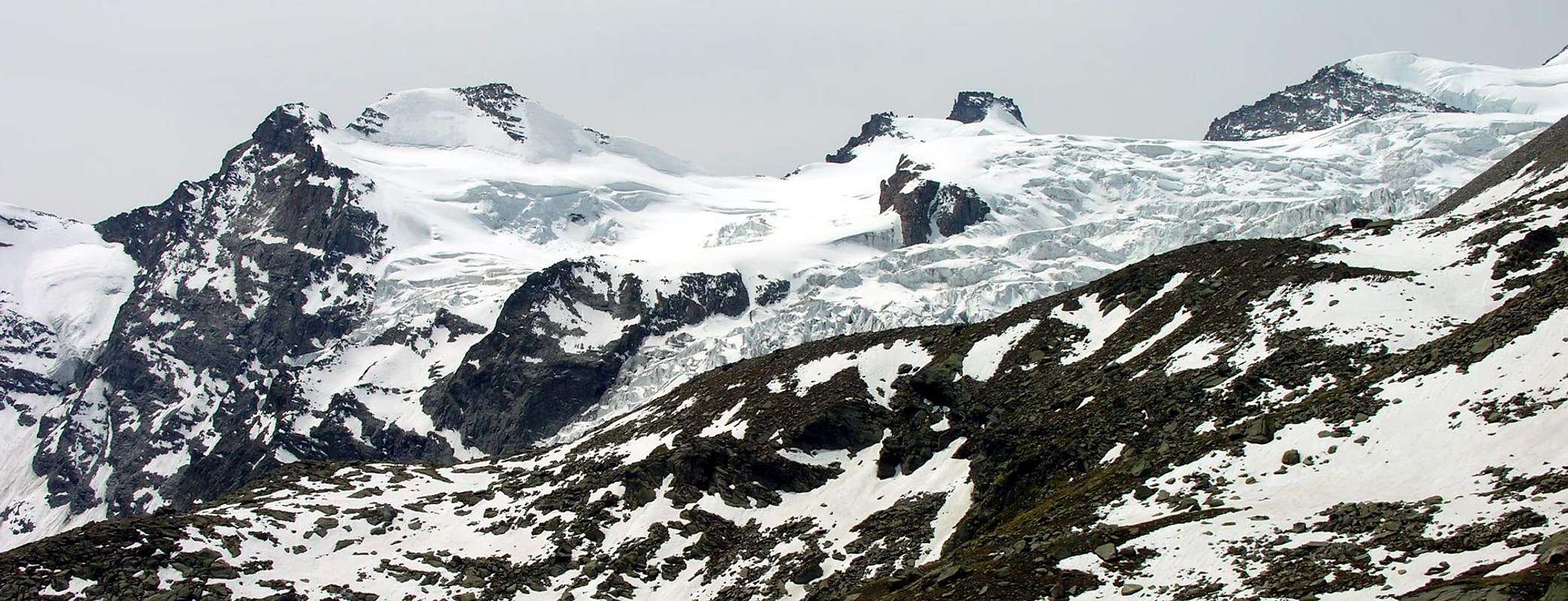
This mountain is located between the Valley of Cogne (Valnontey) and that of Noaschetta (Piedmont) above their respective Glaciers of the Tribulation and the Grand Croux to the Valley of Aosta and gay in the direction of Piedmont; the first is quite extended to the north, the second smaller toward the Northeast and the third down, rather reduced, Southeast towards Nasca in the Valley of the Orco. More precisely, it is located between a secondary depression or Colle West Grand Croux (3.382m) which separates it from Tete du Grand Croux and Becca of Gay in the East and the Col de Vanontey (3.530m) to the west, before the crest border gets up gradually until the summit of Gran Paradiso (4.061m). It consists of three peaks and as many sides of a pyramid is a little depressed, when viewed from the south, while in the Northeast drops high rock face of over 550 meters. More easily accessible from Piedmont through the bivouac Ivrea than from Valnontey because of approaches so long as they are complex, Summit is rarely visited although bestows beautiful views over the same up to Cogne and a splendid view over the Eastern Gran Paradiso Massif.
Questa montagna é collocata tra la Valle di Cogne (Valnontey) e quella di Noaschetta (Piemonte) sopra i rispettivi Ghiacciai della Tribolazione e di Grand Croux verso la Valle di Aosta e Gay in direzione del Piemonte; il primo risulta alquanto esteso verso Settentrione, il secondo di minori dimensioni verso Nordest mentre il terzo scende, piuttosto ridotto, a Sudest in direzione di Nasca nella Valle dell'Orco. Più precisamente è collocata tra una depressione secondaria o Colle Ovest di Grand Croux (3.382 m) che la separa dalla Tete du Grand Croux e dalla Becca di Gay ad Oriente ed il Col de Vanontey (3.530 m) ad Occidente, prima che la cresta di confine si rialzi progressivamente fin alla Sommità del Gran Paradiso (4.061 m). Formata da tre creste ed altrettanti versanti risulta una piramide un pò depressa, se vista da Sud, mentre a Nordest lascia cadere un’alta parete rocciosa di oltre 550 metri. Più facilmente raggiungibile dal Piemonte tramite il Bivacco Ivrea che non dalla Valnontey a causa degli avvicinamenti tanto lunghi quanto complessi, risulta Sommità assai raramente visitata anche se elargisce belle vedute sopra la medesima fino a Cogne ed uno splendido panorama sul Massiccio Orientale del Gran Paradiso.
First Ascents
First ascent on the summit: W.A.B. Coolidge and G. Yeld with swiss Mountain Guides C. junior and R. Almer, (Aug 13th, 1888).
First ascent in winter: Don Piero Solero, lone, Mar 06th, 1940.
SW Ridge: W.A.B. Coolidge and G. Yeld with Guides C. junior and R. Almer, (Aug 13th, 1888).
NE Wall: G. Tonella and F. Righetti, (Aug 02th, 1925).
SE Crest (partially): Felicina Paganone and Pompeo Viglino, (Aug 14th, 1918).
SE Crest (entirely): G. Tonella and F. Righetti, (Aug 02th, 1925).
S Face: E. Adami and P. Malvezzi, (Jul 29th, 1933).
Getting There
BY CAR:
From Torino, Milano, etc: Motorway A5. Exit at Aosta Ovest. Drive to the near Aymavilles. Follow the directions for Valle di Cogne.
From Switzerland: through the Grand Saint Bernard Tunnel or the namesake Pass. Drive to Aosta, then follow the direction for Courmayeur on SS.26. Just after Sarre, turn to the left, in the direction of Valle di Cogne.
From France: through Mont Blanc Tunnel or Petit Saint Bernard Pass. It isn't necessary to take Motorway A5: you can drive on SS.26, in the direction of Aosta. Before arriving at the Village of Sarre, turn right following the sign for Valle di Cogne. After Aymavilles, the SR.47 crosses the Villages of Vieyes, Epinel and Cretaz and after about 25 Km arrives at Cogne (1.534m). From Cogne you can get the Village of Valnontey (1.666m).
BY PLANE:
Aeroporto "Corrado Gex" Saint Christophe (Aosta).
Approach
From the central small place of Cogne (1.534m) go up by bus or car to little Village of Valnontey (1.666m). Cars can be parked in the large square in soil nearby the center of the village. With departure towards the Valnontey Valley on its orographic right side (climber's left), continue past the pleasant Pastures of Valmiana or Vermiana (1.728m) and reach the small Erfaulet Bridge (1.830m); cross it and continue along the trail to an alternative (2.040m, 1h'15/1h'30), where you take the left ramification (Southeast). Follow the right bank of the stream and head for the moraine called "Barma des Bouquetins" (2.698m). Climb the morain's ridge in its entirety reaching a hump. Follow this relief to a large snowfield, at the end of which you can discern a ledge going left. Climb on a faint, exposed trail for the entire length of the ledge; turn right and reach a small hanging valley. Head for the opposite side, and climb to a glacial dell between two spurs, cross it in the direction of a distinct rock gully. Climb the gully with circumspection, for the rocks are often covered with "verglass" and gravel. Past the gully, you'll get to the top of the spur where two fixed Bivouacs are located or Marcello Gérard - Ettore Grappein (3.200m, sleeps 9) and the nearby Carlo Pol (3.183m, sleeps 6; 5h'30/6h'30 from Valnontey).
Dalla piazzetta nel centro di Cogne (1.534 m) salire tramite il bus od in auto sino al Villaggetto di Valnontey (1.666 m), ove si parcheggia, nel grande piazzale in terra battuta sito quasi al centro della frazione. Iniziare la salita sul versante della destra orografica e, superato l'ameno Alpeggio di Valmiana o Vermiana (1.728 m) si giunge al Ponticello dell'Erfaulet (1.830 m); lo si attraversa e si prosegue per il sentiero sino al bivio (2.040 m, ore 1h'15/1h'45). Seguire il sentiero verso sinistra (Sudest) costeggiando il torrentello sulla destra, dirigersi verso la morena detta "Barma des Bouquetins" (2.698 m); risalirla interamente in cresta fuoriuscendo su d'un dosso. Seguire attentamente il rilievo sino ad un grosso nevaio, al cui termine è abbastanza evidente sulla sinistra una cengia; risalirla interamente su tracce di sentiero (esposto). Continuare svoltando sulla destra fino a raggiungere un valloncello. Dirigersi ora sul versante opposto e risalire fino alla conca glaciale posta tra i due crostoni rocciosi; attraversarla puntando decisamente ad un ben visibile canale roccioso; risalirlo con molta cautela, in quanto le rocce sono sovente ricoperte da "verglass" con terriccio. Superato il canale, si raggiunge la cima dello sperone dove sono posti i due Bivacchi Marcello Gérard - Ettore Grappein (3.200 m, 9 posti) e il vicino Carlo Pol (3.183 m; 6 posti letto; 5h'30/6h'30 da Valnontey).
Route
Follow for about one hundred meters toward the rocky promontory immediately behind the two bivouacs, then turn to the left (beware of crevasses), towards the Colle della Luna. But do not get the same, but with ascent towards Southeast glacier and rounding the Testa della Tribolazione (Head of the Tribulation; 3.642m) go up to the Col of Valnontey (3.530m) being careful of the crevasses here very numerous and the crevasse, not always easy to overcome. Past the same, climb the short but steep slope leading to the hill above. From this continue towards the Northeast through the snowy, short and easy Crest Southwest dominating the small Glacier Noaschetta; always climbing up the last rocks, preceding slightly the Summit (2h'30/3'00 from the two Bivouacs Pol and Gerard-Grappein).
Descent: along the same route.
Dirigersi verso la scarpata rocciosa posta proprio dietro ai due bivacchi per un centinaio di metri; poi girare verso sinistra (attenzione ai crepacci), puntando verso il Colle della Luna. Ma non raggiungere il medesimo, bensì con percorso più verso Sudest sul ghiacciaio e doppiando la Testa della Tribolazione (3.642 m) risalire verso il Colle di Valnontey (3.530 m) facendo ben attenzione ai crepacci qui molto numerosi nonché alla crepaccia terminale non sempre facile da superarsi. Oltrepassata la medesima, salire il breve ma piuttosto ripido pendio soprastante conducente al colle. Da questo salire verso Nordest tramite la nevosa, corta e facile Cresta Sudovest dominando il piccolo Ghiacciaio di Noaschetta; sempre in salita fino alle ultime roccette, che precedono di poco la Sommità (2h'30/3'00 dai Bivacchi Pol e Gerard-Grappein).
Discesa: lungo lo stesso itinerario di salita.
Gear
Mountaineering equipment, including rope, ice axe, and crampons.
Da Alta Montagna, comprensivo di corda, piccozza e ramponi.
Huts
From Cogne: Bivacchi Carlo Pol (3.183m) and M. Gérard - E. Grappein (3.200m), located on the spur that divides the Northern and Southern branches of the Tribolazione Glacier. Difficulty: PD. Reachable from Valnontey (see above).
Da Cogne: ai Bivacchi Carlo Pol (3.183 m) Marcello Gérard - Ettore Grappein (3.200 m), siti sullo sperone roccioso divisorio i due rami Settentrionale e Meridionale del Ghiacciaio della Tribolazione. Difficoltà: PD. Raggiungibile dalla Valnontey (vedi sopra).
Difficulty
The route is rated A/F+.
L'itinerario è da classificarsi in A/F+.
Red Tape
Within the borders of the P.N.G.P. (Parco Nazionale del Gran Paradiso), at the moment (summer 2004), dogs generally are not allowed, except on a couple of trails, and camping is forbidden (except for climbers from sunset till dawn). No fees are due.
Entro i confini del P.N.G.P. (Parco Nazionale del Gran Paradiso), al momento (estate 2004), i cani in genere non sono ammessi, se non per alcuni sentieri, e il campeggio è vietato (tranne che per gli alpinisti dal tramonto fino all'alba). Nessuna spesa viene richiesta.
"Guida delle Alpi Occidentali", di Giovanni Bobba e Luigi Vaccarone C.A.I. Sezione di Torino Volume II (parte II), 25 Maggio 1896.
"Guida della Regione Autonoma Valle d'Aosta", di Mario Aldrovandi; Ed. S.P.E. di Carlo Fanton, Torino 1964.
"Rifugi e bivacchi in Valle d'Aosta", di Cosimo Zappelli aggiornata da Pietro Giglio, Musumeci Editore, Luglio 2002.
"Guida dei Monti d'Italia-Gran Paradiso Parco Nazionale" E. Andreis, R. Chabod, M. C. Santis, Club Alpino Italiano/Touring Club Italiano, prima Ed. 1939; seconda Ed. 1963; terza Ed. 1980.
"Il Parco Nazionale del Gran Paradiso (Valli di Champorcher-Clavalitè-Saint Marcel-Laures-Cogne-Valsavarenche-Conca di Pila", di Giulio Berruto 3/volume 2°, IGC Torino; prima Ed. 1981; seconda Ed. 2000 (in Italian).
"Gran Paradiso", A. Gegenfurtner, G. Klotz, F. Müller, Ed. Bergverlag Rudolf Rother, Monaco 1980 (in tedesco).
"Gran Paradiso", G. Klotz, Ed. Bergverlag GmbH Rother, Monaco 2005 (in tedesco).
"Gran Paradiso", di Pierandrea Mantovani e Renato Misischi, Ed. Rassegna Alpina, 1974.
"Gran Paradiso-Itinerari Alpinistici e Sci Alpinistici", di Franco Brevini, Ed. Musumeci, Giugno 1982.
MAPS:
Kompass "Gran Paradiso Valle d'Aosta Sentieri e Rifugi" Carta Turistica 1:50.000.
SIRIO Blue Vision "Cogne Valnontey" Carte fotografiche.
Parents refers to a larger category under which an object falls. For example, theAconcagua mountain page has the 'Aconcagua Group' and the 'Seven Summits' asparents and is a parent itself to many routes, photos, and Trip Reports.

 4376 Hits
 81.84% Score
 14 Votes