-
 1103 Hits
-
 75.81% Score
-
 6 Votes
|
|
Mountain/Rock |
|---|---|
|
|
47.27953°N / 12.00716°E |
|
|
Hiking, Mountaineering |
|
|
Spring, Summer, Fall |
|
|
7687 ft / 2343 m |
|
|
Overview
I admit I have a heart for forgotten minor summits. Whereas major summits are often crowded and noisy, those minor summits mostly have few to no visitors, comparable views, silence and equally interesting routes - sometimes even no trails and tracks at all.
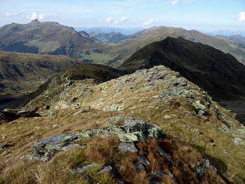
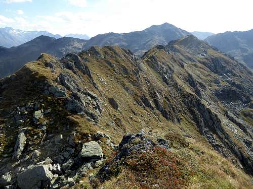
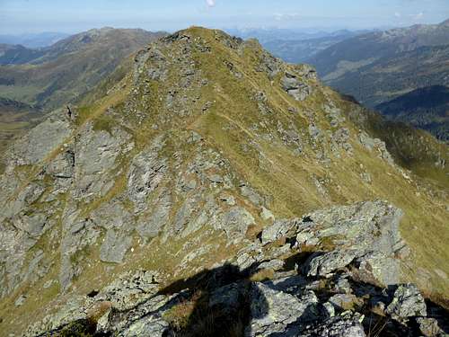
This is the case with Grubachkogel, the northern neighbour summit of wellknown Torhelm in the Kelchsau subrange of Kitzbüheler Alpen. About 150 meters lower than broad and dominating Torhelm, Grubachkogel features a long and elegant meadow and rock ridge with several rocky bumps and outcrops. You can hardly say which one is the highest and thus culmination point .....
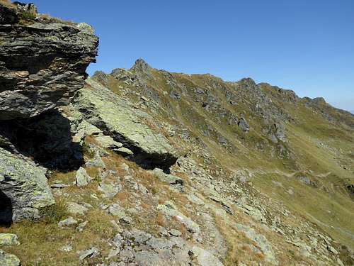
Easily accessible from Öfelerjoch, the broad col between Torhelm and Grubachkogel, but on an off-trail route, these outcrops and their connecting ridges offer a nice traverse with some easy rock scramble, some short exposed aretes, nice looks into Märzengrund to the west, Langer Grund to the east and on the surrounding peaks of Kelchsau range.
Grubachkogel can be part of a long and epic ridge traverse of the southern part of Torhelm range. Mostly off-trail, the whole ridge between Sonnenjoch to the north and Torhelm to the south offers a strenuous but satisfying outing, including the whole of Grubachkogel ridge.
My first ascent of this forgotten mountain started at Öfelerjoch after having summited Torhelm and ended at the last sharp rock outcrop of Grubachkogel ridge, a very short but very nice climb of UIAA gade I+ along an exposed rim of a steep slab. The rock can be bypassed at its eastern base but what the ... should we do that ....?
I descended then the steep east slopes below this last outcrop to gain a hiking trail some 300 meters lower - not something to be recommended! It is better to follow the meadow ridge to the north until you reach the col south of Regenfeldjoch, the northern neighbour of Grubachkogel, to reach the system of hiking trails and thus to get back to the valley ground.
Getting There
The best trailhead is:
- Tiefentalalm / Langer Grund - in winter and spring: Erla Brennhütte / Langer Grund, to the northeast.
You reach the trailhead:
By car:
- From Munich, Salzburg or Innsbruck leave the autrian highway A 12 at exit "Wörgl Ost" and proceed on road number 178 and then on road number 170, direction Kirchberg, Kitzbühel to the village of Hopfgarten. After passing underneath the highway turn immediately to the right and then left onto "Kelchsauer Landstraße". Drive through Kelchsau until you reach the toll station. Pay your toll and go straight on onto "Langer Grund Forststraße", passing Gasthof Moderstock and Erla Brennhütte until the toll road ends at Tiefentalalm parking area.
By train and bus:
- The next railway station to the north is Hopfgarten. Take bus number 4057 from Hopfgarten to Kelchsau. Alas there is no public transportation to Tiefentalalm.
Routes Overview
For Grubachkogel and its many secondary peaks start alternatively at Öfelerjoch to the south or at the unnamed col south of Regenfeldjoch to the north.
You reach Öfelerjoch from Tiefentalalm via Oberkaralm and Öfeleralm (forest road and marked trail).
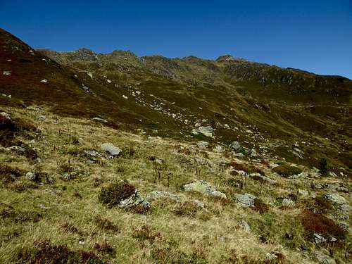
You reach the col south of Regenfeldjoch from Tiefentalalm via Foissachalm (forest road) and Regenfeldalm (trail). From Regenfeldalm follow the southbound trail in the direction of Öfeleralm until you reach the first creeks to traverse. Look there for an easy possibility to ascend to this col off-trail (meadows and bushes).
The whole ridge of Grubachkogel between Öfelerjoch and the col south of Regenfeldjoch is an off-trail scramble with steep meadows, rocks, short aretes and some short UIAA grade I climbs. You can combine this traverse with a visit of Torhelm and/or Regenfeldjoch.
Red Tape & Accommodation
No Red Tape as far as I know.
The road to Tiefentalalm is a toll road. As you have to pay at a machine have enough coins with you .....
Accommodation
Accomodation can be found at:
Mountain huts:
no overnight stay - only food and drinks:
with overnight stay:
Gear & Mountain Condition
Grubachkogel is mainly a hiking summit. It should be accessible late spring through summer an d autumn until the first heavy snowwfalls.
You need hiking gear and good shoes.
The traverse of Grubachkogel is an off-trail and unmarked route with steep meadow ascents, rock scramble and exposure.
Weather
Maps
Alpenvereinskarte, scale 1 : 50000, number 34/1, Kitzbüheler Alpen West, edition 2018, with UTM-grid
Topographische Karte von Österreich, scale 1 : 50000, number 3219, Neukirchen am Großvenediger, BEV Bundesamt für Eich- und Vermessungswesen, Wien


