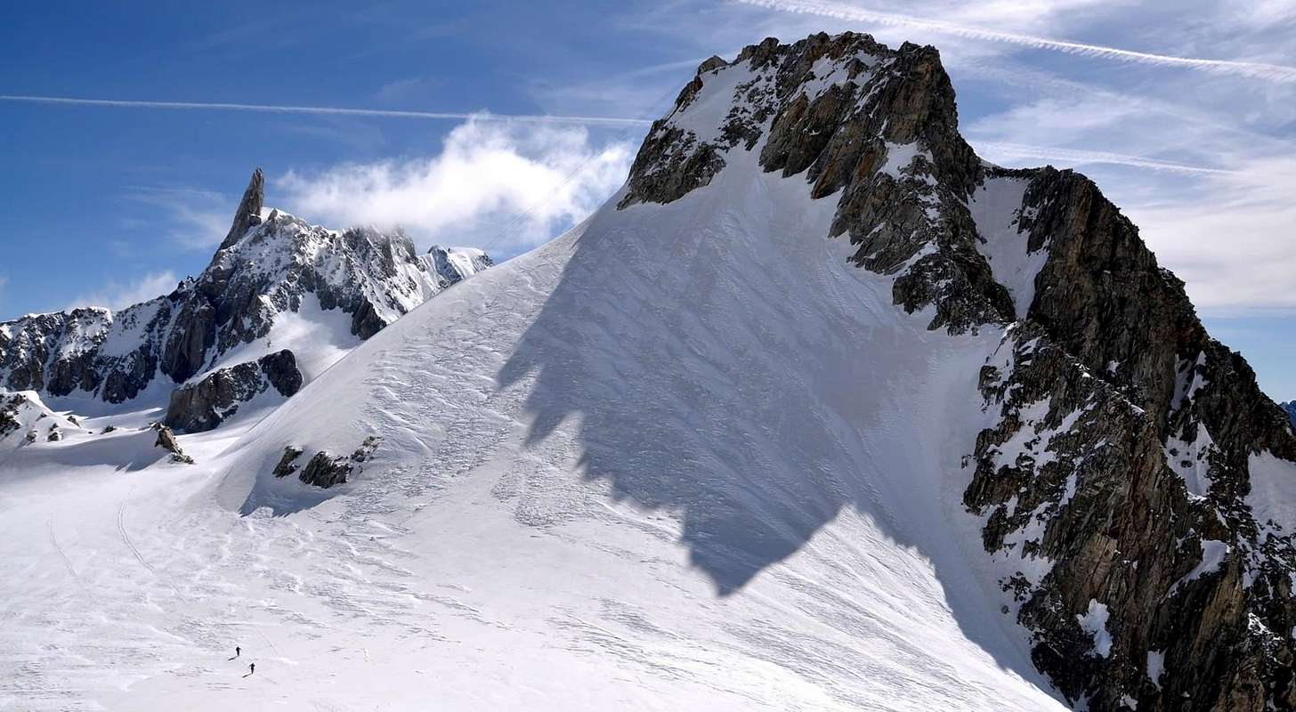
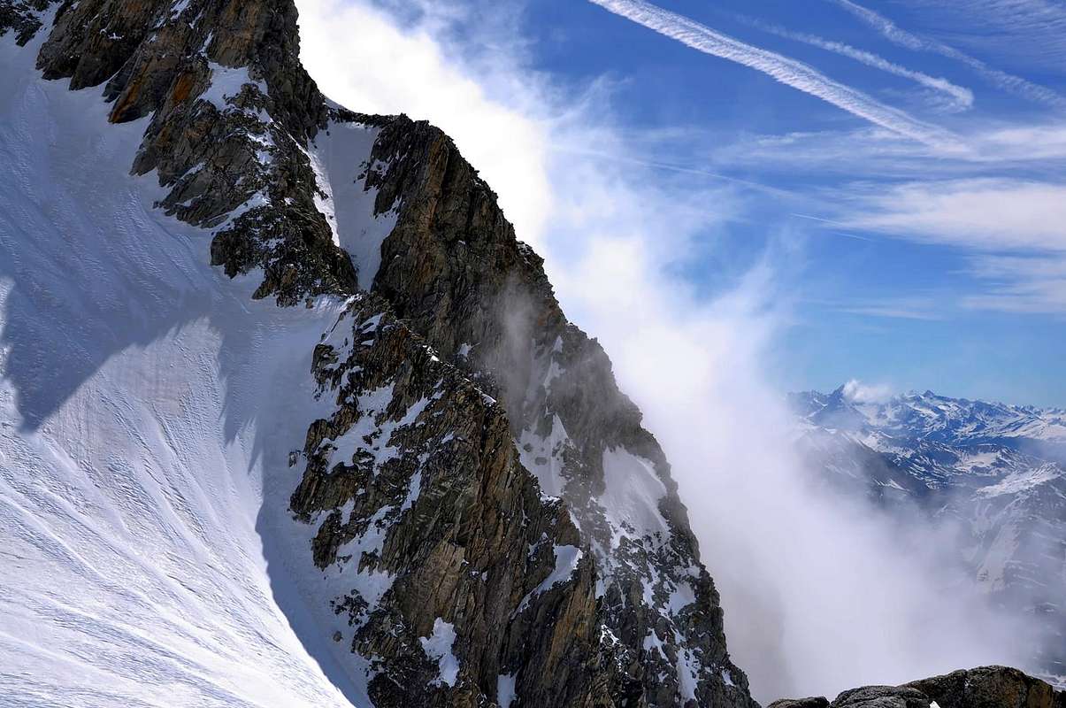
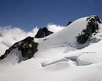
High and rather important summit though overtopped by the titanic surroundings. Easy and fast access from Punta Helbronner and the close new and old ref. Torino, this summit is S of the omonymous pass while to NE the minor brother Petit Flambeau (3.440m) grows only few meters from the Geant glacier. Both summits are fine panoramic spots.
Alta montagna abbastanza importante anche se sovrastata dal titanico circondario che la accerchia. Di facile e rapido accesso dalla Punta Helbronner e dai vicini rifugi Torino Nuovo e Vecchio, è situata a S dell'omonimo colle mentre a NE si eleva di poco sul Ghiacciaio del Gigante il fratello minore Petit Flambeau (3.440 m). Entrambi ottimi punti panoramici.
First Ascents
First in the summit: Henri Cordier, Jacob Anderegg and Kaspar Maurer, (Jul 20th, 1876).
In winter: Unknown.
S-E Arête: Henri Cordier, Jacob Anderegg and Kaspar Maurer, (Jul 20th, 1876).
N Arête: Unknown.
S Wall (from Toules Glacier): Eugene Bron, Renato Chabod and Louis Lanier, (Jun 06th, 1940).
W Slope (from Colle Est de Toules): Fabien Croux, Agostino Ferrari and Joseph Petigax, (Sep 07th, 1896).
Getting There
BY CAR:
From Torino, Milano, etc: Motorway A5. Exit at Morgex.
From Switzerland: through the Grand St. Bernard Tunnel or the homonym pass.
From France: through Mont Blanc Tunnel or Petit St. Bernard Pass.
BY PLANE:
Aeroporto "Corrado Gex" Saint Christophe (Aosta).
ACCESS FROM COURMAYEUR (La Palud) PUNTA HELBRONNER:
Funivie Monte Bianco S.p.A. - Frazione La Palud n° 22 - 11013 Courmayeur Aosta FUNIVIE MONTE BIANCO
From A5 Morgex toll drive along the SS.26 toward Courmayeur, cross it and once in Entréves follow for the Village La Palud - car parking car parking - Funivies of the Monte Bianco.
Dall'uscita dell'Autostrada A5 nel comune di Morgex (921 m) proseguire lungo la SS.26, verso il Paese di Courmayeur (1.228 m) e, raggiunta la Frazione di Entrèves/La Palud (1.370 m), posteggiare l'auto nel parcheggio delle "Funivie del Monte Bianco".
Route
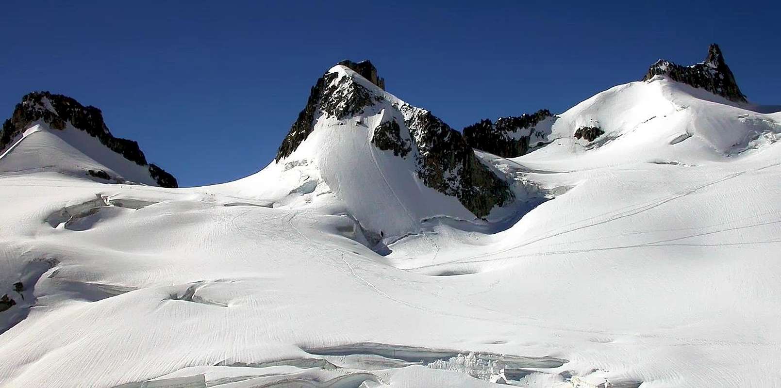
From Rifugio Torino or from Punta Helbronner station "the Italian door to Vallèe Blanche and Mont Blanc massif", (with the funivies of the Monte Bianco), walk toward NW bordering on easy glacier up to the Colle de Saussure (3.428m). Follow the watershed ridge that in little more than 100m leads to the summit. Another route: on the right, along the ESE side, follow a minor ridge bordering the E channel. Descent along the same routes.
Dal Rifugio Torino al Colle del Gigante o dalla Punta Helbronner, "porta d'ingresso" italiana alla Vallée Blanche ed al massiccio del Monte Bianco (con le funivie del Monte Bianco), costeggiare con direzione NW e con percorso facile su ghiacciaio raggiungere il colle de Saussure (3.428 m). Dal colle seguire la cresta spartiacque che con poco più di un centinaio di metri porta alla sommità. Si può risalire anche più a destra sul versante E-SE seguendo una cresta di minore importanza fiancheggiante il canalone E. Discesa lungo la via di salita.
Difficulty
Difficulty: F+/PD-.
Difficoltà: F+/PD-.
Gear
Mountaineering equipment, including rope, iceaxe, and crampons.
Da alta montagna, corda, picozza e ramponi.
When To Climb
The period from mid June to mid September usually offers the best conditions. The rock climbs would be substantially more challenging off season.
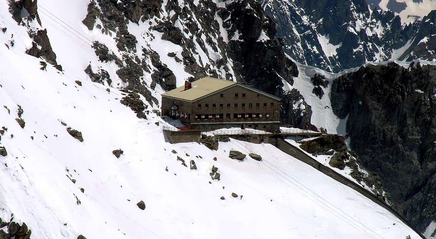
Huts
Rifugio Torino (3.329-3.375m) Tel.: Nuovo numero telefonico +39 3402270121 Cell. Gestore +39 3356184758 Funivie Monte Bianco +39 016589925
Red Tape
No permits are required and no fees must be paid to climb Grand Flambeau. Since it is on the Italian-French border, carry some means of identification.
Campings
Remember that free camping is forbidden (except for emergency reasons, over 2.500m, from darkness until dawn).
Mountain Conditions
You can get meteo information at the official site of the Regione Valle d'Aosta:
"Guida delle Alpi Occidentali", di Giovanni Bobba e Luigi Vaccarone C.A.I. Sezione di Torino Volume II (parte II), 25 Maggio 1896.
"Guida dei Monti d'Italia-Monte Bianco" (Vol. I°) di Gino Buscaini-Club Alpino Italiano/Turing Club Italiano, 1994 (in Italian).
"I Rifugi della Valle d'Aosta" di Stefano Ardito, Ed. Guide iter, Febbraio 2003.
"A piedi in Valle d'Aosta" (Vol. 1), di Stefano Ardito, Ed. Guide iter, Giugno 2003.
"80 itinerari di Escursionismo Alpinismo e Sci Alpinismo in Valle d'Aosta", di Osvaldo Cardellina, Ed. Musumeci, Giugno 1977 (in Italian); seconda Ed. Luglio 1981; terza Ed. Luglio 1984; (in French), prima Ed. Febbraio 1978; seconda Ed. Marzo 1980.
MAPS:
Kompass "Massiccio del Monte Bianco Valle d'Aosta Sentieri e Rifugi" Carta turistica 1:50.000.
I.G.C. Istituto Geografico Centrale Torino "Massiccio del Monte Bianco" (n°4), Torino, 1998 1:50.000.
I.G.C. Istituto Geografico Centrale Torino "Monte Bianco-Courmayeur-Chamonix-La Thuile" (n° 107), 1:25.000.
Kompass "Massiccio del Monte Bianco Valle d'Aosta" Carta escursioni, bike e sci alpinismo 1:50.000.
A.I.NE.VA. (Associazione Interregionale Neve e Valanghe).
Useful numbers
Protezione Civile Valdostana località Aeroporto n° 7/A Saint Christophe (Ao) Tel. 0165-238222.
Bollettino Meteo (weather info) Tel. 0165-44113.
Unità Operativa di Soccorso Sanitario Tel. 118.
Acknowledgements
I am greatly indebted to my friend "Osva" for the detailed description of the route. In addition i want to thank Gabriele Roth for the translation of the text from italian.
Parents refers to a larger category under which an object falls. For example, theAconcagua mountain page has the 'Aconcagua Group' and the 'Seven Summits' asparents and is a parent itself to many routes, photos, and Trip Reports.

 13531 Hits
 89.01% Score
 28 Votes