
|
|
Mountain/Rock |
|---|---|
|
|
40.08100°N / 105.6727°W |
|
|
12130 ft / 3697 m |
|
|
Cherokee Overview
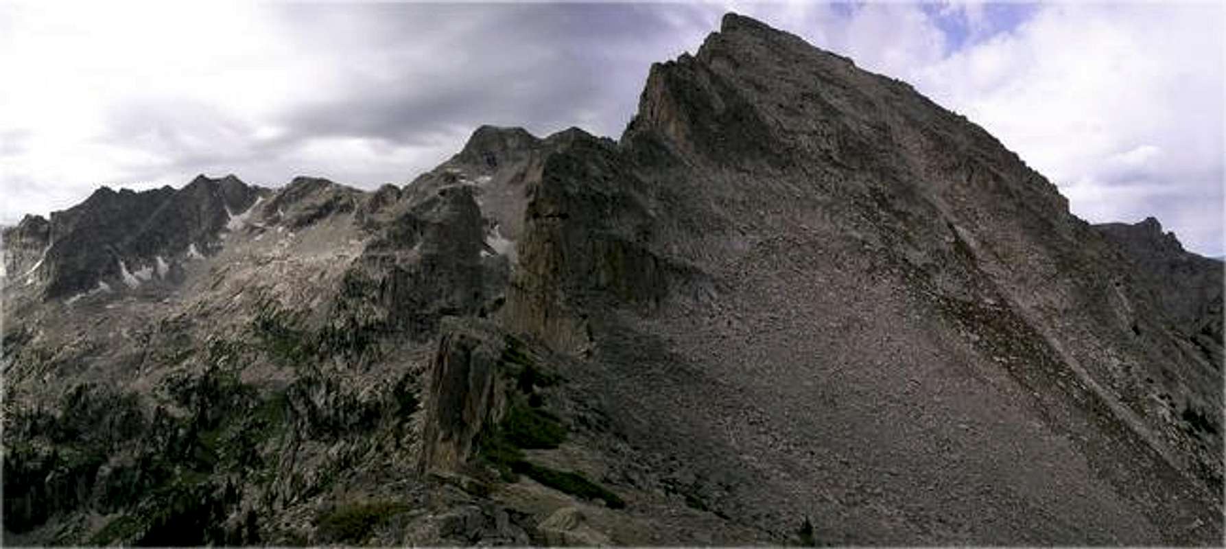
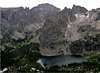
It's a privilege introducing the Indian Peak’s Wilderness most magnificent cirque and undoubtedly one of Colorado’s top 10 most beautiful places, the Lone Eagle Cirque. The Lone Eagle Cirque is three segments, the east rim, Apache Peak massif, and the west rim. At 13,441-ft, Apache Peak is the high point of the Lone Eagle Cirque. Apache Peak is also the only true “bookend” peak of this cirque; it is the centerpiece between the popular east rim and the secluded and solitary west rim. This remarkable cirque harbors a number of excellent mountains. The east rim consists of Mount Toll, Pawnee Peak, Shoshoni Peak and Paiute Peak. All of these peaks can be reached from trailheads that start from the east, most notably the popular and beautiful Brainard Lake area. The west rim is made up of lonely, unvisited points like Iroquois Peak, "Hopi", Mount Achonee, Lone Eagle Peak and “Cherokee.”
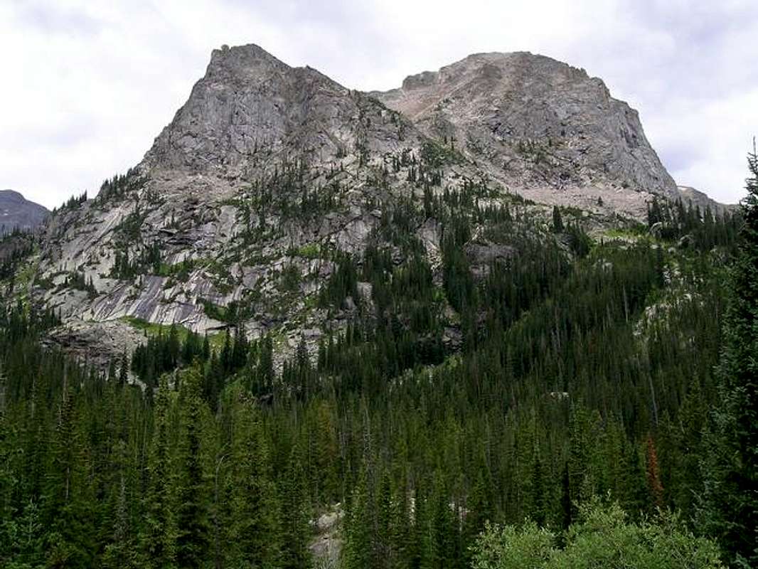
Anchoring the lonely west rim of Lone Eagle Cirque, “Cherokee” (12,130-ft) provides the determined hiker its first dramatic view of the mountain splendor that rests 6 miles from Monarch Lake. Officially unnamed, this rugged little mountain has been given the unofficial name “Cherokee” by Colorado’s famous mountaineer and author Gerry Roach. Logistically, “Cherokee” is an important mountain, it is the final piece of the west rim of the cirque, and it’s connected to Mount Achonee by an incredibly jagged ridge that forms the wall of rock that rises northwest of the amazing Crater Lake.
Now, I have been on the summit of twenty different mountains in the Indian Peak Wilderness, I have easily concluded that “Cherokee’s summit view is the best of the bunch. My submitted photos should give you an idea of what I’m talking about. I have also concluded that “Cherokee” ranks very high in my all time favorite mountains as well. Take it for what it may be worth, enough said.
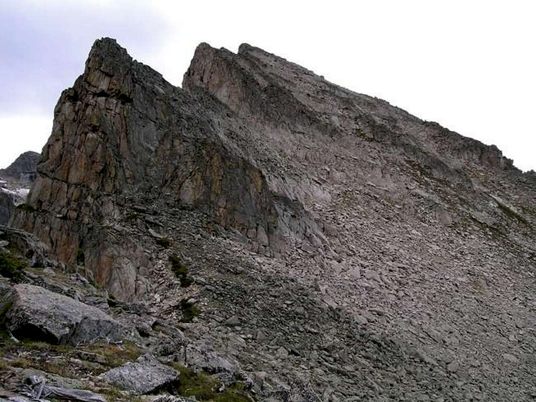
North Face Route
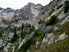
“Cherokee’s” tiny, exposed summit is attained by a really fun class 3 scramble that can be ascended from either Crater Lake area or the early ramparts of the high basin to the north. This route is slightly different than the route Gerry Roach describes in his excellent IPW book. Instead of starting the climb at Crater Lake the route ascends the drainage to the north of “Cherokee” and attains the same saddle that Roach describes in-between Point 11,602 and “Cherokee,” just from the north.I really recommend the short, exposed hike out to Point 11,602; from here the perspective of “Cherokee” and Piaute Peak’s west ridge is magnificent. The remaining class 3 route/climb ascends a solid ledge system, and ends abruptly at a short, exposed catwalk to the true summit. The entire route from Monarch Lake, round trip will cost you 15 miles and 3,937-ft, so start early and expect a long day.
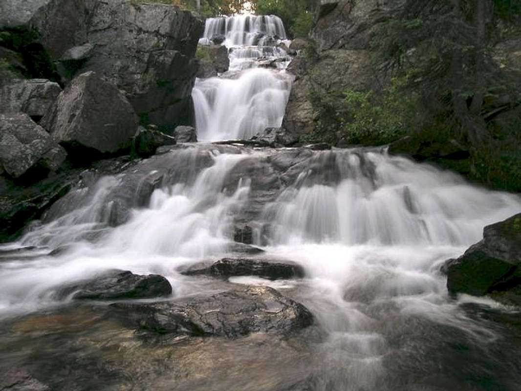
This is one of the most interesting routes I have ever experienced. This route will undoubtedly stamp perfect a memory in your head that will last forever. If you like solid class 3 climbing, controlled exposure, interesting route finding challenges, big waterfalls, and views that may make you cry like a 3 year old, then this may be the mountain for you. The view of Lone Eagle Peak, and the Hopi/Achonee massif will inspire you to come back.
 |  |  |  |  |
Mountain Conditions for Lone Eagle Cirque
Click here to view a 7-day forecast for the Lone Eagle Cirque
Click image to enlarge

Monarch Lake Trailhead
From Denver go west on I-70 to the Winter Park turn-off. Drive north over Berthoud Pass and continue to the ski resort of Winter Park. Continue on Hwy 40 and pass the tiny towns of Frazier, Tabernash and and Granby. After driving through Granby look sharp for Hwy 34 turnoff to Grand Lake on the right. Go 5 miles north on 34 to the well-signed Grand Lake Recreation Area. Turn right on FDR 125 (Arapaho Bay Road) and go 9.4 miles on an improved dirt road to Big Rock Campground at the south end of Arapaho Bay. From the campground follow the road another .07 miles to the Monarch Lake TH.Since this is a recreation area you will need to pay a $5.00 day-fee at a pay station about 1 mile in on the Arapaho Bay road. It takes credit cards.
A side note:
Monarch Lake, located just south of Lake Granby's Arapaho Bay, was built in the early 1900's to store logs awaiting transport to the sawmill. The Forest Service acquired Monarch Lake and the land surrounding it for recreation in 1962. The 150-acre reservoir is kept at a constant level to support a high quality non-motorized experience. Explore old logging techniques by visiting the "steam donkey"; the steam-operated engine that was used to move logs off the hillsides.
Indian Peak Wilderness Red Tape
A summary of the Indian Peak Wilderness Rules and Regulations.Monarch Lake Camping
Excellent camping opportunities are available at the Arapaho Bay area on Grand Lake. There are 3 different campgrounds around the tiny Arapaho Bay. I would highly recommend reserving a spot, especially on the weekends. Car camping in the area is not easy; there just are not many turnoffs. I ended up car camping at the Roaring Fork TH, which is only about a half mile from the Monarch Lake TH. Yes, I ignored the “no overnight stay” sign posted at the TH. Here are the specifics for camping at Arapaho Bay.Season: Open Memorial Day to Labor Day with full services. After Labor Day, camping is available on a first come, first serve basis (no reservations) with reduce services while weather permits.
Reservations Accepted: Yes, 1-877-444-6777 National Recreation Reservation Service.
Sites: 84 (Total includes all three campgrounds in bay area: Big Rock, Moraine, Roaring Fork.)
Daily Fee: $12.00
Credits
Buy his book here.