
-
 35193 Hits
-
 73.06% Score
-
 3 Votes
|
|
Mountain/Rock |
|---|---|
|
|
38.93280°N / 106.7181°W |
|
|
Gunnison |
|
|
Hiking |
|
|
Spring, Summer, Fall, Winter |
|
|
12713 ft / 3875 m |
|
|
American Flag Mountain Overview
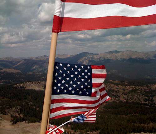
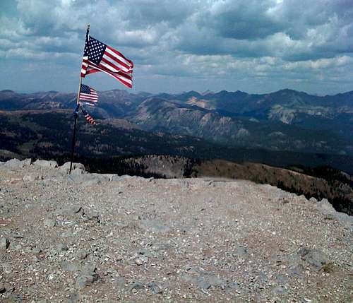
Many flags on top of American Flag Mountain
American Flag Mountain is Colorado's 848th highest peak and it gets its name from all of the United States flags on the summit. Every year people put new flags on its summit in large quantities. Some years there could be 20 different flags on the top including Colorado flags as well. It remained unnamed until the late 1890's when miners in the area put flags on its summit, then it officially got named American Flag Mountain.
It is one of the most reached summits in the area around it due to the fact that you can drive/ATV/dirtbike all the way up. Saying that, as far as I know the only way that the mountain is reached is from Italian pass or Cement Creed Roads unless it is combined with its popular neighbors, Italian Mountain and/or UN 12830. This is because its west face is a steep rock wall that drops about 300 feet. Its prominence however is 733 feet, which is pretty big for the area. Anyone attempting to summit this should be in for a rather patriotic day.
In-depth Details

Summit
Here are more details:
Elevation: 12,713 ft.
CO Peak Rank: 848
Range: Elk
Counties: Gunnison
Quadrangle: Italian Creek
Coordinates: 38.9328°N, -106.7181°W
Prominence: 733'
Saddle: 11,980 ft.
Proximate Parent: 12830
Line Parent: Italian Mountain
Isolation: 1.74 miles
YDS Class Rating: 1
Getting There
Summit
From Buena Vista, get onto Main Street and go west and accent Cottonwood Pass (paved). From the top of the pass, a twisty dirt road remains that is suitable for passenger cars. It may be a little washboard at times so drive slowly to be safe if you are in a passenger car.
Once you are all the way down, you will see a sign that marks Taylor Park Reservoir. Make a right at that sign and continue all the way down the dirt road until you are past Pothole #2 and reach a sign marking Italian Creek/Pass Rd. From here, 4WD vehicle is required. The mountain will be in view almost the entire way.
Continue up the (muddy sometimes) road until you reach the top of Italian Pass. To your left is the road leading to the summit of American Flag Mountain. Don't be surprised if the road to the left is closed. It is very steep and only vehicles with enough power should drive up it. The top is obviously marked with American Flags.
Red Tape
No permits required. Make sure you follow National Forest standards and don't drive off road.
Camping
There are plenty of campsites suitable for camping on your entire way to the summit. Most of them are before the left into Italian Creek, but many more exist on the first parts of the road.
External Links
http://listsofjohn.com/PeakStats/Climbers.php?Id=1100