
-
 45993 Hits
-
 93.07% Score
-
 41 Votes
|
|
Mountain/Rock |
|---|---|
|
|
40.06700°N / 105.638°W |
|
|
12967 ft / 3952 m |
|
|
Overview
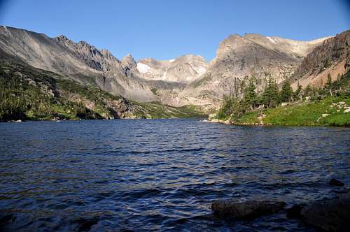
Navajo, Apache, and Shoshoni from Lake Isabelle. July 2011.
Shoshoni Peak is the 15th highest summit in the Indian Peaks Wilderness. It is an oddly shaped, almost ungainly mountain; but it offers one of the best views in the Indian Peaks. Shoshoni has a sheer south face, composed of two magnificent butresses, that roar up from the Lake Isabelle drainage.
Yet the north slopes of Shoshoni consist of gently rolling grassy terrain (with some talus thrown in of course), allowing this summit to be taken as an easy stroll from Pawnee Pass. This juxtaposition of the verticle and the verdant is what makes Shoshoni so special. And the little tower that ultimately marks Shoshoni Peak's summit is a delightful way to end the pedestrian aproach.
Shoshoni is located in what may be the eastern heart of the Indian Peaks. It is easily spotted from Brainard Lake near the head of the Isabelle Lake drainage. As the northern constraint on the Isabelle Glacier Cirque it is a mountain surrounded by more famous neighbors. Connected to Apache by a nigh impassable ridge guarded by pinacles aptly named the Chessmen, and standing opposite Navajo Peak; Shoshoni offers an intimate look into this marvelous area. I
ndeed Shoshoni Peak's summit offers a better view then that afforded by either of its more lofty and shapely neighbors. Aproaching Shoshoni's summit tower with the view of Navajo and Apache Peaks soaring above the cirque that cradles the Isabelle Glacier is what this mountain is all about.
Although the ridge connecting Shoshoni and Apache is not easily traversed Shoshoni can easily be combined with Pawnee Peak or Mount Toll for a grand 2 to 3 mountain day. The easy aproach and multiple routes make this an exciting mountain to have so near the Denver/Boulder metropolis.
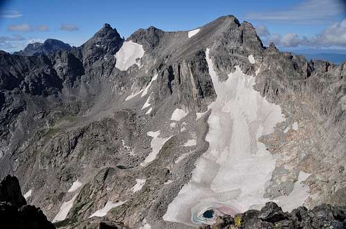
The view from Shoshoni's summit. The Arapaho Peaks, Navajo Peak, Apache Peak, and the Isabell Glacier.
Getting There
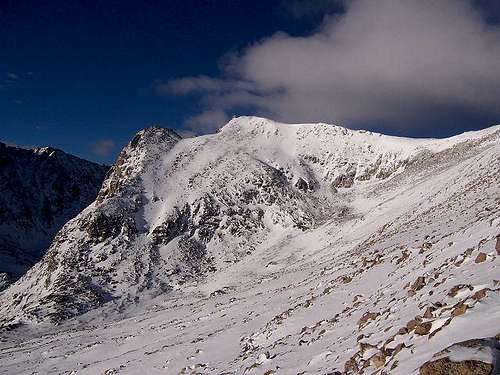 Shoshoni Peak under a blanket of snow. Image by jwclimbs.
The eastern aproaches to Shoshoni Peak are all reached by the Long Lake Trailhead in the Brainard Lake Recreation Area. From the town of Nedeland drive 12 miles north to the town of Ward. On the outside edge of town turn west (left) onto the Brainard Lake Road. Follow this road 4.9 miles to Brainard Lake (from here one gets an excellent view of the summits to the west). Contour around the north side of Brainard Lake to then take a right on the road marked with a sign for the Lang Lake and Mitchell Lake Trailheads. Turn left after a tenth of a mile and park at the Long Lake Trailhead (this may be a zoo if you arrive late on a summer weekend... go early or on a weekday).
Red Tape
The Brainard Lake Recreation area charges $9.00 for a two day use pass between May 1st and September 15th (fees ar collected at a toll station about 3.5 miles up the Brainard Lake Road). Camping at the established (i.e. RV type) campgrounds near Brainard Lake is by reservation only. Backcountry camping is NOT allowed within the Brainard Lake travel area of the Indian Peaks (except durring the winter for the more hardy souls). As this is the most popular (and overused) area within the Indian Peaks it can get crowded and obnoxious. That said I have had the summits to myself most of the time. The area is SPECTACULAR and most of the people stay down low.
Please follow Wilderness Guidelines. Keep dogs on leashes. Be friendly to all the pedestrians and their kids.
When To Climb
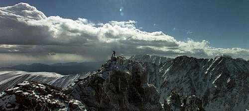 Image of Shoshoni summit by coloradoiceclimber
The Brainard Lake Road closes in late september making the approach much longer. But in the off season the day use charge does not apply. I believe Shoshoni could be climbed year round if avalanche conditions are favorable. The route to Pawnee Pass goes by only a few potential avalanche zones and once on the divide windscour should eliminate the danger (that said only those who are confident at identifing and avoiding avalanche danger should even bother). The Indian Peaks do get an ungodly amount of snow in the winter months so travel could be difficult.
The prime season is from May 1st to mid September. Afternoon thunderstorms are a savage event in Colorado and much of the standard route is on the exposed Continental Divide. Evaluate the weather carefully.
Camping
 Camping below Shoshoni Peak. Image courtesy of Chris.
Camping is ONLY allowed at established, reservation-only, campgrounds around Brainard Lake from May 1st to September 15th. After mid November through March backcountry camping is permited. The rules are harsh but this area has been over utilised.
Please contact the Boulder Ranger District for additional info:
USDA Forest Service
2995 Baseline Road, Room 110
Boulder, CO 80303
303-444-6600
Office hours are 8am to 4:30pm Monday through Fridays
Mountain Conditions
Conditions in the Brainard Lake region of the Indian Peaks can also be previewed at the TundraCam website. The TundraCam is located on Niwot Ridge at 11,600'.