
|
|
Mountain/Rock |
|---|---|
|
|
39.10960°N / 106.65395°W |
|
|
Pitkin |
|
|
Mountaineering |
|
|
12791 ft / 3899 m |
|
|
Overview
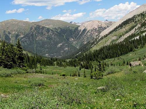
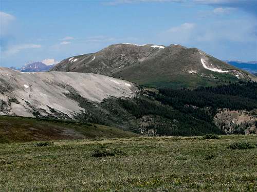
Southern Slopes, Green Mountain (L) & Point 12690 ft to the right of it

From 11890 ft Saddle

Summit
Below Summit
Green Mountain rises on the south side of Route 82 near the town of Aspen in Central Colorado. It is well visible from the switchbacks on the west side of Independence Pass on Route 82.
The northern slopes of Green Mountain go down to the bottom of the Roaring Fork River Valley (where Route 82 runs) and its southern slopes go to the bottom of the valley of Lincoln Creek. To the east, a 11980 ft saddle separates Green Mountain from a series of 12ers, one of which is known as Independence Mountain. The western slopes of Green Mountain reach the junction of the Roaring Fork and Lincoln Creek Valleys.
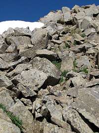
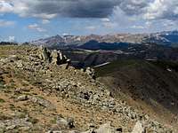
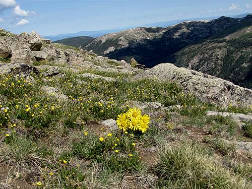
The summit of Green Mountain has gentle grassy slopes (a few rocky areas may also be encountered). A notable 12690 ft sub-peak sits to the east of the summit of Green Mountains.
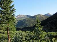
Green Mountain can be accessed from Route 82. An abandoned Jeep Road that has been converted into a trail will take you from Route 82 to Mt. Hope Mine (11500 ft) where you will find the remains of a few crumbling log cabins. You will then find your own way to the 11980 ft saddle and hike to the summit.
From the summit of Green Mountain you will have great views of portions of Route 82 and Independence Pass. Many of the other famous peaks of the area will also be in good view.
The east face of Green Mountain
Views From The Summit:
 Castle Peak | 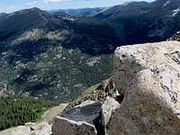 Lost Man Creek Valley |  New York Creek Valley |
 Tabor Creek Valley | 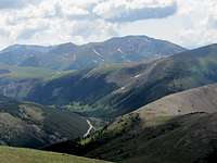 Independence Pass | 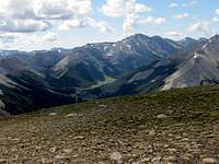 Grizzly Peak |
Getting There

Southern Slopes
You will not see any signs for Green Mountain Trailhead on Route 82. The trailhead sits at a nonspecific pull-off area on Route 82 between the well marked Lost Man Trailhead and Independence Lake (Linkins Lakes) Trailhead. The GPS coordinates for the trailhead are:
39 Deg 06.511 min, North
106 Deg 36.814 min, West
From the town of Aspen, drive 14 miles east on Route 82 until you see the sign for Lost Man Campground and Trailhead. Continue east a short distance until you see a small pull-off area. The pull-off sits just before (to the west of) an abandoned mining structure by the side of the road (and before the signed area for the ghost town of Independence). Once you get out of your car, you will see an abandoned Jeep Road and a gate that is closed to motorized vehicles.
Route 82 in this area is closed in winter.
 View NE | 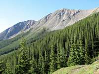 Independence Mountain |  Trail |  Point 12690 ft |
Red Tape
No fees or permits needed for day hikes.For other regulations, see the website for White River National Forest.
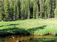 Meadow |  Below saddle | 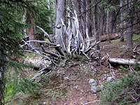 Pine Forest | 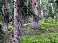 Pine Forest |
Weather
Click to see the forecast for the nearby town of Aspen. Stream Crosing | 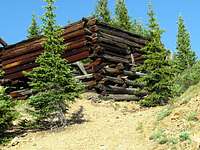 Mt. Hope Mine Area |
Map

Misc.

Route 82
Just below the Summit