-
 10414 Hits
-
 91.14% Score
-
 34 Votes
|
|
Mountain/Rock |
|---|---|
|
|
45.94432°N / 12.01728°E |
|
|
Hiking, Skiing |
|
|
Spring, Summer, Fall, Winter |
|
|
5151 ft / 1570 m |
|
|
Overview
Monte Cesen is a humble, rounded, grassy mountain, the highest in its small group of fore-Alps, but of no major mountaineering importance. Yet, it is very popular and visited in all seasons. Rising just above the Po river plain, it excells with a broad panorama. A good mountain road reaches Pianezze, some 1075m high, then it continues narrower up on the saddle on cca 1480 m. From there, only an easy grassy ridge leads to the top. Monte Cesen is popular for hiking, ski mountaineering, mountain biking, horse riding and paragliding, to name only a few outdoor activities.The mountain rises above the knee of Piave river, there, where it comes down from Belluno, and below Feltre cuts its way through the last hills towards the Po river plane. So, according to the Italian classification it belongs to a broad group of Prealpi Venete e Trentine.
My special weird rationale to ascend Monte Cesen
When Jasmina first read it's name on the map, she immediately wanted to visit the mountain. It's name sounds so funny, in Slovenian language česen means garlic. And, in addition, it is also the name in our family, my mother's maiden name. So, Cesen had to be visited.
Getting There
The majority of visitors will come on Monte Cesen from Valdobbiadene, a nice town on its southern foothills, also a centre of a distinguished vineyards and orchards district. You will probably come there from the south, from Treviso or Castelfranco Veneto, but may be also by the roads below the fore-Alps, from Conegliano or Vittorio Veneto (east), or from Bassano del Grappa (south-west). The northern approach comes, as said, from Belluno.From Valdobbiadene main square a mountain road uphills Monte Cesen starts. Via San Floriano first reaches the church of San Floriano (nice view on the town), then Via San Francesco goes up on Pianezze. From there, a more narrow, but still good mountain road goes first far to the west, then back far to the east and reaches Malga Barbaria, above which there are communication towers. Then the road continues towards the NE to the hut below Monte Mariech and over the saddle, where the road starts descending towards the north.
In winter 2009 the road from above Pianezze was closed but as it was cleaned and the ramp was lifted, we were able to drive up to some 500 meters before Malga Barbaria. In summer the road is certainly good for driving, but I don't know if it's officially opened for public traffic.
From the north, a narrow road brings you up to Malga Garda, just below Monte Garda, 1333 m. There you can start a hiking or biking tour to Monte Cesen. The other option is to use a narrow road wgich detours Monte Garda and reaches Capitel del Garda, 1208 m, a saddle even closer to Monte Cesen.
The Summit Ascent
It is short, if we use mountain roads, otherwise the altitude difference from the valley can be sonsiderable and the distance as well. From Pianezze, 1075 m, we don't need to hike up by the road, but can go directly up on Malga Barbaria, 1425 m. Then towards the saddle below Monte Mariech, cca 1500 m, we go by the road. On the saddle we deter left and continue by the summit ridge. First we reach Point 1559 m, descend some 35 meters and continue over one more bump on the highest point. From Pianezze it's less than 2 hours, also a nice ski tour.Our Funny January Tour
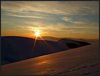
The road gets more and more narrow, more and more snowy. Then it's not cleaned enough any more and I must start turning the car. Only a little space, so I hit the snow wall and the registration plate falls off the car. Then we start walking. The sun is already setting down, but the hike is short. For the first time we have with us short, 90 cm long skis, which you mount on your ordinary shoes. At least good for the road. The scenery is exceptional, we soon reach the saddle near Malga Mariech and deter left. The snow holds nicely, but when we reach the fore-summit the sun already set down. I mount skis fine, but Jasmina has soft summer shoes and her skis are attached more or less by persuasion. Then first turns down. I fall twice, before knowing at all what happened. Short skis are really strange, especially when you have some crust snow. But the slope is short, we soon continue walking again. The last meters below the top are completely icy. That's fine - the older we are, the more we are crazy. Carefully we ascend up take a breath and prepare for skiing again. Over the icy part we just slide down. You do a turn where some fresh wind-blown snow holds on the ice, and that's enough. Then it goes fine, from the fore-summit to the saddle I even manage to make a few nice turns in a fresh snow. The road is hard and these short skis are just appropriate. In a complete darkness we are approaching the car. There's light. The guy is cleaning the road and he looks first surprised, seeing us, and also not very pleased, as he probably had troubles passing our car. It's 6:30 p.m. when we drive further down. We shall sleep in the car lower on the mountain. And then, next day, on the banks of river Po. We have two more travel days ahead of us, but it turned out that weather was awful - cold and snowing, so we were just visiting the nice Italian towns.Monte Garda and its North Ridge
Overview
In spring (mid May) this is a fantastic, panoramic hiking or biking tour. I believe that in the Prealps of Belluno this grassy ridge is one of the most beautiful countrysides of the province. Monte Garda is a grassy summit of only 1333 m. It rises on a ridge, extending from Monte Cesen towards the north. Just a few meters below its summit there is Malga Garda, a group of houses where you can find "agriturismo" and can be reached also by car. The destination is very popular, especially in spring when narcissus fields below Monte Garda are in full blossom, creating an impression that snow fell on those hills again. The easy tour can be done of course any time of a year. In one hour and half you can do some 5 km of walk up and gain some 250 m of elevation. Along the ridge a narrow road goes, allowed also for public traffic. But even if you can reach Malga Garda with car, it is advisable to go on foot or with a bike. The tour can be prolongated at wish. You can start it even down in Colderù, or you can continue from Malga Garda just up on Monte Cesen. All hiking options are easy, while continuing from Malga Garda on Monte Cesen you will encounter a few steep sectionsTrailhead
It is best to park at Baita Sci Club Lentiai (1.050 m, Monte Artent). Coordinates are: N.46°00'28.8" E.12°01'24.0". From the valley of Piave river you drive up on the ridge from Lentiai town, a few kilometers NE of Feltre. From Lentiai you proceed to a higher lying village of Colderù and then continue by an already well marked road towards Malga Garda.Description
No real description is needed, as itinerary is simple and you can all the time follow the mountain road. From Baita Sci Club Lentiai you go all the time towards the S-SW. The terrain is open and on the gentle ridge there are nice meadows, in spring densely covered with narcissus and other flowers. The views towards the north offer a great background to the scenes. There the sharp mountains of Dolomiti Belunese and more towards the west Vette Feltrine stretch. Along the road there are some exceptionally beautiful shepherds hamlets and huts, either being sheltered in a shadow of magnificent trees, or perched high on rounded grassy hills. The elevations on the ridge are mostly avoided by the road, but are worth ascending, especially if they are covered with narcissus. Their names are: Monte Arten, 1183 m, Col Moscher, 1238 m, Col dei Piatti, 1256 m, and Monte Garda, 1333 m.Just before reaching Malga Garda, a side road deters to the left, detouring the hill of Monte Garda. By that road you can reach Capitel del Garda, 1208 m, the saddle between Monte Garda and the main massif of Monte Cesen. Capitel del Garda can be reached by bike also from Malga Garda, descending those 100 meters. On that saddle other hiking and biking options in Monte Cesen massif open.
Summit View
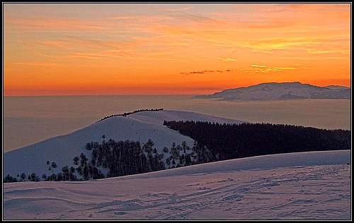
Besides the pleasant neighbourhood with gentle slopes and decayed shepherds huts on mountain pastures, from the summit of Monte Cesen the most attractive are long distance views. Along their edge the southern chain of Eastern Alps can be nicely viewed. Towards the north the most attractive are Dolomites, we see them already from quite a distance. Dolomiti Belunese are closer. Towards the south the view is open across the Po river plane, where we can see several north Italin towns, depending of the visibility.Other Information
On the mountain there are no special restrictions. Depending on conditions and on your willingness how long you want to hike, you can ascend it any time. If you would want to sleep on the mountain, a good choice would be Agriturismo Malga Mariech, 1504 m. It is opened from June to September, from October to Mai only on weekends. E-mail: info@agriturismomariech.com. Tel.: 338-5619434.External Links
Besides other web pages, some useful information can be found here.Your Help Needed
- Can you describe hike approaches, other than from Pianezze?
- Do you have nice pictures - spring, summer, autumn?
- Are there other attractive things to see on the slopes of Monte Cesen?
- How about other outdoor experiences?


visentin - Oct 4, 2010 8:31 am - Voted 10/10
garlic mountainmay you add in the page that one secondary summit of Cesen is Monte VISENTIN, which is a quite important mountain, at least spiritually for me ;) (p.s: there are a couple of pictures of Mount Visentin to attach too)
Vid Pogachnik - Oct 4, 2010 11:41 am - Hasn't voted
Re: garlic mountainAha! Yes, indeed, I see on the map Col Visentin! But it's enough far away to be an independent mountain. You should ascend it in post on SP ;) Also for Monte Cesen I'm not sure if it can be translated into garlic mountain. Cesen is garlic in Slovenian, but this mountain is deep in the Italian territory. Cheers! Vid
visentin - Oct 5, 2010 3:39 pm - Voted 10/10
Re: garlic mountainNot sure when I'll be able to climb it ! But we were in Vittorio Veneto in 2007 so I've seen it at least ! Sure, it's fairly distant from Slovenia to be a garlic peaklet. As for Visentin, the real origin is less "sexy" than a peak name, it means the inhabitants of Vicenza. Peak Visentin is named after pass Col Visentin, itself named after the Via Visentin leading to it, street named after.. someone called Visentin, which takes us back to Vicenza and the flat lands in all cases :)