
|
|
Mountain/Rock |
|---|---|
|
|
47.61492°N / 121.54855°W |
|
|
King |
|
|
5580 ft / 1701 m |
|
|
Overview
Goat Mountain is a 5580' peak located 14 miles northeast of Snoqualmie/North Bend, and 11 miles southwest of Skykomish. It is bound on the north and east sides by Lennox Creek, and on the south and west sides by Sunday Creek. Both creeks are major tributaries of the North Fork Snoqualmie River.
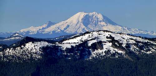
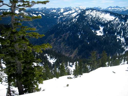
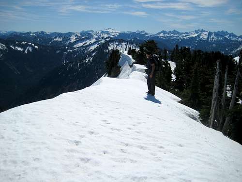
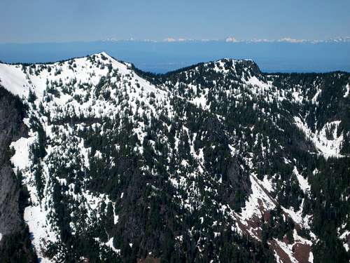
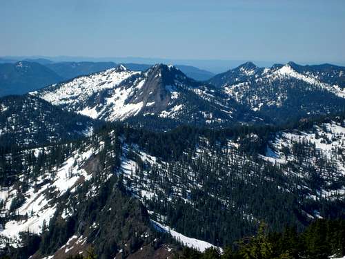
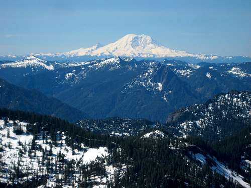
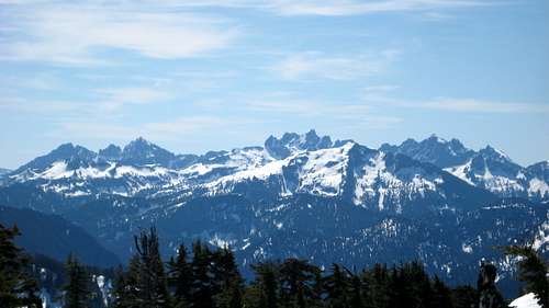
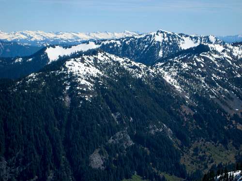
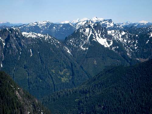
While not particularly striking when viewed from a distance, Goat Mountain does boast 1080' of prominence, and is the second highest (behind Lennox Mountain) of the named peaks in the North Fork Snoqualmie area. Views from the summit are grand, with a plethora of Alpine Lakes Wilderness peaks in all directions, as well as a good overview of the Puget Sound basin to the west.
Despite the aforementioned qualities, Goat Mountain is rarely summited. This is very likely due to a number of factors, which include: a long, pot-holed drive to the base of the peak, lack of approach trail (ie brush), and a necessary ford of the relatively large Lennox Creek. Despite these obstacles, Goat Mountain will provide an enjoyable scramble and guaranteed solitude for those willing to accept the challenge.
Getting There
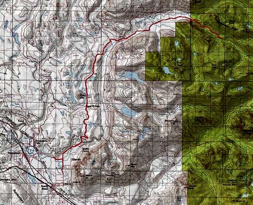
Navigate yourself by whatever means is most convenient to 428th Ave SE, which leads north out of North Bend. Those coming from points north may find it easier to take back roads from the Snoqualmie Falls area. There are a number of ways to skin this cat, so use your Google Maps if unsure. Follow 428th Ave until it forks at an 'End Of County Road' sign. Take the left fork uphill (shown as North Fork County Road on Green Trails maps), which will turn to gravel in short order. After roughly 16 miles (shortly after crossing Lennox Creek on a large bridge), turn right on FR57, which will closely parallel Lennox Creek on its north side. Follow FR57 for about 2.5 miles, and find a wide spot on the shoulder to park. Exact location is unimportant, as it will be necessary to do some hunting to find a safe fording location. Just make sure you are east of the creeks draining Goat Mountain's north slope, as they add substantially to Lennox Creek's flow.
Route
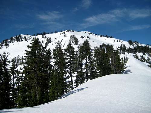
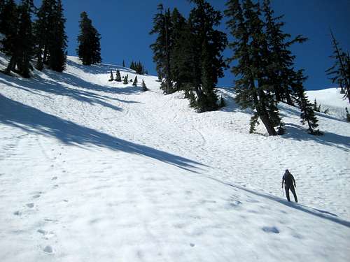
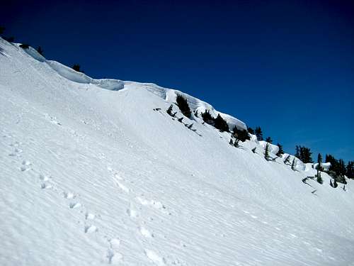
The most difficult part of scaling Goat Mountain will start within 50 paces of your vehicle - crossing Lennox Creek. You can either hope and pray that you find an adequate crossing log, or bring a separate pair of footwear for making the crossing. Once you have made it across, your objective is clear - head straight up the obvious north-trending ridge directly in front of you. The first 200' of elevation gain is probably the worst, as it is choked with large blowdowns. After that, it is fairly typical Cascade bushwacking up to 3600', with a mixture of open forest, vine maple, devil's club, salmonberry, and blueberry brush. It's really not too bad in early season (I'll give it a four out of ten on the Cascade bushwacking scale), but it would probably be substantially worse in late season. Use caution for an occasional small rock step on the ridge - they are few and far between and easily bypassed.
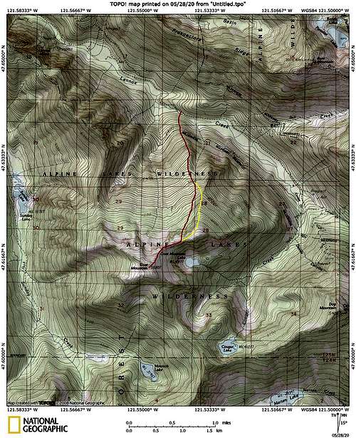
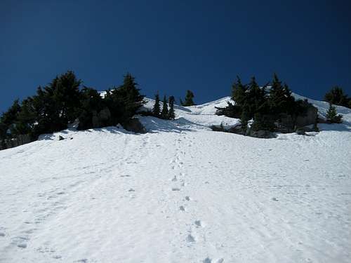
As the vegetation and trees open up (around 3800'-4000'), you will have the option of continuing up the ridge, or dropping off the ridge slightly to the right to make a small shortcut. We elected to take the 'shortcut' route, which worked well, but the ridge route would be safer if there were any possibility of avalanche danger.
Either way, upon reaching the top of the ridge just north of Goat Mountain Lake, the summit will be in sight, and the route will be obvious.
There is an interesting catwalk section between 5100' and 5200' that is reminiscent of the 'knife-edge' on Eldorado (but not nearly as steep) - an ice axe is highly recommended here.
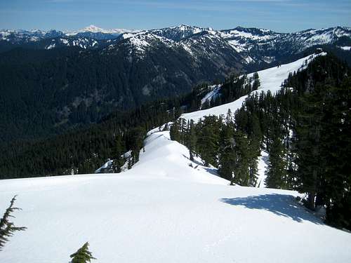
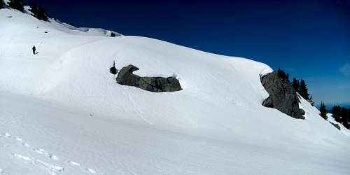
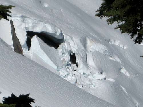
The summit ridge of Goat Mountain trends northwest to southeast and tends to make large cornices. Either find a break in the cornices near the summit, or deviate several hundred feet to the left or right of the summit and regain the ridge. Be sure to stay back a good 10' from the edge while on the summit in early season.
Note: The map seems to indicate that one could make an oblique traverse from 4000' until directly north of the summit at 4800' - this, in fact, was our original intention. Closer inspection revealed substantial avalanche debris and large, partially-hidden schrunds. Based on our observations, I can't highly recommend this route.
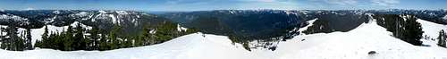
Goat Mountain is very nicely placed for great mountain views in all directions.
The Cascade Alpine Guide makes mention of two other approach possibilities. One approaches from Sunday Lake, the other from Cougar Creek. Neither route looks easier than the one described above.
Red Tape
A Northwest Forest Pass is not required to park on this section of FR57. I'm not sure if it is required at the Bare Mountain trailhead, which is a short distance away.
When to Climb
Provided one took the ridge all the way up, Goat Mountain would probably be safe to climb any time FR57 is accessible. Having said that, if it were my personal choice, I would go after this one in April or May. Any later than this may result in some epic devil's club battles.
Camping
There are a number of unofficial camping spots along the Snoqualmie once you get onto USFS land. There are also plenty of flat areas above 4000' if you want to camp on the mountain.
External Links
Add External Links text here.