
-
 19863 Hits
-
 76.79% Score
-
 8 Votes
|
|
Mountain/Rock |
|---|---|
|
|
39.05130°N / 107.1542°W |
|
|
Gunnison |
|
|
Hiking, Mountaineering, Skiing |
|
|
Spring, Summer, Fall, Winter |
|
|
11975 ft / 3650 m |
|
|
Overview
Whitehouse Mountain is the 1,325th highest mountain in Colorado, but the 12th highest elevener in Colorado. Whitehouse is located about two miles southeast of Marble, CO in the Elk Range of Central Colorado. Whitehouse Mountain rises 4,000 vertical feet above Marble, CO. Yule Marble Quarry is about one mile from the summit. Whitehouse is a popular destination for people living in the area. Whitehouse can be climbed during any season.
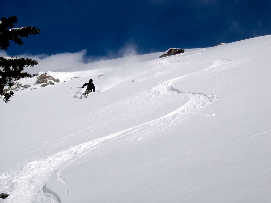
Whitehouse Mountain's Northwest Face
The northwest face offers an excellent ski run of over 4,000 vertical feet with no approach! The northwest face is an advanced glisse route with a maximum slope angle just under 45 degrees. In addition, if a car shuttle is used, only 3,275 feet of elevation gain up the west face are required. The north face, northwest face and west face are huge avalanche paths. There have been at least two avalanche accidents on Whitehouse Mountain.
Skiing Whitehouse Mountain's Northwest Face
Getting There
Drive Highway 133 from Paonia or Carbondale. Turn east onto a well-signed road leading to Marble on the north side of McClure Pass. Drive 6 miles to a stop sign in Marble. Turn right onto Quarry Road. Drive 2.6 miles and park at the base of Mud Gulch. If no parking is available here, park at the Windy Corner Trailhead an additional 0.5 miles up the road. The West Face is the easiest and most popular route, but the north face can also be climbed.Red Tape
There is a lot of private property in this area. For more details refer to Louis W. Dawson II's "Dawson's Guide to Colorado Backcountry Skiing Volume 1."Marble Peak is located in White River National Forest Aspen Ranger District.
Mountain Conditions
7 Day Forecast for Marble, COColorado Avalanche Information Center (CAIC)
Roaring Fork Avalanche Center