
-
 14207 Hits
-
 74.92% Score
-
 5 Votes
|
|
Mountain/Rock |
|---|---|
|
|
38.97220°N / 107.1062°W |
|
|
Gunnsion |
|
|
Hiking, Mountaineering, Skiing |
|
|
Spring, Summer, Fall, Winter |
|
|
12559 ft / 3828 m |
|
|
Ruby Range Overview
The Ruby Range is a long, southern extension of the Elk Mountains. Most of the Ruby Range is within the Raggeds Wilderness. Yule Pass and Kebler Pass are the northern and southern boundaries of the Ruby Range, respectively.Overview
Augusta Mountain is located in the Elk Mountains less than 2 miles south of Yule Pass and close to the towns of Pittsburgh (Pittsburg) and Crested Butte. It is the second most northern peak in the Ruby Range, a subrange of the Elk Mountains.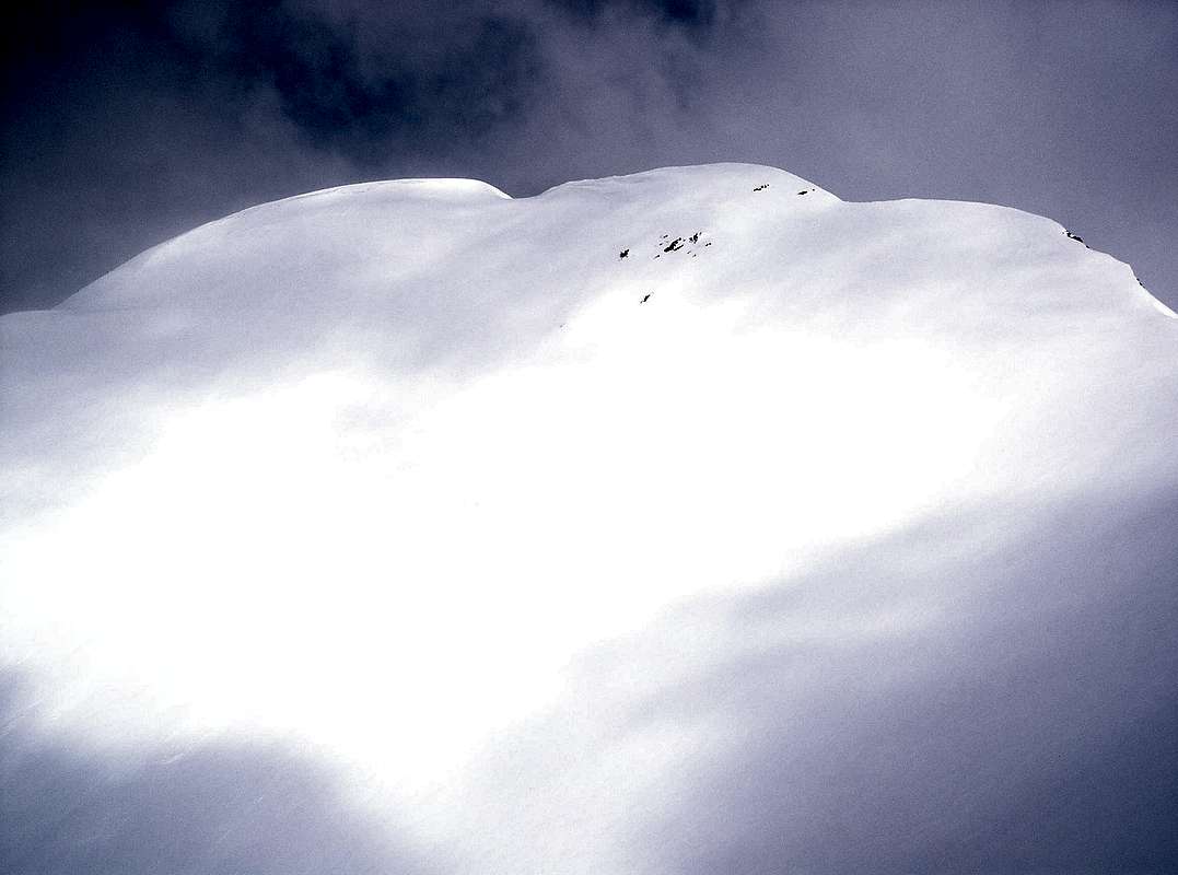
Augusta Mountain from Mineral Point's southwest face.
Augusta Mountain is the 960th highest peak in Colorado and the 323rd highest twelver in state.
In addition to providing a fun hike in the summer, the southeast face makes a fine ski descent in the fall, winter and spring during times of low avalanche danger.
From the summit, its parent, Purple Mountain, Treasure Mountain, Treasury Mountain, Cinnamon Mountain, North Maroon Peak, South Maroon Peak, Pyramid Peak, "Thunder Pyramid" and "Lightning Pyramid" can be seen.
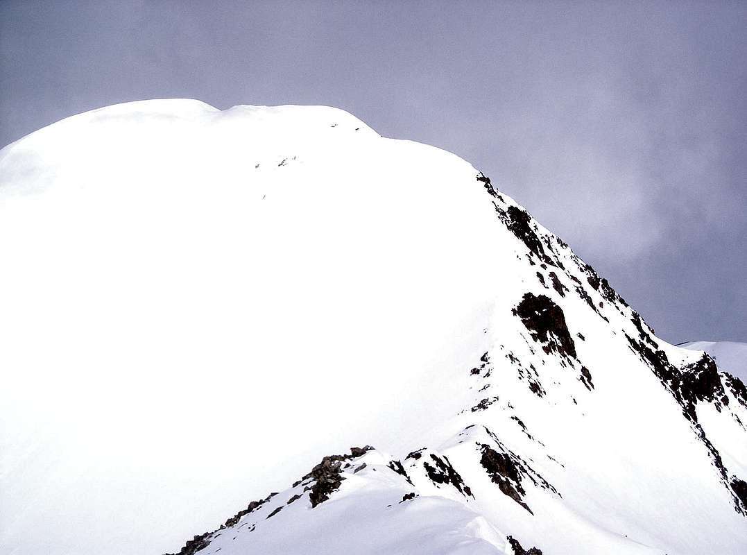
Augusta Mountain from its east ridge.
Getting There
Summer
From CO 135 and Main St. in Crested Butte, Colorado, drive 0.9 mile north to Slate River Road (FSR-734). Follow Slate River Road to Poverty Gulch Road (FSR-552 or shown as FSR-734.2A on the Trails Illustrated Map) just before Pittsburgh, Colorado. For the shortest hike, use the Baxter Basin Road approach. Follow Poverty Gulch Road (high clearance) up Poverty Gulch, then follow four wheel drive Baxter Basin Road (FSR-552.2A or shown as FSR-552 on the Trails Illustrated Map) to its terminus. Hike north past a n unnamed lake, gain the Augusta Mountain-Mineral Point saddle, then follow Augusta Mountain's eats ridge to the summit.
Alternatively, for more hiking and less four wheeling, use the Poverty Gulch Road approach. Instead of turning onto Baxter Basin Road, follow Poverty Gulch Road to its terminus (four wheel drive). Continue on foot on the old road which crosses the creek to the west and switchbacks up to Augusta Mine at ~11,000'. Follow the drainage west up to a bench lake, then climb the southeast face directly or gain the Augusta Mountain-Mineral Point saddle and follow Augusta Mountain's east ridge to the summit. The ridge is no more than class 2, but has a bit of exposure on the north side.
Snow closure is less than 3 miles from the CO 135/Slate River Road intersection. When Slate River Road is closed, using the Poverty Gulch Road approach will add ~11 miles roundtrip to the summer route.
Colorado Avalanche Information Center
Crested Butte Avalanche Center
![Augusta Mountain Approach Routes]()
Augusta Mountain approach routes. Red = Baxter Basin Rd Approach, Blue = Poverty Gulch Rd ApproachFall, Winter & Spring
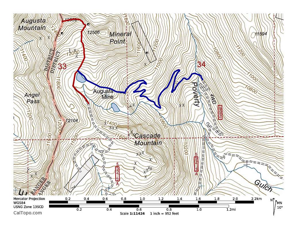
Augusta Mountain approach routes. Red = Baxter Basin Rd Approach, Blue = Poverty Gulch Rd Approach
Snow closure is less than 3 miles from the CO 135/Slate River Road intersection. When Slate River Road is closed, using the Poverty Gulch Road approach will add ~11 miles roundtrip to the summer route.
Red Tape
Augusta Mountain's summit is on the eastern border of Raggeds Wilderness, so motorized travel is permitted from the east.Mountain Conditions
7 Day Forecast for Crested Butte, COColorado Avalanche Information Center
Crested Butte Avalanche Center