-
 3730 Hits
-
 79.04% Score
-
 10 Votes
|
|
Mountain/Rock |
|---|---|
|
|
43.76111°N / 103.59858°W |
|
|
Custer |
|
|
Hiking |
|
|
5680 ft / 1731 m |
|
|
Overview
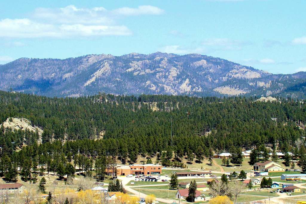
With the wealth of rocky summits in the central Black Hills, it would be easy to overlook a fun little summit that sits on the south edge of Custer, South Dakota. Evening visitors to Custer often notice the “Hollywood-style” Custer sign, lit up on the southern skyline above Custer. The sign is situated near the summit of Pageant Hill.
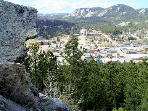
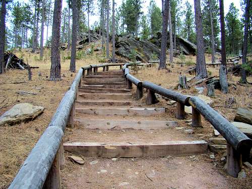
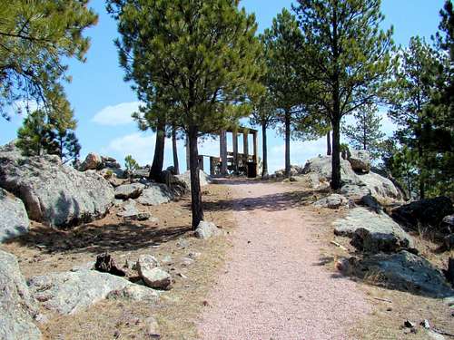
This 5,680-foot summit is accessible to the public by three trails through 73-acre Big Rock Park. Those who reach the summit area find a large rock formation, which is known as Big Rock. A steep stairway, with handrails, to the Big Rock Lookout summit platform is there for the safety of visitors. The views are outstanding, giving a panoramic look at surrounding peaks, including Black Elk Peak, Little Devils Tower, Sylvan Peak, Mount Coolidge, Cicero Peak, Buckhorn Mountain and Calamity Peak.
Another scenic outlook, Sunrise Point, is situated along the Skywalk Trail, and also gives outstanding views to the north and east. The map attached to this page shows the route of the three trails.
These dirt and gravel trails used a few old roads on the hill and pass through an area rich in history, as native American tribes used to camp here when attending events and festivities in Custer a century ago. At one time, there was a tramway to the summit block. All that is left of the old tramway are the anchors in the summit block.
All the Pageant Hill trails are well-used, and sometimes serve a double purpose for the disc golfers who frequently compete at the 18-hole course on Pageant Hill. Sledding is popular in the park every winter.
Some people are concerned by the mountain lion population in the Black Hills. However, due to the large number of visitors to Big Rock Park, sightings of mountain lions are rare. If you are still concerned, please carry a working canister of pepper spray.
Getting There
Pageant Hill’s main trailhead (Skywalk Trail) is located two blocks south of the downtown area along Highway. The hill is on the south side of Harbach Centennial Park, which is located at South 6th Street and French Creek Drive.
Interestingly, the 109-mile Mickelson Trail also passes through that park, and trail permit requirements for the Mickelson are waived within the city limits.
Routes
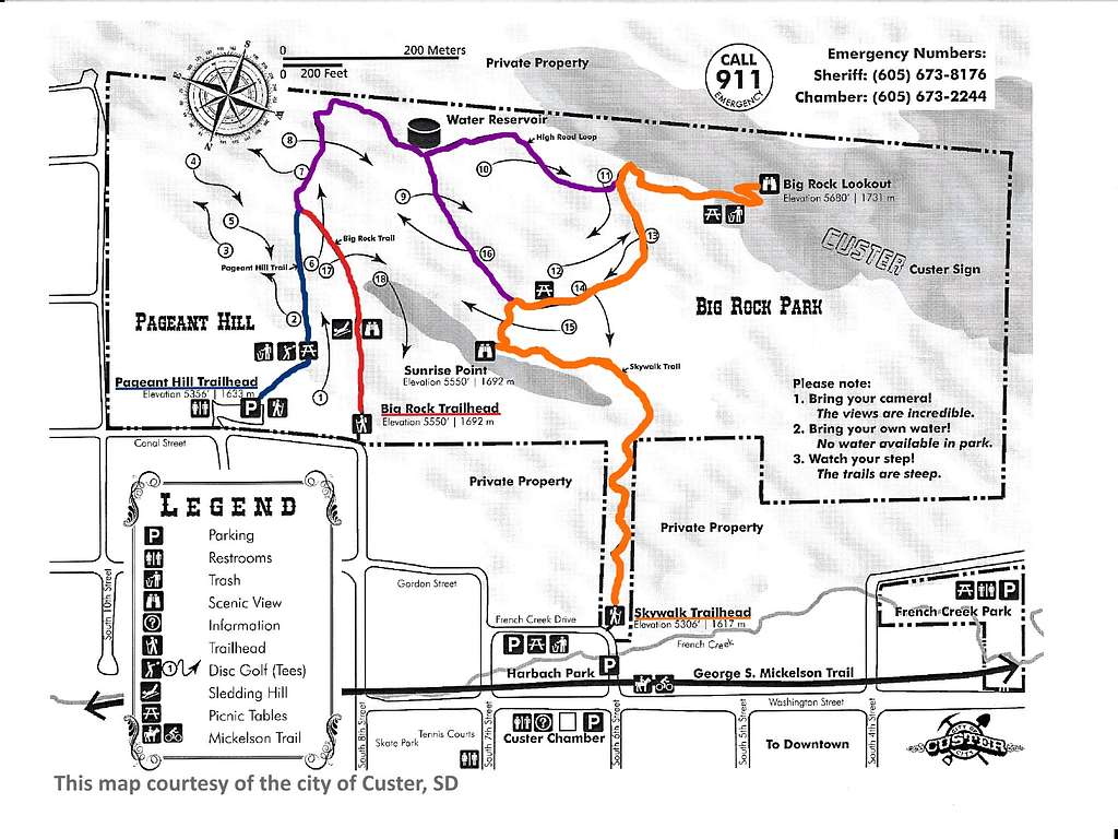
The Skywalk Trail is the most commonly used trail and features over 300 stair steps, making this trail rated as “difficult”. It is only a half-mile long, but ascends over 370 feet to the summit. The trail passes the scenic Sunrise Point on the way to the summit.

The Pageant Hill Trail starts at a parking lot at 9th and Canal Streets. It’s rated as a moderate trail and when it joins with the Big Rock Trail, the distance to the summit is around .6-mile, with over 320 feet of elevation gain.

The Big Rock Trail is a another trail rated as moderate and is nearly the same distance from trailhead to summit as the Pageant Hill Trail. The elevation gain on this trail is just over 300 feet.
Red Tape

There are no permits needed for hiking here. Camping and campfires are not allowed in the park, but there are plenty of campgrounds in the area. Pets need to be on a leash.
When to Climb
When making your plans, you may wish to check out the latest forecast and conditions at the link below:
Forecast & Conditions for Custer, South Dakota
Area Campgrounds & Lodging
The town of Custer has long been popular with tourists, due to nearby Custer State Park, Jewel Cave National Monument, Mt. Rushmore, Crazy Horse Monument, Black Elk Peak and the Black Elk Wilderness. Camping and lodging opportunities abound. Here are some links that will give you up-to-date information on the best available:
Custer South Dakota Cabins & Campgrounds