
|
|
Mountain/Rock |
|---|---|
|
|
37.76942°N / 107.73928°W |
|
|
San Juan |
|
|
Mountaineering |
|
|
Summer |
|
|
12764 ft / 3890 m |
|
|
Overview
Note: This peak has no official name.Rank: Peak 12764 ft is Colorado’s 810th highest ranked peak.
A lot of effort to climb an obscure peak, but that is what it is all about.
Peak 12764 ft rises to the west of Route 550 in the San Juan Mountains of southwestern Colorado to the south of the town of Silverton. The summit of Peak 12764 ft is grassy and broad. Like many of its neighbors, a band of cliffs makes access to the top of Peak 12764 ft difficult. You could, however, start at Little Molas Lake Trailhead and hike part of the “Colorado Trail” to a broad saddle at the base of Peak 12764 ft. From there, you can leave trail and bushwhack your way up a steep grassy slope through an opening in the cliffs to reach the top of Peak 12764 ft.
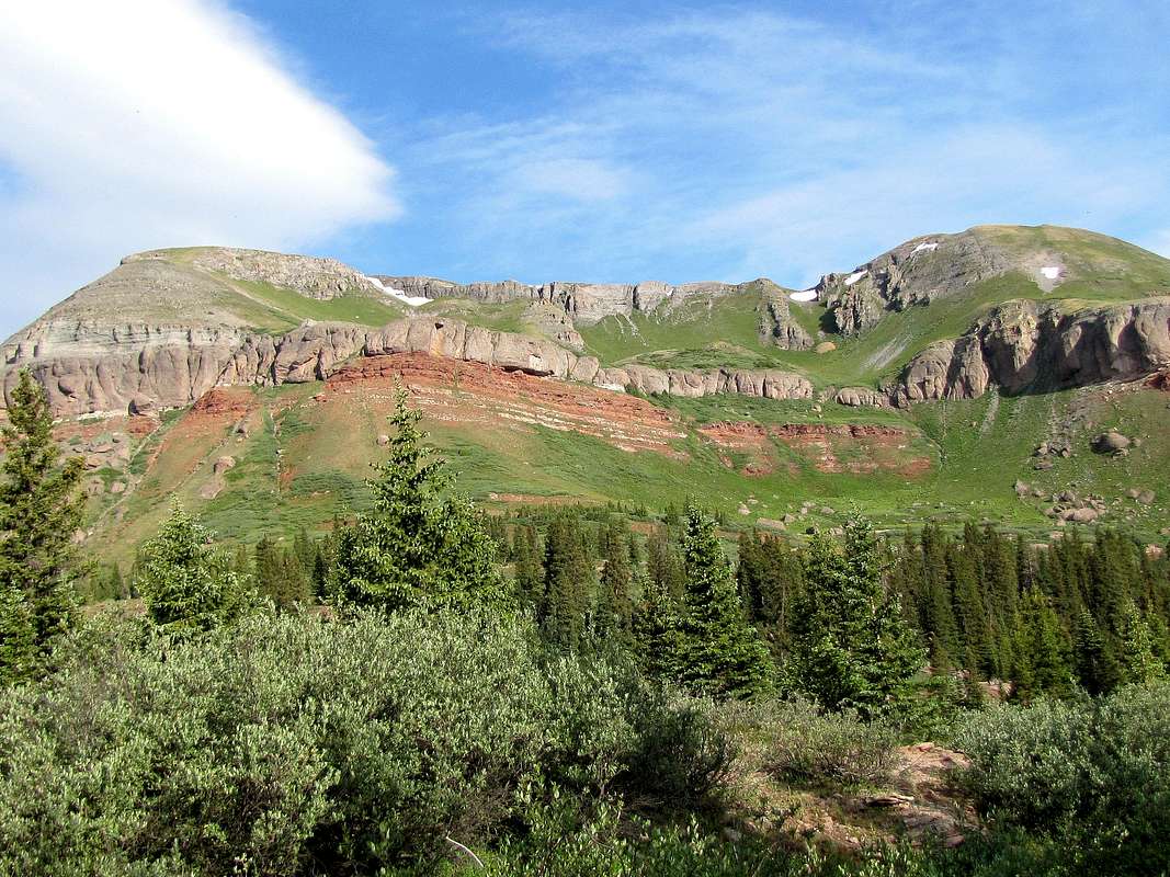
East face, (L) Peak 12764 ft, (R) Point 12613 ft
Getting There
Directions to Little Molas Lake Trailhead (not to be confused with Molas Lake Trailhead):From Silverton, drive 7 miles south on Route 550 to the well signed Little Molas Lake Campground/Trailhead on the west side of the road. Turn west and drive the well graded dirt road about a mile past the camp site to the end of the road at the trailhead.
Route, from Little Molas Lake

Map
All distances are per my GPS
At the trailhead, Peak 12764 ft will not be visible. Get on the Colorado Trail and head south/west. The trail zigzags through a sparse forest and soon gets onto grassy slopes with no trees. You will have good views of Snowdon Peak and part of the Grenadier Range.

Snowdon & South Snowdon Peaks

Grenadier range
You will then find the trail on the crest of a very broad and gently sloped ridgeline going uphill.

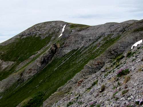
Peak 12764 ft and its companion Point 12613 ft to the north, will come to view.

(L) Peak 12764 ft, (R) Point 12613 ft
You will also get good views of the 12987 ft Bear Mountain to the north.

Bear Mountain
After 3.2 miles, you will reach a very wide saddle between Peak 12764 ft to the west and Peak 12849 ft to the east. You will note a band of cliffs obstructing direct access to Peak 12764 ft. Look carefully on the slopes of Point 12613 ft to find a grassy slope going up through an opening in the band of cliffs. You must leave trail and find your own way to the base of this grassy slope. I went to the west side of the saddle and found a beaten path that headed north toward Putnam Basin. Followed this path north for some time until I lost it and then did some bushwhacking to reach the grassy slope.

Bushwhacking toward grassy slope

Hiking up the steep grassy slope.

Grassy slope, opening in the cliffs

Grassy slope and cliffs
Views from the grassy slope:

Peak 12849 ft

Snowdon & South Snowdon Peaks

Red slopes of Anvil Mountain
As you go higher, the grass turns to alpine tundra. You will soon find yourself above the cliffs.

Above the cliffs
The summit of Peak 12764 ft will now appear.
Summit of Peak 12764 ft
To avoid difficulties, I went almost to the very top of Point 12613 ft. Peak 13042 ft appeared to the west. A band of cliffs seemed to rise above Putnam basin on the slopes of Peak 13042 ft.

Peak 13042 ft
I was then on easy grassy slopes, a short hike down and then up again, brought me to the summit of Peak 12764 ft. Views from the summit:

Twin Sisters
 Golden Horn/Pilot Knob | |  Lookout, Three Needles | |  Bear Mountain | |

Fuller/Vermilion and Beattie Peaks
 Sultan Mtn & Grand Turk | |  Twilight Peaks & Potato Hill | | 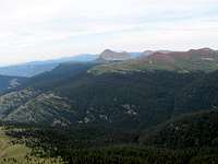 Engineer Mountain | |

Grenadier Range

Snowdon Peak & Needle Mountains