
-
 3434 Hits
-
 79.78% Score
-
 11 Votes
|
|
Mountain/Rock |
|---|---|
|
|
37.71600°N / 107.6842°W |
|
|
San Juan |
|
|
Hiking, Mountaineering |
|
|
Spring, Summer, Fall, Winter |
|
|
12628 ft / 3849 m |
|
|
Overview

"N 1" and Snowdon Peak
Colorado Rank: “N 1” is a soft ranked peak, which basically means there is no confirmed 300-ft variance between its summit and the lowest point of the saddle with its next highest neighbor.
Prominence: 288 feet
USGS Quad: Snowdon Peak
Planning Map: Trails Illustrated #140 Weminuche Wilerness
Rank & Prominence: Lists of John
Sarah Simon near the summit of N1 (UN12,628) | Kiefer Thomas
Getting There

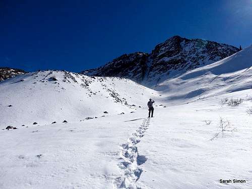
Snow on slopes of "N 1"

Heading up "N 1"

Approaching "N 1" from the southwest

Silverton from "N 1"
14 miles south of Silverton; 53 miles north of Durango on U.S. 550 and about 1 mile south of Molas Pass, head south on the access road for Andrews Lake. Trailhead is 2 WD accessible in dry conditions; 4x4 needed in snow.
Molas Pass Trailhead 10,000 feet
13 miles south of Silverton, 54 miles north of Durango on U.S. 550 and about 1 mile north of Molas Pass, turn east into the Molas Lake access road. Plenty of parking is available at the trailhead.
Kiefer making his way up the gully between Snowdon Peak and "N 1" | 9 Nov 2013
Route
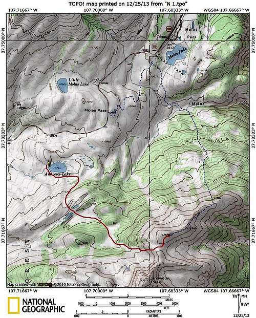
This route map outlines two primary approach options to the summit of "N 1"
From Andrews Lake
•Roundtrip Distance: 6 miles
•Elevation Gain: 1900 feet
•YDS: 2
•This would be considered the standard / more heavily traveled route
From Molas Pass / Molas Lake
•Roundtrip Distance: 9-11 miles depending on parking
•Elevation Gain: Approximately 3000
•YDS: Unknown
•Involves a crossing of Molas Creek
 In the upper gully |  Mad climber scientist |
 Almost to the top |  Kiefer on summit |
Red Tape

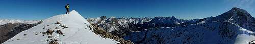
This pano gives a small taste of the scenery from the summit of "N 1"
 Grenadier Views
 Needle Mountains
Please practice Leave No Trace principals:
1. Plan Ahead and Prepare
2. Travel and Camp on Durable Surfaces
3. Dispose of Waste Properly
4. Leave What You Find
5. Minimize Campfire Impacts
6. Respect Wildlife
Weather and Seasons
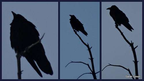
This raven was posing for us during our descent from "N 1"
 Click for weather forecast | Summer in the San Juans is heavenly, with warm sunny daysand cool, crisp nights. Mid-summerwildflowers will knock your socks off. As with the other mountainous areas of Colorado, the afternoonthunderstorms mean summertime hikers need to leave the summit by noon. The San Juans are well-known for thawing outlater than other parts of Colorado; it is not uncommon for an ice axe to berequired year-round on certain routes. |  Click for weather forecast |
Autumn sunset in the San Juan Mountains
Camping and Lodging
 East face of "N 1"
 "N 1" from the south
 Snowdon Peak
 Views from the top
Established National Forest Campgrounds
The South Mineral Campground is about 6 miles from Silverton. The campground has 26 sites, available on a first-come, first-served basis. At 9,800 feet elevation, even summer nights will be chilly. To get there, drive two miles west of Silverton to Forest Road 585. Follow FR 585 west along the creek for four miles to the campground entrance. The facilities provide picnic tables, composting vault toilets, fire grates, trash disposal and potable water.
San Juan National Forest campground map
Commercial Campgrounds
Silverton hosts at least three commercial campgrounds offering services such as RV hookup, snacks and showers. These include Silverton Lakes Camper Park, Silver Summit RV Park and Red Mountain RV Park. Additional RV parks can be found by visiting the Silverton Magazine online lodging guide.
Cabins, Cottages, Hotels and Bed & Breakfasts
The lodging in and around Silverton could be described as “limited” and “eclectic”. Many are family owned and operated and tend toward the friendly and cozy, versus the sophisticated or luxurious. The Silverton Magazine provides a good online lodging guide.
External Links
Feel free to notify me of any external trip reports or other useful information pertinent to this peak to add here.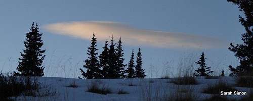
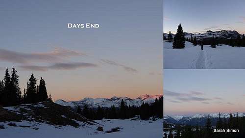
The sun setting in the San Juans during our outhike from "N 1" | 9 Nov 2013