
|
|
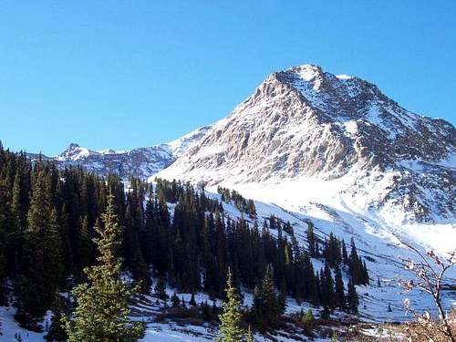
Mountain/Rock |
|---|---|
|
|
37.90870°N / 107.4804°W |
|
|
Hiking, Mountaineering |
|
|
Spring, Summer, Fall, Winter |
|
|
13795 ft / 4205 m |
|
|
Overview
Point 13,795 is the 109th highest point in Colorado. This makes it a Bi-Centennial, one of Colorado's 200 highest.

Getting There
In Lake City begin measuring from the bridge crossing Henson Creek, heading south. Go 2.2 miles to the Lake San Cristobal Road and turn right. Go past the beautiful lake and up the Lake Fork of the Gunnison River. Continue to mile 14.3 where the road forks and a take the right fork up Cinnamon Pass Road. At mile 18.3 you will see the large parking lot at the Silver Creek - Grizzly Gulch Trailhead. An alternate way to reach the trailheads is from Silverton. Measuring from Silverton's north end, follow Hwy110 for 12.3 miles to Animas Forks, climb steeply east to reach Cinnamon Pass at 15.3 miles, cross the pass and descend on its east side to reach the Silver Creek- Grizzly Gulch Trailhead after 21.1 miles. A 4 WD is required for this approach.There is ample parking available at the Grizzly Gulch trailhead. The trailhead also has toilet facilities.
(source kilimanjaro1 from his excellent & accurate Handies Peak page.)
Camping
There is ample camping space at the Silver Creek/Grizzly Gulch trailhead. Be warned that during the peak summer climbing season, this is a heavily used area due to Sunshine & Redcloud peaks are accessed via Silver Creek Trailhead, as well as Handies Peak via Grizzly Gulch trailhead, so plan your trip accordingly.Mountain Conditions
Lightning Safety - Use common sense. If there are dark clouds forming, pay attention to this. If you can hear the thunder, you can be struck. If you are heading up the trail and everyone else is heading down, TURN AROUND! The summit is not worth your life, come back a different day weather is better. The mountain will always be there the next time you're there.For more information, Lightningtalks