
|
|
Mountain/Rock |
|---|---|
|
|
45.92972°N / 10.68251°E |
|
|
Trentino |
|
|
Hiking, Mountaineering, Ice Climbing, Scrambling |
|
|
Spring, Summer, Fall, Winter |
|
|
6657 ft / 2029 m |
|
|
Overview
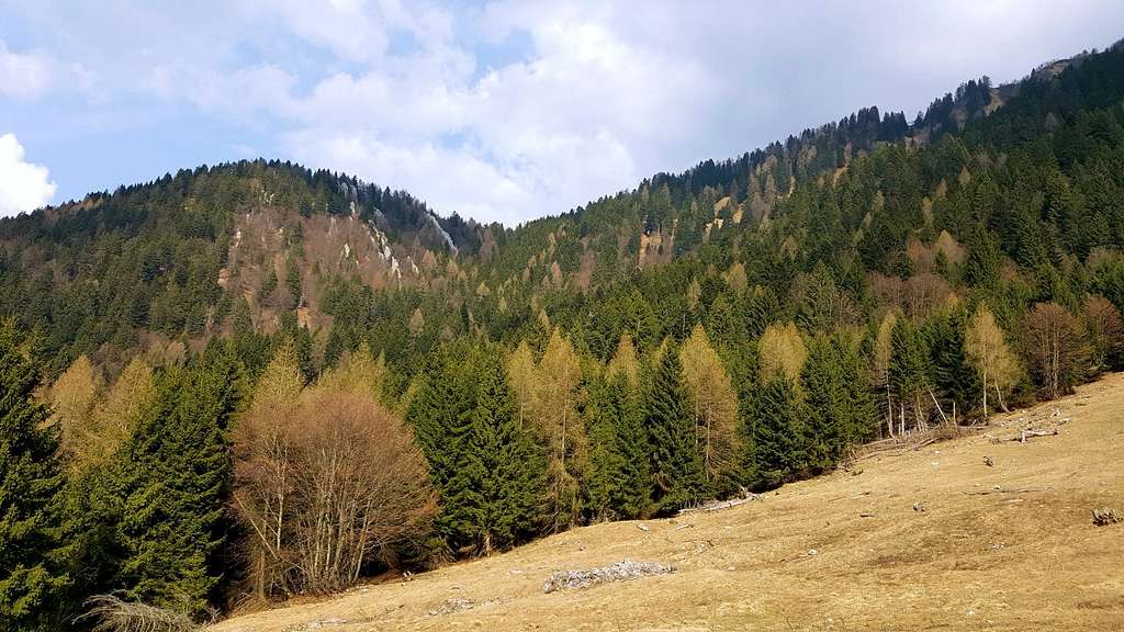
Monte Campellet 2029 m
Monte Campellet 2029 m - also named Nozzolo Grande - is a massive mountain belonging to Prealpi Bresciane and Gardesane and located in the Cadria chain, the group including Monte Cadria, the highest mountains in the area. Its main ridge develops from SW to NE, towards the Brenta Dolomites, more specifically between Bochét dell'Ussol (N), Tiarno (S), Concei Valley (E) and Chiese Valley (W). Monte Campellet, located to the South-West of the highest Monte Cadria, closes its basin from the South.


Monte Campellet is formed by two adjacent summits, plunging on the South side with steep gullies and rocky walls in shape of vertical layers, called "Le Pale". On the contrary the North side is gentle, and appears grassy, crossed by mule tracks connecting the several war tunnels that pierce the mountain. In addition to the galleries and walkways, there are numerous remains of the fortification especially on the side that connects to Bocca Ringia, in fact Monte Campellet was one of the sides of the fortified triangle of Cadria, an Austrian stronghold on these peaks. The view of Valle di Ledro and the Monti del Garda taken from the summit is fantastic.
Getting There
There are two different standard routes to summit Monte Campellet, rising from different sides (the route from West starts from Deserta above Valle del Chiese and the route from East from Val dei Molini di Concei and converging in the upper part on a saddle named "Sella della Pozza di Cadria" 1912 m.
- Route to Deserta
From Ponte Caffaro at the northern end of Lago d'Idro drive to the north to the village of Pieve di Bono, where you leave the main Val Giudicarie road and turn right towards Deserta - Forte Cariola. Follow the road rising to reach the small hamlet of Deserta, where you need to park your car. The road continuing to Malga Ringia it is in fact prohibited to vehicles.
- Route to Val dei Molini di Concei
From Riva del Garda take the road to Val di Ledro and reach Val dei Molini di Concei.
History
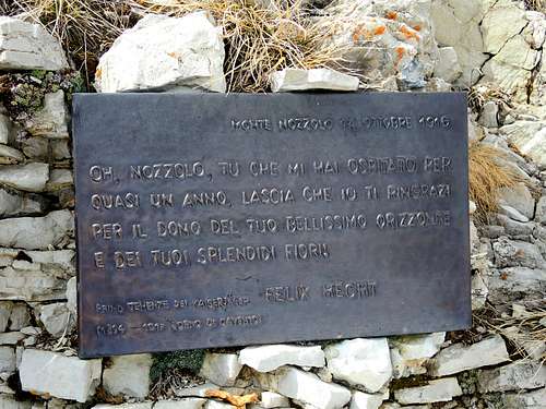
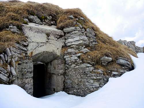
Monte Campellet together with the nearby Nozzolo Piccolo (Little Nozzolo) was one of the sides of Monte Cadria fortified triangle, an Austro-Hungarian stronghold in this area. Monte Campellet Northern side and still more the adjacent and lower Nozzolo Piccolo are all pierced with caves and tunnels, which are still well visible. On the summit of Campellet a plaque commemorates the Austrian Lieutenant Felix Hetch, fallen on Corno di Cavento (Adamello), who previously had spent long months on Monte Campellet, where he wrote "War diary from Cadria to Stivo". Another historic detail about this summit regards an Italian aircraft, here been dropped by the Habsburg antiaircraft in 1917, on February 20.
Route: Monte Campellet from Deserta
Monte Campellet from Deserta
Summit quote: 2029 m
Difficulty: EE
Difference in level: 900 m from Deserta
Exposition: West, then North West
Starting point: Deserta 1143 m
From the small hamlet of Deserta 1143 m take the concrete road that enters the forest and with several bends leads to the wide grassy clearing on which it stands Malga Ringia 1398 m. Ignore the path heading left and passing near the shelter and turn definitely to right on a wide track (signposts Malga Cadria), soon narrowing, penetrating within the valley - closed at the top by steep walls - and rising with gentle slope on the right side of the valley. Ignore a track heading right and continue to follow the signpost to Malga Cadria on the old military trail built by the Austrians before the First World War to connect their Cariola Fort (situated in the current Deserta) with the powerful fortifications situated on Nozzolo Grande and the near Nozzolo.
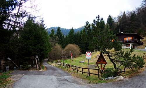
The hamlet of Deserta |
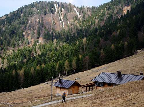
Malga Ringia |
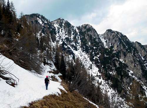
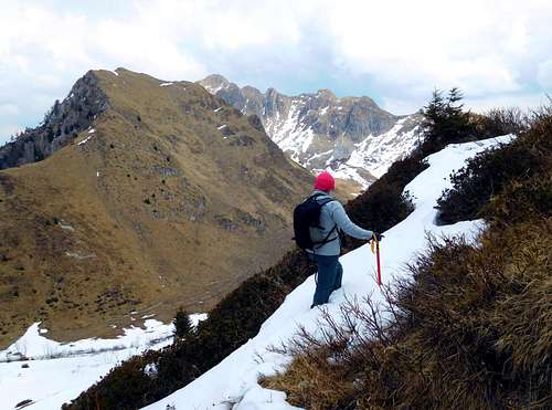
Snow slopes below Pozza di Cadria saddle |
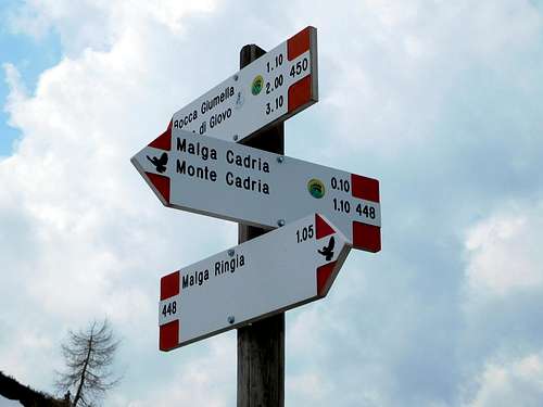
Signpost on Pozza di Cadria saddle |
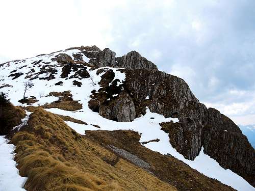
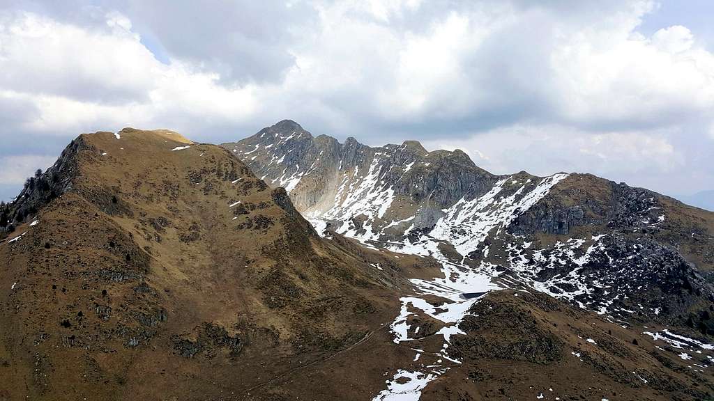
Campellet North side from Pozza di Cadria |
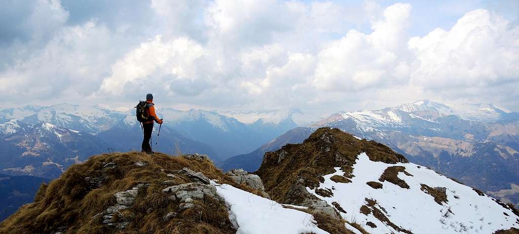
Cadria seen from Monte Campellet NW ridge |
Getting a second signposted junction there are two possibilities: to the right the trail continues with several bends and the constant upward trend typical of military mule tracks on the right side of the valley, nearing some characteristic rock pinnacles. Alternatively, heading left at the signpost, you will join another trail rising more steeply on the left side of the valley. Anyhow the military mule tracks returns left and the two itineraries end on a narrow and very steep trail rising on the left with several hairpins, then traversing right along the steep upper slopes of the valley to reach the Sella della Pozza di Cadria 1912 m, a wide saddle between Monte Campellet (on the right) and the SW ridge of Monte Cadria (on the left) and overlooking the valley just traveled. The saddle, also named Bocca di Cadria, gives access to the opposite valley, where it rises Malga Cadria 1914 m. Below the saddle it's located a natural and lonely high altitude pond, the Pozza di Cadria, which gives the name to the col. From the saddle take a not well worn path on the right (West) rising uphill on the NW crest of Campellet, then traverse left in the direction of the rocky spurs of Monte Campellet and follow the wide ridge bordering the rocks admiring old military cave and building and getting quickly the double summit. On the first summit it's located the memorial plaque and a cave. From the first summit follow the ridge, leading quickly to the second summit.
Descent: reversing the same route
Route: Monte Campellet from Val dei Molini di Concei
Monte Campellet from Val dei Molini di Concei
Summit quote: 2029 m
Difficulty: EE
Difference in level: 1080 m from Val dei Molini di Concei
Exposition: East, then NW
Starting point: Hydroelectric power plant in Val dei Molini di Concei 950 m
From the Hydroelectric power plant in Val dei Molini di Concei 950 m follow the numerous bends of the road, sometimes concrete, up to Bocca Vies 1555 m. Head to right and cross the meadows aiming at a military trail partially carved into the rock. Continue along the hillside beneath the NE foothills of Monte Campellet to reach the Sella della Pozza di Cadria, from where you continue on the previous itinerary.
Red Tape
There are not special restrictions in climbing, hiking and mountaineering. Cars are not allowed on the concrete road starting from Deserta.
Hiking and scrambling grades of difficulty
T - Turistico (Tourist): Itineraries on wide, clear and well worn paths, sometimes on mule tracks or gravel roads. The routes are never exposed, don't give any orientation problems and don't exceed 2500 meters of altitude. Suitable also for children.
E - Escursionisti (Hikers): Itineraries on marked trails, even narrow and with possible steep and impervious sections. They are never exposed and don't give any orientation problems. They can tread different kinds of ground, such as forests, gravel, meadows, pastures, easy rocks, etc.). They form the majority of the trails that wind up in the mountains and require a certain habit to walk; you need equipment suitable for the altitude and resistant footwear with soles suitable for rough terrain.
EE - Escursionisti Esperti (Experienced Hikers): Itineraries for hikers with experience and good knowledge of the mountain. Some of these paths may have exposed sections, however brief, which require firm foot and no dizziness. They require the ability to adapt to particular terrain, such as steep grassy slopes or stretches of rocks with difficulties that can reach the 1st degree of the UIAA scale. They can also reach high altitudes (3000 m or more). Sometimes they may include unmarked sections, requiring a good sense of orientation. Snow slopes are possible, however which can be overcome without specific mountaineering gear (rope, harness, crampons, ice-axe).
EEA - Escursionisti Esperti con Attrezzatura (Experienced Hikers with equipment - The same as EE, in addition these routes require the use of via ferrata equipment (lanyards, harness, carabiners, heat sink, helmet). This kind of itineraries range from the trails with short easy and not much exposed sections, previously equipped with fixed ropes and iron pegs, to the true and more difficult Via Ferratas climbing on rocky walls or on aerial ridges and ledges, previously equipped with long stretches of iron ropes, iron steps, ladders without which proceeding would constitute a real climbing. It is necessary to know how to use the technical equipment and have a certain habit of exposure and mountaineering terrains.
Accomodation
Different possibilities in Valli Giudicarie and Val di Ledro.
When to Climb
The best period goes from late April to November. In winter the climb is reccomended only with poor amount of snow, in facts the route starting from Deserta is not advisable in presence of considerable amount of snow (danger of avalanches).
Bibliography
"Prealpi Bresciane" by Fausto Camerini - Collana Guide dei Monti d'Italia, CAI-TCI
Maps:
Lagiralpina sheet 016 - Alpi di Ledro - Tremalzo 1:25.000